ATTENTION!

This site has oodles of information about boating and the San Juans, it helps to use the search box BELOW to find what interests you.
Search - "things to do" or try "places to go"
search - Sucia Island
search - Friday Harbor
search - hiking or bicycling
try - kayak - try CAMPING - try Anchoring

++++ ============================= All Posts Below

Current Posts Below
Showing posts sorted by relevance for query matia island. Sort by date Show all posts

11/28/2014

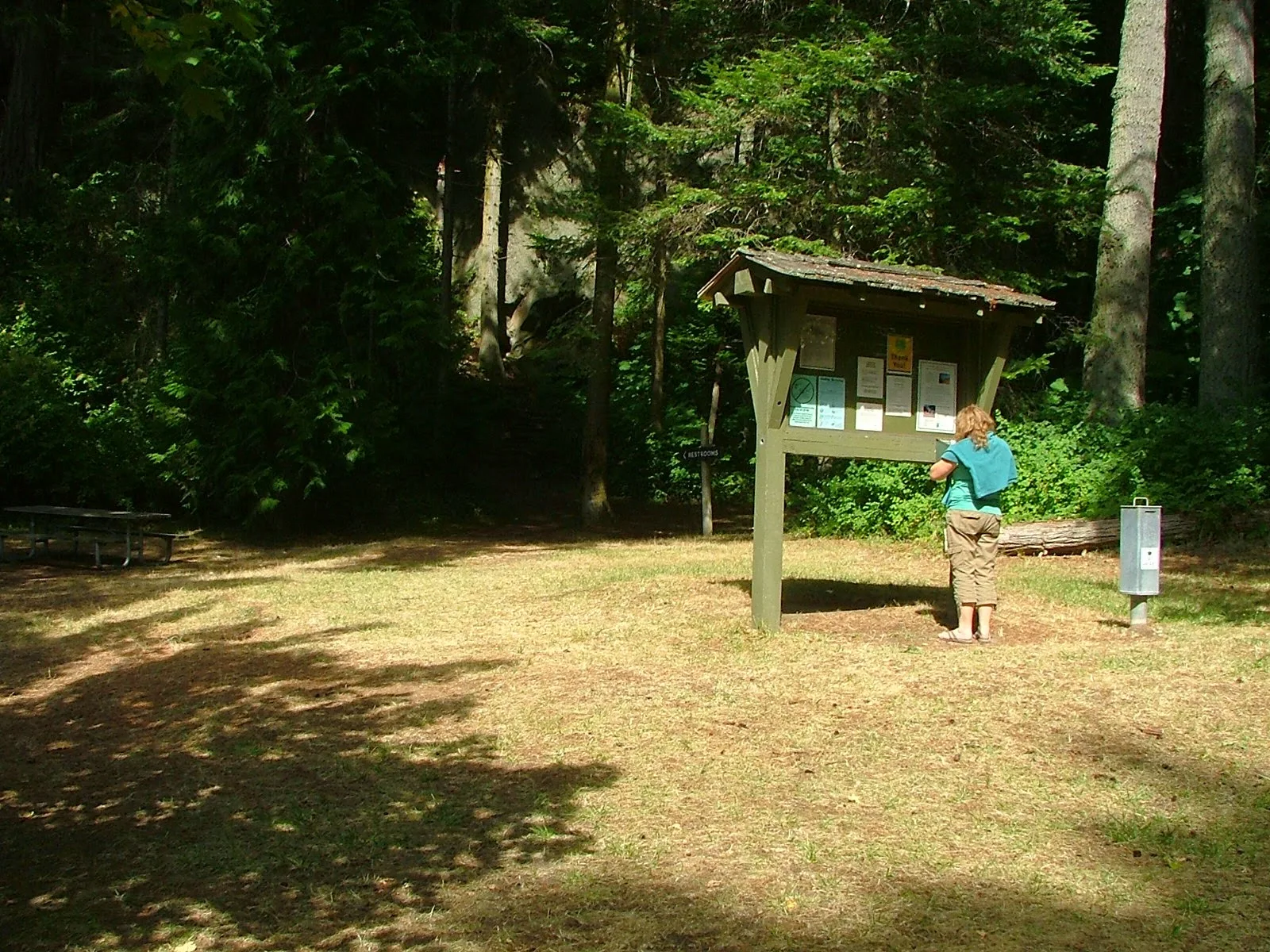
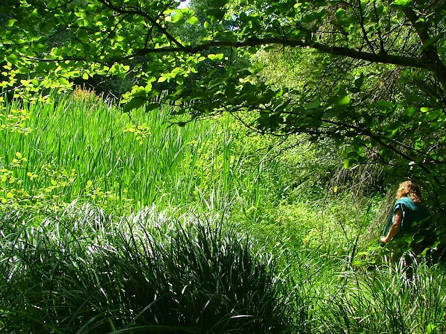
Pictures by Land and Sea Around Matia Island in the San Juan's


      A few years back, I  hiked the trail from Pelican Beach to the top of Eagle Bluff on Cypress Island, taking pictures every few minutes along the way.  The resulting pictorial is a pretty good synopsis for those that can't make the journey themselves. See the Eagle Bluff Pictorial hike here.  I decided to do the same thing on Matia, but with a little change up. First I hiked the trail snapping away with wild abandon, then I jumped in the dinghy and hugged the shore continuing taking pictures while I circled the island. Then I deleted most of what I had. The results are  below, you decide if it was worthwhile.
Matia Island picture
The blue marker on the far left marks Rolfe cove, and where we  begin our visit to Matia

First off, exit the dock!
The little four boat float, may be full, but there are two buoys and room for a few boats to anchor.  In a pinch you can anchor in the much larger cove at the other end of the island and do this hike/dinghy tour in reverse.


Hiking boating Matia Island
Boater park fees are  a great deal for what we get in return.


Matia Island in the San Juans
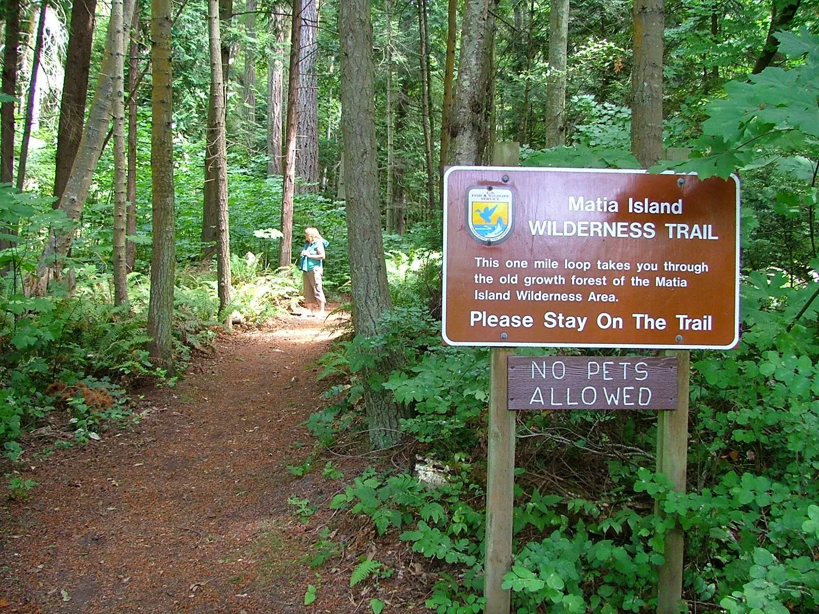
The trail starts at the top of ramp beyond the small picnic campground area.  Matia is unique in that fires are not allowed anywhere, and pets are restricted from trail system.
click where it says read more for the rest of the picture tour!

8/23/2017

Ten lessor known places to visit in the San Juan's


     Everyone knows about Rosario - Friday Harbor - Roche Harbor and Sucia Island.  Of course they are famous and not to miss, but some of the best San Juan area destinations are much less traveled and even less talked about.  Out of the way places have secrets where local knowledge may turn a ho-hum cruise into a truly memorable event.  I am listing and describing some favorites, feel free to make them yours too.

   Not in any order or preference!

   #1  Saddlebag Island
       At the top of Guemes Channel northeast of Anacortes in Padilla Bay is diminutive Saddlebag Island State Park.

       Saddlebag has only 24 acres, its distinctive dog-bone shape creates two teeny bays. The north one suitable for  two anchored boats, or only one if the skipper hogs the middle on a long rode. We have always been able to anchor fifty feet from shore.  The dinghy ride is short and sweet, the gravel beach is friendly and steep.  The bay catches a little flotsam and wayward seaweed so an aroma may be mixed in with treasures you find.

      The narrow center isthmus holds a small campground and outhouse (newer).  Hiking the shoreline trail is easy and follows a handy figure eight shape affording views in all directions.  Being less than two miles from Anacortes makes Saddlebag an easy kayak destination.

      The waters on the east side of Saddlebag are shallow and rock strewn, circling the island is a white-knuckle event at lower tides. Your dinghy or kayak would be a better choice than the mother ship if you are determined to gunk-hole.

      We stop at Saddlebag for lunch and a hike, overnight if it is late, or just a quick anchor and hike.  We always see something new, and never go away unhappy.

       Saddlebag may only be rated as  five star, you will be glad you stopped by.

Saddlebag Island State Park


     #2 Lopez Village


     Stop, don't think that I think you don't know all about Lopez Village, of course you do.

But do you know how to land your dinghy right downtown?

     Many people, go to the Islander Resort or Islands Marine Center in Fisherman Bay and then walk or bicycle the 3/4 mile back to town. That's a long way to carry groceries or walk to breakfast, and you don't have to!

     There is a public beach access to the village just outside the entrance to Fisherman Bay and here is how to spot it and what to do.

      First you have some choices:
        #1 anchor outside the Fisherman Bay entrance, but you will be waked by other boats so this is a short term at best choice. #2 anchor just inside Fisherman Bay (no wake zone)  on the right side at the first corner, or anchor a little further in in front of Islands Marine Center or the Islander Resort.  #3 tie up at one of the two mentioned resort docks and pay the fees. I prefer option #2 because it is protected from the wind and gives easy access to the Spit Preserve.

      Once anchored or tied up to the dock, jump in the dinghy and race back outside the entrance.  Run as far as the  red navigation aid (dolphin) marking the safe entrance to Fisherman Bay and look towards shore, there you will easily spot a galvanized stairway way with switch back and viewing platform.

      Bring the dinghy ashore right in front of the stairway. The beach to the left and right are private with signs reminding us.  We drag the dinghy all the way up to the stairs and tie off on a steel support.

       Once you charge up the stairs and get your bearings you will find you are right smack in the middle of the village.  The fudge shop is fifty feet away and across the street is the free hot shower and bathroom supported by the Lopez Chamber of Commerce (donations accepted).  Another block up the road brings you to the grocery stores.  Sometimes we bring our bikes ashore here or rendezvous with others that came by ferry.

Public access stairs to Lopez Village
Public access beach and stairs for Lopez Village


     #3 Matia Island Trail

        We all have our favorite place, trail, or experience we remember fondly.  I conveniently forget the rainy foggy times, recalling just the good stuff. Matia has always been that place for me.  I once said to a fellow boater that if I was stuck somewhere due to bad weather or rough seas, Matia was where I wanted to be.

         Matia Island State Park is about one mile east of Sucia and a little more north of Orcas.

       My preferred access is Rolf Cove on the west end.  From the dock on Matia, with field glasses you can look right up Echo Bay and count the yachts at Sucia (sort of).  Rolfe cove is cute, smallish, stops most wind and rogue wakes and feels homey, private and comfortable at the dock or paddling the dinghy.  The rickety single pole gangplank and old wood float is quaint, but due to be replaced, and currently holds only four boats.  The bay has room for three or four more at buoys or anchored.

       The second less preferred but equally protected access is a large cove on the far east end, but there is no dock. (The trail is at the dinghy friendly beach at the head of the cove)

        What makes Matia special is the one mile trail circling the south half of the island. Part rain forest, part sea shore, part wildlife habitat, hiking the trail is an experience worth repeating.  It connects you with the island and with nature, it renews and grounds you..  Once you start down the, no dogs allowed path, you become immersed in the island and leave the world somewhere else.  

Matia Island one mile trail is special


Matia Island loop trail at Matia State Park


Matia Island trail near hermits cabin location
For an up close personal look at Matia, check out the
 Matia pictorial here Land and Sea around Matia

      #4 Bicycle Around Lummi Island

      Lopez Island is known as the bicycling Island because it is less hilly than Orcas or San Juan Island, but did you know that Lummi Island is flatter by far than Lopez?  It's true, the loop around the north end of Lummi is a delightful pedal along the shore the entire 7 1/2 miles.   Lummi's lack of commercial development means very few cars too, and the few you do encounter will be locals that generally drive like they live there.

        There are no public docks where you may tie up or come ashore, but there is a public park and beach where you can anchor and come ashore by dinghy.  It is a little bit of work but well worth the effort to lug your bikes ashore.  There is also a cafe and general store walking distance from the public beach.

Here is a link to a post that describes in detail  >>> How to go ashore on Lummi Island

Lummi Island  bicycle ride access point


      #5 Eastsound - the village (city)

       Eastsound is not visited much by boaters, few boats anchor or tie to the county dock even though it is the second largest town in San Juan county. Never the less, this artsy craftsy city is always worthy of a stopover. Eastsound has the largest store on Orcas Island, a dog park, a people park with live music festivals. Summer farmers markets, craft galleries, and loads of bistros.  

       Eastsound's location is great for rendezvous with friends and family arriving by car or bicycle. It is easy to spend the entire day being a tourist and then retire to the boat, a day well spent.

      When you visit, plan on anchoring and rowing over to the county dock with the dinghy since the county only allows short time tie ups and no over-nighters at the float.

      For those of you without a chart, map or gps, Eastsound is at the top of East Sound on Orcas Island.  Simply go past Rosario until you run out of water.  The dock and anchor area are in Fishing Bay on the west shore of Madrona Point.
Eastsound county dock and anchor area
The tiny Eastsound county dock is used mostly for dinghy landing, and is only one block to the village center and the largest food store on Orcas Island.

     #6  Vendovi Island Preserve

      Vendovi Island is a small island on your chart, north of Cypress and south of Lummi.  When heading out from Bellingham you probably steer around it on your way to the inner islands.

       The entire island was once a private home-site, hence has never been developed. The single modest home is where the caretakers live and is off limits, the rest of the property is forest with trails leading to view points and meadows around the island.

       Access is on the islands north end where a breakwater forms a bay protecting a nice float. Admission is free.  This is a good place to break up your cruise and spend a few hours walking on shore or just have lunch in the gazebo.  Comical Puffins live in the rocks of the breakwater and are sure to entertain you.
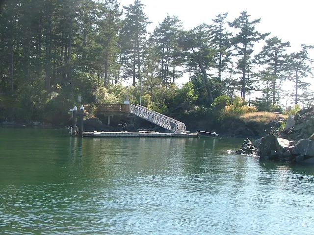
Vendovi Island free public dock to access Island hiking trails
Vendovi Island float


Vendozi Island


       #7 Fort Whitman on Goat Island

      Fort Whitman and Battery Harrison easily win the battle for least visited and are virtually unknown except to locals. There are no signs, no brochures, no promotion.  Even the state of Washington seems loath to admit its existence or encourage tourism.

     According to online sources, Goat Island is managed by Washington's department of fish and wildlife, visiting is not restricted, although they prefer to not talk about it. 

     For gunk-holers and true explorers, Fort Whitman is tops and it is unbelievably easy to get to and access. 

      Follow this link to a posting detailing every last detail you need to check this place out.  You will be glad you added it to your - must see/do list. Your inner child will love it.

Click here to go to >> Fort Whitman on Goat Island
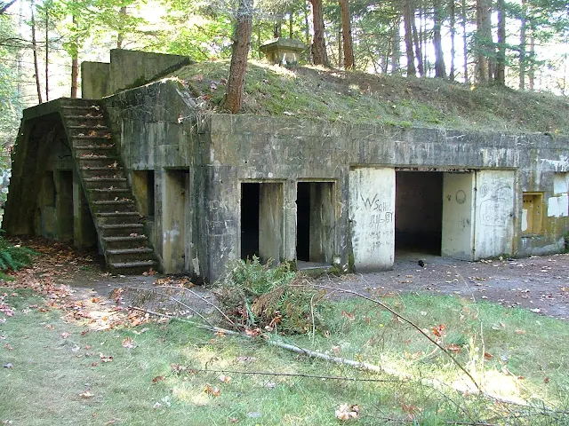
Fort Whitman Goat Island Battery Harrison on Swinomish channel
Battery Harrison at Fort Whitman on Goat Island


Last on my list of lessor known places to visit are hikes - I mean real uphill hikes, the kind that work up a sweat and you are really glad when you finally arrive at your destination.


#7 Young Hill

     Start this hike at English Camp on Garrison Bay.  Begin by anchoring near the tiny dinghy dock, please don't hog the entire dock with your big yacht.  Wear your hiking shoes and bring plenty of water, your going to drink all of it.

        Check out the interpretive center, and grounds if this is your first visit and then get going. Walk up the trail to the parking lot and then rejoin the trail at the top of the parking lot.  From now on you can't get lost or miss the trail, just keep going up, up, and up some more.

      When you get to the top, it is a false top, take a break and then follow the trail up another five minutes, up to the real top.

        Noticeably absent on this two hour hike are resting benches, use a handy rock or stump.  Perhaps the smooth wide trail and welcome shade trees, make up for a lack, of rest stops, you decide.
view from Young Hill overlooking mosquito pass and Garrison bay
View of Garrison Bay from Young Hill, Mosquito Pass is barely visible,
beyond is Haro Strait, Sidney Island, and then Vancouver Island


        #8 Cypress Lake on Cypress Island

       This is the longest loop hike I know of except Turtleback Mountain and the hikes in Moran State Park which of course are not accessible by boat alone.

        The trails on Cypress interconnect making long and varying hikes possible.  The most straight forward access to Cypress Lake is by anchoring or hooking one of 18+  buoys in Eagle Harbor, and then dinghy ashore landing at a small gravel beach on the south shore of the bay.  It is an easy to spot landing because it's about the only place without grass and muck, plus there is a DNR rules and regs. sign to greet you complete with a free trail map if you are lucky. (don't steal the posted one, that's not nice)

       Much of the trail to the lake is not really a trail, it is more like a rutted jeep road that steadily climbs to about 1,000 feet in a little less than two miles.  It is a grinding workout but not too bad, the lake is just so so,  but never the less a good destination. I don't know about fishing, let us all know in comments if you have fished it.

        On the way back down be sure to take the loop side trail that leads to the old airstrip and winds through the woods past a small unnamed lake that is warm and people swim in.  The once, panoramic view from the airstrip is all but gone as planted trees take hold, but the hike is a good one anyway.

        I strongly suggest that you go online and find a map to print and take with you, my description will get you to Cypress Lake just fine, but the other trails are just waiting.
Cypress Island trail map
Cypress lake hike on Cypress island
Cypress Lake


    #9 Eagle Bluff on Cypress Island

    This is possibly my favorite hike and I must warn you right off that hiking to the bluff is not allowed until after July 15 each year. Apparently people affect the baby birds. Sometimes we plan our schedule so we can make this hike.

Eagle bluff aka Eagle Cliff from Rosario Strait on Cypress Island
Imposing Eagle Bluff 

       Eagle bluff overlooks Rosario Strait giving you great views north and south down the waterway and of course of Orcas Island.  The trail is in good shape with handy steps and a short five foot ladder at a particularly steep section. As you hike you will see peek a boo peeks at clearings and drop offs, but nothing dangerous until you get to the very top, then watch your step and grab the children and pets.  If you are patient or fortunate you will see eagles and ospreys soaring in the updrafts, sometimes in mock aerial attacks with siblings.

       Access this extraordinary 1-2 hour hike from Pelican Beach, you won't need a map the trail is well marked.

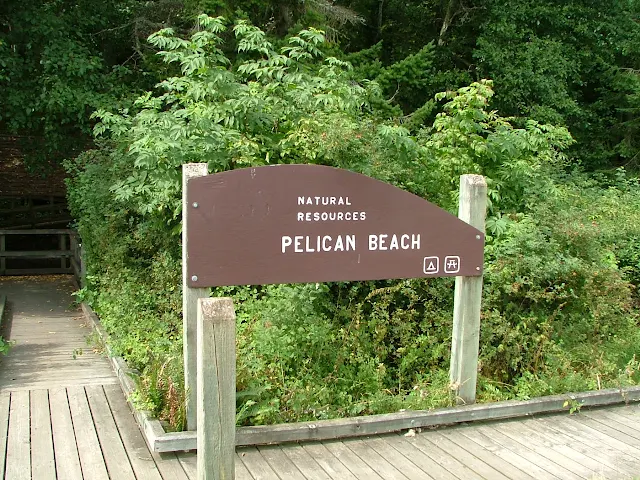
     Pelican Beach is near the north end of Cypress Island facing Sinclair Island.  It is one mile north of Eagle Harbor, there are picnic tables on shore a DNR sign and a restroom in the woods. Off shore are four or six anchor buoys. You can't miss it.

Free camping at Pelican Beach on Cypress Island

Pelican Beach


       Follow the link below to a posting full of pictures.
Eagle Bluff pictorial hike

Oops, did I say ten?  Okay, try #10 - Sharpe Cove at Deception Pass
click here >> Sharpe Cove

Sharp Cove, Bowman Bay, Rosario beach, Maiden of deception Pass
Maiden of Deception Pass at Sharpe Cove.


That's it, if you go see these ten places and also hit the biggies like Roche and Friday Harbor, Jones, Sucia and Stuart, etc., you will have years of great cruises.


A critic once wrote:

 "All the author has done is write about his favorite places"  Yes, that's exactly what I have done.
John -

8/10/2023

Fifteen best lessor known destinations and hikes not to miss when cruising the San Juan Islands


San Juan Islands Boaters Must-See List

These are special places to go and great things to do that our years of cruising have rewarded us with. Some of the very best places are walks or hikes that are off the beaten path and seldom visited. I have listed them in somewhat of a great circle to help you stay oriented, but you will not be able to visit all of them in one day. I suggest that you mark them on a paper map or chart for later reference.
Check out these places too.  Not really must see places but exploring and gunkholing places.  little coves and back doors

#1 Spend at Least Half a Day at Friday Harbor

While technically not off the beaten path, nor seldom visited, Friday Harbor must be listed. If you only have time for one choice, make it a visit to Friday Harbor, even if just for a few hours. Arrive around noon when marina slips are being vacated from the day before. Walk up the stairs and go to the whale museum. Circle Spring Street and the core area on foot, and visit the many boutiques, bistros, and souvenir shops. If you stop by on a Saturday, there is a Saturday Market at the Brickyard. Shop at Kings Market for all you need for a special meal on board or choose from one of the many restaurants all within a short walk. Walk to the end of Spring Street landing pier and look at the local sea creatures in the huge saltwater aquarium.

While out on the wharf, watch seaplanes land and take off. Stay long enough to watch a 460-foot, 5,000-ton ferry expertly pull into the terminal next to you. Check your watch; you don't want to miss the sunset bus tour to Lime Kiln Point State Park. San Juan Transit van/bus loads alongside the ferry terminal parking lanes and leaves promptly each evening one hour before sunset, delivering passengers to Lime Kiln Park parking lot in time to watch the sun set over Vancouver Island and Haro Strait. Be sure to bring your camera; you may be fortunate and catch an Orca breaching in the evening sun. San Juan Transit will have you back to Friday Harbor in time for your late dinner.

Spring street Friday Harbor
Spring Street (main st) Friday Harbor


Lime Kiln Lighthouse
Lime Kiln Park Lighthouse

The next morning, if you have an inkling to go for a free ferry ride, check the schedules and go as a foot passenger. Simply walk on, using the foot passenger lane, while cars are being loaded. Eat breakfast onboard, ride to Orcas Landing, do some shopping, and then ride the opposite direction ferry back to Friday Harbor.

If you are more adventurous, bring your bicycle and spend the day riding around Orcas, Lopez, or Shaw Island; your boat will be waiting in your slip when you return. Ferry rides for foot and bicycle riders are free in the inner islands. There is a fee only when departing from Anacortes.

3/12/2017

Marine Parks of the San Juan Islands and Surrounding Area


Below is the marine parks list
             followed by reviews, charts, and pictures
                         in the order listed.
        This is not all the parks, just the ones you may want to make part of your cruising. It's unlikely you can visit all in one trip and still do a decent job of sightseeing. You should plan multiple visits to the San Juans.
Many people choose Jones as their favorite for just hanging for a few days, so Jones is first.
For hiking, Sucia, or Pelican Beach on Cypress Island are the best, but all the parks have hiking trails.
      Some parks are in a convenient location when you need to spend the night and you're between destinations, Saddle Bag, Eagle Harbor, and Odlin would fit this description.  Most parks with docks have picnic tables on the floats, which are very handy for extending your living area, socializing, and meeting other boaters.
        For marinas/etc. where you can get fuel and provisions try this list >> Marinas - fuel - beer and ice - slips for rent

  • Jones Island
  • James Island
  • Clark Island
  • Doe Island
  • Obstruction Pass
  • Pelican Beach
  • Eagle Harbor
  • Cypress Head
  • Matia
  • Patos
  • Sucia
  • Stuart Island  (Prevost & Reid Harbor)
  • Spencer Spit
  • Odlin County Park
  • Washington Park
  • Deception Pass Park
  • Saddlebag Island
  • Sidney Spit Marine Park (Canada)
Click here to go to complete description and maps of above listed parks

10/12/2020

Pictorial Hike to Eagle Bluff on Cypress Island

       repost from an earlier time

      Some readers of this blog will never get to hike to the top of Eagle Bluff on Cypress Island so I snapped a whole bunch of pics while I walked along.

I'll try to keep the text to a minimum

 We took the dinghy to shore at Pelican Beach, which is a Department of Natural Resources Site (DNR)  see Pelican Beach >> Read about Pelican Beach on Cypress right here

Pelican Beach anchorage on Cypress Island, camping, hiking

Pelican Beach anchorage on Cypress Island, camping, hiking


Pelican Beach anchorage on Cypress Island, camping, hiking
The boardwalk quickly gives way to forested trail

Cypress Island hiking, camping, pelican beach

Many, many pictures yet to see

12/09/2015

Nine Little Coves and Backdoors in the San Juan's

      It's easy to go to the marine parks and jostle with the other boaters at the dock or scramble amongst a minefield of anchors and buoys.  Sometimes seclusion and communing with nature is simply a matter of going around the point.


East cove Matia Island  facing Lummi in the San Juan Islands
Low tide and still lots of water for anchoring, but open to swell from Rosario Strait.

       As with all gunkholing and exploring, you must be vigilant, watch for rocks, know your tide range and proceed dead slow  or pay the price.
Speaking of paying >>>   paying the price

  Suggested backdoors, (none preferred over another) and places to get away from other boaters.
  • Matia Island:  Matia Cove is a fairly long indent (see pic) at the east end of the island and holds several boats. An unnamed cove is just around the corner from Rolfe Cove where Matias dock is located.  Both these coves offer anchorage away from the usual hustle and bustle.
  • Sucia Island: Snoring Bay is between Echo Bay and Fossil Bay on Sucia and Ewing Cove is accessed via Echo bay on the northeast side.  Both coves offer access to the Sucia trail system, and may have anchor buoys still intact.
  • Saddlebag Island:  This state park is so little visited, you may consider the entire island a backdoor, but there is a second minor cove on the south side with a great view of Cap Sante should the northside be full up.
  • Inati Bay on Lummi Island is located on the southeast side of Lummi Island.  This medium size cove holds a handful of boats and is a perfect storm refuge when you are caught on your way to or from Squalicum Harbor.
  • Cypress Head: The normally used cove with anchoring and buoys is on the north side of the isthmus and open to passing wakes, but the long cove on the south side of the isthmus is easily navigated and may be calm. Watch your depth here.
  • Doe Island State Park: The last we looked (2015) the float was still gone but you can anchor here in relative peace and protection.
  • East Sound:  If you're at Eastsound (the city) and it gets dark, you can anchor in Judd Bay on the far north end (left side) of East Sound.  You will be a dinghy ride from the Eastsound dock which does not allow overnighting.  Anchoring near the county dock is liable to be rolly.
  • Roche Harbor:  If  crowds drive you bonkers and you want to run away, just run two miles to Westcott or Garrison Bay.  Anchor anywhere but watch your depth and don't block access.  You wont be totally  secluded or alone, but you will be away from the mob at Roche.
  • Smallpox Bay:  This small bay is on the Haro Strait side of San Juan Island just a few miles south of Roche Harbor  (scoot through Mosquito Pass) it's a dinghy ride to shore  at this San Juan County Park where campers watch for orca's.
  • There are lots more hidden places, too many to list but you can use the search box the for them. Search - coves, bays, anchoring, camping, parks, things to do, places to go, etc.
      You can anchor off to one side virtually anywhere but you may suffer wakes.  I left out well known places like Blind Bay, Fisherman Bay, Parks Bay. which will all be crowded.  I wanted to suggest mostly secluded easily overlooked locations that will be appreciated by the discerning recluse. 

5/16/2020

Ten Best Parks of the San Juan Islands


Ten best San Juan Island parks
      Picking the best of anything is asking for an argument but I thought folks planning a visit would benefit from the discussion.

     Let's start by listing my choices in order of best first, first because they have overnight docks,  followed by some pros and cons and a few real world comments.  (hopefully I haven't omitted your favorite)  Keep in mind, we go to all the parks and don't dislike any but  there is no doubt some parks are five star and some are not depending on what we are doing or the weather during that particular cruise.
     For a more detailed review of the San Juan area marine parks including maps try this post.  marine parks
    • parks with docks
      • Jones Island   
      • Matia
      • Fossil Bay on Sucia 
      • James Island
      • Stuart Island  (Prevost & Reid Harbor)
      • Sharpe Cove and Cornet Bay at Deception Pass
    • parks without docks
      • Saddlebag Island
      • Pelican Beach
      • Turn Island
      • Eagle Harbor
      • Cypress Head
      • Patos
      • Sucia   (Echo and Shallow bays)
      • Spencer Spit
      • Odlin County Park  (has 2 hr dock)
      • Clark Island
      • Doe Island
      • Obstruction Pass
      • Sidney Spit Marine Park (Canada) (has overnight dock)
      • Washington Park  (launching ramp only dock)
      • San Juan County Park
      • Shaw Island Park
    1. Jones Island is my number one choice and here's why.
                    Pros:
      • bigger but not biggest dock
      • protected bay 
      • great dinghy beach with a couple tidepools
      • anchor buoys and lots of room to anchor
      • running water and four nice nearby composters
      • hiking the many loop trails at Jones never gets boring
      • tiny deer, many tame, are unique to Jones
      • dock is very close to camp sites for evening fires
      • close to Deer Harbor for supplies
                    Cons:
      • crowds sometimes
      • long ways back to the mainland
      • open to north wind
      • no bicycle trails
         2.   Matia Island never disappoints us.

                 Pros:
      • very small intimate dock for four boats
      • usually room when we arrive
      • small protected bay holds about four more boats
      • great gravel beach
      • multiple coves for beachcombing
      • puffins, seals and eagles and great sunsets
      • unique rain forest one mile or less loop trail
      • somewhat close to Squalicum Harbor (2-3 hours)
      • restroom at top of gangplank
      • Matia is a peaceful quiet special place

    click here for the rest

    7/14/2023

    First Time Trip to the San Juans Suggested Itinerary for a Nine Day Trip


    San Juan Islands for First Timers

    Suggested Itineraries for  San Juan Island boating trips

    (Updated (2014) alternate itinerary with Echo Bay at Sucia Island as 1st stop)
    click here  Sucia Trip Intinerary


    (For a  shorter itinerary on your first cruise and with different island stopovers (click here) 


          This article is designed to get you going on that first boating/sailing trip to the San Juan Islands in Washington State.

    Below is a snapshot map of your dreamed about vacation land (or water) 


    map of San Juan Island area


    The map above identifies many  (not all) common names and places

    Take a moment to familiarize yourself with some locations you may have read about.


    You may want to follow this link and take a quick look at the detailed marine parks list and then come back to the suggested itinerary below, "MARINE PARK LIST AND MAPS" click here 

    for your detailed itinerary click (read more) below  >>

    5/02/2020

    Beach Camping in the San Juan's

         Beach camping is alive and well in the San Juan island area but let's be clear,  it is not the same as camping in the dunes along the Oregon or Washington coast, it's much better. Except if you want to hear the surf lolling you to sleep or be mesmerized by endless rows of breaking waves or have your entire body sandblasted from nonstop winds.  Instead, in the islands you will find gentle winds or none at all, still and flat water unless the wind pipes up against the tide. Of course it is always warmer (not) with less clouds and no crowds in the San Juan's.

        There are no approved places that you may pull up your boat or park your car, or ride your bicycle to and then pitch a tent.  That leaves parks and resorts and there are plenty to choose from including those with waterfront or beach camping sites.

         County, City and State  Parks:
         These are the parks that are accessible by vehicle, bicycle or hiking, reservations are a good idea.

    • Washington Park in Anacortes
    • San Juan County Park on San Juan Island
    • Odlin County Park on Lopez Island
    • Shaw Island County Park on Shaw Island
    • Spencer Spit State Park on Lopez Island
    • Moran State Park on Orcas Island
    • Deception Pass State Park near Anacortes
    • Obstruction Pass State Park on Orcas island, (requires short hike)


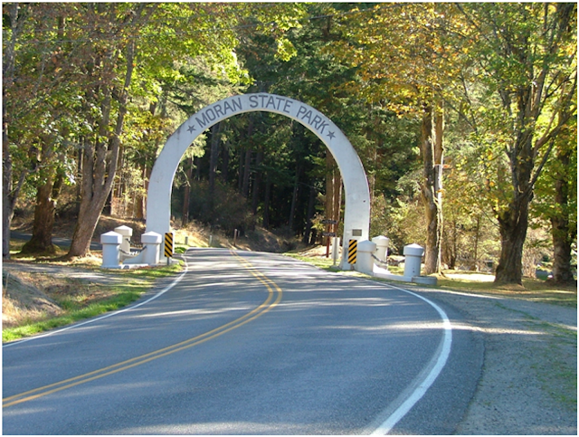
    Moran State Park entrance arch, Orcas Island
    Moran Park entrance on Orcas Island

    Cornet Bay dock San Juan Islands Deception Pass
    Cornet Bay transient dock and launch ramp at Deception Pass park

           Washington State Marine Parks:
           These parks are only accessible by boat or kayak, most are entire island. All have campgrounds with beachfront sites. None may be reserved or provide garbage service.

    • James Island
    • Jones Island
    • Clark Island
    • Doe Island (possibly still closed)
    • Pelican Beach on Cypress Island
    • Cypress Head on Cypress Island
    • Eagle Harbor on Cypress Island (anchor buoy field only)
    • Matia
    • Patos
    • Sucia (campground reservations are availalbe)
    • Stuart Island  (Prevost & Reid Harbor)
    • Saddlebag Island
    • Sidney Spit Marine Park (Canada)

    Jones Island marine park dock and campground in the San Juan Islands
    Jones Island State Park
    For detailed descriptions, maps and charts and pictures for all the parks in the San Juan Island area, click here.  maps and charts and pictures


    11/06/2022

    Top Things to do and Places to go in the San Juan Islands

    Discover the top places to go and the best things to do by boat in the San Juan Islands. 

    The difference between a truly wonderful vacation and a ho-hum boat ride is the memorable experiences and special places visited along the way.  These are some of our favorite haunts and things to do.  Maybe some will become your favorites as well.  

    • Matia Island one-mile loop trail:  This easy one-mile loop immerses you deeply into the shaded forest the minute you take your first steps. Towering trees, oversized ferns, and thick mosses line the trail.  Our first walk many years ago was so serene and calming that even our young kids were quiet and talked in whispers.  Matia Island pictorial
    • Pygmy deer on Jones Island:  The northwest is full of wildlife and deer are everywhere, or so it seems sometimes.  However, apparently, the many deer on Jones Island have developed to a much smaller size. Even the older bucks with big racks are only about waist-high.  Many of the deer are tame, and some are downright annoying.  One time a deer met me at the water's edge as I came ashore in the dinghy.   Several times deer have joined us around our campfires looking for handouts and letting the kids rub their heads and pet them.  I remember once a spike kept crowding too close to the fire, he was intent on getting at a bag of corn curls. It is against park rules to feed the animals so I don't know how they learned to expect treats from boaters.  Jones Island deer
    • While Deception Pass isn't located within San Juan County, any boating enthusiast would be remiss not to include it in their cruising itinerary. In fact, Cornet Bay, with its well-facilitated ramp, serves as a prime launch point for those embarking on their nautical adventures. But, here's a piece of advice – don't just launch and rush through; take the time to savor the breathtaking scenery.

      Consider planning part of your voyage around the four daily occurrences of slack tide. At slack tide, the turbulent waters temporarily calm, providing an excellent opportunity for exploration. A mere quarter-mile beyond the pass, still within the park's boundaries, you'll discover Sharpe Cove. Here, you can moor your vessel at the floating dock, and at the head of the ramp stands the remarkable Maiden of Deception Pass.

      This extraordinary statue, carved from a towering cedar tree, stands at an impressive twenty-five feet. It portrays a Samish woman gracefully holding a salmon aloft. The story it tells is one of unwavering sacrifice, representing a Native Indian woman who risked her life to ensure her people would never go hungry. It's a powerful testament to the deep connection between the indigenous people and the land.

      Just a stone's throw from the Maiden lies Rosario Beach, a renowned tide pool area. It's a place where nature's wonders are on full display, offering an opportunity to observe a rich variety of marine life and coastal ecosystems up close. So, when charting your course through these waters, ensure you dedicate some time to exploring Deception Pass and its fascinating surroundings. The remarkable beauty and cultural significance of the area are sure to leave a lasting impression on any adventurer. Deception Pass

    • Did you notice?
      •  As a writer wannabe, I enjoy playing with words. Lately, I have been kicking around artificial intelligence.  The next passage and the preceding passage were passed through an AI program.  I supplied the basic information, the fluffy language, not so much, enjoy.
    • The Swinomish Channel, a hidden gem for seasoned boaters, provides a picturesque and relaxing alternative to the sometimes turbulent waters of Deception Pass. Many visitors who park long-term at the  Cornet Bay boat ramp in Deception Pass Park, myself included, choose to embark on this delightful detour. When heading out, instead of veering right into the unpredictable waters of the Strait of Juan de Fuca and Rosario Strait, consider retracing your route for a few miles and setting a course through the serene Swinomish Channel. This not only offers a respite from the challenges of the Pass but also shields you from the often encroaching fog in the Straits. As a delightful bonus, you can make a pit stop at the charming town of La Conner. Nestled along the banks of the channel, La Conner welcomes boaters with open arms. The town offers four docks, perfect for short-term or overnight stays. A leisurely stroll along the charming boardwalk presents a plethora of quaint shops, inviting bistros, and even a provision store for all your needs.So, when charting your course, why not opt for the scenic great circle route, meandering through the Swinomish Channel? Along the way, take in the breathtaking scenery, and don't forget to treat yourself to a delectable ice cream cone at La Conner, making your journey all the more memorable.  (not bad, but not me)
    • The San Juan's are full of hikes, walks, and places to explore and I'm not going to list all of them on Sucia, Stuart, Matia, James, Jones ...  But two hikes beckon me back again and again because they reward me, not just exhaust me.  Hiking to the top of *Eagle Bluff on Cypress and the top of  *Youngs Peak, aka Young Hill at English Camp. Both hikes are thigh burners and just plain hard work. Both are short and intense, we pace ourselves, rest, and keep coming back.  The summit views are worth it. Bring cameras and water.  Go to this link and then scroll down to #7 and #9
    • Use your dinghy, kayak, or paddleboard to explore Echo Bay:  Sounds simple enough and you probably already plan to,  but I suggest you go to Ewing Cove at the far northeast end of Echo Bay. You can sneak in with your big boat but using the dinghy allows you to paddle through some narrow slots and get up close to some cool cliffs and rocks.  You can even go ashore to use the privy, have a campfire, or drop off passengers who want to make the long hike back through the woods to Fossil Bay.  Ewing Cove has two buoys and is at the far north end or point of Echo Bay on Sucia Island.  Watch for rocks, follow your chart, watch the sounder, and go slow.
    • Sculpture Park at Roche Harbor: I don't believe the park is part of Roche Harbor but if you go by boat, you need to get a slip at the marina or anchor and go ashore at a dinghy dock.  Once on shore, walk uphill past the pool and cabins, and cross the road, you can't miss it. It's free, donations are welcome.  We enjoy strolling through the fields, meadows and woods. The unique large art pieces are spread out over twenty acres. Some spin and whirl, some are interactive, and some have deer grazing nearby.  There is something for all ages and dogs are welcome too.
    • Turn Point lighthouse museum hike:  Chances are that you already know about this very popular destination.  Most newcomers will be staying at either Prevost or Reid Harbors and then hike the 2.5 miles  (one way) from the State Park docks.  You can save two miles and an hour by taking the dinghy to the county dock at the far north end of Prevost Harbor.  We usually anchor near the county dock and then leave the dinghy tied to the small float while we walk out to Turn Point.
    •  Moran Museum:  You should stop by Rosario Resort in East Sound on Orcas Island.  You may anchor, tie to a buoy, ask for a complimentary slip, or spend the night.  While you are there make your way to the third floor of the mansion-turned-resort office and restaurant.  The top floor museum is dedicated to the early days of Robert Moran and the San Juans.
    • Friday Harbor music on the promenade:  The short promenade that runs between the marina office and main street is a small city park.  Most summer weekends the stage is filled with musicians entertaining cruisers and locals.  It is lots of fun and free,  Music will drift out on the dock to your boat but not if you are somewhere else.  When planning your travels, plan Saturday at Friday Harbor.  
    Your interests will vary from ours, so this list may not be perfect for you. I suggest that you search this website, you may discover the perfect idea.
    Turn point lighthouse museum
    Turn point museum at the lighthouse


    1/02/2024

    Cruise the San Juan Islands – Sample Itinerary, Trip Plan, Info Guide

          Talk to ten San Juan Island cruisers and you will get ten different answers to the question, "What's the best place to go or thing to do in the San Juan's."   Each will be correct, mostly. To support their answers, they will offer first-hand exciting personal experiences.  That is why you must gather the best information, inject your wants and quirks, and then chart your own course to the San Juan's.  

    Our experiences and local knowledge have been earned the old-fashioned way – one cruise at a time. Sailing, hiking, biking and gunkholing, all while immersed in nature has been our reward. 

         This website is a compilation of our travels in five sailboats and two trawlers spanning over two decades.

         Along the way we published a cruising guide, “San Juan Islands Cruise Guide,” followed later with a Land and Sea Guidebook, “San Juan Islands Travel Guide.”  My goal for this website and these books is to help boaters, travelers, sailors, and families enjoy the good times we have enjoyed for many years.

         What is the best five-day itinerary?  That's like asking what's the best color.  But there are certain things that our experience and local knowledge will help with.  Sometimes, one just needs a little push in the right direction to get on the right tack, so to speak.  It is impossible in an essay or article to cover everything important to everybody or all the possible places to go.  However, this website does cover every state park, every county park, every public dock, and much much more.  You will find many links to pictures and specific posts, all composed for San Juan Island boaters.  Be sure, while reading to click the links and follow your interests. Be sure to use the search box at the top of this page on the left side.

    You're invited!

         To help you muddle through this dilemma and provide some interesting reading, please come along with us on our summer cruise in the San Juan Islands.  Of course, you will be taking your own boat since ours is full.  

         Today, we use our laptop as a chart plotter, I only use the GPS function. The program was free online Free chart plotter software but I had to buy a USB antenna for $19.95.  You can get by with a small handheld GPS or even your cell phone but I enjoy the big screen.   I don't want you to get lost if we get separated, or your battery is dead, so you should pick up a paper chart and a compass.   chart #18421 I carry a colorful roadmap with us as well.

        Let's get on the same page and assume this is your first boat trip to the San Juan's, and you are in a trailerable sailboat with a 5-6 mph speed.  There are five or six starting points we have used but only three are preferred.  They are Cornet Bay in Deception Pass, Cap Sante in Anacortes or Squalicum Harbor in Bellingham.  If you have a fast powerboat or are coming up from the Seattle direction you will want to make time and distance adjustments.  We will plan to sleep on board but use bathrooms on shore. Okay, let's go. ----- We have narrowed it down to about twenty parks to choose from for the first night, and that's not counting the marinas at Friday Harbor, Roche Harbor, or Rosario.   Not to worry, I have a plan >>>  all the parks and then some

          Sometimes when we plan a vacation trip to the San Juan's,  we try to make a great circle route because it saves time and resources. But this time we're going to decide where we go, as we go. We will see how that non-plan works out.  Certain people on the boat have expressed a desire for hot showers, I guess we will see how that works out too. Since we may travel all the way across the San Juan's and back, your boat will need a minimum 75-mile range. Fuel is readily available everywhere but smart skippers figure one-third of the miles out, one-third back, and a third as a cushion.  If your fuel tank is a little small you can tie a five-gallon can on deck.  Knowing you have reserve fuel will ease anxious thoughts and ensure you have a great visit.  Shall we also assume that you have a seaworthy vessel with all safety gear?  If not, correct it before we head out, or stay home.  Life jackets for all

    Plan as we go itinerary:

    Cornet Bay boat launch San Juan Island's
    Cornet Bay Launch Ramps

            Let's begin at Cornet Bay in Deception Pass Park.  However, after reading this post, I suggest that you search this website and check out the other launch locations. Some may fit your plans better. launch points Also, search the other parks and marinas and things to do.  It is easy to overlook a great place or mini adventure that will make your cruise the best of all.  I chose to launch at Cornet Bay this time because I really enjoy the pass scenery.  The dock and the long-term parking are ideal.  Plus being able to take off or return from both directions 24/7 opens up even more possibilities when not having a firm plan. If I was heading for the Sucia area first off, I may have chosen Squalicum Harbor in Bellingham but where we end the cruise may dictate where to begin.

    Read the rest?