ATTENTION!

This site has oodles of information about boating and the San Juans, it helps to use the search box BELOW to find what interests you.
Search - "things to do" or try "places to go"
search - Sucia Island
search - Friday Harbor
search - hiking or bicycling
try - kayak - try CAMPING - try Anchoring

++++ ============================= All Posts Below

Current Posts Below
Showing posts with label San Juans. Show all posts

2/25/2023

Map locating Boat Ramps, Docks, Marine Parks and boat launching ramps serving the San Juan Islands


Map of San Juan Island Area
With selected Parks, Docks, and Trailer Boat Ramps

Map of the San Juan Islands showing launching ramps, parks and docks


 •  Boat Ramps = Purple    Parks = Red  •  Docks = Green
Most docks (floats) are in parks, resorts, marinas and may be used for overnight camping. Boat launching ramps have long term parking.  Parks without docks have anchor buoys or areas suitable for anchoring.

The facilities listed, are in my opinion, most useful for cruisers, which means lots of private resorts are not shown because they don't cater to transient boaters.

Click on the picture and then enlarge it to see dot colors better!

Note on trip planning:
I don't recommend taking your boat on a ferry and launching somewhere in the islands.  However if you must, there are county ramps on all four  islands served by the ferries except Shaw.  Many private resorts have ramps but they are inferior at best, nonfunctional at worst. The one exception is Jackson Beach Park  (Port of Friday Harbor) near Friday Harbor on San Juan Island. Jackson has a good double ramp and float and you can park for free up to 72 hours.
The mainland ramps I recommend are Washington Park, Deception Pass Park or Squalicum Harbor (#1 choice most trips is Squalicum Harbor in Bellingham)

3/19/2022

Roche Harbor Marina Map


Thanks to Roche  Harbor Resort for letting us use their area map, it also shows where the Mausoleum and Sculpture Garden/Park are located.
Our 2019  cruise guide shows this updated map and the new  Friday Harbor map as well. It's really nice when getting a slip assignment to be able to check the map and know exactly where to go.
Roche Harbor marina map showing slips, numbers, dinghy dock, fuel dock, stores, anchorage, boat ramp, visitor trails
Roche Harbor

7/03/2021

They say Canada visits are open after July 21st 2021

      I just read a website that says we can go back and forth after July 21st.  This is undoubtedly subject to change with current conditions and remember what the US says and Canada says may differ so check with both sides before you cross over.

     Interestingly,  the last time I had a passport problem (expired) and could not find the answer online.  I simply called the office in Friday Harbor and talked directly with an agent. He gave me the straight and current poop in a simple phone call.  It made me realize how much I had gotten away from talking to people who actually run the show.  Now if I can get certain people to quit texting for hours on end when picking up the phone is more expedient anyway.


San Juan Islands visiting Victoria, Butchart Gardens


4/28/2016

Bicycling Shaw Island in the San Juans

       Even though I espouse, "Just Get Going" type San Juan trips, I still do a little research from time to time.

bicycle Shaw Island in the San Juan's

         A few years back I stopped at Shaw Landing. (Thats the little float and seasonal market next to the Shaw ferry landing at the entrance to Blind Bay)  We got some snacks and while there inquired about coming back in a day or two and leaving the boat at the dock while we explored the island on our bicycles. 

     We were not told straight out yes or no, they said something about docks being for paid overnighter's and to check back later.       I decided not to come back and we went to Lopez.  There's more  >>>    

3/08/2016

Where are the Public Boat Ramps in the San Juans - just the basics to get your boat in the water

      Buried in this website are itineraries, helpful hints and everything you need to get going to the San Juans.

         And that's the problem, it's buried.


Some of us don't need anything but to be pointed to the boat ramp.


This post points the way.
BOAT RAMPS TO THE SAN JUANS   << hot link, clickety click!


Should you take your boat trailer on the ferry and get off somewhere?  NO! - I don't recommend it unless you are going to a resort that has a ramp and you plan to rent a cabin -- plan on spending substantial time waiting in  ferry lines.  Be forewarned, some so-called local ramps are simply sandy beaches with no docks. Plus the ferry rates for trailers - ouch.

If you carry kayaks on the roof, riding a ferry makes good sense.  My #1 suggestion for kayakers that don't want to paddle across Rosario Strait -- go to Deer Harbor on Orcas Island, park your car and paddle two miles to Jones Island for a night or two camping.

Let's say you carry a kayak on the roof or trailer a day-sailer and plan on camping on shore, and you don't want to deal with ferries - do this.  Drive to Washington Park in Anacortes, (campground and ramp) set up your camp, splash your boat and sail or paddle to either Pelican Beach on Cypress or Saddlebag Island.  Spend the night or come back each evening.  Using the currents, you can avoid difficult paddling or  fluky sailing if that's what works for you.

Hint, use the search box and search Saddlebag or Cypress or Pelican Beach or Deer Harbor, or Jones.

Boat ramps for trailer tourists and visitors to the San Juan's
Public ramps with floats and parking open 24/7

7/29/2015

What's new at Stuart Island Lighthouse

First I need to tell you that as of this posting date, Boundary Pass Traders is still in business selling T-shirts along the road to Stuart Island Lighthouse.  For those of you that don't know, Boundary Pass Traders is a local family business, they have two unmanned sales kiosks complete with fresh water.(after hiking up the hill you will appreciate a drink) They sell screen printed t-shirts on the honor system.  One booth, (more like an opening in the trees that resembles an upscale homeless camp) is next to the schoolhouse at the top of the long grueling hill coming up from Reid Harbor.  The other and newer location is at the intersection of the road coming from the county dock.  This means if you walk from the state park you will stroll by both, but if you walk from the county dock at Prevost Harbor, you will only see the one.  Moving along - You  make your choice from ten or more San Juan Island themed shirts, and then when you get home, mail them a check in the provided envelope. (or pay online) that's right, they trust you! We picked out an adult size replacement shirt for our youngest son, (think "Pirates of the San Juans")  to replace his stretched out, frayed, and faded child size he picked out many years ago.
Decked out outhouse at Stuart Island lighthouse
Volunteers at Stuart Island Lighthouse keep a pretty spiffy privy

more - click here

11/28/2014

Pictures by Land and Sea Around Matia Island in the San Juan's


      A few years back, I  hiked the trail from Pelican Beach to the top of Eagle Bluff on Cypress Island, taking pictures every few minutes along the way.  The resulting pictorial is a pretty good synopsis for those that can't make the journey themselves. See the Eagle Bluff Pictorial hike here.  I decided to do the same thing on Matia, but with a little change up. First I hiked the trail snapping away with wild abandon, then I jumped in the dinghy and hugged the shore continuing taking pictures while I circled the island. Then I deleted most of what I had. The results are  below, you decide if it was worthwhile.
Matia Island picture
The blue marker on the far left marks Rolfe cove, and where we  begin our visit to Matia

First off, exit the dock!
The little four boat float, may be full, but there are two buoys and room for a few boats to anchor.  In a pinch you can anchor in the much larger cove at the other end of the island and do this hike/dinghy tour in reverse.


Hiking boating Matia Island
Boater park fees are  a great deal for what we get in return.


Matia Island in the San Juans
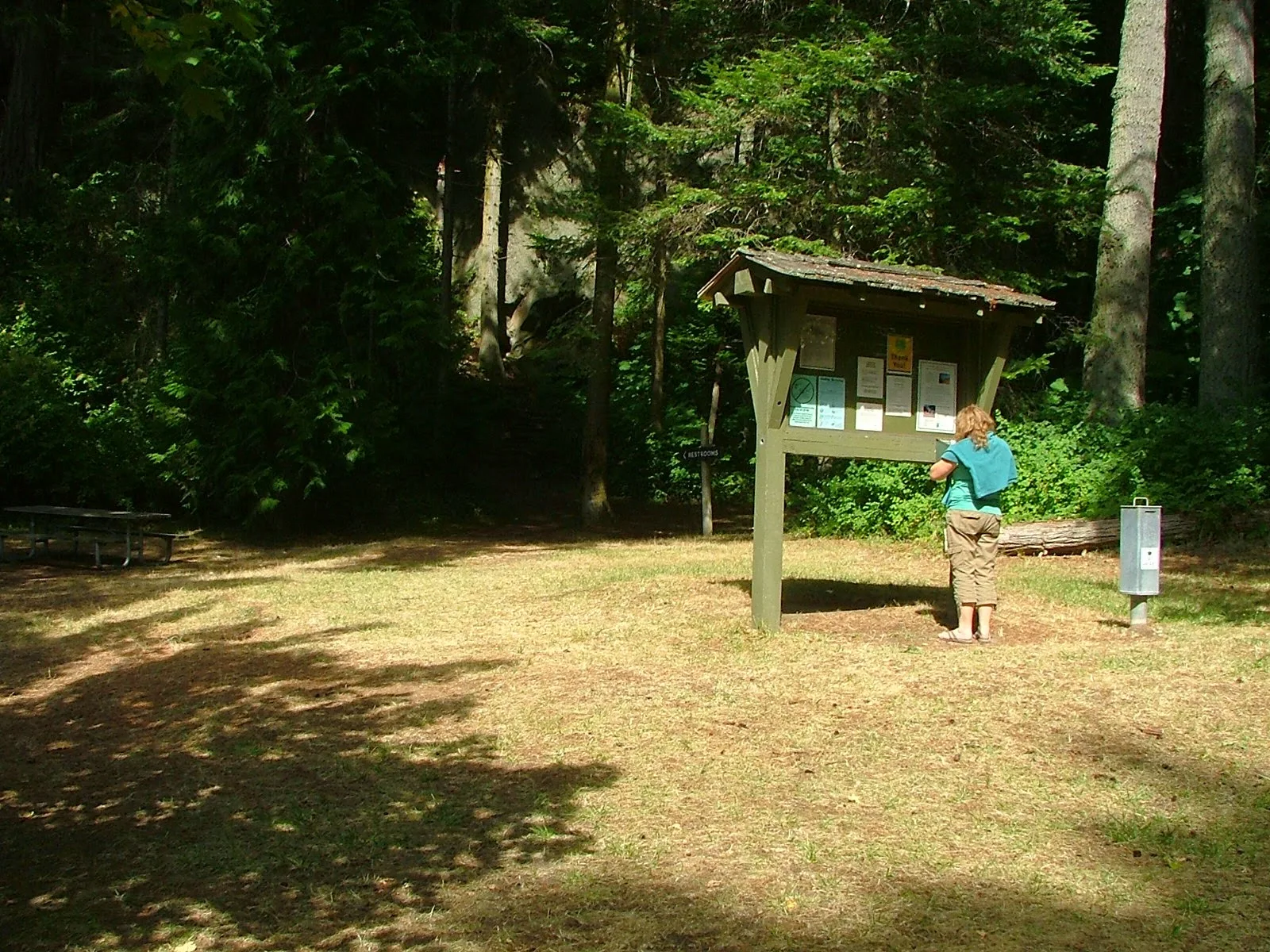
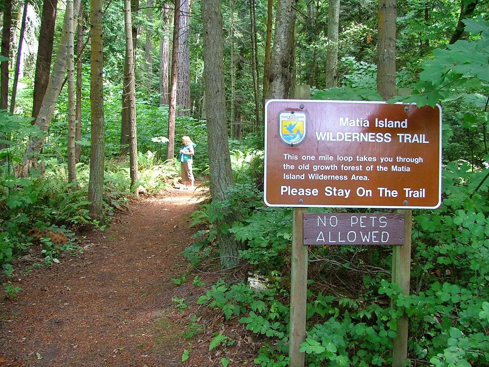
The trail starts at the top of ramp beyond the small picnic campground area.  Matia is unique in that fires are not allowed anywhere, and pets are restricted from trail system.
click where it says read more for the rest of the picture tour!

9/02/2014

At Last Pictures of Bimini in a Bag are posted

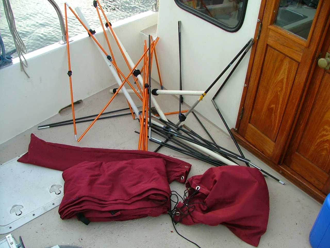
     Not all of us can just go out and order a $5000 bimini and have it magically appear installed on our boat. So the mother of invention leads us once again down the path of necessity and creates a "Bimini in a Bag"

Do it your self bimini top #1
"Bimini in two bags"
fits under the v-berth

Do it your self bimini top #2
Organized chaos
is the secret behind many good things.


Do it your self bimini top #3
Rainy day at Roche Harbor and the new bimini was priceless


Read the full description and many more pictures in the long posting titled  "Doing it yourself page" over on the right side menu bar or just click here  >>   doing it yourself ideas


12/20/2011

Why go to Cypress Island? Just go somewhere else - Please

        I hesitate to write about Cypress Island, my impulse is to keep the secret.

     For some, Cypress Island is a destination. For others it's just a stop on the way to somewhere else.
For me, it's a dependable refuge that I return to again and again.

        This selection of images is from Pelican Beach on Cypress Island.  The beach is very dinghy friendly. Pelican Beach should be visited for one hour or overnight, or you are missing out on something truly special.

cypress island eagle cliff hike


Pelican beach campsites


Cypress island, Pelican beach

Find your own trail on Cypress

Please use this link for all the other parks and keep Cypress secret.

11/24/2011

Using Current Charts Will Get You a Free Ride in the San Juan Islands - Riding the Current North in Burrows Bay

      Who ever said there's no free ride has never been to Burrows Bay. If you are a kayaker and your kayak paddle is  getting heavy, or your in a putt-a-putt puttster boat and need another knot of speed, you should know that the current pretty much  always flows north in Burrows Bay.
        Don't believe me, check your current atlas and find a day of the year or time of day that the current is forecast to flow south.

        Burrows Island and Allan Island are strategically located to create a whirlpool counter current within the bay, so along the shore is a dependable northward current at all times.

      What this means is that when you are cruising from Deception Pass north to Anacortes, or anywhere north, in Rosario Strait, it will pay you to come in close to the eastern shore and get a little boost. Of course if you're heading south you should stay out in Rosario Strait.
        Hugging the shore in Burrows Bay  will get you about 4 miles of free current to ride. Wouldn't it be great if all the channels and passages were this helpful, this back and forth tidal thing is nice, but doesn't always  keep to my schedule.