ATTENTION!

This site has oodles of information about boating and the San Juans, it helps to use the search box BELOW to find what interests you.
Search - "things to do" or try "places to go"
search - Sucia Island
search - Friday Harbor
search - hiking or bicycling
try - kayak - try CAMPING - try Anchoring

++++ ============================= All Posts Below

Current Posts Below
Showing posts with label post. Show all posts

11/28/2014

Pictures by Land and Sea Around Matia Island in the San Juan's


      A few years back, I  hiked the trail from Pelican Beach to the top of Eagle Bluff on Cypress Island, taking pictures every few minutes along the way.  The resulting pictorial is a pretty good synopsis for those that can't make the journey themselves. See the Eagle Bluff Pictorial hike here.  I decided to do the same thing on Matia, but with a little change up. First I hiked the trail snapping away with wild abandon, then I jumped in the dinghy and hugged the shore continuing taking pictures while I circled the island. Then I deleted most of what I had. The results are  below, you decide if it was worthwhile.
Matia Island picture
The blue marker on the far left marks Rolfe cove, and where we  begin our visit to Matia

First off, exit the dock!
The little four boat float, may be full, but there are two buoys and room for a few boats to anchor.  In a pinch you can anchor in the much larger cove at the other end of the island and do this hike/dinghy tour in reverse.

Hiking boating Matia Island
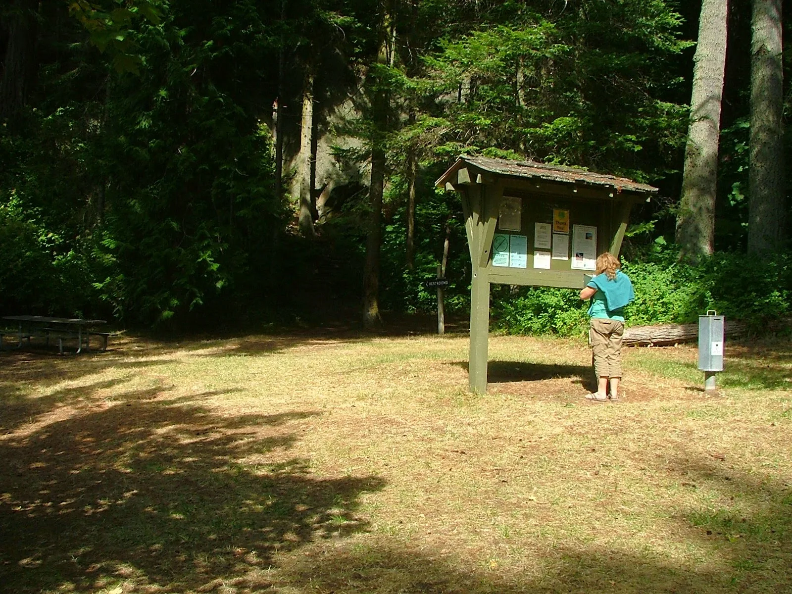
Boater park fees are  a great deal for what we get in return.


Matia Island in the San Juans
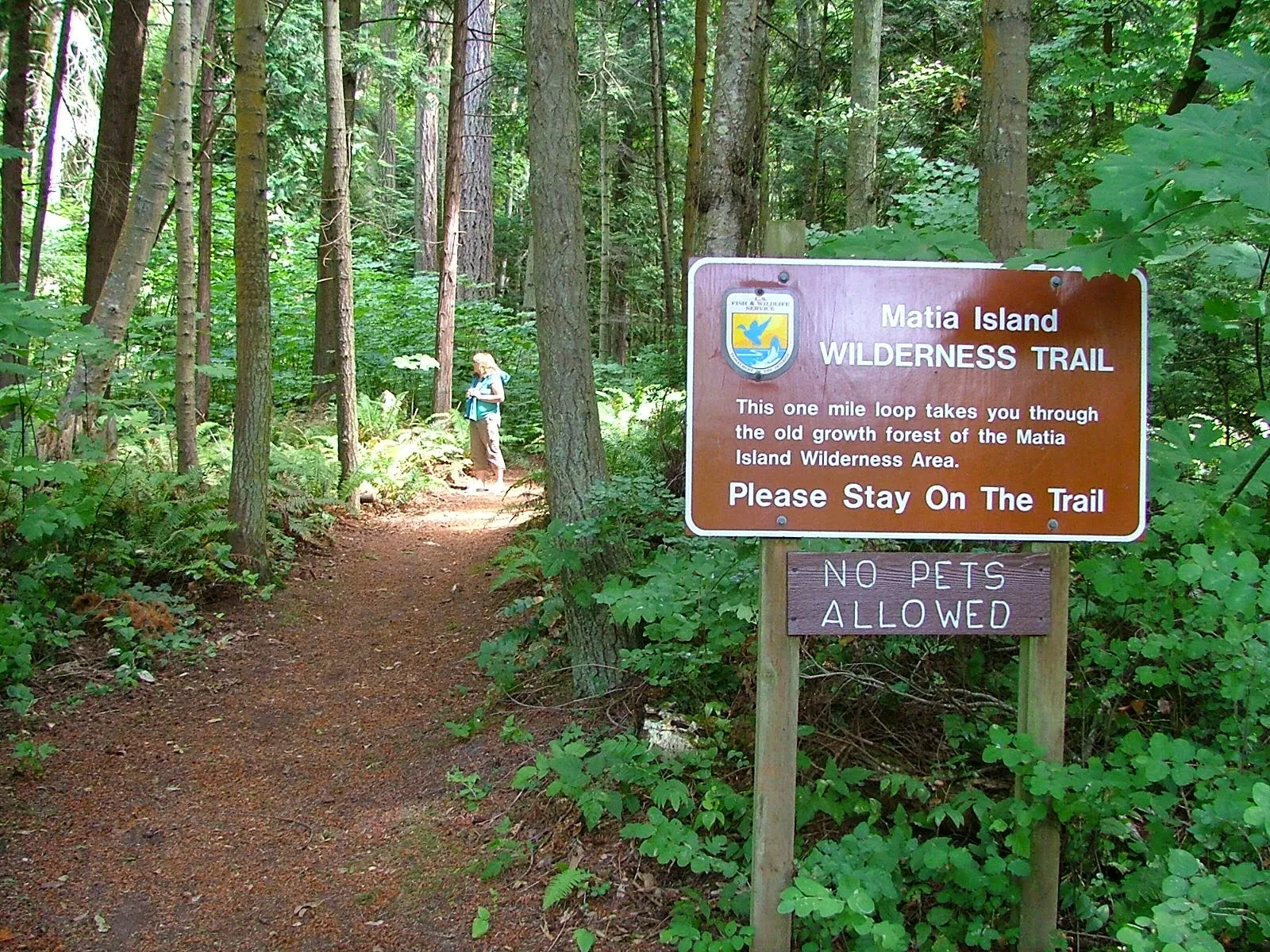
The trail starts at the top of ramp beyond the small picnic campground area.  Matia is unique in that fires are not allowed anywhere, and pets are restricted from trail system.
click where it says read more for the rest of the picture tour!

6/29/2014

Princess Louisa Inlet Cruise and Chatterbox Falls

          Our Princess Louisa Inlet Cruise was a great success.  Success to me means no breakdowns or major deviations from the plan.

          We cast off for this approximately 150 mile (one way) joy ride from our slip in La Conner at a little before noon on a sunny Saturday.  Our first stop was just a mile up Swinomish Channel where we visited the fuel dock to top off our 70 gallon diesel tank.  Heading off with the tanks full, the fridge and cabinets crammed with ten to twelve days of very good eating, we headed north towards ominous looking storm clouds and the forecast of gale force winds.  Yes, we are very apprehensive.  Many thoughts occupied our thinking, the first was, were we making a mistake heading into bad weather.  The second was, would we get stuck somewhere and not be able to get back in time for our breakfast date with Linda's mother a week from Tuesday.
Kraken at Princess Louisa Inlet and Chatterbox Falls
Chatterbox Falls from park float

           Our first overnight stop is Patos Island.  Patos is as far north, not counting Point Roberts as a boater can go before entering Canada.  We anchored with plenty of daylight left to walk out to the lighthouse and hike around.  The next morning we got going  early before 7 am. With 40 miles to cover at 5-8 mph, False Creek in Vancouver may be an 8 hour run.  With no good options to duck and cover along the way, I was a still a little apprehensive to say the least.  The wind never really was a factor that day but about halfway to Vancouver we were about 5 miles off shore from the  Tsawwassen ferry terminal when a following swell began to overtake us and toss Kraken around like the little 26 Nordic Tug she is. Steering the wallowing boat became full time work and I found myself driving a zigzag course. I was zigging to make our selves more comfy and then zagging back onto a course that would eventually get us to False Creek where we would check into Canada and spend the night.  Linda got out the Dramamine, and I took one also, something I almost never do. About every fourth zigzag an extra big quartering swell would turn us sideways causing severe rolling and much crashing sounds coming from all of Krakens many stores and equipment.  At this point we are seriously discussing changing course for Bedwell Harbor on South Pender Island. Bedwell was about the same distance, the waves would be more on our nose, and we could continue northward on the inside of the Gulf Islands affording ourselves much better protection, but then we would be on the wrong side of the Strait of Georgia, and north of Nanaimo was where the real gale winds were churning up the strait.  This is not how my Princess Louisa Trip was supposed to go.

Click below to read the rest of posting and see a few pictures along the way


Princess Louisa Inlet Cruise - Malibu Rapids - Skookumchuck Narrows - Nine Day Itinerary with layover at False Creek in Vancouver

        We just completed this trip, I mentioned in earlier posts it was in the works, and now it is history.
        We started as usual in La Conner and visited, Vancouver, Skookumchuck Narrows, Malibu Rapids, Princes Louisa Inlet, and Chatterbox Falls.

       This short accounting may help others plan out their trip.  The mileages are approximations.   We kept our speed in the 6 - 7 knt range, most of the time.

You may read a more detailed accounting over on the right side menu or just click here >>Princess Louisa Cruise - long story!
  • Day 1,  Left La Conner with full tanks, destination Patos Island. - 32 miles - Very easy day.
  • Day 2,  Patos to False creek in Vancouver - 40 miles - This was a rough water, rainy windy day that used buckets of fuel, dramamine and really made us think about changing destinations.
  • Day 3, Weather layover -  This was a great day, bicycling Stanley Park, False Creek, and exploring the shops at Granville Island. (this is a must do place to visit again)
  • Day 4,  Vancouver to Egmont  -  57 miles - On this leg I planned stays at Sechelt, Secret Cove or Pender Harbour if needed.  This day was a hard slog, but very doable.
  • Day 5   Egmont to Princess Louisa Inlet - 32 miles - A somewhat boring, very easy day. Plenty of time to check out Park.
  • Day 6   Princess Louisa to Pender Harbour - 38 miles Another bore, but we had planned Secret Cove, and rough water forced us into Pender
  • Day 7   Pender to Point Roberts, then onto Patos - 70 miles - With the currents help, this day was an easy  run.  This could have been a miserable day, I think we got lucky!
  • Day 8    Patos to Pelican Beach on Cypress with a stopover on Clark - 17 miles - We didn't leave Patos until well past 2 pm.
  • Day 9  Cypress to La Conner with a stopover at Cone Islands and a figure eight hike on Saddlebag Island. - 17 miles -   Filled all tanks in preparation for Roche Harbor and the 4th of July.

Kraken at Chatterbox Falls in Princess Louisa Inlet British Columbia
Chatterbox Falls at the head of Princess Louisa Inlet
      In retrospect, if I could do it over, I would have planned a few days at Vancouver.  We were forced by bad weather to hang out in False Creek after customs but it was the best part of the trip.  We are planning a return to Vancouver as our destination.

      Secondly, I would have planned our Skookumchuck Narrows visit (Egmont) for when  big water rapids were forecast.  It was kind of a waste to go to all the effort and not see anything but a little tide rip.


You may read a more detailed accounting over on the right side menu or just click here >>Princess Louisa Cruise - long story!

5/08/2014

What Is The Perfect San Juan Islands Boat - What Equipment is Mandatory


    I  was talking to someone the other day that was earnestly looking for a boat for a passage to Hawaii. He remarked that the vessel he was considering did not have an anchor windlass and he sure would like one.  That comment got me thinking about how often one needs to anchor on the way to Hawaii, and then I thought what else do we think we need but really don’t need at all. 
                In the San Juans we anchor all the time, plus an anchor can be a last chance emergency brake when the motor conks out.  On the way to Hawaii I just don’t see any use for an anchor or windlass, and I doubt motoring very far is in the cards either, so a dependable motor ranks somewhere behind standing rigging because if the mast folds up and goes over the side in the San Juans it’s a big deal and probably will require motoring  back to home base.  If the same thing happens a thousand miles from shore its more than a big deal, it could mean a rescue, so having stout rigging is a must going to Hawaii, but not in the San Juans. How about tanks, do we need a holding tank in the San Juan’s, the answer is no, but they are very handy if you do not want to be tied to resorts and shore side facilities. On the way to Hawaii, I think a holding tank won’t be missed.  Fresh water tank, yes. I think you need one going to Hawaii, but in the San Juans, no, you can make it from place to place with a sports bottle in your pocket.  How about a compass, I think yes in both scenario’s.   Radar is a resounding not needed in either case but a gps and radio I think you need, and since they are relatively cheap and portable there is no real good reason not to have them with you. A chart plotter is not needed but a paper chart is needed whether going to Hawaii or hanging around the San Juans.
How about a refrigerator, nope you can get by without one and save a lot of juice at the same time. 
Did I leave out anything big?  Yes! No!  Of course you need basics like a bilge pump or a bucket, but let’s face it a dinghy is handy but not required, so is a new suit of sails.  I think a good argument can be made for having an emergency life raft out in the middle of the ocean, but not so good an argument in the San Juans.
The purpose for this line of thought as I said in the beginning was to think some about
what gear is really needed on my boat, or on the boat  being considered.
Click below to read more

4/05/2014

Practicing What I Preach

          One way to plan a cruise to the San Juan's!

     Many times on this site I have suggested that the most important planning thing to do is set a date, and the rest of the cruise will come together, that philosophy has not changed.  But that doesn't mean you can ignore important details expecting them to magically fall in place.  Someone still has to grease the wheel bearings, apply for passports, order techie toys, mow the lawn.
     
     Just put a big X on the calendar and then sit back and let your cruise plan unfold (bad word choice, sounds too much like unravel) just sit back and let your plan develop.  In our case, with some prodding (one poke) from my oldest daughter, I agreed to go to Roche Harbor for the 4th of July.  No big X date on exact arrival but the 4th is the 4th, so I figured  we would arrive in the general area a few days earlier.

     Now, some months later,  the plan is starting to come together.  I have a day planned for bike riding on San Juan.  I have a  campfire night planned on shore at Jones for hot dogs.  I have a toss up day to get Ice Cream at Blakelys or Friday Harbor, and it looks like if I can make my Livingston Dinghy sail properly, I will have the day of the 4th to sail around Roche Harbor dodging anchor lines and other dinghies.  Yesterday another daughter announced she and her friends had camping reservations on San Juan Island, also over the 4th of July, and that I could give her, her friends and their bicycles a ride over to Lopez on the 2nd, and then they would ride the ferry back that evening.  The plan for Saturday after the 4th is still open, but I know it will fall in place just like always.

       So, we put the big X on the calendar, and the plan is evolving, I can't believe I used to actually stress over vacation details.  I wonder if I should enter the blind dinghy race the day of the 4th.  hmmm!


Just in case someone needs an exhausting check list to stress out over when making plans, take a look here.
Cruisers - Mother of all Packing lists!   <<< click there


2/15/2014

Understanding the Rule of Twelfths Formula for Tide Predictions in the San Juan Islands

Disclaimer #1 
I have read this little tool rule many times by different authors and each time have come away confused and surprised at how such a simple idea can come out so convoluted and nonsensical. I wrote my clearly understandable version below and tried it on Linda who knows and understands the rule only to hear  "Your writing is  confusing, why did you say tidal range?"
Using the Rule of twelfths when anchoring
phooey
"The Rule of Twelfths"
      
 First, lets think in terms of where we will apply this tool.  For me it is when I need to anchor and I don’t know how far the tide is going to drop or rise.  Will my keel touch bottom in two hours, will the anchor drag while we sleep?  These important questions need answering before setting the hook.

       To employ the rule you must know some approximate facts first. #1, what is the tidal range in the area, ie. if the tide book states high tide is 8.5 feet and low tide is 1.5 feet, the total range the water rises or falls is 7 feet. As you know every day is different and varies by area so our first fact is just an approximation.  #2, we need to know what time high or low tide is forecast.  These two facts are all we need to know and we can arrive at the anchorage and make a good estimate of what to expect.

       Most areas have a six hour duration from low tide to high tide so we need to think in terms of six one hour segments. During the first hour the water rises or falls slowly. During the second hour the rise or fall picks up speed.  During the third and fourth hours, the water is moving at its fastest rate, and the fifth and sixth hours are slower and mirror hours one and two.  That’s the cycle that is repeated regardless of area or total range.  Slow at first, picking up speed, very fast, then slow down, and come to a stop, in six hours and then repeat.

       So now we have a six hour period broken into one hour segments, it’s time to assign a value to each hour and the following is the backbone of the Rule of Twelfths  123321, (each number represents one hour) yes they do add up to twelve. In the first hour after slack water, the water will move 1/12 of the range, in the second hour the water will move 2/12 of the range, or double the first. In the third hour the water moves 3/12 of the entire range. So this means that three hours after slack, or three hours  before the next slack, the water has moved a total of 6/12 or halfway through its range.  We already know that at the halfway point the tide is moving at its fastest and is halfway in or out, so no surprise there.  When we arrive at an anchorage exactly halfway between high and low tide, all we need to know is the total range and we can easily determine how much more or less to expect.  Where this tool helps most is during the second hour or fifth hour, referring back to our rule of 123321 we see the fifth hour totals 10/12, and the second hour total 3/12 of the range. By reducing fractions we easily understand that in the fifth hour the tide has moved 5/6 of the range and only has about 1-2 feet still to go. In the second hour the tide has only moved  1/4 the range and so still has about 4-5 feet to move.


       Armed with this knowledge you can easily determine how much the water will rise or fall and anchor where the depth is best for your boat.  So remember 123321,  know the tidal range in your area, and what time high or low tide is forecast. The rest is just fractions.

Disclaimer #2
       As a practical matter, I don't park the boat with just a foot of clearance under my goodies unless I have a good reason, such as I'm at a dock at low tide and I know whats coming.  Swinging at anchor with only a foot to spare is asking for it in some locations.  For you naysayers consider what happens to your boat when a big swell comes your way, that's right it is followed by a trough.  Well not only does a one foot trough take away your clearance, but it slams you violently on the bottom to tell you so.

       So, even though the Rule of Twelfths is a fun exercise, and I recommend everyone understand the ups and downs of tides, (ha) I still look for lots of depth at low tide, set my anchors very well, and sleep even better.

Here is a link to the NOAA tide tables  > NOAA tide tables

11/24/2011

Using Current Charts Will Get You a Free Ride in the San Juan Islands - Riding the Current North in Burrows Bay

      Who ever said there's no free ride has never been to Burrows Bay. If you are a kayaker and your kayak paddle is  getting heavy, or your in a putt-a-putt puttster boat and need another knot of speed, you should know that the current pretty much  always flows north in Burrows Bay.
        Don't believe me, check your current atlas and find a day of the year or time of day that the current is forecast to flow south.

        Burrows Island and Allan Island are strategically located to create a whirlpool counter current within the bay, so along the shore is a dependable northward current at all times.

      What this means is that when you are cruising from Deception Pass north to Anacortes, or anywhere north, in Rosario Strait, it will pay you to come in close to the eastern shore and get a little boost. Of course if you're heading south you should stay out in Rosario Strait.
        Hugging the shore in Burrows Bay  will get you about 4 miles of free current to ride. Wouldn't it be great if all the channels and passages were this helpful, this back and forth tidal thing is nice, but doesn't always  keep to my schedule.