ATTENTION!

This site has oodles of information about boating and the San Juans, it helps to use the search box BELOW to find what interests you.
Search - "things to do" or try "places to go"
search - Sucia Island
search - Friday Harbor
search - hiking or bicycling
try - kayak - try CAMPING - try Anchoring

++++ ============================= All Posts Below

Current Posts Below
Showing posts with label San Juan Islands. Show all posts

Friday

First Time Trip to the San Juans Suggested Itinerary for a Nine Day Trip


San Juan Islands for First Timers

Suggested Itineraries for  San Juan Island boating trips

(Updated (2014) alternate itinerary with Echo Bay at Sucia Island as 1st stop)
click here  Sucia Trip Intinerary


(For a  shorter itinerary on your first cruise and with different island stopovers (click here) 


      This article is designed to get you going on that first boating/sailing trip to the San Juan Islands in Washington State.

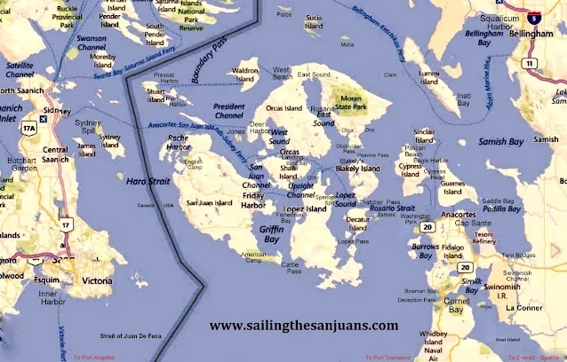
Below is a snapshot map of your dreamed about vacation land (or water) 


map of San Juan Island area


The map above identifies many  (not all) common names and places

Take a moment to familiarize yourself with some locations you may have read about.


You may want to follow this link and take a quick look at the detailed marine parks list and then come back to the suggested itinerary below, "MARINE PARK LIST AND MAPS" click here 

for your detailed itinerary click (read more) below  >>

Thursday

What is the Best Dinghy for Cruisers in the San Juan Islands? The Dinghy Dilemma!

       We all know asking "What's the best dinghy" is a loaded question; boaters can be passionate when it comes to  equipment choices.  Based on my own frugal, sailing/boating should be affordable philosophy "The best dinghy is the one you already own."  Whoa now, lets start listing exceptions.  I don't mean too small, too big, leaky, unsafe, etc. etc.   I mean a basic dinghy, that only has to float you and your stuff to shore.

    In keeping with this blogs purpose to help first timers get to the San Juans, lets talk reality.

     Here are ten or more irrefutable truths about dinghies.
  • You must have a dinghy to go ashore at most parks, because you can't count on there being room at the dock. Many docks have room for only four boats. Many parks have no dock.
  • You don't need a dinghy if you only go to resorts and marinas.
  • You will probably tow your dinghy everywhere you go.
  • You may not use it at all (makes you wish you left it home).
  • If you need it you will be thankful you brought it with you.
  • There is no place you will go that you can't drag your dinghy along.
  • Dinghies may be major status symbols among some groups.
  • Towing a dinghy slows you down and uses fuel
  • You may run over your tow line and foul your prop or rudder (use a floating tow line).
  • Certain people have a hard time climbing into or out of a dinghy alongside their boat.
  • Children need a dinghy.
     Okay, that list is far from complete but highlights some points. Yes you need a dinghy, even if you can beach your boat, there are simply too many limitations and problems with beaching your water borne camper.  Lets say for example you rush to shore to use the bathroom at one of the great State Parks.  In the ten minutes you're ashore, a falling tide could leave you high and dry.  With a dinghy you simply pick it up and carry it back to the water. You need a two or three person dinghy, a one person craft can't ferry others to shore. When using dinghies, a multi hull catamaran style such as a Livingston is very stable, rows  well, beaches easy, and can carry big cargoes, however when towed they track to one side, hunt back and forth, forcing you to keep them on a very short leash. A conventional V hull dinghy is  tipsy crawling over the bow on the beach, carry's less cargo, but rows very nice and will tow directly behind you on a long or short leash.  Inflatables can carry enormous loads, some (not all) row poorly and some create so much drag they are impossible to tow. Just about all dinghies can be outfitted with an outboard motor, but you really don't need one for simple cruising in the San Juan Islands unless you plan on doing miles of shoreline exploring.

        In the summer season you probably wont see any big dinghy capsizing waves, but storms and adverse winds can churn up anywhere anytime, my dinghy floats when swamped, but not with the outboard, with the outboard bolted to the transom it's straight to the bottom or at least as far down as my tow line is long. Inflatables may be swamped without damage or sinking, which is something to think about if  your main boat is not up to the challenge, and could itself be sunk somehow.
Livingston Dinghy, one of five best shore boats
Our Livingston dinghy is nine feet long and a tad bit overloaded
Two man inflatable kayak for cheap shore boat in the San Juan Islands
This inflatable was $69 and holds two people
This inflatable stows on deck, or deflated stows below and carries three people. 
      How about two dinghy's?
If you have children that take off with the dinghy, they are effectively leaving you stranded on the boat or ashore.  Well that's not going to happen you may say.  I say, "what if they get hurt ashore and call you on the phone or radio for help? What do you do? What if they take off in the dinghy and it gets dark, what do you do? (swim)"
Several years past I sent my bored and restless son (in the dinghy) to shore at dusk, telling him to invite himself to one of the many campfires we could see from the boat.  He met some other boaters with kids and before you know it it was after 10:00 pm and very dark.  His mother and I started to wonder what to do as we were stranded, and had no way to communicate with him. After a few minutes I took a strong flash light and blinked it into the darkness in the direction we thought he was last seen.  A short while later he appeared at our transom asking if we wanted him or something.  This little non event made me realize how handy a second dinghy would be, so we bought an inflatable kayak to stow below, just in case.


10/13/13 update worth noting
I'm selling the new sailing dinghy

4/17/17 update on converting the 9'  Livingston dinghy to sailing
 >> go to the do-it-yourself page and scroll way way way down to see the finished conversion << The dinghy conversion section is before the Bimini top on the cheap instructions and after the Boat acronyms if that helps you find it.
Livingston dinghy sailing conversion

9/13/20 another dinghy update. Last winter I plunked down about a grand in boat bucks and bought a new inflatable. My criteria was as follows. First, it must be light enough for me to muscle it around onto and off of the cabin roof by myself. It must have two seats. I must be able to inflate and deflate it on the boat. I bought a 9.5 foot boat with aluminum seats, plywood transom and high pressure inflatable floor.  Without seats, oars or pump, the rolled up package is about 4 feet long, 1.5 feet in diameter and weighs in at 73 pounds.

Standing on the cabin roof, I was able to fully inflate the new boat and slide it into the water.  Dragging it back up was much more work, even with two of us.  Then we drove around for three days with the inflated boat on the roof. All in all I like the new boat and am happy with my choice.

Testing complete, we deflated our new dinghy, rolled it up and headed for the San Juans.  At the last minute before heading up the freeway, I put the Livingston back on it's  swim step snap davits.  I know my plan was to replace the Livingston with something more seaworthy but I decided to bring the new and the old anyway.

In the San Juans we never inflated the new dinghy, and used the Livingston as usual.  Now the new inflatable is sitting collecting dust in my boat shed. I used it once for one hour. I still have high hopes to somehow justify my purchase. I hope mice and squirrels don't chew on it in the meantime.

Friday

Eight places in the San Juans where you can dent your pride and check your ego

        Someone famous once wrote, "I only worry near shore because that is where the shallow water is."  Okay, I don't remember exactly what I read but you get the idea.

        In the San Juan's we are pretty much always near shore (it's not that big an area) so should we worry all the time?  No! We should pay attention using our heads and our tools.

      All the rocks, reefs and shallows are marked on charts, the especially egregious places have buoys, signs, sticks and posts out in the water.   Of course with storms, high tides, poor maintenance, things go missing, so we are back to paying attention and using the old noggin.

       Once not too long ago we were motoring in flat mirror perfect water at about 7 knots in twenty feet of depth.  Up ahead I saw a disturbance (some itty bitty  ripples) I glanced at my chart plotter and saw nothing alarming, nevertheless as we neared the ripples I braked and prepared to go full astern.

         While watching the depth gauge,  suddenly -- there it was -- the depth dropped to six and then four -- and we came to a halt. (no we didn't hit) I stopped, turned and went around the shallow spot.

Worst places in the San Juans for rocks and running aground
on watch

Here is a list of potentially problem spots where you could easily relax your vigilance and get hurt.


read more - click here

Monday

Creating maximum space at the dock and general good manners.

Orca killer whales in  Haro strait Off shore from LIme Kiln park


   Having just returned from a 200 mile sweep around the San Juan's, I am fresh with observations and thoughts of how to improve the experience.

      Everyone knows that dock space is first come first served and not to expect room for one more when you arrive.  However, there is room for more if you try using some common sense.  Somewhere in the mountain of state park dock rules and regs is the suggestion to locate boats close together.  Spacing boats fifteen feet apart is not helpful and yet it is common. Tying ones dinghy to the float instead of rafting it is another obvious inconsiderate ploy that effectively exclude others.  By the way, did they pay for the extra dinghy footage?

       Speaking of dinghy's, many parks have designated dinghy docks but I see people with fifteen foot inflatables, complete with 50hp outboards, consoles, windshields and bimini's, side tied at the dinghy dock forcing real dinghy's to make do as best they can.  What is really annoying is when you realize the offending dinghy belongs to the fifty five footer tied to the same float.

      Speaking of  bigger or smaller boats,  a considerate skipper will let his longish bow area stick out beyond the end of the float so his fifty five feet only uses forty feet of  dock.  Stop! I know this trick is a bad idea in some locations and for some boats. Obviously, I'm not suggesting being foolish, I'm suggesting being thoughtful and considerate.

       While we are talking considerate  activities,  how long is long enough or too long to run a generator?  During my latest visit we were treated to a generator running for eight hour stretches.  It was during the daytime and it was fairly quiet but come on, at least get off the dock and anchor out a ways. I was anchored out myself, it must have been no fun at all for the people close by.

       I spend some of my non San Juan boating time around jet skis, water skiers, tubers, newbies, loud music and alcohol fueled people enjoying the water.  As such, I expect close encounters, big wakes and general on water mayhem.  But not in the San Juan's, the San Juan's attract an older more refined, mature crowd. We have miles of room to navigate, there is really no reason for close encounters. Jet skis are outlawed and proper boating is the norm.  On this visit a thirty five footer at high speed overtook us and passed by so close they would have hit us if I had turned unexpectedly.  I had no time to react, their wake rolled us so violently that one crew was thrown out of their seat and some of our belongings came crashing off shelves and out of cabinets breaking on the cabin sole.  I regret I did not get a picture or name of the offending boat.  I am not embarrassed that acting on reflex, I cussed them over the radio.  Then after realizing in my haste I may not have keyed the mike, I did it again clearly to make sure they heard.  I hope they heard me but my antenna was down with the inflatable on the roof so my range was greatly reduced.  I apologize for may last paragraph, I'm still reeling when I think about the incident.

     On an upnote, at Jones Island, as we were anchoring, a skipper at the float yelled over to us that he was leaving in a few minutes. We aborted lowering the hook and moved over, thank you very much.

     Also at Jones, we thought we lost a cell phone, trail mix and passports in a drybag at our camp site, only to find it two days later where a racoon had stashed it in the bushes, unharmed but chewed on.


Sobering thought worth thinking about


I was busy cleaning out my laptop and as usual became sidetracked reading something I wrote.  I immediately noticed punctuation and other errors but more than that, I vividly remembered the situation I had written about and how shaken I was.  I remember thinking that perhaps risking my family's lives was not my decision to make.  I remember considering turning around and quitting boating right then and there.

I hope I have caught the attention of others like me.  Below is the gist of what I wrote almost ten years ago.


Crossing Rosario Strait heading into Thatcher Pass, we were all staring out the front and not paying attention to our sideways set (side drift) when out of the corner of my eye I caught a movement that turned out to be rocks coming at us fast. (full flood must have been 3+ knots) The current was forcing us sideways straight onto the rocks of tiny Pointer Island. I swung hard over and pushed her to full throttle, our outboard barely pulled us away with one hundred feet and two or three seconds to spare. I shuddered thinking of my family on board and almost quit boating right then and there.


While we’re talking currents, I am sure you know that your boat will be dragged sideways whilst you drive forward when crossing a channel or fast water.  It is very easy to not pay enough attention to the currents “set and drift” and what’s on the side of your boat. Let’s put it simpler, if you’re driving forward and looking forward you will miss what you’re heading for sideways. It is easy when close to hazards to allow yourself to be dragged into them because your looking where you want to go, not where you are really going. Tip. Please re-read that last sentence and get it into your default system, it may save your boat or someone’s life.


Please leave your SCARY story in the comments below.  You will never know but you may save someone. John

Friday

Summer Cruising Plans - Do it now! - Ten resorts and phone numbers where you can reserve a slip

 Sometimes it is really nice to have a slip reserved just for you.

      After spending a few nights on the hook somewhere, or jostling for dock space at a park that only holds four boats and has no water or shower, I look forward to my guaranteed reservation.

If you have a firm date planned, 4th of July maybe, you can call or get online and reserve a slip.


  1. La Conner 360 466 3118
  2. Cap Sante  360 2930694
  3. Squalicum Harbor 360 676 2542
  4. Blakelys   360375 6121
  5. West Beach  360 375 6121
  6. Islander Resort  360 468 2233
  7. Friday Harbor   360 378 2688
  8. Roche Harbor   800 586 3590
  9. Deer Harbor  360 376 3037
  10. Rosario Resort  360 376 2152

Most of these places will be able to fit you in with short notice, but plan ahead to be sure.

Did you know?
For your land bound friends and relatives (children). They can make campground reservations.

  • Sucia Island State Park
  • Odlin County Park
  • San Juan Island County Park
  • Spencer Spit State Park
  • Washington  Park (Anacortes city park)
These five parks are boater accessible and take reservations for camping.

Think outside the box, and plan a combination land and sea adventure with your non-boater friends.

Follow this link to a post outlining a land and sea outing involving - cars - campgrounds - ferry rides - bicycles and one boat used as a taxi.
Outside the box cruising

Marinas and telephone numbers in the San Juan's
What are you waiting for - Winter?


Excellent Anchoring Etiquette and Proper First Impressions at State Marine Parks

        Oh yeah!   Everyone remembers when you anchored, you were the one saying eff'g this and eff'g that while instructing your crew in dealing with your short comings. Yeah, we remember you calling your wife an idiot and moron.  Idiot for not pushing you over the side tied to the anchor is more accurate.

Loud, obnoxious, boisterous, yelling and foul language are no way to announce your arrival to the anchorage.  You should be on your good behavior, you will never get another chance to make that first impression.

It's entirely possible that there is no room where you want to anchor, and you have no choice but to move along to your second choice.  You can't squeeze in where you wont fit, and if you do force the issue, and there is an incident causing damage, you will be responsible financially.  I think most boaters are a forgiving and helpful bunch, but not if your an inconsiderate dweeb to begin with.  Hint: Ask the other boaters already anchored for help in anchoring before you anchor in their yard.  They may just move over a little to help you out.

The old adage first come first served is true when you anchor, meaning the guy there ahead of you has claim to his spot, and you need to respect his anchor location and swing of his boat. The guy that comes in after you will stay out of your way, and so forth.

Stern anchor plus bow anchor:
Many hot spots will have more boats than can hang and swing safely so skippers have taken to hooking out both directions, and stretching the boat in the middle to limit swing, thereby cramming more boats in safely.  This is perfectly acceptable provided the weather agrees.  If you arrive in one of these places and don't follow suit you're being somewhat within your limited boater rights, however taking an exorbitant amount of room to anchor your yacht spoils the fun so  you may not be invited to sun-downers.   When it gets really crowded, skippers will raft boats together, usually anchoring just the biggest boats.  Let the party begin.

Defensive boating, is just like in your car, you need to be prepared to move when a boat comes at you dragging its anchor.  Watch others upstream of you when they anchor, if they don't have much scope out, or didn't set their anchor, watch out.  Its better to move your boat in the daylight before they drag into you in the dark.

What about private anchor buoys?
Most of the harbors and resorts around the San Juan's have private buoys scattered around. You should leave them alone unless you have permission to use them. They may be not maintained and unsafe, the owner may show up after dark and tell you to leave.  Emergency's are different, but your emergency may not matter to the owner.

Anchor lights:
If you're in an established anchorage, (all parks are ) you don't need to have a light, but if you think someone may run into you in the dark, turn it on, that's the smart call.  We use a battery powered light run up a halyard, plus if we are on shore after dark, it makes finding the boat easier.  It is disconcerting paddling the dinghy into the darkness and not being able to see your boat.

See  article on first time anchoring,  How to anchor that yacht  Anchor that Yacht


Sunday

San Juan Island's Map with Marine Parks - Marinas - Cities - Ferry Routes

If you find some useful places on the orientation map below, you will want to click this link of Parks and Islands to zoom in on details of specific parks.

   Up close look at all the Parks in the San Juan's

(this map post stays on top -  all new posts are below it)

San Juan Islands map showing parks, citys, Canada, Gulf Islands


                                              CLICK ON PIC - IT GETS BIGGER FOR SOME OF US     Map data © 2015 Google
           Lets see, I missed Fort Whitman on Goat Island,
Eastsound (city) is misspelled, Lime Kiln is missing, any more?


Thursday

Farmers Markets on San Juan Island - Saturday Markets on Lopez Island, Orcas Island Saturday Market


Saturday Markets in the San Juans

If your running out of things to do and places to go when cruising the San Juans, try Saturday Markets, Farmers Markets and Craft Fairs.  Lopez, Orcas and San Juan Island, all have regular scheduled markets in the summer months.

 At Friday Harbor on San Juan Island you will find every Saturday morning, April through September the "San Juan Island Farmers Market" at the Brickworks Plaza. Bring your appetite for breakfast or lunch and feast on the island cuisine, then bring home locally made arts and crafts.
Friday Harbor San Juan Island, farmers market

Tie up in a slip, or anchor out and use the dinghy dock, its a very short walk.


In Lopez Village on Lopez Island look for the "Lopez Farmers Market" next door to the community center. Open 10am to 2pm mid May into September every Saturday. Plan on having lunch and picking up some local produce and seafood. Local crafts people and artists will be  displaying their work.

Lopez Village Lopez Island in the San Juan's, farmers markets

Berth at a slip in Fisherman Bay and walk about a half mile to Lopez Village.
OR go by dinghy and land right in town -  here's how >>> Lopez Village by dinghy


Don't miss the "Orcas Island Farmers Market" in Eastsound on the Village Green, Open every Saturday from 10am to 3pm  May through October.  Crafts, arts, food, gardeners, museum and history booths, you will find just what you need. 
Eastsound county dock on Orcas Island, farmers markets
Eastsound county dock

Village Green in Eastsound on Orcas Island, music festivals, farmers markets,
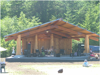
Music festivals on the green

Use the county dock at Madrona Point or anchor out, and dinghy to the dock, its just a block or two to Eastsound.

Anacortes, Bellingham, and LaConner should be on your short list of things to do & places to go!

At Anacortes the Farmers market is at 611 R Ave in Anacortes, just a few steps from Cap Sante Boat Haven, and runs 9am until closing every Saturday beginning in May.
Don't miss the "Waterfront Festival," normally held in June

Bellingham boasts a Farmers Market that is just a one mile walk from Squalicum Harbor at Depot Market Square, Railroad and Chestnut streets, open 10am to 3pm April thru Christmas.

Lastly, LaConner on Swinomish Channel has several public docks downtown where moorage is on a first come basis. As of this writing there is no established close by Saturday Market, but they have an extensive menu of shops jus steps away on main street. Visit the chamber website calendar of events right here.   http://www.laconnerchamber.com/chamber_calendar.cfm


Tuesday

Five Things Everyone Should Know Before Cruising the San Juan Islands

Fun Observations and Frivolous Knowledge  for 

All Boaters new to the San Juan's (repost)

#1 Hugely fluctuating water levels   (tides)

The San Juans have high and low tides every day, some very high, some very low. This means you will need to be prepared to deal with going ashore at locations lacking floats.  The easiest solution is to bring a dinghy; if you don't have a dinghy I suggest you buy a cheap inflatable boat or 2 person kayak for around $75.  Once in the San Juans most people simply tow the dinghy everywhere they go, or deflate and stow it away. Those of you going in a ski boat or skiff may be thinking you can beach your boat, which will work, but only for a few minutes. On a falling tide in ten minutes your boat may be high and dry, unless you can carry it, your stuck until the tide comes back up. On a rising tide your boat will float away while you're on shore.  Since your going to anchor in six feet of water at low tide you will need one hundred feet or more of anchor rode to accommodate a ten foot plus increase at high tide. Smart boaters bring two anchors and rode and a dinghy they can carry up above high tide.
San Juan Islands - very low tide at Matia


#2 Strong Swirling Currents (in places)
San Juan currents are notorious, and the root of many stories. For fast planing boats you can pretty much ignore adverse current; however slower boats live and die by planning passages to get an assist from the current. A typical sailboat may putt along at 4.5 mph, against a 2.5 mph current their real speed over ground is 2 mph.  Going with the same current their sog is 7 mph.  So a ten mile passage takes 5 hours the dumb way or 1 hour 25 minutes the smart way. There are many prediction and forecast books and charts available and online.  While you don't need a publication, I recommend that you buy something and keep it with you. I would also go online and print out a tide schedule for the time and area you expect to cruise.  CLICK BELOW for Rosario Strait at Guemes Channel
NOAA tide forecasts
In a nut shell, here's a simple rule of thumb to follow.  On a incoming or rising tide, the water in most straits and passes flows "north" while during a falling tide the water reverses and flows "south."  When the current hits an island straight on, the water will split and flow around the island usually at a slightly higher speed creating eddies at headlands and the tips of the island.
San Juan and Gulf Islands Current Atlas

San Juan Islands current charts


#3 Weather could be fog  (pea soup is the term)
You can get lost in the dark, in the fog, or just plain lost on a sunny day.  You need to bring with you a chart, and you would be smart to protect it from getting wet or torn up. I sandwich mine between two clear acrylic sheets held together with velcro.
Some will say the chart needs to be new and of the highest resolution, which may be true for ship captains and other navigators.  What were talking about here is not getting lost, even a google print out may do the trick.  If you are going to boat in the fog you must have a compass, and  GPS, a portable handheld GPS will do fine and some new phones may do the trick too. (in thick fog you will go in circles and be totally disoriented without a compass) A gps will not replace a compass in rough water and fog, a gps is much too slow  reacting when you are getting spun from broadsides or quartering waves (broaching) you need both.   Many times in the San Juans visibility may be down to 3 or 4 miles and you think you can sneak across some open water to the next island, and you probably can, but if the fog thickens to pea soup you will be glad you have your compass and GPS.  BTW, fast boats can't always go fast when waves and swells stack up. And only very dumb skippers go fast when they can't see.
San Juan Islands fog hiding a ferry
See the ferry approaching the anchored sailboat?

#4 Wind or lack of wind  (sorry sailors)
OK, here's some bad news for sailors.  The San Juans are not known for great sailing winds in July and August. Out in the straits (Haro, Rosario, Georgia, Juan De Fuca)
you may get some decent sailing, but inside the islands, don't bet on it.
Sailing with reefed main in cold weather
Sailing in April rain with reefed main


#5 Crowd control   (no worries)
Most likely you won't have any problems with crowds except on the 4th of July and Labor Day.  The good side is that you will always find a place to anchor, even on holidays, the dinghy ride may just be a little longer for some.  Most marinas take reservations and you may as well take them up on it, but you don't need to.   I suggest you slow down a little and enjoy the freedom of not planning ahead, take one day at a time and see where you go.  Lastly, because this area is so close to Bellingham and Anacortes many boaters are day boaters.  At the end of the day they head for home, leaving some resorts and parks half empty, especially on weekend Sunday nights. Monday or Tuesday are good days to begin your outing if you want to be alone.
Roche harbor dock on holiday
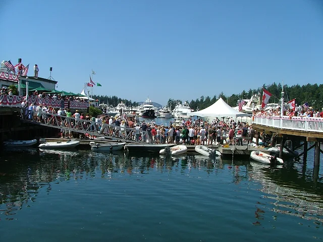
Fourth of July celebration in the San Juan Islands at Roche Harbor Resort
Roche Harbor summer celebration with children

Roche Harbor balloon chasing contest


Roche Harbor 4th of July balloon contest for kids in dinghys
yes, there was room for more, lots more


Expenses
DNR buoys are free (Cypress Island) State Park buoys are $10, many park floats are 50 cents a foot,  Marinas charge between 75 cents and $2 a foot. Gasoline is a little more expensive than on land, but not much more.  Food, groceries, ice are just a little more than the mainland but very fair priced overall.

How many days to plan
Plan a minimum of four days, but up to two weeks depending on what you like to do. (I like to sit on the dock at Jones Island and read my book between naps and walks, then I make a campfire in a empty tent site and cook Kielbasa followed by a glass of wine. Then retire to my boat for a good nights sleep.  The next day, do it again)

Salt Water
Salt water drys sticky and does not suds up well with soap, you will get it all over you and your boat, count on it.  After a week you will look forward to a shower.  Your boat will be covered with salt crystals.  Most marinas have little water and don't want you washing your boat.
Squalicum Harbor in Bellingham has boat and trailer fresh water wash down hoses in the parking lot.  You should use them each time you dunk your trailer.

Provisions
For the most part you will want to provision before you leave on the boat.  Anacortes and Bellingham have all the big stores and each has a West Marine store.  All the resorts and towns have grocery stores, if you drive a fast boat, supply's may be only minutes away, putt putt's should work a store visit into your circuit.  I say circuit because most cruisers will follow a circle of some sort trying to hit many stops.  We find that ice needs renewing after four days, so a stop over at Friday Harbor, Deer Harbor, Roche Harbor, Blakelys, or Orcas landing fills the bill.  All these places  except Orcas, have gas and showers.  Showers will cost a handful of quarters so be quick or be poor. Cold showers are free. Lopez Village has free showers but no dock so you will need a dinghy.how to dinghy to Lopez village

Garbage
All the parks are pack it in and pack it out, the marinas have dumpsters.  If you are new to boat camping you will find garbage to be a pain because you are not used to storing everything in your boat.  Little things like empty water bottles suddenly take space you don't have.  You must give careful thought to what you are bringing, and the garbage it will generate.  We don't use disposable bottles, minimize pop consumption, and try to have campfires to burn burnable trash.  It is against the law to toss anything, (even a apple core) in the water.

Animals
Your dogs must be on a leash, period, everywhere.  Raccoon's are on all islands and will climb right into your boat or kayak in the day time if you let them.  Deer are all over too, but they shy away, except on Jones Island where you can hand feed them.
Otters live under most floats and docks, they will crawl all over your boat, get into things and make a mess.  Otters also will mark their territory by pooing on your stuff, dock lines are a favorite.

Bathrooms
All the parks have nice composting toilets, (each island mentioned for overnight is a park) the rangers service all parks on a regular basis.  You will be pleasantly surprised at how clean the facilities are.

Where to go:
Your destination is simply that, its the journey getting there and the experiences on the way that make a trip a wonderful vacation. Try the links below for some Island Park descriptions.

Emergency's 
Bring your cell phone and charger, bring at least a portable handheld marine radio, bring basic first aid kit, call the Coast Guard, they can be there pretty fast, or arrange for vessel assist on your credit card, bring a friend with a similar boat, then you can help each other.

Wednesday

Cypress Island trail map


To view larger image,  try right clicking and open in new window and then look for plus/minus icon.
The best way, is clicking or pasting the url below and you may then enlarge the image without it being blurry.

https://file.dnr.wa.gov/publications/amp_rec_updated_cypress_island_trail_map.pdf?yh0w7u


San Juan Islands trail map - Cypress Island
Cypress Island trail map

Tuesday

Twenty Marine Parks - Twenty Public Docks - Five Boat launching Ramps in the San Juan Islands


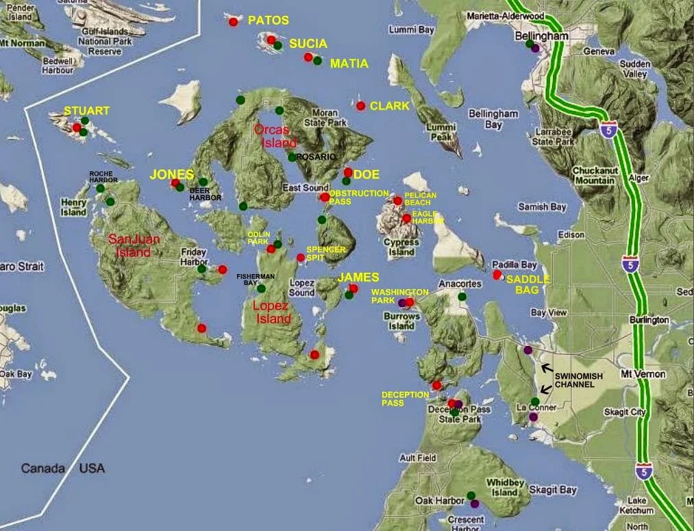
Map of San Juan Island Area
With selected Parks, Docks, and Trailer Boat Ramps
Map of San Juan area parks, docks, trailer boat launch ramps
The  boat ramps (purple) are all on the mainland


 •  Boat Ramps = Purple    Parks = Red  •  Docks = Green

Most docks (floats) are in parks, resorts, marinas and may be used for overnight camping. Boat launching ramps have long term parking.  Parks without docks have anchor buoys or areas suitable for anchoring.

Sunday

Marine Parks of the San Juan Islands and Surrounding Area


Below is the marine parks list
             followed by reviews, charts, and pictures
                         in the order listed.
        This is not all the parks, just the ones you may want to make part of your cruising. It's unlikely you can visit all in one trip and still do a decent job of sightseeing. You should plan multiple visits to the San Juans.
Many people choose Jones as their favorite for just hanging for a few days, so Jones is first.
For hiking, Sucia, or Pelican Beach on Cypress Island are the best, but all the parks have hiking trails.
      Some parks are in a convenient location when you need to spend the night and you're between destinations, Saddle Bag, Eagle Harbor, and Odlin would fit this description.  Most parks with docks have picnic tables on the floats, which are very handy for extending your living area, socializing, and meeting other boaters.
        For marinas/etc. where you can get fuel and provisions try this list >> Marinas - fuel - beer and ice - slips for rent

  • Jones Island
  • James Island
  • Clark Island
  • Doe Island
  • Obstruction Pass
  • Pelican Beach
  • Eagle Harbor
  • Cypress Head
  • Matia
  • Patos
  • Sucia
  • Stuart Island  (Prevost & Reid Harbor)
  • Spencer Spit
  • Odlin County Park
  • Washington Park
  • Deception Pass Park
  • Saddlebag Island
  • Sidney Spit Marine Park (Canada)
Click here to go to complete description and maps of above listed parks

Tuesday

False Creek in Vancouver - it's a great cruise destination

        I know, I know, Vancouver is not the San Juan's, but it is definitely in the area.  We had such a fantastic experience I felt everyone should hear about it.

        Sooner or later we get tired of going to the same great places and Canada is the answer if you are in the San Juan's.


Boating to Vancouver and anchoring at False Creek

       
         At sixty miles from Squalicum Harbor, Vancouver is one day's drive away for powerboats and two days for pokey sailboats.  With an overnight stop at Sucia or Patos Island you can break the mileage down to a thirty six mile jaunt, and have time to explore after you get anchored in Vancouver.

         Your destination is False Creek in NW Vancouver. For those of you going for your charts to find False Creek, it is a dead end bay off the end of English Bay in Burrard Inlet.

          If you already know Vancouver -- False Creek surrounds Granville Island Peninsula and shopping district. One last little hint -- False Creek and English Bay form one side of Stanley Park. (That's right, the Lions Gate suspension bridge Stanley Park)

        Now that you are properly oriented let's cut to the details. Stanley Park trails and the False Creek shoreline promenade provide almost unlimited level bicycling.  Granville Island is like a giant Saturday Market, only with permanent buildings.  You could spend a week here and just get started.  The surrounding high rise condos are some of the most expensive property around, and you can drop your anchor and spend the night in front of them for free.


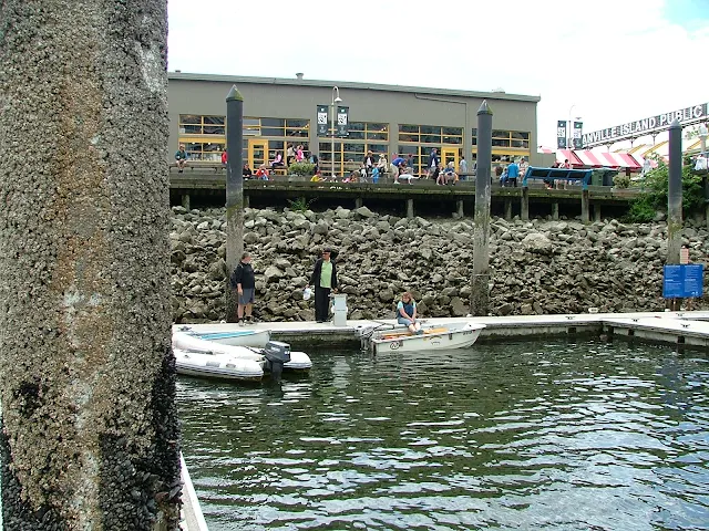
Dinghy dock at False Creek
Free  3 hr slips and dock space at Granville Island Mall make getting dinner and souvenirs easy.
Now if they can just get the tide to quit going up and down or put in elevators.

            The city welcomes transient boaters and even has a welcome committee boat (at the dock under the Granville Island bridge) stuffed with brochures and knowledgeable ambassadors.


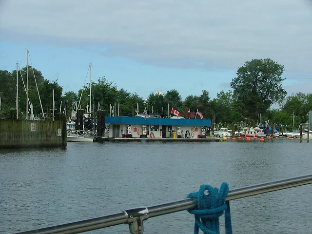
Of course there is a fuel dock, and paying by the liter sounds cheap at first.


          When you arrive in False Creek simply get on your phone and call the 800 number to check in with customs and immigration, it's that easy.

          If you don't want to anchor, there are plenty of marinas and yachts clubs willing to take your money or extend reciprocal privileges.   


False creek dinghy sailing
False Creek is big enough to go dinghy sailing and the entire inlet is a no-wake zone.
Vancouver is on our short list for a return visit!
Did I mention everyone is friendly?

           If you need more cruising to round out your trip, consider running around the point Stanley Park occupies and scoot under Lions Gate bridge up Burrard inlet.  You might even run the eighteen or so miles up to Indian Arm Provincial Park.  Go to ActiveCaptain "live map" to check out the possibilities.


To help or not to help? - boaters assisting other boaters - basic docking tips are common sense

        In the San Juan's, you will either  #1, already be at the dock with your boat, or  #2, coming at the dock with your boat.  All the other skippers are in the same situation.

        The runabout or daysailer or forty footer all have windage and current issues, and when it is crunch time, things happen fast.

        The driver of the smallest vessel may have decades of experience, and the person with the largest yacht may be a newbie over his head in bells and whistles.   In all cases the considerate proper boater will get out there and be helpful when a fellow boater is coming in.


Here are some basic tips some of us use when docking:

  1. Explain to your crew ahead of time exactly what you are doing, and what you expect them to do.
  2. Prepare your fenders, dock lines, and boat hook ahead of time.
  3. Sometimes it is wise to drive up and make a full stop out a ways to judge the wind and current.
  4. Put on pfd's - at the dock is where most drownings occur.
  5. Having a plan, also includes an abort action should things go awry.
  6. If someone is on the dock offering to help --- hand them a rope.
  7. When the next boat arrives, get out there and be helpful.

boating assist at the dock


       helping other cruisers

Nice boat gramps, need a hand?


Wednesday

What's new at Stuart Island Lighthouse

First I need to tell you that as of this posting date, Boundary Pass Traders is still in business selling T-shirts along the road to Stuart Island Lighthouse.  For those of you that don't know, Boundary Pass Traders is a local family business, they have two unmanned sales kiosks complete with fresh water.(after hiking up the hill you will appreciate a drink) They sell screen printed t-shirts on the honor system.  One booth, (more like an opening in the trees that resembles an upscale homeless camp) is next to the schoolhouse at the top of the long grueling hill coming up from Reid Harbor.  The other and newer location is at the intersection of the road coming from the county dock.  This means if you walk from the state park you will stroll by both, but if you walk from the county dock at Prevost Harbor, you will only see the one.  Moving along - You  make your choice from ten or more San Juan Island themed shirts, and then when you get home, mail them a check in the provided envelope. (or pay online) that's right, they trust you! We picked out an adult size replacement shirt for our youngest son, (think "Pirates of the San Juans")  to replace his stretched out, frayed, and faded child size he picked out many years ago.
Decked out outhouse at Stuart Island lighthouse
Volunteers at Stuart Island Lighthouse keep a pretty spiffy privy

more - click here

Friday

Fast Track to the San Juan's and Patos Island State Park

In keeping with this sites purpose to help newcomers get to the San Juan's, you will find listed below selected posts and links.

These posts are the bare essentials needed to get you off on that trip to the San Juan's, the rest is up to you. (click on the links)

  1. Where to launch your boat and park your rig!
    • Where to Launch your boat and park your rig
      • First choice = Bellingham - (Squalicum Harbor)
      • Close runner up = Deception Pass State Park (Cornet Bay)
      • La Conner city ramp (Swinomish Channel)
      • Washington Park - Anacortes
      • Cap Sante - Anacortes (sling only)
  2. Suggested Itinerary!
  3. All the Parks with complete descriptions and chart snips!
  4. Rent if you don't have a boat!
  5. 12 fuel docks- marinas - resorts - you should know about before you take off into the unknown!

Is this all you need?
Of course not, but if you are a competent boater, the above posts will answer many questions you want answered.


Anchor at Patos Island State Park
Patos Island Anchorage


Did you know you can ask silly questions? Use the e-mail box on the left side somewhere.

Tuesday

Waterfront San Juan County Parks for Camping


San Juan County parks are pretty much ignored by the boating crowd, could it be that the lack of overnight floats keeps them away?

Anchor and paddle to shore at  Small Pox Bay on Haro strait in the San Juan Islands
SJ County Park is an easy dinghy ride from anchor in Small Pox Bay.  This popular campground is great for  kayakers heading out to Haro Strait for Orca watching.
Shaw Island Campground
Shaw County Park Campground picnic shelter
     On Lopez Island is Odlin County Park, the only county park  with a dock.  You can load and unload but the sign says to limit your tie up to two hours.  Out in the bay are a handful of buoys and decent anchoring, but expect swells from passing traffic. This park would make an excellent rendezvous spot with friends arriving by ferry, or in twenty minutes you can ride your bike to Lopez Village for snacks or provisions.  Beachfront camping rounds out a really nice place.

     Shaw Island, boasts Shaw County Park in Indian Cove. (off Upright Channel across from Odlin county park) While offering a protected bay for anchoring, the beach is somewhat  flat making dinghy landing a chore and wet feet likely. The campground is cliff front in the trees requiring using a stairway to access from shore.  A wooden boat ramp gets your vehicle across the sand but leaves a lot to be desired at anything but high tide.

     San Juan Island County Park is located at Small Pox Bay on Haro Strait.  The road from Roche to Lime Kiln Park (Whale Watch Park) provides vehicle access.  The quite small rock free bay is easy to drive into from Haro Strait offering room to anchor one or two boats front and center in front of the ranger station. The beach is dinghy friendly and has a boat launch ramp provided your skiff is an easy launch and your car is four wheel drive.  This park is a favorite for orca watchers that crowd the point jutting from shore offering elevated unobstructed viewing equal to that at Lime Kiln Park.

 (FYI, you can make reservations up to 90 days in advance at all three San Juan county parks at https://secure.itinio.com/sanjuan/  or google San Juan County Parks) All the parks offer bike and hiker sections.
Odlin park county dock on Lopez Island
Odlin Park on Lopez island has a two hour dock limit -
find Odlin across from Indian Cove and  Canoe Island on Upright channel.

Shaw Island County Park
The house on right side marks the edge of public beach at Shaw Island County Park. Up in the trees are campsites, grassy fields, restrooms and a picnic shelter. This park is very hard to spot, none of the facilities are visible from the water.