ATTENTION!

This site has oodles of information about boating and the San Juans, it helps to use the search box BELOW to find what interests you.
Search - "things to do" or try "places to go"
search - Sucia Island
search - Friday Harbor
search - hiking or bicycling
try - kayak - try CAMPING - try Anchoring

++++ ============================= All Posts Below

Current Posts Below
Showing posts with label boating Puget Sound. Show all posts

7/06/2019

When a boat comes in to the float, should you offer your assistance?

Dinghy and small child learning how to handle rowing in the wind
This is a re-post I have moved to 2019

would you offer this guy a hand?

Heck yes!
That's just basic thoughtfulness, if a boat was sinking you would offer aid, (that's the law) give them a lift or pull them from the drink. Right! I certainly hope so.  This would be a good time and place to check out a post called "Paying it Forward" click to rush away and read it!>>
Welcome back, you can now read the rest after the jump >>


8/21/2018

Who owns the Shoreline above and below the high tide line in the San Juan Islands?


         Probably since before exploration, men have claimed ownership of just about everything above and below the surface of the ocean, and this includes the San Juan Islands.
Thatcher Pass from on top of James Island

         The good news is that the arguments of who owns what and where are pretty much settled.  The bad news is that, as a boater staring across the water at some desirable beach or mudflat (if there is such a thing) you don’t know what to do, or where to land.

       For the most part, you may anchor anywhere you want, except vessel navigation channels and marked farms. It doesn't take much common sense to figure out not to anchor in the middle of a boat congested narrow thoroughfare, (marked or not) but some daydreamers will do just that. 

        Just because it’s legal to anchor doesn't make it a good idea. You can walk most beaches, below the normal high water line, but many properties own the adjacent tidelands and may or may not be marked. Not all shorelines have beaches and so private land will extend to the water’s edge.  Most of the dry land (above high water) is private and you will be trespassing if you come ashore and hike into the woods.  Some landowners don’t care if you come ashore, and some do.  Many will have signs that alert you to their wishes and you should respect their wishes.  If it were me I would not anchor off shore from a sign that said no trespassing, why ruffle someone’s feathers by anchoring or walking in their backyard.

      There are places, marked and some not marked, where seagrass has been damaged, and signs ask you to anchor elsewhere. Who’s not for being an environmentalist? Just move along, there’s plenty of other places to drop a hook.

      At resorts and marinas, (Roche, Friday, Deer, Rosario, Fishermans, etc, etc etc., you will usually see boats anchored nearby, just follow their lead and anchor your boat too. Ask someone where the dinghy dock is and go spend some money.  You may be thinking, how long can I anchor and what’s the cost, so I remind you it’s public, it's free, and you can anchor as long as you want.

       There are some exceptions, but we don’t need to discuss them now, or ever, so go have a good cruising day. 

12/26/2017

Five Things Everyone Should Know Before Cruising the San Juan Islands

Fun Observations and Frivolous Knowledge  for 

All Boaters new to the San Juan's (repost)

#1 Hugely fluctuating water levels   (tides)

The San Juans have high and low tides every day, some very high, some very low. This means you will need to be prepared to deal with going ashore at locations lacking floats.  The easiest solution is to bring a dinghy; if you don't have a dinghy I suggest you buy a cheap inflatable boat or 2 person kayak for around $75.  Once in the San Juans most people simply tow the dinghy everywhere they go, or deflate and stow it away. Those of you going in a ski boat or skiff may be thinking you can beach your boat, which will work, but only for a few minutes. On a falling tide in ten minutes your boat may be high and dry, unless you can carry it, your stuck until the tide comes back up. On a rising tide your boat will float away while you're on shore.  Since your going to anchor in six feet of water at low tide you will need one hundred feet or more of anchor rode to accommodate a ten foot plus increase at high tide. Smart boaters bring two anchors and rode and a dinghy they can carry up above high tide.
San Juan Islands - very low tide at Matia


#2 Strong Swirling Currents (in places)
San Juan currents are notorious, and the root of many stories. For fast planing boats you can pretty much ignore adverse current; however slower boats live and die by planning passages to get an assist from the current. A typical sailboat may putt along at 4.5 mph, against a 2.5 mph current their real speed over ground is 2 mph.  Going with the same current their sog is 7 mph.  So a ten mile passage takes 5 hours the dumb way or 1 hour 25 minutes the smart way. There are many prediction and forecast books and charts available and online.  While you don't need a publication, I recommend that you buy something and keep it with you. I would also go online and print out a tide schedule for the time and area you expect to cruise.  CLICK BELOW for Rosario Strait at Guemes Channel
NOAA tide forecasts
In a nut shell, here's a simple rule of thumb to follow.  On a incoming or rising tide, the water in most straits and passes flows "north" while during a falling tide the water reverses and flows "south."  When the current hits an island straight on, the water will split and flow around the island usually at a slightly higher speed creating eddies at headlands and the tips of the island.
San Juan and Gulf Islands Current Atlas

San Juan Islands current charts


#3 Weather could be fog  (pea soup is the term)
You can get lost in the dark, in the fog, or just plain lost on a sunny day.  You need to bring with you a chart, and you would be smart to protect it from getting wet or torn up. I sandwich mine between two clear acrylic sheets held together with velcro.
Some will say the chart needs to be new and of the highest resolution, which may be true for ship captains and other navigators.  What were talking about here is not getting lost, even a google print out may do the trick.  If you are going to boat in the fog you must have a compass, and  GPS, a portable handheld GPS will do fine and some new phones may do the trick too. (in thick fog you will go in circles and be totally disoriented without a compass) A gps will not replace a compass in rough water and fog, a gps is much too slow  reacting when you are getting spun from broadsides or quartering waves (broaching) you need both.   Many times in the San Juans visibility may be down to 3 or 4 miles and you think you can sneak across some open water to the next island, and you probably can, but if the fog thickens to pea soup you will be glad you have your compass and GPS.  BTW, fast boats can't always go fast when waves and swells stack up. And only very dumb skippers go fast when they can't see.
San Juan Islands fog hiding a ferry
See the ferry approaching the anchored sailboat?

#4 Wind or lack of wind  (sorry sailors)
OK, here's some bad news for sailors.  The San Juans are not known for great sailing winds in July and August. Out in the straits (Haro, Rosario, Georgia, Juan De Fuca)
you may get some decent sailing, but inside the islands, don't bet on it.
Sailing with reefed main in cold weather
Sailing in April rain with reefed main


#5 Crowd control   (no worries)
Most likely you won't have any problems with crowds except on the 4th of July and Labor Day.  The good side is that you will always find a place to anchor, even on holidays, the dinghy ride may just be a little longer for some.  Most marinas take reservations and you may as well take them up on it, but you don't need to.   I suggest you slow down a little and enjoy the freedom of not planning ahead, take one day at a time and see where you go.  Lastly, because this area is so close to Bellingham and Anacortes many boaters are day boaters.  At the end of the day they head for home, leaving some resorts and parks half empty, especially on weekend Sunday nights. Monday or Tuesday are good days to begin your outing if you want to be alone.
Roche harbor dock on holiday
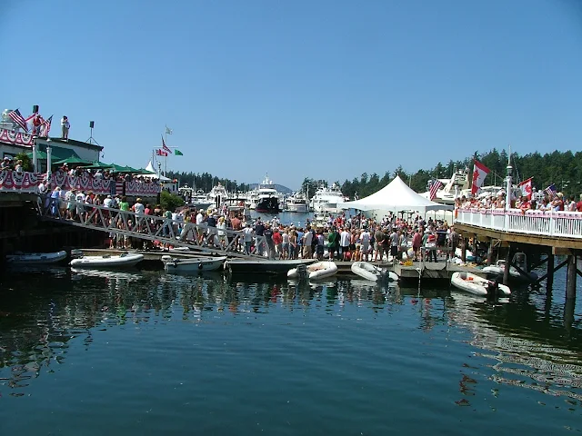
Fourth of July celebration in the San Juan Islands at Roche Harbor Resort
Roche Harbor summer celebration with children

Roche Harbor balloon chasing contest


Roche Harbor 4th of July balloon contest for kids in dinghys
yes, there was room for more, lots more


Expenses
DNR buoys are free (Cypress Island) State Park buoys are $10, many park floats are 50 cents a foot,  Marinas charge between 75 cents and $2 a foot. Gasoline is a little more expensive than on land, but not much more.  Food, groceries, ice are just a little more than the mainland but very fair priced overall.

How many days to plan
Plan a minimum of four days, but up to two weeks depending on what you like to do. (I like to sit on the dock at Jones Island and read my book between naps and walks, then I make a campfire in a empty tent site and cook Kielbasa followed by a glass of wine. Then retire to my boat for a good nights sleep.  The next day, do it again)

Salt Water
Salt water drys sticky and does not suds up well with soap, you will get it all over you and your boat, count on it.  After a week you will look forward to a shower.  Your boat will be covered with salt crystals.  Most marinas have little water and don't want you washing your boat.
Squalicum Harbor in Bellingham has boat and trailer fresh water wash down hoses in the parking lot.  You should use them each time you dunk your trailer.

Provisions
For the most part you will want to provision before you leave on the boat.  Anacortes and Bellingham have all the big stores and each has a West Marine store.  All the resorts and towns have grocery stores, if you drive a fast boat, supply's may be only minutes away, putt putt's should work a store visit into your circuit.  I say circuit because most cruisers will follow a circle of some sort trying to hit many stops.  We find that ice needs renewing after four days, so a stop over at Friday Harbor, Deer Harbor, Roche Harbor, Blakelys, or Orcas landing fills the bill.  All these places  except Orcas, have gas and showers.  Showers will cost a handful of quarters so be quick or be poor. Cold showers are free. Lopez Village has free showers but no dock so you will need a dinghy.how to dinghy to Lopez village

Garbage
All the parks are pack it in and pack it out, the marinas have dumpsters.  If you are new to boat camping you will find garbage to be a pain because you are not used to storing everything in your boat.  Little things like empty water bottles suddenly take space you don't have.  You must give careful thought to what you are bringing, and the garbage it will generate.  We don't use disposable bottles, minimize pop consumption, and try to have campfires to burn burnable trash.  It is against the law to toss anything, (even a apple core) in the water.

Animals
Your dogs must be on a leash, period, everywhere.  Raccoon's are on all islands and will climb right into your boat or kayak in the day time if you let them.  Deer are all over too, but they shy away, except on Jones Island where you can hand feed them.
Otters live under most floats and docks, they will crawl all over your boat, get into things and make a mess.  Otters also will mark their territory by pooing on your stuff, dock lines are a favorite.

Bathrooms
All the parks have nice composting toilets, (each island mentioned for overnight is a park) the rangers service all parks on a regular basis.  You will be pleasantly surprised at how clean the facilities are.

Where to go:
Your destination is simply that, its the journey getting there and the experiences on the way that make a trip a wonderful vacation. Try the links below for some Island Park descriptions.

Emergency's 
Bring your cell phone and charger, bring at least a portable handheld marine radio, bring basic first aid kit, call the Coast Guard, they can be there pretty fast, or arrange for vessel assist on your credit card, bring a friend with a similar boat, then you can help each other.

3/12/2017

Marine Parks of the San Juan Islands and Surrounding Area


Below is the marine parks list
             followed by reviews, charts, and pictures
                         in the order listed.
        This is not all the parks, just the ones you may want to make part of your cruising. It's unlikely you can visit all in one trip and still do a decent job of sightseeing. You should plan multiple visits to the San Juans.
Many people choose Jones as their favorite for just hanging for a few days, so Jones is first.
For hiking, Sucia, or Pelican Beach on Cypress Island are the best, but all the parks have hiking trails.
      Some parks are in a convenient location when you need to spend the night and you're between destinations, Saddle Bag, Eagle Harbor, and Odlin would fit this description.  Most parks with docks have picnic tables on the floats, which are very handy for extending your living area, socializing, and meeting other boaters.
        For marinas/etc. where you can get fuel and provisions try this list >> Marinas - fuel - beer and ice - slips for rent

  • Jones Island
  • James Island
  • Clark Island
  • Doe Island
  • Obstruction Pass
  • Pelican Beach
  • Eagle Harbor
  • Cypress Head
  • Matia
  • Patos
  • Sucia
  • Stuart Island  (Prevost & Reid Harbor)
  • Spencer Spit
  • Odlin County Park
  • Washington Park
  • Deception Pass Park
  • Saddlebag Island
  • Sidney Spit Marine Park (Canada)
Click here to go to complete description and maps of above listed parks

1/15/2017

Take What you Have and -- GO

      As the primary irritant and contributor to this website, I am drawn back to promoting boating and the San Juans.

        How many times have you heard  (or said yourself)  "I can't because...."   -- finish the statement with any handy excuse for not making that long talked about trip.  In many cases, the excuses I use are bogus or easily overcome.

For instance:

  • The no money excuse:
    • If you are dead broke, I suggest that you forge ahead and make plans anyway, things have a way of working out.
    • Reduce the budget some,  try dialing back what you really need to get going to the San Juans.  
      • New radar - NO, new motor - NO - how about used? New plotter - NO.  You may be  hopeless if you need all the newest toys to vacation or go on a boat ride.

  • The no boat excuse:
    • Take what you have, or consider renting or buying a used runabout or skiff.
      • One time we came across a couple (a well seasoned couple I might add) at Pelican Beach.  They arrived in an 8' plywood sailing pram (with oars and no motor) and they had towed another 8' pram with  camping gear.  They told us they had put in at Anacortes and were spending a week as they had done for many years.  I was  impressed and somewhat embarrassed for my boat full of goodies, and creature comforts.
                Let's expand on the idea of buying a used boat.  Once a few years back, I sold our primary boat just a few weeks before a planned trip to the San Juans.   Now boat-less, except for my beloved 9' dinghy, I was faced with canceling my family vacation. Instead, I decided to buy an inexpensive boat, and use it once for our  San Juan trip and then sell it upon our return.  I bought a small well known   readily available sailboat and trailer.  We boat camped for ten days, and then  I sold the temporary boat for 100% what I paid for it. 
          The overall cost for that trip was just the cost of fuel and provisioning.  I know, some people will criticize the wisdom of taking an unknown boat, breakdowns, blah blah blah. Thats OK, I agree what we did is not for everyone, but it worked well for us, and besides, I brought my dinghy and trusted 5hp Honda as back up.

  • The no time excuse:
    • Baloney - If you really want to go you will make the time, so go mark your calendar right now!

  • One last thought; life happens, when everything in life gangs up on you conspiring to stop your boating trip, don't give up.  Instead, postpone the boat part and go in your car. Camping or resorting around the San Juans is almost as good as boating around the San Juans.

Take what you have and -- GO!
San Juan Islansd Ferry with Mt Baker


     My new travel guide may be just what you need.  That's right, I am shamelessly promoting my 2017 "San Juan Islands Travel Guide" -- It is a Land and Sea Guidebook, so whether you are a boater, biker, or car camper, it has what you want.   CLICK HERE   or search Amazon Books - "San Juan Islands Travel Guide"
Thanks - John


1/04/2017

How to Predict Current Direction in Swinomish Channel

        Sooner or later regulars to the San Juans learn to love or hate Swinomish Channel.  Many skippers form an opinion on their very first transit through this popular eleven mile alternative to Deception Pass. Sailors and under powered puttsters fighting the current, hate it, but turn them around and  suddenly their tune changes as the current whisks them along at four miles per hour.

         One day we pulled in to the city float at La Conner and I grumbled to a local boater about how we had been battling the current for hours on our way from James Island.  I remember his comment, he said, "The current flows one way for twenty three hours and then reverses, and no one knows when."  We all laughed and I figured I should get over it.

         I came across this rule of thumb posted on the Port of Skagit County website for estimating the current direction.  

        The rule of thumb for estimating Swinomish Channel current direction at La Conner goes like this:
                 
The current flows north from 2.5 - 4 hours before high tide to 2.5 - 4 hours after high tide
The current flows south from 2.5 - 4 hours before low tide to 2.5 - 4 hours after low tide
Slack water occurs 2.5 - 4 hours after high or low tide, not at the tide change like in some areas.
          You will still need to consult with high and low tide predictions for La Conner to put these rule of thumbs to use.  Be forewarned, many people consider La Conner tide predictions as hocus pocus because they are often wrong.


      I cannot remember this rule so I am going out on a limb here and offering my own memory trick as follows.   We already know that in the San Juans a rule of thumb is that the current flows north on an incoming tide (flood) and south on the ebb, and we know in the Puget Sound and southern area it is basically the opposite.  So my memory hack is to consider Swinomish Channel as part of and subject to the San Juan rules of thumb.  This means, Swinomish Channel flows NORTH on the flood just like the San Juans, but it is late due to distance.

FYI - did you know that all of Swinomish Channel (at least where land is) is a "No Wake - Slow Zone"


6/27/2015

Puget Sound is not the San Juan Islands, but if you want to try cruising somewhere new, it's a logical choice.

      Puget Sound is different things to different folks.  If you read a few articles  or listen to more than one traveler you will likely come away with some overlapping opinions. Lots of people think the San Juans and Puget Sound are the same.  They are not.  On your noaa chart, there is a place labeled Puget Sound, it's offshore from Seattle all the way up to Whidbey Island.  Virtually every body of water is named something.  Names sometimes include a descriptive hint, such as bay, passage, inlet, cove, strait, and of course sound. Did I miss any besides canal, and channel? Oh yeah, bank, shoal, flats...

       Some of us consider, Puget Sound (as an area) to encompass everything salty, from the Strait of Juan De Fuca south.  So this means both sides of Whidbey Island are included, but not the northwest side that faces the San Juans and Vancouver Island, or Anacortes, or Bellingham. I like to think of Bellingham as on Bellingham Bay and Anacortes as up Guemes channel a bit from Rosario Strait. So where does that put Olympia?

     We started in Olympia, at Swantown Marina, and so should you.  There are numerous ramps scattered around the area, but nothing compares to the Port of Olympia facilities, they have the welcome mat out more than any (boating) city we have ever visited, bar none.  I haven't forgotten the praise I lavish on Squalicum Harbor in Bellingham, but the entire waterfront at Olympia is boater friendly, which bumps them to the head of my list.

       At Swantown, is a two lane all tide ramp, open 24/7 with a long term parking lot for only $3/day.  Transient moorage is abundant, both at the ramp and a short walk away, at the old town waterfront.  Don't make a mistake and think of Olympia as simply a place to splash the boat and take off from.  Plan your trip to include one or more nights or days at the dock, and bring your bikes, you will be glad you did.

      Rather than gush over Olympia, let's get going north. On this trip our turnaround point is Lake Washington.  This means we will wander a circuitous course to Seattle, visiting as many Marine State Parks as we can.  At Seattle we will go through the Ballard Locks, through Lake Union (Lake Union is the downtown area you see from the freeway) and into Lake Washington to spend the night anchored at Seward City Park.  All total we will visit eleven parks, bike and hike most of them, spend seven nights at docks, one at anchor, and motor about 175 miles.  Wow-- when I write the specifics it sounds rushed, but we relaxed the entire time.

       Day One: We are in the water and on our way at 5pm, this may seem late to get going, but we only have 8 miles, maybe 16, to our first nights stop.  We ran the 8 miles to Hope Island State Park, but all the buoys were taken so we continued to the dock at  Jerrel Cove State Park, another easy 8 miles, and with plenty of daylight, why not?  You sail-boaters should know that we encounterrd a low 31 foot fixed bridge providing vehicle access to Harstine Island. You can avoid the bridge by taking the long way around Harstine. Jerrel Cove has two docks, and across the way is a private marina with a store and transient space.  The park is well kept with onsite rangers, car campers, a mile or two of trails that are rideable, and of course you can head out onto the island roads and ride to your hearts content.  Perhaps I should remind you that, unlike most of the San Juan destinations, all of the places we spent the night are car accessible.  This means you can plan a Puget Sound rendezvous with friends or family to re-supply or switch out crew members.
Jerrel Cove Park float
Jerrel Cove at low tide, the ramp is as steep as we have ever seen.


Day two: click here

10/10/2013

Deception Pass Whirlpools in your Nightmares, Standing Waves and Currents

       I have avoided posting potentially scary pics.  I don't want  people with vivid imaginations to have runaway thoughts and fears.   But recently I spent half an hour in Deception Pass playing with the currents, letting them spin the boat while we watched whirlpools develop and subside all around us.
      We would run up a few hundred feet and then drift back, letting the boat spin and wander.

       As you know when the tide changes, so does the pass and the water conditions.  The changes happen in minutes and even seconds, so be forewarned that you can easily get into trouble here in any number of ways.  I'm not going to argue or defend the safety point or even seamanship. Thirty minutes earlier the water was so nice you would safely paddle a canoe. Thirty minutes later well that's another story too.

        My photography skills are lacking and water pics seem to always come out flat looking so I will describe the picture below.  What you see is a swirling rotation about thirty feet across. Placid calm water on one side of the swift flowing current is slowing the flow and throwing off one whirlpool after another. The whirls are both big and little and move with the current for about a hundred feet from creation to disappearance.  At this particular spot there are 3-5 visible at any one time eliciting ewes and awes from us as we yell and point out especially big ones to each other.  The inner whirl in this pic is funnel shaped, about 10 feet across  and very pronounced dropping about 12-18" in the center.  The white center is taking in air and continues down under water just like a land borne tornado funnel.  The wispy white air bubble tail is clearly visible below the surface for quite a distance.
Deception Pass currents, waves and whirlpools


With the motor idling and the boat drifting we not only watch hundreds of whirlpools form and die but we can hear sucking sounds the particularly big ones emit.  Of course the conversation always touches on how a swimmer would be affected, with or without a pfd.  Next comes the kayak and dinghy what if's. On this day a standing wave began to form while we dally about.
Some standing waves look a lot like a whirlpool on its side, only without the funnel  You can see the water well up from deep down, roll over at the surface and then dive back down.  When the action gets severe a nasty roller just sits there in one spot. If a small boat (kayak) gets sideways in any wave its liable to be rolled over, but in a fast flowing pass, it is best to be somewhere else.
This standing wave was developing unnoticed and still mostly flat, but as we drifted sideways over the beginning stages, our keel got hooked and we violently lurched to one side, heeling enough to slide the coffee cups on the table, and snapping my attention back to the fact we were in Deception Pass.

Having enough fun and games, and acutely aware that the tourists watching from the bridge were by now probably making bets on our ultimate demise, I pushed her into forward gear, gunned the diesel and made a broad swinging pass back through the standing wave spot, and then for good measure, turned and ran right down whirlpool alley straddling or bisecting every whirly in sight.  An hour later or with storm conditions, the pass may not be navigable.
Another perfect July day at Deception Pass


11/09/2012

Submarines have right of way! And the Coast Guard the Navy and anyone with big guns

They got lots of guns around them too. woohoo!


Cutting across the entrance to Hood Canal  on our way to Port Ludlow we were suddenly stopped by Coast Guard and Navy patrol boats.  They were all business insisting we stop and wait, the submarine soon came by at about 10 knots, all the the while they kept the patrol boat between us and the sub as if we may be a threat. (or they were camera shy)

The sub had 12 to 15 boats running interference for it as it headed out. All done very efficiently.

BTW afterwards from somewhere we got hit with a big big wake.


Crossing paths with a submarine was an unexpected treat. The next day we cruised up Hood Canal past the Navy base but failed to see anything worth reporting except maybe a huge sign saying lethal force authorized.  We kept our distance.

11/05/2011

How Small of a Boat is Too Small, for the San Juan Islands?

Using common sense and smart practices, just about anything that floats has a time and place. Hobie 16's - 14's - inflatable kayaks, canoes and hundred foot palaces, all work for cruising and boat camping in the San Juan Islands.


If you look in the background of these three pictures, you see calm tranquil waters
While its true much of the summer you can expect these conditions, you should still be prepared for some nastiness.

Being prepared sometimes means simply changing your schedule so as to not get caught in the middle of Haro strait during a blow. Or worse, accepting your fate and being  forced to spend an extra night at Jones Island, or Rosario while the weather gods sort out the big plan.

If you travel light and are flexible, sensible and not too foolhardy just about any boat is suitable for travel in the San Juans.

We once passed a couple of young men paddling their becalmed  little 16' sloop part way between  San Juan Island and Stuart Island.  The current was helping them along at about 1 mph and they had six or more hours of daylight left. Later that afternoon we noticed they had tied to the dock a few boat lengths down from us, apparently none the worse. That night one slept on the dock and one in the boat.  The next morning they were comparing who had the most uncomfortable sleep. 

Sometimes we see groups in open long boats from local camps, they will come ashore to unload gear and then using an anchor and  long rope loop, pull their boat out to deep water for the night.

I have seen ski boats so overloaded with camping gear and people that they have no reserve buoyancy, essentially they are waiting for a rouge wave or wake to sink them. Small boat cruising is perfectly acceptable, but you still must follow basic boating seamanship and safety rules.

A sailing partner of mine in Portland wants to bring his Hobie 16 to the San Juans. My first thought was --your going to freeze to death-- but then I remembered he uses a wet suit.  He asked if I thought a 1 hp outboard could be rigged up for an auxiliary (about 25 lbs I think) I said why not, as long as you don't weigh yourself down with camping gear, all you need is 1 hp,  a gallon of extra fuel, wet suit, booties, gloves, hand held waterproof VHF radio, and a dry bag  (or two).
But if he flips the boat and needs help, he could be in trouble and all Hobie Cat sailors like to fly a hull.  I suggested he travel in company with other boats, so they could carry his camping gear and cruise nearby for emergency's, just in case.

We came across a family with a dog in a canoe halfway to Patos Island,  gutsy or foolish, maybe just ignorant, but they were a long way from land.

I have never seen a paddle-board being used to cruise, but I'm sure I will.


10/05/2011

Does Paying It Forward Work? (like money in the bank) How to get yours!


Paying it Forward - Fact or Fiction.   
           Have you ever noticed someone parked beside the road, most likely broke down?  Is everyone flying by, rushing to their next piece of life?  Sometimes you will see a Good Samaritan pulled over offering help.  There’s a certain concept floating around, that if you help someone out of the goodness of your heart, it’s like putting money in the bank so to speak, money you will draw upon in the future in your own time of need. Often called, “paying forward” Sound about right, right.  Well not really, if you’re just banking goodwill, then it’s not really out of the goodness of your heart.

          Enough philosophy, “paying it forward” is alive and well in the boating world, and especially among cruisers.  If you are a newbie to cruising or boating you may be hesitant to offer a helping hand, don’t be. The people in distress will appreciate the offer and may well be hoping someone would help them out. Help can be as simple as handling a dock line when they arrive to helping rebuild a balky pump, or giving a tow.
Turn Point lighthouse on Stuart Island
          Where I day-sail in Portland on the Columbia River, I have gotten into the habit of soft grounding my boat off to one side near the entrance to my marina.( I sail alone) I then take the sails down (no furlers for me) and get everything ready to dock at my own slow pace without worrying about traffic or drifting away, because I'm stuck in the sand.  When everything is ship shape I lift the swing keel a bit and motor off the sand and proceed to my slip.  Sometimes when I do this maneuver, boaters knowing I’m obviously aground stop and ask if I need help. Were they paying it forward? was I receiving payment for my past good deeds? 
           Last summer at the  Matia Island dock in the San Juan's, a cruising couple appeared at our boat early in the morning while I was having coffee in the cockpit.  They gave us a large chunk of warm carrot cake. It was delicious, hitting the spot perfect. Possibly I was receiving some interest on my account, what do you think?