ATTENTION!

This site has oodles of information about boating and the San Juans, it helps to use the search box BELOW to find what interests you.
Search - "things to do" or try "places to go"
search - Sucia Island
search - Friday Harbor
search - hiking or bicycling
try - kayak - try CAMPING - try Anchoring

++++ ============================= All Posts Below

Current Posts Below

12/28/2015

SAVE YOUR RUBBER

I have always known the devastating effects of UV radiation.
  How can you miss hearing about it with today's instant internet news.

If you are like me, you have pretty much ignored it though - that is until about ten years back when I had two of my travel trailer tires pop one at a time while on a trip.

On close inspection all four had simply rotted with age.  They had very little miles and virtually all the tread was perfect.

UV radiation is more than just sunshine - it's all daylight all the time.

My trailer boater days run from spring to Christmas, then I change the oil and put the boat away for about 4-5 months.  Now I also cover my tires so I wont be buying new ones.

You can probably get some tire sacks from your local tire store, but I don't like the bright colors and I already had some extra 6 mil plastic.

All I did was cut the plastic into a long enough strip to circle my wheel and then use my desk stapler to close the top leaving an open gap in the back for the axle.

BTW, my covers frustrate cats and dogs too.
uv cover protects rubber from damage
Save your tires - black construction plastic stapled into a bag shape
another cheap  option --  use big black garbage bags


12/09/2015

Nine Little Coves and Backdoors in the San Juan's

      It's easy to go to the marine parks and jostle with the other boaters at the dock or scramble amongst a minefield of anchors and buoys.  Sometimes seclusion and communing with nature is simply a matter of going around the point.


East cove Matia Island  facing Lummi in the San Juan Islands
Low tide and still lots of water for anchoring, but open to swell from Rosario Strait.

       As with all gunkholing and exploring, you must be vigilant, watch for rocks, know your tide range and proceed dead slow  or pay the price.
Speaking of paying >>>   paying the price

  Suggested backdoors, (none preferred over another) and places to get away from other boaters.
  • Matia Island:  Matia Cove is a fairly long indent (see pic) at the east end of the island and holds several boats. An unnamed cove is just around the corner from Rolfe Cove where Matias dock is located.  Both these coves offer anchorage away from the usual hustle and bustle.
  • Sucia Island: Snoring Bay is between Echo Bay and Fossil Bay on Sucia and Ewing Cove is accessed via Echo bay on the northeast side.  Both coves offer access to the Sucia trail system, and may have anchor buoys still intact.
  • Saddlebag Island:  This state park is so little visited, you may consider the entire island a backdoor, but there is a second minor cove on the south side with a great view of Cap Sante should the northside be full up.
  • Inati Bay on Lummi Island is located on the southeast side of Lummi Island.  This medium size cove holds a handful of boats and is a perfect storm refuge when you are caught on your way to or from Squalicum Harbor.
  • Cypress Head: The normally used cove with anchoring and buoys is on the north side of the isthmus and open to passing wakes, but the long cove on the south side of the isthmus is easily navigated and may be calm. Watch your depth here.
  • Doe Island State Park: The last we looked (2015) the float was still gone but you can anchor here in relative peace and protection.
  • East Sound:  If you're at Eastsound (the city) and it gets dark, you can anchor in Judd Bay on the far north end (left side) of East Sound.  You will be a dinghy ride from the Eastsound dock which does not allow overnighting.  Anchoring near the county dock is liable to be rolly.
  • Roche Harbor:  If  crowds drive you bonkers and you want to run away, just run two miles to Westcott or Garrison Bay.  Anchor anywhere but watch your depth and don't block access.  You wont be totally  secluded or alone, but you will be away from the mob at Roche.
  • Smallpox Bay:  This small bay is on the Haro Strait side of San Juan Island just a few miles south of Roche Harbor  (scoot through Mosquito Pass) it's a dinghy ride to shore  at this San Juan County Park where campers watch for orca's.
  • There are lots more hidden places, too many to list but you can use the search box the for them. Search - coves, bays, anchoring, camping, parks, things to do, places to go, etc.
      You can anchor off to one side virtually anywhere but you may suffer wakes.  I left out well known places like Blind Bay, Fisherman Bay, Parks Bay. which will all be crowded.  I wanted to suggest mostly secluded easily overlooked locations that will be appreciated by the discerning recluse. 

11/10/2015

Where do you go on a Typical Cruise to the San Juan Islands -- What does a week long Itinerary include?

         Ok,Ok - this is a trick question.
There are no typical cruises.

      Some of you aspiring San Juan cruisers might be a little nervous and holding back making that long talked about trip.  If you are not quite sure you have it figured out and need a little push to take off for the San Juans, let me assure you that you can do it. Everything doesn't have to be figured out. So to help you take the plunge and entertain vicarious armchair captains, I have put together a simple run down of our last outing in the San Juans. (2015)

      Our cruises start out with a general idea, and a few hard dates, but no carved in stone  plans.  It just happens.


       In the months (years) leading up to actually departing, we talk and think about what we want to do.  Kinda daydreaming if you will.

This time:
  • I wanted to Orca watch off San Juan Island in Haro Strait
  • I wanted to visit Victoria without rushing
  • I hoped to see English Camp again
  • I wanted to hang out, and have a campfire on Jones and go dinghy sailing in the bay, and maybe circle the island if conditions are favorable.
  • I already had promised Linda a romantic dinner in Friday Harbor
  • We had a firm date to pick up our kids in Eastsound - with bikes and gear.
  • We had a firm date to drop the kids at Odlin Park on Lopez (these kids are 30 something's)
  • I promised I would drop the kids somewhere they could catch the ferry back to Anacortes.
  • I semi promised I would take them to some neat places they could only get to by boat.
  • I wanted to ride my bicycle some since I bring it everywhere.
  • We knew we would start at Squalicum Harbor in Bellingham for the great ramp and free parking.
So that pretty much sums up my plans.

Let's see what we really did:
  1. 1st night, I slept like a baby on board at Squalicum Harbor after pigging out at a  Chinese buffet in Bellingham.
  2. 1st morning, had a great but costly breakfast in downtown, (always hungry after Chinese) and then cast off about noon and head for Inati Bay for a look-see at the logging operation. We have lots of time, so I detoured through Pea Pod Rocks over to Doe Island to verify the dock is still missing, it is, and then we stopped by Shaw Landing for a cold coke and quick look around to check out bicycling possibilities. Next we moseyed past Deer Harbor and on to setting the hook at Jones Island before dark.  Fire danger has canceled campfires anywhere in the state, so I cross off number four on my list of things I want to do.  But it's ok, who wants smokey clothes anyway. We cooked hot dogs on the stove and cracked open the 1st boxed wine. 
  3. Drip coffee on the boat is how every day begins.  We headed out mid morning on the north side of Spieden Island into Haro Strait for whale watching and a lazy run to Victoria.  A couple hours later -  all heck broke loose on us and over the decks. The little ship was tossed, we were tossed, provisions were tossed. It's not long before I lost interest in whale watching and Victoria and said to heck with this bs and turned toward Roche Harbor. Scratch one and two from my list. We pounded  into Roche Harbor and peacefully putted right by the resort and on to English Camp where we got a spot at the dinghy dock and enjoyed walking around the park. Some volunteer hosts entertained us in the interpretive building. When leaving I continued out Mosquito Pass and  took another stab at Haro Strait but turned around quickly to putt putt right by the Roche marina again without stopping.  We anchored back at Jones in my favorite corner in time for a nice hike.
  4. Spent the next two days hiking (two days we could've been at Victoria) and reading at Jones, (and washing dried salt crystal from windows) finally at 5pm on our 4th night we tried to start the motor to discover the starting battery had shorted (could've been at Victoria) and the house battery was too discharged to help. Two hours later (another story) we got her going and head for Eastsound and tie up at the county dock just before sunset.
  5. 8 am we have a really great breakfast in town and hitch a ride to NAPA, by noon our new battery is online and our daughter and husband show up on bicycles after riding the 7:30 ferry from Anacortes. They drop some gear, and pedal off to tour the local brewery.  Eventually we take off for Jones where we anchor back in the very same spot, waving to the folks we met earlier. Still can't have campfires, but there is plenty of time to beachcomb and hike around. The kids camp on shore not the boat, that was the deal we made.
  6. This morning we head for the county dock on Stuart Island.  We spend a busy day riding out to the lighthouse museum and the shut down schoolhouse museum.  I bought a tee shirt at the honor system tee shirt stand. We then motored all the way across the San Juans to the county dock at Odlin Park on Lopez where we drop the kids and their bikes on the dock and then anchor in front of their reserved campsite and dinghy their gear ashore.  It's close to 5 pm, we say adios and run over to Friday Harbor where we take a slip for two nights.  Alone again, I think we walked and hung around the promenade enjoying the music. This was a busy day, but it worked out great. We are really tired.
  7. We start out this next day by sleeping in, eating on the boat, and then walking around town, we end up riding the Transit Bus out to Lime Kiln (Whale Watch Park) for another shot at spotting Orcas, but no luck.  Back in town we eat at a water front crab place overlooking the harbor, its not romantic, and not very good.  I think number five on the list needs a do-over, but we spent lots of money so someone is happy.  Btw, the kids are bicycling Lopez, but forgot and left their helmets on board with us.
  8. I think we slept in this morning too, after topping off with fuel, we eventually got going back to Lopez to pick up the kids. We did the reverse of when we dropped them off, all the gear came off the beach by dinghy, and the bikes off the county dock.  We left Odlin Park and went straight to Blakey's for double ice creams, we hung around sitting on the lawn and watched deer try to out-lazy us. Boaters came and went getting fuel and zoomed off through Peavine Pass, it was peaceful to be sure.  At about mid afternoon we left Blakely's for Cypress where we snagged a buoy off Pelican beach.  We dinghied ashore and hiked to the top of Eagle Bluff.  An hour later we let go of the buoy and ran down to Cypress Head where we wanted to anchor and the kids could camp but couldn't find a suitable place because of the wind. By now, it was getting late so I took my own advice and headed for dependable Saddlebag Island, anchoring in the cove just a stones throw from the beach.  The kids set up in an empty campsite,  (still no fires)
  9. This morning there is no rush, there seldom is, we have breakfast burritos, and then we all hike the figure eight shore trail from different directions.  From Saddlebag Island State Park, it's only five miles to Washington Park where they left their car when they biked over to ride the ferry four days earlier. They wanted to get back to the car around 1 pm so we pulled the anchor at noon.  We dropped them at the Washington Park dock with their gear and bikes, and then, alone once again, we headed north for Squalicum Harbor where we tied to the transient float for our last dinner and night on the boat.
      From my lame descriptions, you should be able to follow our course on the maps or charts.  The distances are small enough that just about any boat could duplicate our wanderings, but that's not the idea.  The idea is to just cut loose and go, charting your own great cruise.


       That's it, that's what a typical cruise is for us today.
 Many years ago a cruise might have included all day sailing in the straits and keeping little kids entertained around tidepools.   
You might want  to stay at Friday Harbor seven nights in a row, venturing out to distant points each day and then returning to a waiting slip and four star restaurants.  You could even sleep on shore at a B&B or hotel.  For me, I prefer to hang at Jones Island.

Here is the promised itinerary if you still want a day by day list of where to go  --  click here  >>Cruise Itinerary around the San Juan Islands

Mt Baker with Ferry Boat

10/22/2015

Touring San Juan Island, Orcas, and Lopez Using Public Transportation and Bicycles and Ferries

        Don't go to Friday Harbor and just stay there. If you do you are missing out.  About once an hour the San Juan Transit van/bus picks up and drops off passengers.  From the marina, simply walk over to the ferry lanes where cars are waiting to board and look for the small four foot wide island between the waiting lanes and the road.  There's a little sign saying Transit Stop - that's where you wait, the posted schedule will tell you when the next bus leaves.  For five bucks you can ride anywhere, and for five more you can ride back. For fifteen bucks you can ride all day back and forth everywhere.  Kids are cheaper.

       The talkative drivers will give you a mini tour guide talk while taking you over  to Roche or to whale watch at Lime Kiln.

        So, get on the bus, get off somewhere and hang around, get on the next bus, and repeat. When you've had enough, go back to the marina and talk to your neighbor boat people that went nowhere.

        Lopez and Orcas transit bus/vans are the same, except with different stops (you think?)

Click here to go to the page with all the schedules and links and much more
>>   getting around on public transit and ferries
public transportation in the San Juan Islands
all---aboard!

10/21/2015

Where are the BIG grocery stores on Lopez, Orcas, San Juan Island?

       When you cruise somewhere with no local knowledge, you must bring it with you or make do as best you can. That's how you avoid buying $5 wine for $20, and getting outdated perishables.

        Just about all little landings have snack bars and minimally stocked shelves, and I admit I buy lots of stuff from these guys and so should you.  If we don't support them with our purchases they will not stay in business. When they are gone, everyone loses.  

        But,  what about the other products that the little guys simply don't have?


  • Lopez Village
  • Friday Harbor
  • Eastsound
  • Cap Sante
  • La Conner
  • Roche Harbor
These places have major stores with everything we want.

Lopez Village:  This is a hard one to get to from a dock, but you can dinghy ashore, here's a link to get you provisions.  Anchoring and Getting ashore at Lopez Village
The store is about a one block easy walk.  You can walk from the Islander in Fisherman Bay, but its further than I want to carry groceries.  You can bicycle from Odlin Park in twenty minutes.


Friday Harbor:   The marina will let you park in a slip or at the breakwater while you walk up to Kings Market. It's about two blocks right on the main street, you cant miss it. This is a big and busy place and so close you can run up from the boat when your cooking breakfast and need eggs.

Eastsound:  It's kind of a long run up East Sound to Eastsound but the store is big and only one block to walk from the county dock.  Note: the dock is small, you may not get to park the mother ship and may have to anchor and dinghy over. One time we dragged the dinghy up on to the dock because there was no room in the water, you can also beach the dinghy and climb up a trail.   Don't worry, you will get to the store one way or another.  BTW - Eastsound has a good assortment of places to eat, yum.

La Conner:  There are three public docks scattered along the city waterfront,  all right on main street.  (these docks are not the marina, which is a little longer walk)  Once on shore, walk to the  left on the main drag to the stop sign and then follow the only main street to the right.  Follow this street about one block to the towns grocery store, it's pretty big, keeps long hours and is only two blocks from boat at worst.   
Chart of Laconner public docks and boat ramp
The above map shows the five tie up floats at La Conner and the red dot is the grocery store, (no, not the dot marking the boat ramp under the bridge)

Cap Sante (Anacortes):  The store is a full size Safeway and is directly across the street from the marina.  Call the harbor master to arrange for a short term shopping slip.  If you are transiting Swinomish Channel, its just a small detour into Cap Sante to provision.

Roche Harbor:   Lastly, don't forget Roche Harbor for groceries.  The store is right at the top of the marina gangway.  You can get a free slip assignment for shopping or anchor out and dinghy over to one of several dinghy docks.  You could even walk upstairs while getting fuel.  The Roche Harbor store is the smallest of the bunch but is complete and stuffed to the gills.


More Stores: Yes, but those are the biggies with complete inventories.  The smaller stores include Blakely's, Rosario, Deer Harbor, West Beach, Shaw Landing, Orcas Landing, Cornet Bay at Deception Pass, and that's pretty much all of them. 

10/20/2015

What's in your Galley? - improvements, hacks and tricks for our San Juan Cruising and Boat Camping

         First some background thinking - most of us simply use the boat we have the way the PO (previous owner) set it up, plus some of our own tinkering.  Once in awhile though we get to make a major decision. For example; about twenty  years back we acquired a boat with a pump up alcohol cook top, and of course it was a useless rusty piece of stainless (s)crap so over the side it went.  (dumpster) My cheap rush rush solution was to nail a piece of plywood over the gap where the alcohol stove used to take up, and set my propane camp stove on top. And then we took off for the San Juans or somewhere.

        Later I replaced the nails with screws and painted plywood for formica on plywood and created a pretty nice looking counter top.  Of course while underway the propane camp  stove is stowed away.  Boring - Ok, what I learned was how well the set up worked. Over the years several of our boats have had factory propane ovens, some with gimbals, and I admit they were nice, but they also took up precious space 100% of the time. Don't forget the propane bottle fills a locker too.

           So let's fast forward to Kraken to see what we do today.  Thanks to the PO, Kraken has a Dickinson diesel stove which gets zero use in the summer because its primary function is to blast us out of the boat in freezing weather, which it does very well. Our cast iron soot belching mini monster  takes forever to heat up and cool off, but for now, I put up with it in spite of the baggage, weight, space,  and occasional tantrums.
Bristol diesel stove
Our  Dickinson Bristol with door open - yes,  the oven on your boat is bigger.


      I could have set kitchen dishes etc. on the cold cook top, but I opted for a cleaner counter and varnished up a scrap of plywood with little spacer legs.
Counter top over diesel stove
See!

But wait there's more.  I made sure my camp stove would sit comfortably on top.
boat camping with portable cook stove
I also whacked up a set of shims for leveling, which we use once in awhile when making pancakes.


Here's more in our galley bag of  tricks.
cook top oven by coleman
This cool Coleman oven fits just fine, and is just a smidge bigger than the Dickinson, (see the same tray)
It also heats and cools as fast as the flame can be turned on or off.  This set up makes fantastic biscuits, pizza and cookies, I highly recommend it


Wait, it gets better.
cook top oven and drip coffee maker
Our camp drip drip coffee maker fits too!
Hot cinnamon rolls and coffee anyone!
(guilt free boating at its best)

Everything gets easily stowed, and we get our counter space back.
folding oven
The oven folds up into that little box and fits under the Dickinson next to the camp stove

And that's the way our galley stove works.

Galley improvements on Nordic Tug
BTW - when the diesel stove is hot we place the camp stove on the counter to the left of the sink and  carry on.
The rest of the story, follow this link and then scroll way down to our last straw with soot and the diesel stove replacement.  new propane stove install

8/19/2015

Broken Battery at Jones Island Hardly Slowed Us Down - Or is it more proof that paying it forward really works

This post could go several ways
  I'll list a few  

  1. More proof that paying it forward is alive and well
  2. Evidence that being prepared helps (well duh)
  3. Dumb luck favors the ignorant (not true, but it reads well)
  4. Redundancy - redundancy - redundancy
  5. Do County Cops work late?
  6. Do regular auto parts work on boats?
  7. enough already
I'll try to just hit the important points. 
     We were on the hook at Jones for two days, the battery switch was clearly on #1, saving #2 for starting.  Lights and the fridge killed #1 as expected.  But what we did not know, was that #2 had shorted while we sat and only held 10 volts -it sounded like this -- #2 click click, #1 click click, oh crap!  #all click click, shit!  

I fired up the portable Honda 2000 and plugged in the shore-power cord, plus I plugged in my portable smart charger, only to discover that my on-board Guest 2 bank smart charger wasn't smart enough to coexist with my portable smart charger meaning nothin worked -  grrrrrr.

One and a half hours later, after separating wiring charging circuits and waiting and waiting, the diesel fires up.  We are of course not going to turn it off for anything.

Previously I had pulled the stern anchor, against my own advise to not pull anchors until the motor is idling. So I'm frantically re-anchoring my dead boat from the dinghy - nice show for everyone watching and wondering.

When we arrive at the San Juan County Dock in Eastsound 2 hours later, I squeeze our thirty feet onto fifteen feet of dock right under the sign saying four hours max. (or is it two?)and -no over-nighting-

At midnight the local constable wrote us a warning and taped it to the stern rail. It said -vacate immediately- or risk getting cited.  Midnight!  I know it was midnight cause he wrote 11:55 pm in the box.

The next day a really nice guy living offshore in a boat, gave us a ride to NAPA,(he owned a rusty Land Cruiser)(it was his inflatable I squeezed) and he carried the new battery down to the boat for me (see, paying it forward works).

By noon we were in good shape and on our way back to Jones Island.
Sunset in the San Juan's maybe?

        OK, lets wrap this up.   Our misadventure turned out to be slightly inconvenient at most.  We got to bike around Eastsound and had breakfast out.  The battery I bought, I would have bought anyway.  We met a nice guy.  It was creepy knowing a cop had been hanging around our boat while we slept.

The lessons learned are:
  1. don't pull anchors until the motor is running or your ready to hoist sail
  2. don't leave home without the Honda. (we have a Honda kicker too)
  3. get an old fashioned dumb charger for the tool bag
  4. have two batteries that work if your going cruising overnight
  5. stuff happens, and things break at inconvenient places -  be prepared
  6. be flexible, take it easy  (and bring a credit card)


8/01/2015

Current Page Tables for use with the Canadian Current Atlas of the San Juans

Here is the url to find tables for use with the Canadian Current Atlas - I checked it and it worked as of  August 2015

http://code.borsboom.io/current-atlas-tables/


If you don't know what this is referring to, you need to go to the Current Atlas guide posting several years ago  >> go now by clicking this link 
Current atlas for San Juans and Gulf Islands


BTW if you find something you like, or helps you, you should say so.  Lots of people work for nothing, not even a thank you!

No No Not me, I work for nothing cause I'm bored
JR
how to use Current guide and charts for the San Juan's

7/29/2015

What's new at Stuart Island Lighthouse

First I need to tell you that as of this posting date, Boundary Pass Traders is still in business selling T-shirts along the road to Stuart Island Lighthouse.  For those of you that don't know, Boundary Pass Traders is a local family business, they have two unmanned sales kiosks complete with fresh water.(after hiking up the hill you will appreciate a drink) They sell screen printed t-shirts on the honor system.  One booth, (more like an opening in the trees that resembles an upscale homeless camp) is next to the schoolhouse at the top of the long grueling hill coming up from Reid Harbor.  The other and newer location is at the intersection of the road coming from the county dock.  This means if you walk from the state park you will stroll by both, but if you walk from the county dock at Prevost Harbor, you will only see the one.  Moving along - You  make your choice from ten or more San Juan Island themed shirts, and then when you get home, mail them a check in the provided envelope. (or pay online) that's right, they trust you! We picked out an adult size replacement shirt for our youngest son, (think "Pirates of the San Juans")  to replace his stretched out, frayed, and faded child size he picked out many years ago.
Decked out outhouse at Stuart Island lighthouse
Volunteers at Stuart Island Lighthouse keep a pretty spiffy privy

more - click here

7/17/2015

Are you throwing away FREE MONEY ?

Why not Give it to someone that wants it!
Boat Dollars


Here is the deal. Lots and lots of people that you know have web sites (like this one) and advertise products. When a click is registered or a product is ordered the web site gets paid. (same as boat dollars)

For instance someone clicked an Amazon advertisement on this site and bought a $25.00 item, since they started here (this site) and ultimately bought something, this site got about  a buck (boat buck)

So, if you are planning to buy something from  Amazon anyway (You know they sell everything in the world) why not give someone the free money.  Go to your favorite site first,(this site) then click an Amazon ad, then buy anything you want, it does not need to be what is advertised.

Now go tell everyone you know to come here first -- to order anything Amazon sells.
(free boat bucks stop here)
~John~

TRY THIS link TO YOUR FAVORITE EATERIES AND COFFEE SHOPS -  Restaurant gift cards


6/27/2015

Puget Sound is not the San Juan Islands, but if you want to try cruising somewhere new, it's a logical choice.

      Puget Sound is different things to different folks.  If you read a few articles  or listen to more than one traveler you will likely come away with some overlapping opinions. Lots of people think the San Juans and Puget Sound are the same.  They are not.  On your noaa chart, there is a place labeled Puget Sound, it's offshore from Seattle all the way up to Whidbey Island.  Virtually every body of water is named something.  Names sometimes include a descriptive hint, such as bay, passage, inlet, cove, strait, and of course sound. Did I miss any besides canal, and channel? Oh yeah, bank, shoal, flats...

       Some of us consider, Puget Sound (as an area) to encompass everything salty, from the Strait of Juan De Fuca south.  So this means both sides of Whidbey Island are included, but not the northwest side that faces the San Juans and Vancouver Island, or Anacortes, or Bellingham. I like to think of Bellingham as on Bellingham Bay and Anacortes as up Guemes channel a bit from Rosario Strait. So where does that put Olympia?

     We started in Olympia, at Swantown Marina, and so should you.  There are numerous ramps scattered around the area, but nothing compares to the Port of Olympia facilities, they have the welcome mat out more than any (boating) city we have ever visited, bar none.  I haven't forgotten the praise I lavish on Squalicum Harbor in Bellingham, but the entire waterfront at Olympia is boater friendly, which bumps them to the head of my list.

       At Swantown, is a two lane all tide ramp, open 24/7 with a long term parking lot for only $3/day.  Transient moorage is abundant, both at the ramp and a short walk away, at the old town waterfront.  Don't make a mistake and think of Olympia as simply a place to splash the boat and take off from.  Plan your trip to include one or more nights or days at the dock, and bring your bikes, you will be glad you did.

      Rather than gush over Olympia, let's get going north. On this trip our turnaround point is Lake Washington.  This means we will wander a circuitous course to Seattle, visiting as many Marine State Parks as we can.  At Seattle we will go through the Ballard Locks, through Lake Union (Lake Union is the downtown area you see from the freeway) and into Lake Washington to spend the night anchored at Seward City Park.  All total we will visit eleven parks, bike and hike most of them, spend seven nights at docks, one at anchor, and motor about 175 miles.  Wow-- when I write the specifics it sounds rushed, but we relaxed the entire time.

       Day One: We are in the water and on our way at 5pm, this may seem late to get going, but we only have 8 miles, maybe 16, to our first nights stop.  We ran the 8 miles to Hope Island State Park, but all the buoys were taken so we continued to the dock at  Jerrel Cove State Park, another easy 8 miles, and with plenty of daylight, why not?  You sail-boaters should know that we encounterrd a low 31 foot fixed bridge providing vehicle access to Harstine Island. You can avoid the bridge by taking the long way around Harstine. Jerrel Cove has two docks, and across the way is a private marina with a store and transient space.  The park is well kept with onsite rangers, car campers, a mile or two of trails that are rideable, and of course you can head out onto the island roads and ride to your hearts content.  Perhaps I should remind you that, unlike most of the San Juan destinations, all of the places we spent the night are car accessible.  This means you can plan a Puget Sound rendezvous with friends or family to re-supply or switch out crew members.
Jerrel Cove Park float
Jerrel Cove at low tide, the ramp is as steep as we have ever seen.


Day two: click here

5/29/2015

Fast Track to the San Juan's and Patos Island State Park

In keeping with this sites purpose to help newcomers get to the San Juan's, you will find listed below selected posts and links.

These posts are the bare essentials needed to get you off on that trip to the San Juan's, the rest is up to you. (click on the links)

  1. Where to launch your boat and park your rig!
    • Where to Launch your boat and park your rig
      • First choice = Bellingham - (Squalicum Harbor)
      • Close runner up = Deception Pass State Park (Cornet Bay)
      • La Conner city ramp (Swinomish Channel)
      • Washington Park - Anacortes
      • Cap Sante - Anacortes (sling only)
  2. Suggested Itinerary!
  3. All the Parks with complete descriptions and chart snips!
  4. Rent if you don't have a boat!
  5. 12 fuel docks- marinas - resorts - you should know about before you take off into the unknown!

Is this all you need?
Of course not, but if you are a competent boater, the above posts will answer many questions you want answered.


Anchor at Patos Island State Park
Patos Island Anchorage


Did you know you can ask silly questions? Use the e-mail box on the left side somewhere.

5/12/2015

Waterfront San Juan County Parks for Camping


San Juan County parks are pretty much ignored by the boating crowd, could it be that the lack of overnight floats keeps them away?

Anchor and paddle to shore at  Small Pox Bay on Haro strait in the San Juan Islands
SJ County Park is an easy dinghy ride from anchor in Small Pox Bay.  This popular campground is great for  kayakers heading out to Haro Strait for Orca watching.
Shaw Island Campground
Shaw County Park Campground picnic shelter
     On Lopez Island is Odlin County Park, the only county park  with a dock.  You can load and unload but the sign says to limit your tie up to two hours.  Out in the bay are a handful of buoys and decent anchoring, but expect swells from passing traffic. This park would make an excellent rendezvous spot with friends arriving by ferry, or in twenty minutes you can ride your bike to Lopez Village for snacks or provisions.  Beachfront camping rounds out a really nice place.

     Shaw Island, boasts Shaw County Park in Indian Cove. (off Upright Channel across from Odlin county park) While offering a protected bay for anchoring, the beach is somewhat  flat making dinghy landing a chore and wet feet likely. The campground is cliff front in the trees requiring using a stairway to access from shore.  A wooden boat ramp gets your vehicle across the sand but leaves a lot to be desired at anything but high tide.

     San Juan Island County Park is located at Small Pox Bay on Haro Strait.  The road from Roche to Lime Kiln Park (Whale Watch Park) provides vehicle access.  The quite small rock free bay is easy to drive into from Haro Strait offering room to anchor one or two boats front and center in front of the ranger station. The beach is dinghy friendly and has a boat launch ramp provided your skiff is an easy launch and your car is four wheel drive.  This park is a favorite for orca watchers that crowd the point jutting from shore offering elevated unobstructed viewing equal to that at Lime Kiln Park.

 (FYI, you can make reservations up to 90 days in advance at all three San Juan county parks at https://secure.itinio.com/sanjuan/  or google San Juan County Parks) All the parks offer bike and hiker sections.
Odlin park county dock on Lopez Island
Odlin Park on Lopez island has a two hour dock limit -
find Odlin across from Indian Cove and  Canoe Island on Upright channel.

Shaw Island County Park
The house on right side marks the edge of public beach at Shaw Island County Park. Up in the trees are campsites, grassy fields, restrooms and a picnic shelter. This park is very hard to spot, none of the facilities are visible from the water.


5/04/2015

North to Patos Island

Patos is as far north as you can get and still have some land to land on before entering Canada.(Okay, I know Point Roberts has some land, but we have no need for customs today)

        Patos is just north of Sucia, hardly two miles depending on where you measure, so you can run up there in just an hour or much less.  What you will have when you get there is two islands, Patos and Little Patos, together they create a pretty cool little anchorage. Run your boat all the way to the north end and enter alongside the lighthouse, have your camera ready, its a picturesque  place for sure.  There are no docks so puttster up to the dinghy beach and drop anchor in front of the picnic area. Back in the woods 75 yards or so is a nice campground along the trail to the lighthouse.

         Basically there are two trails to hike.  There is a one-miler or so that makes a circle in the woods and is sort of boring, so you have been warned. The other is a ten minute walk out to the lighthouse and most of it is akin to a road.  Be sure to visit the lighthouse, recently volunteers have been holding open house during peak summer months. Inside they have old photos, scrap books, artifacts and you can climb the light tower.  (it's hot up there if the sun is out)

         If you want to keep your walking to an absolute minimum on perfect concrete pathways, run your dinghy ashore next to an old concrete thing with a post sticking out of it.  It's left over from when the coast guard needed a landing spot. This concrete thing is well inside the protection of the anchorage bay, but its at least halfway or closer to the light house.  You will have to scramble up a rock or two, but right at the top begins a three foot wide concrete path that goes all the way to the light house. We choose this route if we are only headed for the lighthouse, its saves rowing and walking, and if we are anchored right in front, why not!

         A little warning about the tiny channel between Patos and Little Patos:
         Yes you can run your boat through there but, there may be a current and at low tide it gets a little thin. It's kinda creepy when you can see bottom on both sides of your boat. We take our boats through, but only dead slow into the current, never with the current.  If you are the least bit concerned, just go around, it's only one or three minutes and you get to take a picture of the lighthouse to boot.

          I recommend visiting Patos for lunch or spend the night, On our last trip to points further north we used Patos as a jumping off point and a return point, it was like coming home.

Light station at Patos Island

Museum and lighthouse at Patos Island

Anchoring at Patos Island
 This is the concrete thingy,  (you have to see it) the teensey dinghy beach and the trail is to the left between the rock and the post.  BTW, you could anchor here and stern tie to that post.  You can see the picnic area and main dinghy beach way, way beyond the anchored boats, so this saves some walking and rowing.
Patos Island Park

Concrete trail on Patos Island
 This trail was built to US Coast Guard standards, it's probably a foot thick.
Patos Island
There is a lot of old foundation concrete out in the grassy areas on both sides, with a little sleuthing you can figure out where the buildings were, and imagine much of the original installation. Pictures and drawings inside the building show where everything was.
Lighthouse at Patos Island
 Volunteers camp in the campground and maintain hours for visitors, you could spend several hours inside learning the history, its well on its way to being a museum.  Don't forget the Stuart Island lighthouse has a similar setup and they do call it a museum. 

4/18/2015

Five Reasons for Taking the Boat Camping in the San Juan's

         I was all set to write a scathing article about the horrors of car camping and tropical cruises, thereby justifying why we go boat camping, but after giving it some time to rest, I admitted I like car camping and tropical cruises.  Some of you probably do too!  But why?  Change of pace and relaxation come to mind, in other words, getting away from it all, whatever "it" may be.

         So rather than list  potential horrible road trip issues lets concentrate on what a boat camping trip promises.

       For starters, the cynics of you (me too) have already thought "no promises."

         OK, enhanced expectations:  (satisfied?)

  • relaxation  (doing nothing at all, nothing!
  • change up in daily grind
  • play with boat, meet and hang with other boat people
  • be with friends and family
  • do a little hiking-fishing-sailing-reading-writing
       We can make this list go on and on, but you get the gist.
      
       Relaxation, or being stress free to me is key to a successful vacation, and worrying about where we will spend the night (on a road trip) is a major stress factor.  You can say get a reservation, but there are many times, reservations are not in the cards, or severely limit what you do.
     
      There is one major difference between car camping and boat camping that is lost to non-boaters, and that is the freedom to come and go, anywhere, anytime, and never having to worry about a "sorry no vacancy sign."   When boat camping, there are no check in check out times, there are no camp hosts, no registration clerks. Docks at parks have some common sense rules, but are not reserved and first come gets it.  You will never, and I stress this, "EVER" be sent away.  Oh sure it may be crowded somewhere from time to time, but there will always be room to anchor. (the dinghy rides just get a little longer) When boat camping, unlike a road trip,  you never need to stress-out over getting a place to stay, just go, you will have a spot when you arrive, and you can count on it.  However if you (not me) must ruin things, you can stress-out over arriving in the dark, or other dumb self-inflicted pain, but that's another discussion.

So the answer is
 We go boat camping to relax and get away from  it all!
Boat camping in the San Juan's


3/22/2015

Orca Watching in the San Juan Islands

       One of the reasons we go to the San Juan's is to see the Killer Whales, except more often than not we are in the wrong spot and only get to see snooty seals.  Probably the same ones we see every year.

       Fear not! You can get in plenty of trouble interfering with any marine mammal you choose.  So even if you miss out on the orca sighting of a lifetime, you still have a chance at getting a big fine levied on you for messing with their smaller cousins.


     With just a little online research, I came up with these rules. Keep in mind that new regulations and changes to existing laws happen all the time, and my interpretation is likely flawed.


      You know of course that you are not allowed to bring your boat closer than 200 yards (that's about the length of two football fields end to end)  of a southern resident whale. Which begs the question, how does one know if it's a resident, let alone from the south? What I knew once, but forgot, was that you are required to put your transmission in neutral if you find your self inside the 200 yd limit.

     You are not allowed to position your boat, (and this includes kayaks, rafts, dinghy's, etc.) so that you intersect with a whale coming towards you.  The rule is 400 yards  ( that's about a quarter mile )


      So if I understand  correctly, when whale watching, you can hang around as long as you're two football fields away, but if they come at you because you cleverly set it up by getting in their way,  you may get a $1,025 fine.  Plus you may unwittingly get yourself in trouble for not putting the motor in neutral when  they approach closer than 200 yards. So all you kayakers, lift your paddles I guess.


      This means you are not supposed to turn tail and run away when you get too close, but stay put in neutral until the Orca has swam outside the 200 yard radius.  This sounds silly at first, but I think the logic is that others may be nearby that you can't see, and your spinning prop is a danger to them.


Now for seals or any cute marine mammals:  
It's not legal to feed, harass, handle, jeer, taunt, or make fun of them, and this includes lost or abandoned pups.  Fines may reach $11,000, jail time, and losing the boat. Ouch.

My last words of warning:   Enforcement or compliance is a subjective thing, this means you might disagree with the grounds for your citation.

    To be safe, keep back a fair distance, and don't feed the non-human animals that hang around your boat.


  Happy whale watching! 
and for gosh sakes, have some fun!


BTW.  We have seen large groups of Orcas in Rosario Strait  off of James Island, and in Haro Strait off of Lime Kiln, which tells me they circle the San Juan's.  

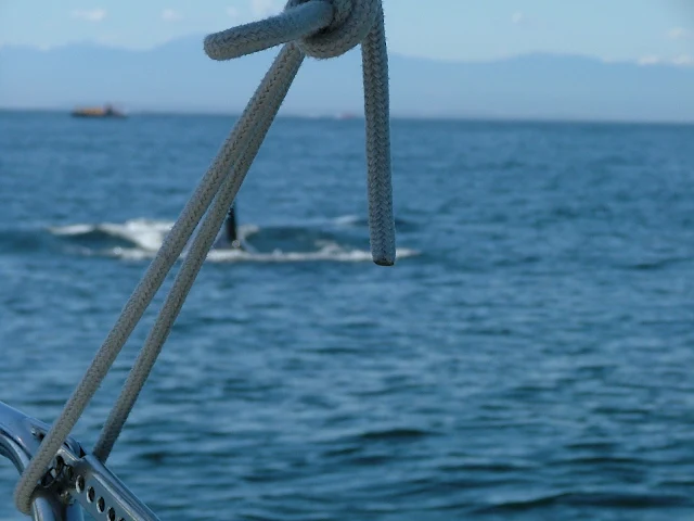
Killer whale off the port bow