ATTENTION!

This site has oodles of information about boating and the San Juans, it helps to use the search box BELOW to find what interests you.
Search - "things to do" or try "places to go"
search - Sucia Island
search - Friday Harbor
search - hiking or bicycling
try - kayak - try CAMPING - try Anchoring

++++ ============================= All Posts Below

Current Posts Below

Monday

How Long is Your Painter? Does it reach all the way to shore?

You know, that short little rope tied to the front of your dinghy!
Echo Bay on Sucia Island
This may look like an unpleasant circumstance waiting for our return, but it is exactly what we planned.

Let me explain.  When we arrived many hours earlier at a much lower tide, we beached the dinghy and walked away just like so many other times. Knowing the rising tide would float our boat, and we were going for an all day hike I ran my line all the way up to the permanent driftwood pile, above the high water mark.  Its true the dinghy will eventually float free and may wash up on shore, but the weather is fine and wakes are frowned upon at Echo Bay.
If I was really worried I could have deployed a light anchor that does not dig in, then when we returned I would have simply hauled it all to shore dragging the anchor with it.

So what, you say?

The point is, when you outfit your shore boat you should anticipate needing a really long rope just in case you need it. My current dinghy has a fifty foot floating line, and if I can't reach something solid, I go find a dog-bone shaped rock and carry it to where I want to tie up. Some skippers carry a small dinghy anchor and rode, then simply carry it up the beach.

Having your dinghy float away doesn't always mean you will lose it forcing you and your crew to swim out to your boat.  In popular anchorages someone will probably come to your rescue.

Now this next point is very important.  Conditions at the shoreline may change from flat glassy water to two foot waves in just minutes. A far off storm can send waves your way, or a ship may pass by. The resulting pounding waves may flood your dinghy or seriously damage it.  With this in mind there will be times and places where you should carry your dinghy up the beach to safety. It is very reassuring knowing your shore boat will be there waiting for you when you return.


Sunday

How to launch at the Port of (fill in name) and the importance of having alternate plans

Never pee into the wind, check.
Never tug on Superman's cape, check.
Never buy a lottery ticket for an investment, check.
Never say never, check,  err-unchecked, err.
Never depend on the marina, check, check, and double checked.

Kraken on way to San Juans
Rest stop on way to La Conner for launching, and then on to the San Juans
In preparation for this seasons cruises I called ahead to the Port of Skagit County in La Conner to arrange for a travel lift launch.  Good news I'm told by the very nice lady on the phone, "We have a forklift that lifts 11,000 pounds and we are open until 6:30 pm."  Okay great, I'm thinking, we can get there around 3 pm and we only weigh 8500, perfect, oh yeah, how much?  "Only $20 or $25 if they have extra work."  Fantastic, for only $25 I don't have to dunk my trailer brakes in salt water, this is too good. (and it was)

Reality, or what really happened:
First the ports forklift  can only lift 5,000 lbs, and they didn't want to even try.  Second they don't have a travel lift, but a  light duty overhead tram with a sling, and again they would not try.

My options are -- go away.

Next, at 3 pm we parked on the main drag outside the still open La Conner chamber of commerce where I asked about private boat yards and was supplied with the telephone numbers for two marinas with big travel lifts. A quick phone call determined both businesses were willing to sling my boat for about $125 if I came back tomorrow.  I begged for compassionate emergency service, explaining I just drove for six hours depending on the ports promises only to hear, "Do you want to reserve a slot tomorrow, we have customers today."  "No thanks," I said.

Plan B, we quickly drove over Rainbow Bridge to Shelter Bay Marina to check out the boat ramp, only to find it high and dry with a falling tide that still had two more hours to go.

Plan C, we quickly drove back over Rainbow Bridge to the La Conner city ramp located almost directly under the bridge.  I asked a fisherman fueling his boat out of a tank in the back of his pickup how far the ramp extended. "To the end of the dock," was his answer.  Keeping in mind the tide was falling, I went to the far end of the float and with a boat hook began probing six feet down while moving up the ramp. Once many years ago I backed off the end of a ramp dropping the trailer about two feet, then became hung up on the end of the concrete. So, better safe than sorry, now I always probe or somehow determine I will have plenty of ramp.

With about two hours of falling tide water still ahead, a thirty five foot trailer and boat, a thirty foot float with a six foot depth in the middle, fours hours of daylight left, I said lets launch, and began rigging fenders and dock lines while the fisherman finished filling his boat with fuel.  When his pickup cleared the single lane ramp I backed down and she floated free.  Five minutes later, my rig is locked up and parked in the city provided spaces, and we are on board motoring towards our waiting slip in Shelter Bay.

Total cost - launching and parking, $2.50 per day. Total frustration - not too much.

There is no moral here, my advice as always is, give yourself plenty of time for plans B, C, D....

BTW, I spent a full hour hosing and flushing my trailer with fresh water after retrieving it from the ramp parking lot later that day.

In the fall I will likely reverse the procedure, but try to do it near high tide.
I will probably mention something here unless it is really boring.


Wednesday

Where is Cypress Head Campground and why should you camp there?

I stopped for a quick look around at Cypress Head.
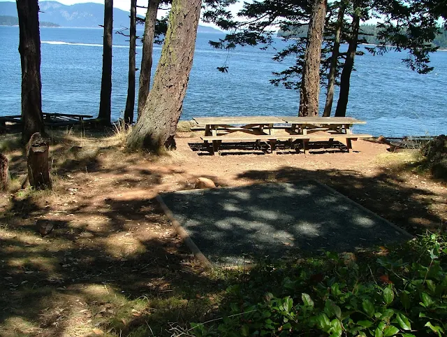
There are quite a few campsites and trail access to all of Cypress Islands trail system.
With a cove on both sides of the head you should be able to find some protection when anchored.
Cypress Head campground, cypress Island

Cypress Head campground, cypress Island

Cypress Head campground, cypress Island
The camping sites at Cypress Head have the best view I have ever seen, but the exposure to wind goes with the view.
Cypress Head campground, cypress Island anchor buoys
One side of the head has mooring balls, the other side nothing, but I would choose the side without a swell for an overnight visit.

For those of us without any idea where this place is - you will find Cypress Head on the east side of Cypress Island on Bellingham Channel.  It is a short kayak paddle from Guemes Channel or Washington Park in Anacortes

Saturday

What can boaters do when faced with persistent San Juan Islands fog and Rosario Strait must be crossed

persistant fog bank blocking Thatcher PassThis is a view down Guemes Channel across four mile wide Rosario Strait at what would be Thatcher Pass if you could see it.

That wall of white is creeping up the tip of Cypress Island.

You can navigate through the soup and wonder about ferries or turn like that cruiser did, and run around behind Cypress island to cross Rosario over to Peavine or Obstruction Passes. The detour adds only a little bit of time and three miles extra travel, but misses todays fog bank. This is a common situation. Further south at Lopez or Cattle Pass, or Deception it will likely be the same.

Here is a link to a foggy article that may enlighten some > Dealing with fog in the San Juans


Wednesday

Some pictures to Share to make you smile

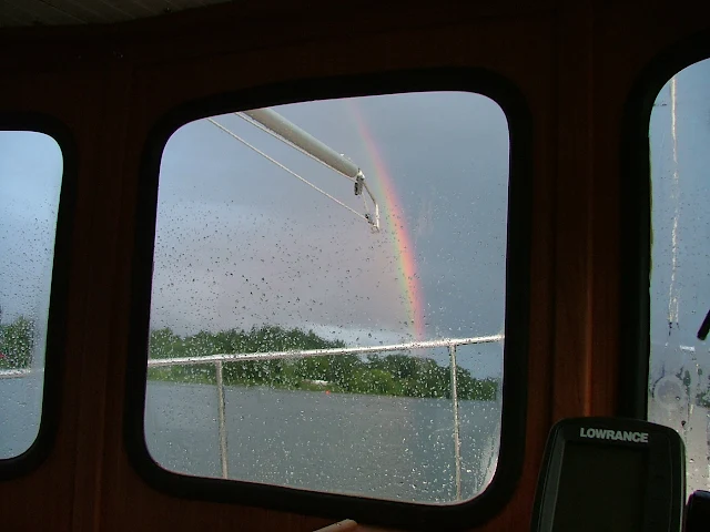
Rainbow outside wheelhouse
Kind of a miserable day but a bright future

left side
right side
new family on the move
That time of year again


More cruising pictures worthy of viewing - click here > Lots of great San Juan images