ATTENTION!

This site has oodles of information about boating and the San Juans, it helps to use the search box BELOW to find what interests you.
Search - "things to do" or try "places to go"
search - Sucia Island
search - Friday Harbor
search - hiking or bicycling
try - kayak - try CAMPING - try Anchoring

++++ ============================= All Posts Below

Current Posts Below
Showing posts with label boating. Show all posts

7/14/2023

First Time Trip to the San Juans Suggested Itinerary for a Nine Day Trip


San Juan Islands for First Timers

Suggested Itineraries for  San Juan Island boating trips

(Updated (2014) alternate itinerary with Echo Bay at Sucia Island as 1st stop)
click here  Sucia Trip Intinerary


(For a  shorter itinerary on your first cruise and with different island stopovers (click here) 


      This article is designed to get you going on that first boating/sailing trip to the San Juan Islands in Washington State.

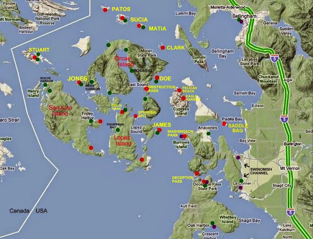
Below is a snapshot map of your dreamed about vacation land (or water) 


map of San Juan Island area


The map above identifies many  (not all) common names and places

Take a moment to familiarize yourself with some locations you may have read about.


You may want to follow this link and take a quick look at the detailed marine parks list and then come back to the suggested itinerary below, "MARINE PARK LIST AND MAPS" click here 

for your detailed itinerary click (read more) below  >>

6/15/2023

What is the Best Dinghy for Cruisers in the San Juan Islands? The Dinghy Dilemma!

       We all know asking "What's the best dinghy" is a loaded question; boaters can be passionate when it comes to  equipment choices.  Based on my own frugal, sailing/boating should be affordable philosophy "The best dinghy is the one you already own."  Whoa now, lets start listing exceptions.  I don't mean too small, too big, leaky, unsafe, etc. etc.   I mean a basic dinghy, that only has to float you and your stuff to shore.

    In keeping with this blogs purpose to help first timers get to the San Juans, lets talk reality.

     Here are ten or more irrefutable truths about dinghies.
  • You must have a dinghy to go ashore at most parks, because you can't count on there being room at the dock. Many docks have room for only four boats. Many parks have no dock.
  • You don't need a dinghy if you only go to resorts and marinas.
  • You will probably tow your dinghy everywhere you go.
  • You may not use it at all (makes you wish you left it home).
  • If you need it you will be thankful you brought it with you.
  • There is no place you will go that you can't drag your dinghy along.
  • Dinghies may be major status symbols among some groups.
  • Towing a dinghy slows you down and uses fuel
  • You may run over your tow line and foul your prop or rudder (use a floating tow line).
  • Certain people have a hard time climbing into or out of a dinghy alongside their boat.
  • Children need a dinghy.
     Okay, that list is far from complete but highlights some points. Yes you need a dinghy, even if you can beach your boat, there are simply too many limitations and problems with beaching your water borne camper.  Lets say for example you rush to shore to use the bathroom at one of the great State Parks.  In the ten minutes you're ashore, a falling tide could leave you high and dry.  With a dinghy you simply pick it up and carry it back to the water. You need a two or three person dinghy, a one person craft can't ferry others to shore. When using dinghies, a multi hull catamaran style such as a Livingston is very stable, rows  well, beaches easy, and can carry big cargoes, however when towed they track to one side, hunt back and forth, forcing you to keep them on a very short leash. A conventional V hull dinghy is  tipsy crawling over the bow on the beach, carry's less cargo, but rows very nice and will tow directly behind you on a long or short leash.  Inflatables can carry enormous loads, some (not all) row poorly and some create so much drag they are impossible to tow. Just about all dinghies can be outfitted with an outboard motor, but you really don't need one for simple cruising in the San Juan Islands unless you plan on doing miles of shoreline exploring.

        In the summer season you probably wont see any big dinghy capsizing waves, but storms and adverse winds can churn up anywhere anytime, my dinghy floats when swamped, but not with the outboard, with the outboard bolted to the transom it's straight to the bottom or at least as far down as my tow line is long. Inflatables may be swamped without damage or sinking, which is something to think about if  your main boat is not up to the challenge, and could itself be sunk somehow.
Livingston Dinghy, one of five best shore boats
Our Livingston dinghy is nine feet long and a tad bit overloaded
Two man inflatable kayak for cheap shore boat in the San Juan Islands
This inflatable was $69 and holds two people
This inflatable stows on deck, or deflated stows below and carries three people. 
      How about two dinghy's?
If you have children that take off with the dinghy, they are effectively leaving you stranded on the boat or ashore.  Well that's not going to happen you may say.  I say, "what if they get hurt ashore and call you on the phone or radio for help? What do you do? What if they take off in the dinghy and it gets dark, what do you do? (swim)"
Several years past I sent my bored and restless son (in the dinghy) to shore at dusk, telling him to invite himself to one of the many campfires we could see from the boat.  He met some other boaters with kids and before you know it it was after 10:00 pm and very dark.  His mother and I started to wonder what to do as we were stranded, and had no way to communicate with him. After a few minutes I took a strong flash light and blinked it into the darkness in the direction we thought he was last seen.  A short while later he appeared at our transom asking if we wanted him or something.  This little non event made me realize how handy a second dinghy would be, so we bought an inflatable kayak to stow below, just in case.


10/13/13 update worth noting
I'm selling the new sailing dinghy

4/17/17 update on converting the 9'  Livingston dinghy to sailing
 >> go to the do-it-yourself page and scroll way way way down to see the finished conversion << The dinghy conversion section is before the Bimini top on the cheap instructions and after the Boat acronyms if that helps you find it.
Livingston dinghy sailing conversion

9/13/20 another dinghy update. Last winter I plunked down about a grand in boat bucks and bought a new inflatable. My criteria was as follows. First, it must be light enough for me to muscle it around onto and off of the cabin roof by myself. It must have two seats. I must be able to inflate and deflate it on the boat. I bought a 9.5 foot boat with aluminum seats, plywood transom and high pressure inflatable floor.  Without seats, oars or pump, the rolled up package is about 4 feet long, 1.5 feet in diameter and weighs in at 73 pounds.

Standing on the cabin roof, I was able to fully inflate the new boat and slide it into the water.  Dragging it back up was much more work, even with two of us.  Then we drove around for three days with the inflated boat on the roof. All in all I like the new boat and am happy with my choice.

Testing complete, we deflated our new dinghy, rolled it up and headed for the San Juans.  At the last minute before heading up the freeway, I put the Livingston back on it's  swim step snap davits.  I know my plan was to replace the Livingston with something more seaworthy but I decided to bring the new and the old anyway.

In the San Juans we never inflated the new dinghy, and used the Livingston as usual.  Now the new inflatable is sitting collecting dust in my boat shed. I used it once for one hour. I still have high hopes to somehow justify my purchase. I hope mice and squirrels don't chew on it in the meantime.

9/17/2022

Visit Olga on Orcas Island and ride your bikes up Mt Constitution or Moran Park

      Olga offered us an empty dock, so we gladly accepted. On other visits we turned away vowing to return when there was room.  The private mooring field is peppered with so many buoys it demanded full attention slipping through.
Kraken at Olga dock in the San Juan Islands
Olga public dock has room for about three boats on each side, all buoys are private.

Kraken at Olga dock on Orcas Island
The dinghy's at Olga belong to locals, there is no access to beach except, a nasty slippery, very steep, and thorny trail in brush under ramp.

Olga dock on Orcas Island
The sign says it all

       On shore at the top of ramp is a flagpole, and a memorial bench. There are a couple blocks, if that, of roads to walk, some say private drive, keep out.  There is no bathroom.  The old store across the street was closed up many years ago, and the property is for sale, but the little post office is in business.  Up a moderately steep hill about 1/4-1/3 mile is a restaurant on the main road. Some other boaters made the hike and reported good food.  Other than private homes, most which look like second homes, there is no other business.  That's it for Olga.  I'm glad we finally stopped by Olga, but except for a nice dock to tie up to, and a pleasant little bay to paddle and dinghy sail, what can I say.

       On a much more positive note, I rode my bicycle around a little, and after checking my maps I realized that Olga is the shortest and most convenient starting point for a grueling ride to the top of Mt Constitution.  7 miles versus 7.5 starting at Rosario.  I did not make the ride due to being late in the day, but I plan to come back and give it a try.

         Next time we are in the area and need a place to spend the night, I'm sure we will stop again.
Oh, and we saw a little baby deer on the beach, way to go Olga!


5/02/2022

San Juan Islands Cruise Starting at Cornet Bay in Deception Pass State Park

This post first appeared in the web site in  2011. Parking and launching fees at Cornet Bay have since gone up a little.
       Camping, traveling, vacation rentals, condo's, resorts, on a budget, is it even possible? Yes it is. Inexpensive (cheap) vacations are possible if you go by boat or yacht as some say. The trick is to already own the yacht and then camp on it at all the great places.  Think of it like going to RV parks only without the garish over the top  land schooners parked on the best reserved spots.

           Okay, no more promos for boat camping.  Assuming you are a newbie to the San Juan Island boating group, you may be wanting to know why you should start at Deception Pass State Park if you are headed for the islands.  Simple, the park has the best all weather, all tide launching ramps and long term parking lot. Plus,  Deception Pass is one of the places to see that you should not miss, and the Cornet Bay dock is a wonderful place to hangout overnight, or for a few days or longer. 
Map of San Juan Islands showing rosario strait, Anacortes, Friday Harbor, James Island, Deceptiopn Pass

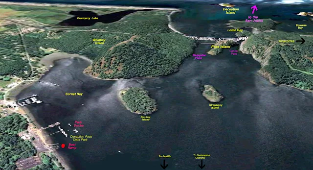
Snapshot showing Cornet Bay and Deception Pass

The Google photos above with labels will help you to orient yourself. Because slow boats must time their passage through the pass you may find yourself spending the night at the dock.  I always plan to spend the first night at the dock because  after driving six hours, rigging and launching my sailboat, it's late and I'm tired.  My crew can fish, hike and race around in the dinghy while I take a break.  The next day I'm ready to go, and cast off at slack tide which may be at noon or 9am.  The time doesn't matter, I'm on island time now.

The launch fee is around $6, parking is $10/day and staying at the dock is 50 cents a foot. The ramp has three or four lanes with floats. Trailer parking is abundant and long term.  You can anchor out for free, anytime, anywhere. There is a fist of quarters shower that short times you in the bathroom.  Lots of locals and campers come down to fish off the floats, but boats tying up have priority. Try explaining that to a fisherman.

It is a very short run out the pass, under the bridge and into the Strait of Juan De Fuca, where high seas or fog may cause you to change your plans, if so, just head the other way to Swinomish Channel.  If you have never cruised the channel do it anyway, it only adds about 15 miles to your trip and is well worthwhile.  Or when you come back a week or so later, use the channel, but try to work it into your plans.  FYI, your boat will need to make 10 mph or better to overcome the worst of pass current, otherwise you will have to time it like the rest of us.  Of course with a favorable current you can rush on through, but the standing waves can be pretty big at times and an open bow boat will seem like a poor choice. The pass is narrowest directly under the bridge, so you will have a fast current for only a very short distance.

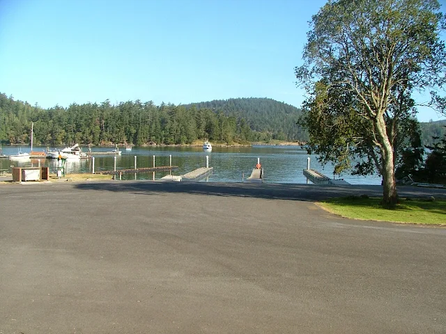
Deception Pass boat launch at Cornet Bay

Dock and ramp at Deception Pass State Park (Cornet Bay)

        You should run through Deception Pass.  Next door, Canoe Pass, while navigable, should only be used at slack water, is very narrow  and sight distance restricted right under the bridge, it is a little creepy when the whirlpools turn on and begin spinning you towards the rock cliff face.  Sometimes we take our 9' dinghy with its 7.5 hp motor around Pass Island and wave to the gawkers on the bridge, but when the flood or ebb starts cascading, a dinghy has no business in either pass.

         When you come back a week or so later and are ready to head home you can wait  for slack water outside the pass at the dock in Sharpe Cove or Bowman Bay. 

           I always spend my last night at the dock, and get a good rest for the long drive home.
Here's a link to the marine parks locating map  marine parks maps etc. click here


Deception Pass at slack water

Tall ship ghosting through the pass at high slack water (photo taken from bridge)
 In 60 minutes standing waves 3-6 feet tall may form and the current will be 5-8 mph

I would be remiss to not point out that  most boats can transit the pass a good deal before or after slack water, slack water is simply zero current like in the picture.  Also don't forget Swinomish Channel is just around the corner and avoids the pass altogether.

10/12/2020

Pictorial Hike to Eagle Bluff on Cypress Island

       repost from an earlier time

      Some readers of this blog will never get to hike to the top of Eagle Bluff on Cypress Island so I snapped a whole bunch of pics while I walked along.

I'll try to keep the text to a minimum

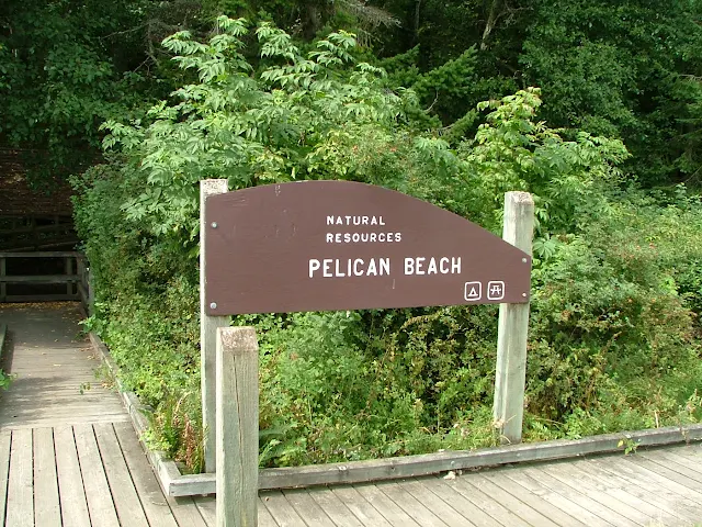
 We took the dinghy to shore at Pelican Beach, which is a Department of Natural Resources Site (DNR)  see Pelican Beach >> Read about Pelican Beach on Cypress right here

Pelican Beach anchorage on Cypress Island, camping, hiking

Pelican Beach anchorage on Cypress Island, camping, hiking


Pelican Beach anchorage on Cypress Island, camping, hiking
The boardwalk quickly gives way to forested trail

Cypress Island hiking, camping, pelican beach

Many, many pictures yet to see

2/28/2019

San Juan & Gulf Islands Current Atlas - Strait of Georgia - Haro - Rosario - Juan De Fuca

   Re-posted  because currents in the San Juan's are part of every day.

If your serious about working the San Juan currents to your advantage you will want to purchase this current atlas, produced by the Canadian Hydrographic Service.  The Atlas is available at West Marine as well as many retailers for about $30

Straight of Georgia - Juan de Fuca Rosario Strait and the entire San Juan's area current atlas
To use the Atlas without doing any math, you will also want to purchase an annual page index such as Washburne's Tables for about $7 
Some genius's have posted their own index tables online that you may copy for free.
(try this one  http://code.borsboom.io/current-atlas-tables/)

 Below is a scan of part of one page from the current atlas.
  This is confusing so read the next section twice or more.
The Current Atlas consists of about 80 pages, each page is identical, except for the direction and size of the arrows.    Each page represents current direction and velocity forecast for one hour of that day. All days and all hours are forecast, some conditions repeat repeat repeat, that's why there are 80 pages and not 8,760, and why you need a page index to locate the correct page.  You will only need one Current Atlas (used or new) but you will need a page index for the date of your cruise.  An old index table such as the "2009" pictured above is of no use unless your yacht is a time machine.

The page below, was the forecast for July 13, 2011 at 6:00 pm.  If you wanted to see the forecast for 5pm, 7pm, or another day, you would look at a different page. (this is similar to tide tables, except with drawings)


San Juan Islands current chart
 The biggest arrows represent current velocity over 2.5 mph, the smallest, under .25 mph. 
The arrows point the direction of flow.
Notice the whirlpool (eddy) south of Victoria and off San Juan Island. Notice the current flowing south on east side of Orcas and north on west side of Whidbey.
When cruising, having this information handy can save you time and fuel and make the difference whether you get to your planned destination. For instance a boat heading north up Haro Strait near San Juan Island will get a big boost, however by checking the next several hours one would see that the free ride is going to end soon and the train will come roaring back.  As a rule of thumb the currents flow north on a flood tide and south on ebb tides but as you can see, rules have exceptions.  This forecast is just before the flood tide reverses and becomes ebb, an apt description would be "confused" The confusion will soon end, get your ticket to ride, its free.
San Juan Islands current chart
This is what the currents looked like on July 13th at 7:49 am, also July 14th at 8:39 am and July15th at  9:26 am.  As you can see, your vessel will get a free ride south just about everywhere, but each day at a slightly different time. When planning your passages and your cruise it would be very helpful to consult the Current Atlas first, a simple free ride one week will be the wrong direction the next week. You may want to choose a different departure date.

While were on subject of currents, picture in your mind these big arrows meeting opposing winds and you should then visualize big, steep (dangerous) waves slamming your boat.  Then after a few hours the current changes, and all is well in Camelot once again.

 this post should be read if big waves bother you  >>>wind-versus-current-and-predicting waves

Lately, I have made it part of my cruising to use as little fuel as possible, one cruise we covered about 120 miles over 8 days and used 6 gallons of gas, and most of the fuel was used battling an opposing current between Jones Island and James Island. Unfortunately my schedule dictated the time.

1/16/2019

Get your Camping, Resort, and Marina Reservations in the San Juans -NOW- before it's too late

       Okay,  here it is, the day before Valentines Day, and you are stuck on  finding the perfect Valentine.  How about a reservation at a B&B in the San Juans for some time in July or August. Or a cozy romantic restaurant dinner date in a  Friday Harbor eatery.

      Enough with Valentines, by the time you read this, you're either in the dog house, living on your boat, or should be making summer cruise plans. In any case its probably not too late to get that reservation at a campground or marina.

      When planning a San Juan cruise you don't need any reservations to have a great vacation, but some people feel better knowing there is an open slip or warm bed waiting their arrival.  As a suggestion you might consider making a reservation at a popular stopover for just one or two nights in the middle of your cruise, leaving the rest of your time free to go where the wind blows you, simply staying where you happen to dock or anchor. With a speedy power boat all the San Juan islands and parks are within an easy run no matter where you start or plan to end up. A more sedate  pokey sailing type vessel  may be somewhat limited how far it can run before the sun sets.

     Even if you don't reserve some fancy resort for a stopover visit you can still make a day time visit to Friday Harbor, Roche Harbor, Deer Harbor or many others, park that yacht for free, or anchor and dinghy to the dinghy dock,  then armed with a fistful of quarters enjoy a wonderful, blissful, rejuvenating, hot shower.  You will get back to the boat refreshed and ready to continue your vacation anew.

Free showers in the San Juans while boat camping


 Hot showers are still free at Lopez Village.
Check it out here >>>  Lopez Village Free Hot showers


12/26/2017

Five Things Everyone Should Know Before Cruising the San Juan Islands

Fun Observations and Frivolous Knowledge  for 

All Boaters new to the San Juan's (repost)

#1 Hugely fluctuating water levels   (tides)

The San Juans have high and low tides every day, some very high, some very low. This means you will need to be prepared to deal with going ashore at locations lacking floats.  The easiest solution is to bring a dinghy; if you don't have a dinghy I suggest you buy a cheap inflatable boat or 2 person kayak for around $75.  Once in the San Juans most people simply tow the dinghy everywhere they go, or deflate and stow it away. Those of you going in a ski boat or skiff may be thinking you can beach your boat, which will work, but only for a few minutes. On a falling tide in ten minutes your boat may be high and dry, unless you can carry it, your stuck until the tide comes back up. On a rising tide your boat will float away while you're on shore.  Since your going to anchor in six feet of water at low tide you will need one hundred feet or more of anchor rode to accommodate a ten foot plus increase at high tide. Smart boaters bring two anchors and rode and a dinghy they can carry up above high tide.
San Juan Islands - very low tide at Matia


#2 Strong Swirling Currents (in places)
San Juan currents are notorious, and the root of many stories. For fast planing boats you can pretty much ignore adverse current; however slower boats live and die by planning passages to get an assist from the current. A typical sailboat may putt along at 4.5 mph, against a 2.5 mph current their real speed over ground is 2 mph.  Going with the same current their sog is 7 mph.  So a ten mile passage takes 5 hours the dumb way or 1 hour 25 minutes the smart way. There are many prediction and forecast books and charts available and online.  While you don't need a publication, I recommend that you buy something and keep it with you. I would also go online and print out a tide schedule for the time and area you expect to cruise.  CLICK BELOW for Rosario Strait at Guemes Channel
NOAA tide forecasts
In a nut shell, here's a simple rule of thumb to follow.  On a incoming or rising tide, the water in most straits and passes flows "north" while during a falling tide the water reverses and flows "south."  When the current hits an island straight on, the water will split and flow around the island usually at a slightly higher speed creating eddies at headlands and the tips of the island.
San Juan and Gulf Islands Current Atlas

San Juan Islands current charts


#3 Weather could be fog  (pea soup is the term)
You can get lost in the dark, in the fog, or just plain lost on a sunny day.  You need to bring with you a chart, and you would be smart to protect it from getting wet or torn up. I sandwich mine between two clear acrylic sheets held together with velcro.
Some will say the chart needs to be new and of the highest resolution, which may be true for ship captains and other navigators.  What were talking about here is not getting lost, even a google print out may do the trick.  If you are going to boat in the fog you must have a compass, and  GPS, a portable handheld GPS will do fine and some new phones may do the trick too. (in thick fog you will go in circles and be totally disoriented without a compass) A gps will not replace a compass in rough water and fog, a gps is much too slow  reacting when you are getting spun from broadsides or quartering waves (broaching) you need both.   Many times in the San Juans visibility may be down to 3 or 4 miles and you think you can sneak across some open water to the next island, and you probably can, but if the fog thickens to pea soup you will be glad you have your compass and GPS.  BTW, fast boats can't always go fast when waves and swells stack up. And only very dumb skippers go fast when they can't see.
San Juan Islands fog hiding a ferry
See the ferry approaching the anchored sailboat?

#4 Wind or lack of wind  (sorry sailors)
OK, here's some bad news for sailors.  The San Juans are not known for great sailing winds in July and August. Out in the straits (Haro, Rosario, Georgia, Juan De Fuca)
you may get some decent sailing, but inside the islands, don't bet on it.
Sailing with reefed main in cold weather
Sailing in April rain with reefed main


#5 Crowd control   (no worries)
Most likely you won't have any problems with crowds except on the 4th of July and Labor Day.  The good side is that you will always find a place to anchor, even on holidays, the dinghy ride may just be a little longer for some.  Most marinas take reservations and you may as well take them up on it, but you don't need to.   I suggest you slow down a little and enjoy the freedom of not planning ahead, take one day at a time and see where you go.  Lastly, because this area is so close to Bellingham and Anacortes many boaters are day boaters.  At the end of the day they head for home, leaving some resorts and parks half empty, especially on weekend Sunday nights. Monday or Tuesday are good days to begin your outing if you want to be alone.
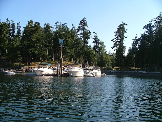
Roche harbor dock on holiday
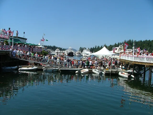
Fourth of July celebration in the San Juan Islands at Roche Harbor Resort
Roche Harbor summer celebration with children

Roche Harbor balloon chasing contest


Roche Harbor 4th of July balloon contest for kids in dinghys
yes, there was room for more, lots more


Expenses
DNR buoys are free (Cypress Island) State Park buoys are $10, many park floats are 50 cents a foot,  Marinas charge between 75 cents and $2 a foot. Gasoline is a little more expensive than on land, but not much more.  Food, groceries, ice are just a little more than the mainland but very fair priced overall.
How many days to plan
Plan a minimum of four days, but up to two weeks depending on what you like to do. (I like to sit on the dock at Jones Island and read my book between naps and walks, then I make a campfire in a empty tent site and cook Kielbasa followed by a glass of wine. Then retire to my boat for a good nights sleep.  The next day, do it again)

Salt Water
Salt water drys sticky and does not suds up well with soap, you will get it all over you and your boat, count on it.  After a week you will look forward to a shower.  Your boat will be covered with salt crystals.  Most marinas have little water and don't want you washing your boat.
Squalicum Harbor in Bellingham has boat and trailer fresh water wash down hoses in the parking lot.  You should use them each time you dunk your trailer.

Provisions
For the most part you will want to provision before you leave on the boat.  Anacortes and Bellingham have all the big stores and each has a West Marine store.  All the resorts and towns have grocery stores, if you drive a fast boat, supply's may be only minutes away, putt putt's should work a store visit into your circuit.  I say circuit because most cruisers will follow a circle of some sort trying to hit many stops.  We find that ice needs renewing after four days, so a stop over at Friday Harbor, Deer Harbor, Roche Harbor, Blakelys, or Orcas landing fills the bill.  All these places  except Orcas, have gas and showers.  Showers will cost a handful of quarters so be quick or be poor. Cold showers are free. Lopez Village has free showers but no dock so you will need a dinghy.how to dinghy to Lopez village

Garbage
All the parks are pack it in and pack it out, the marinas have dumpsters.  If you are new to boat camping you will find garbage to be a pain because you are not used to storing everything in your boat.  Little things like empty water bottles suddenly take space you don't have.  You must give careful thought to what you are bringing, and the garbage it will generate.  We don't use disposable bottles, minimize pop consumption, and try to have campfires to burn burnable trash.  It is against the law to toss anything, (even a apple core) in the water.

Animals
Your dogs must be on a leash, period, everywhere.  Raccoon's are on all islands and will climb right into your boat or kayak in the day time if you let them.  Deer are all over too, but they shy away, except on Jones Island where you can hand feed them.
Otters live under most floats and docks, they will crawl all over your boat, get into things and make a mess.  Otters also will mark their territory by pooing on your stuff, dock lines are a favorite.

Bathrooms
All the parks have nice composting toilets, (each island mentioned for overnight is a park) the rangers service all parks on a regular basis.  You will be pleasantly surprised at how clean the facilities are.

Where to go:
Your destination is simply that, its the journey getting there and the experiences on the way that make a trip a wonderful vacation. Try the links below for some Island Park descriptions.

Emergency's 
Bring your cell phone and charger, bring at least a portable handheld marine radio, bring basic first aid kit, call the Coast Guard, they can be there pretty fast, or arrange for vessel assist on your credit card, bring a friend with a similar boat, then you can help each other.

9/26/2017

Twenty Marine Parks - Twenty Public Docks - Five Boat launching Ramps in the San Juan Islands


Map of San Juan Island Area
With selected Parks, Docks, and Trailer Boat Ramps
Map of San Juan area parks, docks, trailer boat launch ramps
The  boat ramps (purple) are all on the mainland


 •  Boat Ramps = Purple    Parks = Red  •  Docks = Green

Most docks (floats) are in parks, resorts, marinas and may be used for overnight camping. Boat launching ramps have long term parking.  Parks without docks have anchor buoys or areas suitable for anchoring.

1/04/2017

How to Predict Current Direction in Swinomish Channel

        Sooner or later regulars to the San Juans learn to love or hate Swinomish Channel.  Many skippers form an opinion on their very first transit through this popular eleven mile alternative to Deception Pass. Sailors and under powered puttsters fighting the current, hate it, but turn them around and  suddenly their tune changes as the current whisks them along at four miles per hour.

         One day we pulled in to the city float at La Conner and I grumbled to a local boater about how we had been battling the current for hours on our way from James Island.  I remember his comment, he said, "The current flows one way for twenty three hours and then reverses, and no one knows when."  We all laughed and I figured I should get over it.

         I came across this rule of thumb posted on the Port of Skagit County website for estimating the current direction.  

        The rule of thumb for estimating Swinomish Channel current direction at La Conner goes like this:
                 
The current flows north from 2.5 - 4 hours before high tide to 2.5 - 4 hours after high tide
The current flows south from 2.5 - 4 hours before low tide to 2.5 - 4 hours after low tide
Slack water occurs 2.5 - 4 hours after high or low tide, not at the tide change like in some areas.
          You will still need to consult with high and low tide predictions for La Conner to put these rule of thumbs to use.  Be forewarned, many people consider La Conner tide predictions as hocus pocus because they are often wrong.


      I cannot remember this rule so I am going out on a limb here and offering my own memory trick as follows.   We already know that in the San Juans a rule of thumb is that the current flows north on an incoming tide (flood) and south on the ebb, and we know in the Puget Sound and southern area it is basically the opposite.  So my memory hack is to consider Swinomish Channel as part of and subject to the San Juan rules of thumb.  This means, Swinomish Channel flows NORTH on the flood just like the San Juans, but it is late due to distance.

FYI - did you know that all of Swinomish Channel (at least where land is) is a "No Wake - Slow Zone"


3/07/2016

What size boat is best in the San Juans? Bigger Boats - Smaller? Anything Goes

              Sometimes I see micro yachts being paddled or sailed across straits and marvel at them just as much if not more than the mega bruisers with the eight foot freeboard.

              The difference in expense, crew requirements, and comfort are obvious, and if you drill down into the pros and cons of mega versus micro, each skipper will have a laundry list rationalizing and justifying their choices.

                In the end, the boats we use in the San Juans are the ones we have, it's as simple as that.  It's not a matter of what is appropriate or proper, it's a matter of making proper choices for the conditions, and your boat's ability to handle those conditions.

               From a 14 foot open fishing boat, kayak or canoe, to the Queen Mary, all have a time and place in the San Juans.

                The boats in the pictures below are likely to be found just about everywhere.

So if it floats -- get going.


Taking a day sailor to the san Juan Islands
Everything but the kitchen sink

Echo Bay Tall ship cruises
And the kitchen sink

Mega Yachts in the San Juan Islands
Too big to fit in picture (please remove shoes!)

Camping in the San Juan Islands with ski boats
Runabouts - ski boats - open boats
Common at Jones Island


Mega yacht won't be using any of the park facilities.
These guys anchor out and dinghy into the coves and floats
See the tender on top?

Camping cruising  near Thatcher Pass and James island in the San Juans
Another camper on a runabout

runabouts and daysailers at James Island float
They may be using tents onshore at one of three campgrounds on James Island, or just a lunch stop.

Sail and human powered campground at James Island
Kayak  campers use campground at top of steps

old dock at Jones Island north cove
At Jones Island, its a full float of  day-trippers.

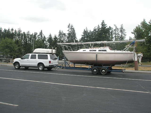
Olympia swantown ramp before facelift
This trailer sailer just rolled down the ramp

towing dinghy in Lopez Sound in the San Juans
becalmed in a car-topper in Lopez Sound

Cypress Island camping at DNR reserve
This boater paddles the final feet to Pelican Beach
Mega Yacht taking all of transient dock at Friday Harbor on 4th of July
Here's a shot that captures mega to mini.
The sailboat is a 70's Catalina 22 towing an inflatable. The mega is 164' Eileen , built in Italy with an 31' beam.  If you look closely you can see the 35 foot center console dinghy attached crosswise at Eileens stern.
This was at Friday Harbor on the 4th of July 2016.


5/29/2015

Fast Track to the San Juan's and Patos Island State Park

In keeping with this sites purpose to help newcomers get to the San Juan's, you will find listed below selected posts and links.

These posts are the bare essentials needed to get you off on that trip to the San Juan's, the rest is up to you. (click on the links)

  1. Where to launch your boat and park your rig!
    • Where to Launch your boat and park your rig
      • First choice = Bellingham - (Squalicum Harbor)
      • Close runner up = Deception Pass State Park (Cornet Bay)
      • La Conner city ramp (Swinomish Channel)
      • Washington Park - Anacortes
      • Cap Sante - Anacortes (sling only)
  2. Suggested Itinerary!
  3. All the Parks with complete descriptions and chart snips!
  4. Rent if you don't have a boat!
  5. 12 fuel docks- marinas - resorts - you should know about before you take off into the unknown!

Is this all you need?
Of course not, but if you are a competent boater, the above posts will answer many questions you want answered.


Anchor at Patos Island State Park
Patos Island Anchorage


Did you know you can ask silly questions? Use the e-mail box on the left side somewhere.

3/09/2015

Is your boat legal in the San Juan's?

            The answer is yes - probably

The laws in Washington State are pretty much the same as where you are coming from.

If  your yacht is legal at home it's legal in the San Juan's, but only for 60 days.  After 60 days you will be expected to leave the state or become compliant.
boat laws


So you get a free pass for two months, but if your monster has expired tags, (vessel or rig) or you do not have a valid boaters card, you may be subject to re-training and fines.

And that's the way it is!

Lets go boating.

2/28/2015

Good News & Bad News - boat camping fees in Washington's San Juan Islands

     Who can resist a headline stating "Good News" or is it the bad part that draws us in?
No matter. The good news is that anchoring is still free, the other news is that Washington State Park fees for boaters have gone up.

      The reported new fee for using park buoys is $15 per night.  Staying at the float has been increased to 70 cents per foot.  So your 30' mega yacht is now $21 per night.

      On this subject, you may remember an old post where I pondered float etiquette -  Case #1 - a 30' boat hogs the middle of a 50' float leaving no room for other boats, should he pay for 50' or 30'?  Case #2 - the same 30' boat scoots way down and hangs over the end leaving room for more boats, should he be rewarded and only pay for the 20' he uses?  Case #3 - and we all no the answer to this one - do you include the bowsprit, swim step and dinghy davits or go with the much smaller boat length stated by the boat builder, come on be honest, no one is watching.

      Other thoughts on fees:  Park fees are a very small part of our overall boating experience, and yet provide us tremendous benefit. The Washington marine parks are top notch, why wouldn't you want to support them?
Washington camping fees for boats