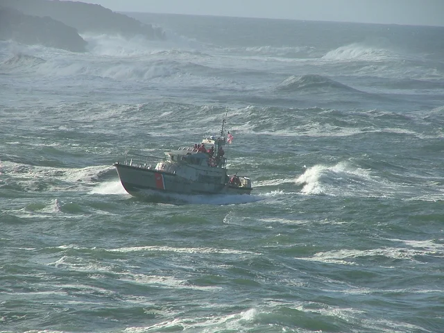
Fortunately we don't have much bad weather or rough water during the summer, but things kick up a little when the wind blows against the current.
The current changes direction every six hours, so with a steady wind, conditions on the water may change from smooth to stacked waves and back to smooth making crossing straits or rounding the tip of points very uncomfortable. Some of the currents slam into each other making things worse at the lee side of islands.
When the weatherman says a "north wind" he means the wind is coming from the north and blowing south. Not confusing ! - but when when they say a "north current" they mean the current is flowing north - (opposites attract waves) Simple to understand?
Take a moment and click on this link to view current Rosario Strait conditions as forecast by Noaa
click here to see Rosario Strait forecast (this is the same handy dandy link on left side of page) The forecast predicts weather and waves and has a handy radar view, plus you can change the target area simply by clicking on the map.
So! - a north wind and a north current are not good if they are at the same time and place, ditto for south wind and south current, east against east, west against west.
When making plans, check the current and wind direction, remembering at slack water there may be no waves, and then as the current speeds up, the waves stack up. And then six hours or less later when the current reaches slack again, the waves go back down.
In the San Juan's, currents flow around islands and land points, and winds blow willy nilly around land masses. This means you may find localized rough conditions where waves are stacking due to north versus north , south versus south etc. The good news is that many times these rough spots can be avoided simply by giving extra clearance when rounding points. The straits and passes though may require you to time your passage to avoid opposing forces. (north versus north, south versus south.)
The southeast tip of Lopez Island at Point Colville and Davidson rock is a good example where conditions often are atrocious and to be avoided.
Remember you can always turn around or wait an hour or two if you are overwhelmed. Simply changing course a little may ease the ride. Don't let your schedule or itinerary dictate your decisions.


No comments:
Post a Comment
The comment box was recently restored after being misplaced for a few years. Feel free to offer comments. Use the e-mail box to ask questions.