ATTENTION!

This site has oodles of information about boating and the San Juans, it helps to use the search box BELOW to find what interests you.
Search - "things to do" or try "places to go"
search - Sucia Island
search - Friday Harbor
search - hiking or bicycling
try - kayak - try CAMPING - try Anchoring

++++ ============================= All Posts Below

Current Posts Below
Showing posts with label sailing. Show all posts

5/02/2022

San Juan Islands Cruise Starting at Cornet Bay in Deception Pass State Park

This post first appeared in the web site in  2011. Parking and launching fees at Cornet Bay have since gone up a little.
       Camping, traveling, vacation rentals, condo's, resorts, on a budget, is it even possible? Yes it is. Inexpensive (cheap) vacations are possible if you go by boat or yacht as some say. The trick is to already own the yacht and then camp on it at all the great places.  Think of it like going to RV parks only without the garish over the top  land schooners parked on the best reserved spots.

           Okay, no more promos for boat camping.  Assuming you are a newbie to the San Juan Island boating group, you may be wanting to know why you should start at Deception Pass State Park if you are headed for the islands.  Simple, the park has the best all weather, all tide launching ramps and long term parking lot. Plus,  Deception Pass is one of the places to see that you should not miss, and the Cornet Bay dock is a wonderful place to hangout overnight, or for a few days or longer. 
Map of San Juan Islands showing rosario strait, Anacortes, Friday Harbor, James Island, Deceptiopn Pass

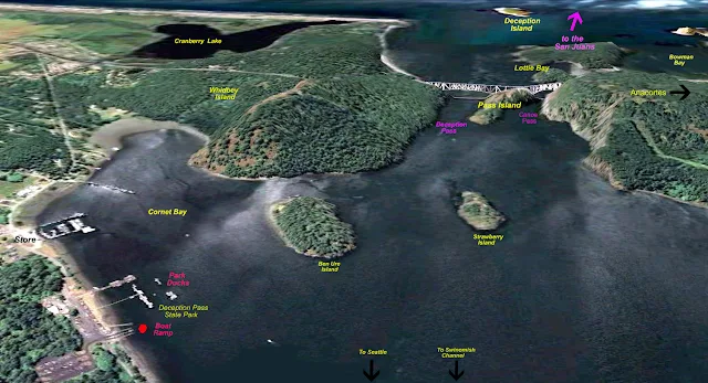
Snapshot showing Cornet Bay and Deception Pass

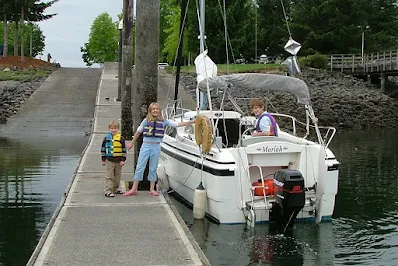
The Google photos above with labels will help you to orient yourself. Because slow boats must time their passage through the pass you may find yourself spending the night at the dock.  I always plan to spend the first night at the dock because  after driving six hours, rigging and launching my sailboat, it's late and I'm tired.  My crew can fish, hike and race around in the dinghy while I take a break.  The next day I'm ready to go, and cast off at slack tide which may be at noon or 9am.  The time doesn't matter, I'm on island time now.

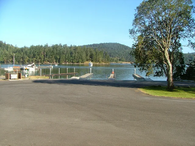
The launch fee is around $6, parking is $10/day and staying at the dock is 50 cents a foot. The ramp has three or four lanes with floats. Trailer parking is abundant and long term.  You can anchor out for free, anytime, anywhere. There is a fist of quarters shower that short times you in the bathroom.  Lots of locals and campers come down to fish off the floats, but boats tying up have priority. Try explaining that to a fisherman.

It is a very short run out the pass, under the bridge and into the Strait of Juan De Fuca, where high seas or fog may cause you to change your plans, if so, just head the other way to Swinomish Channel.  If you have never cruised the channel do it anyway, it only adds about 15 miles to your trip and is well worthwhile.  Or when you come back a week or so later, use the channel, but try to work it into your plans.  FYI, your boat will need to make 10 mph or better to overcome the worst of pass current, otherwise you will have to time it like the rest of us.  Of course with a favorable current you can rush on through, but the standing waves can be pretty big at times and an open bow boat will seem like a poor choice. The pass is narrowest directly under the bridge, so you will have a fast current for only a very short distance.

Deception Pass boat launch at Cornet Bay

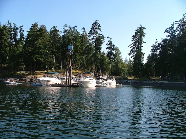
Dock and ramp at Deception Pass State Park (Cornet Bay)

        You should run through Deception Pass.  Next door, Canoe Pass, while navigable, should only be used at slack water, is very narrow  and sight distance restricted right under the bridge, it is a little creepy when the whirlpools turn on and begin spinning you towards the rock cliff face.  Sometimes we take our 9' dinghy with its 7.5 hp motor around Pass Island and wave to the gawkers on the bridge, but when the flood or ebb starts cascading, a dinghy has no business in either pass.

         When you come back a week or so later and are ready to head home you can wait  for slack water outside the pass at the dock in Sharpe Cove or Bowman Bay. 

           I always spend my last night at the dock, and get a good rest for the long drive home.
Here's a link to the marine parks locating map  marine parks maps etc. click here


Deception Pass at slack water

Tall ship ghosting through the pass at high slack water (photo taken from bridge)
 In 60 minutes standing waves 3-6 feet tall may form and the current will be 5-8 mph

I would be remiss to not point out that  most boats can transit the pass a good deal before or after slack water, slack water is simply zero current like in the picture.  Also don't forget Swinomish Channel is just around the corner and avoids the pass altogether.

3/07/2016

What size boat is best in the San Juans? Bigger Boats - Smaller? Anything Goes

              Sometimes I see micro yachts being paddled or sailed across straits and marvel at them just as much if not more than the mega bruisers with the eight foot freeboard.

              The difference in expense, crew requirements, and comfort are obvious, and if you drill down into the pros and cons of mega versus micro, each skipper will have a laundry list rationalizing and justifying their choices.

                In the end, the boats we use in the San Juans are the ones we have, it's as simple as that.  It's not a matter of what is appropriate or proper, it's a matter of making proper choices for the conditions, and your boat's ability to handle those conditions.

               From a 14 foot open fishing boat, kayak or canoe, to the Queen Mary, all have a time and place in the San Juans.

                The boats in the pictures below are likely to be found just about everywhere.

So if it floats -- get going.


Taking a day sailor to the san Juan Islands
Everything but the kitchen sink

Echo Bay Tall ship cruises
And the kitchen sink

Mega Yachts in the San Juan Islands
Too big to fit in picture (please remove shoes!)

Camping in the San Juan Islands with ski boats
Runabouts - ski boats - open boats
Common at Jones Island


Mega yacht won't be using any of the park facilities.
These guys anchor out and dinghy into the coves and floats
See the tender on top?

Camping cruising  near Thatcher Pass and James island in the San Juans
Another camper on a runabout

runabouts and daysailers at James Island float
They may be using tents onshore at one of three campgrounds on James Island, or just a lunch stop.

Sail and human powered campground at James Island
Kayak  campers use campground at top of steps

old dock at Jones Island north cove
At Jones Island, its a full float of  day-trippers.

Olympia swantown ramp before facelift
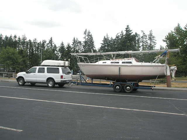
This trailer sailer just rolled down the ramp

towing dinghy in Lopez Sound in the San Juans
becalmed in a car-topper in Lopez Sound

Cypress Island camping at DNR reserve
This boater paddles the final feet to Pelican Beach
Mega Yacht taking all of transient dock at Friday Harbor on 4th of July
Here's a shot that captures mega to mini.
The sailboat is a 70's Catalina 22 towing an inflatable. The mega is 164' Eileen , built in Italy with an 31' beam.  If you look closely you can see the 35 foot center console dinghy attached crosswise at Eileens stern.
This was at Friday Harbor on the 4th of July 2016.


7/29/2015

What's new at Stuart Island Lighthouse

First I need to tell you that as of this posting date, Boundary Pass Traders is still in business selling T-shirts along the road to Stuart Island Lighthouse.  For those of you that don't know, Boundary Pass Traders is a local family business, they have two unmanned sales kiosks complete with fresh water.(after hiking up the hill you will appreciate a drink) They sell screen printed t-shirts on the honor system.  One booth, (more like an opening in the trees that resembles an upscale homeless camp) is next to the schoolhouse at the top of the long grueling hill coming up from Reid Harbor.  The other and newer location is at the intersection of the road coming from the county dock.  This means if you walk from the state park you will stroll by both, but if you walk from the county dock at Prevost Harbor, you will only see the one.  Moving along - You  make your choice from ten or more San Juan Island themed shirts, and then when you get home, mail them a check in the provided envelope. (or pay online) that's right, they trust you! We picked out an adult size replacement shirt for our youngest son, (think "Pirates of the San Juans")  to replace his stretched out, frayed, and faded child size he picked out many years ago.
Decked out outhouse at Stuart Island lighthouse
Volunteers at Stuart Island Lighthouse keep a pretty spiffy privy

more - click here

5/29/2015

Fast Track to the San Juan's and Patos Island State Park

In keeping with this sites purpose to help newcomers get to the San Juan's, you will find listed below selected posts and links.

These posts are the bare essentials needed to get you off on that trip to the San Juan's, the rest is up to you. (click on the links)

  1. Where to launch your boat and park your rig!
    • Where to Launch your boat and park your rig
      • First choice = Bellingham - (Squalicum Harbor)
      • Close runner up = Deception Pass State Park (Cornet Bay)
      • La Conner city ramp (Swinomish Channel)
      • Washington Park - Anacortes
      • Cap Sante - Anacortes (sling only)
  2. Suggested Itinerary!
  3. All the Parks with complete descriptions and chart snips!
  4. Rent if you don't have a boat!
  5. 12 fuel docks- marinas - resorts - you should know about before you take off into the unknown!

Is this all you need?
Of course not, but if you are a competent boater, the above posts will answer many questions you want answered.


Anchor at Patos Island State Park
Patos Island Anchorage


Did you know you can ask silly questions? Use the e-mail box on the left side somewhere.

11/28/2014

Pictures by Land and Sea Around Matia Island in the San Juan's


      A few years back, I  hiked the trail from Pelican Beach to the top of Eagle Bluff on Cypress Island, taking pictures every few minutes along the way.  The resulting pictorial is a pretty good synopsis for those that can't make the journey themselves. See the Eagle Bluff Pictorial hike here.  I decided to do the same thing on Matia, but with a little change up. First I hiked the trail snapping away with wild abandon, then I jumped in the dinghy and hugged the shore continuing taking pictures while I circled the island. Then I deleted most of what I had. The results are  below, you decide if it was worthwhile.
Matia Island picture
The blue marker on the far left marks Rolfe cove, and where we  begin our visit to Matia

First off, exit the dock!
The little four boat float, may be full, but there are two buoys and room for a few boats to anchor.  In a pinch you can anchor in the much larger cove at the other end of the island and do this hike/dinghy tour in reverse.


Hiking boating Matia Island
Boater park fees are  a great deal for what we get in return.


Matia Island in the San Juans
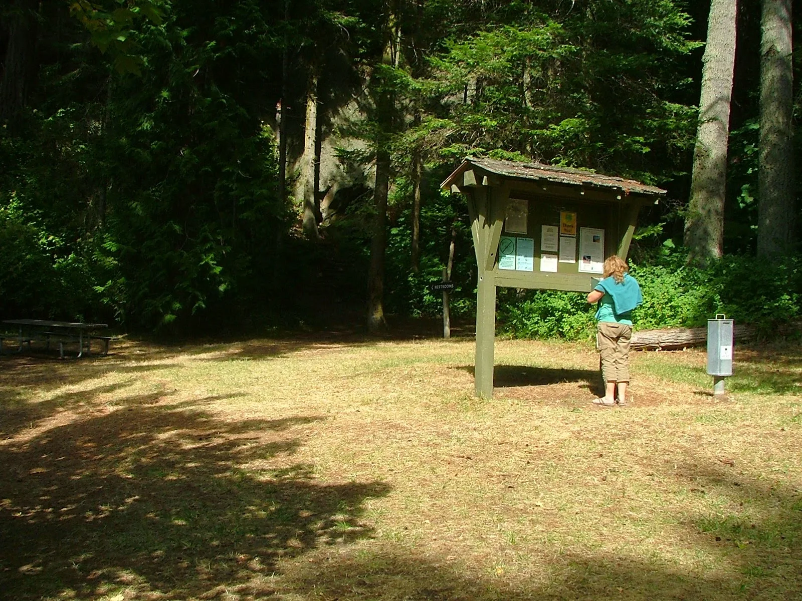
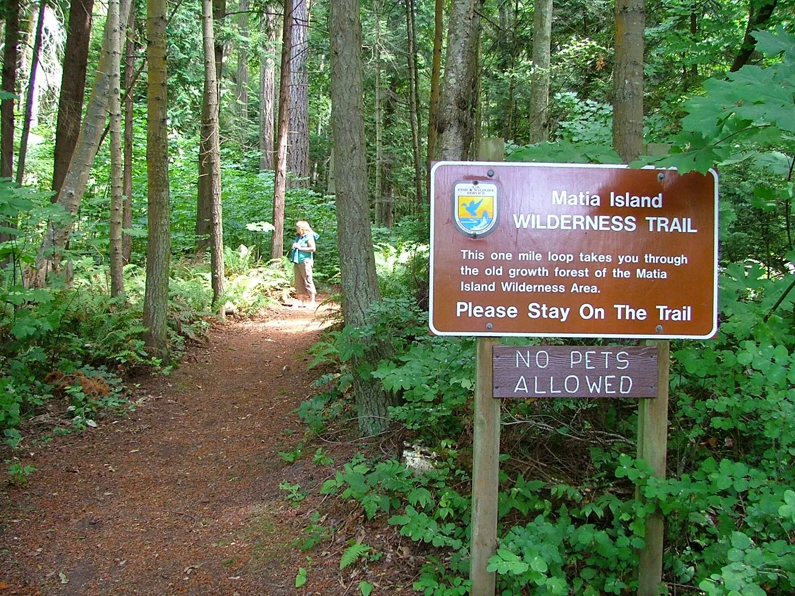
The trail starts at the top of ramp beyond the small picnic campground area.  Matia is unique in that fires are not allowed anywhere, and pets are restricted from trail system.
click where it says read more for the rest of the picture tour!

9/02/2014

At Last Pictures of Bimini in a Bag are posted

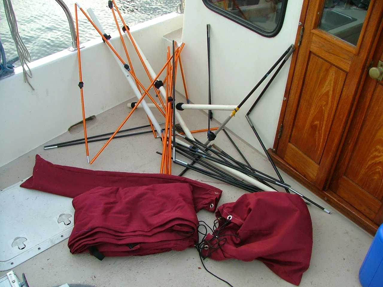
     Not all of us can just go out and order a $5000 bimini and have it magically appear installed on our boat. So the mother of invention leads us once again down the path of necessity and creates a "Bimini in a Bag"

Do it your self bimini top #1
"Bimini in two bags"
fits under the v-berth

Do it your self bimini top #2
Organized chaos
is the secret behind many good things.


Do it your self bimini top #3
Rainy day at Roche Harbor and the new bimini was priceless


Read the full description and many more pictures in the long posting titled  "Doing it yourself page" over on the right side menu bar or just click here  >>   doing it yourself ideas


4/09/2012

Mooring Buoys in Parks are for you to use but watch out!

Not much needed here, except a few comments.

Of course  buoys  are first come first served and you are not allowed to tie your dinghy to one as a way to reserve or save it. But what are you going to do if you find one with a dinghy tied to it? Set it free! No of course not.

Which brings up road rage or should we coin a new term? how about -water rage- or -cruiser rage- boat rage- island rage-   For the most part, boaters seem to leave their rage on shore, but if you pay much attention to the vhf you may think otherwise.

Back to buoys, mooring buoys are supposed to have a blue stripe, and most of the parks are close enough, putting a stripe on an old tire is a little tough.
mooring buoy's in the San Juan Island's

Around the populated areas you may find lots of buoys, most are likely to be private, none are OK to use without permission.


A word to the wise, don't trust buoys any further than you can tow them.
Some are not maintained and break loose when you are asleep or ashore.
Some may be in shallow water, or even be on the ground at low tide (check your depth) or have lots of rope, and flotsam dangling from them.  (yes, park buoys)


I think when you hook onto a buoy where you plan to leave valuable property tied up,  you should back down as if you were setting your anchor, but that's just me.  >> read this post  Anchor Buoy breaks free at Jones Island
Some other time we can talk about cleats and rotten old floats.

1/16/2012

WHY own A BOAT? and for me "Why a Sailboat" when what I really want is to go camping somewhere in the San Juan Islands


      Why a boat? is a fair question, and one usual quick answer is, "why not a boat"
Aha! got me again, remember if you don't like the answer, ask a better question.  Okay, how about this question,  "why take a boat for a cruise instead of taking a car and camping?" Now were getting somewhere;
WHY A BOAT?
Spending most of our lives on land, a boat, at least for me, offers wide open spaces, freedom, and much more. The journey is my desire, my wish, my goal, the destination is simply a mark on the chart, a mere way point in life. The boat is at once a complicated machine I must master, or at least control, and yet a simplistic drifting raft,or racing hydro-foil will also fill the bill. While journeying by water my mind is filled with the pressing matters at hand, what course is safe, what hazards lay ahead, are we drifting toward that menacing lee shore,  will we clear the point, should we tack now or risk thin water, what is that new sound? motion? vibration? Looking ahead I see a rock, a quick glance at the gauge hints at the waters depth, the rock is gone, now it appears to one side, as we glide closer I see it has eyes and a nose. I feel a mariner's connection, and an urge to wave, but no response is forthcoming. Anxiously checking the depth again, I'm ready to start the motor; The wind shifts, the sails fill, a little gust, and the lines pull taut. Looking up the mast to the top, I see the wind-vane has changed direction and is  pointing 90 degrees to starboard. The sails hanging like billowy white clouds floating above the boat are spilling wind, I let out the main sheet, and slack the jib.  click on read more...

12/20/2011

Why go to Cypress Island? Just go somewhere else - Please

        I hesitate to write about Cypress Island, my impulse is to keep the secret.

     For some, Cypress Island is a destination. For others it's just a stop on the way to somewhere else.
For me, it's a dependable refuge that I return to again and again.

        This selection of images is from Pelican Beach on Cypress Island.  The beach is very dinghy friendly. Pelican Beach should be visited for one hour or overnight, or you are missing out on something truly special.

cypress island eagle cliff hike


Pelican beach campsites


Cypress island, Pelican beach

Find your own trail on Cypress

Please use this link for all the other parks and keep Cypress secret.

11/24/2011

Using Current Charts Will Get You a Free Ride in the San Juan Islands - Riding the Current North in Burrows Bay

      Who ever said there's no free ride has never been to Burrows Bay. If you are a kayaker and your kayak paddle is  getting heavy, or your in a putt-a-putt puttster boat and need another knot of speed, you should know that the current pretty much  always flows north in Burrows Bay.
        Don't believe me, check your current atlas and find a day of the year or time of day that the current is forecast to flow south.

        Burrows Island and Allan Island are strategically located to create a whirlpool counter current within the bay, so along the shore is a dependable northward current at all times.

      What this means is that when you are cruising from Deception Pass north to Anacortes, or anywhere north, in Rosario Strait, it will pay you to come in close to the eastern shore and get a little boost. Of course if you're heading south you should stay out in Rosario Strait.
        Hugging the shore in Burrows Bay  will get you about 4 miles of free current to ride. Wouldn't it be great if all the channels and passages were this helpful, this back and forth tidal thing is nice, but doesn't always  keep to my schedule.