These are special places to go and great things to do that our years of cruising in the San Juans have rewarded us with.
Friday Harbor - Turtleback Mountain - Jones Island - Sculpture Park at Roche Harbor - Youngs Hill - Turn Point Lighthouse - China Caves - Matia Island Rain Forest Trail - Patos Island Lighthouse Tour - Inati Bay & Lummi Island Campground - Vendovi Island Preserve - Eagle Bluff On Cypress - Fort Whitman On Goat Island - Rosario Beach & The Maiden of Deception Pass - Victoria & Butchart Gardens
Some of the very best places are walks or hikes that are off the beaten path and seldom visited. I have listed them in somewhat of a great circle to help you stay oriented, but you will not be able to visit all of them in one day. I suggest that you mark them on a paper map or chart for later reference.
Check out these places too. Not really must see places but still wonderful exploring and gunkholing places. little coves and back doors
#1 Spend at Least Half a Day at Friday Harbor
While technically not off the beaten path, nor seldom visited, Friday Harbor must be listed. If you only have time for one choice, make it a visit to Friday Harbor, even if just for a few hours. Arrive around noon when marina slips are being vacated from the day before. Walk up the stairs and go to the whale museum. Circle Spring Street and the core area on foot, and visit the many boutiques, bistros, and souvenir shops. If you stop by on a Saturday, there is a Saturday Market at the Brickyard. Shop at Kings Market for all you need for a special meal on board or choose from one of the many restaurants all within a short walk. Walk to the end of Spring Street landing pier and look at the local sea creatures in the huge saltwater aquarium.
While out on the wharf, watch seaplanes land and take off. Stay long enough to watch a 460-foot, 5,000-ton ferry expertly pull into the terminal next to you. Check your watch; you don't want to miss the sunset bus tour to Lime Kiln Point State Park aka, Whale watch park. San Juan Transit van/bus loads alongside the ferry terminal parking lanes and leaves promptly each evening, one hour before sunset, delivering passengers to Lime Kiln Park parking lot in time for whale watching as the sun sets over Vancouver Island and Haro Strait. Be sure to bring your camera; you may be fortunate and catch an Orca breaching in the evening sun. San Juan Transit will have you back to Friday Harbor in time for your late dinner.
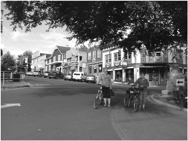 |
| Spring Street (main st) Friday Harbor |
The next morning, if you have an inkling to go for a free ferry ride, check the schedules and go as a foot passenger. Simply walk on, using the foot passenger lane, while cars are being loaded. Eat breakfast onboard, ride to Orcas Landing, do some shopping, and then ride the opposite direction ferry back to Friday Harbor.
If you are more adventurous, bring your bicycle and spend the day riding around Orcas, Lopez, or Shaw Island; your boat will be waiting in your slip when you return. Ferry rides for foot and bicycle riders are free in the inner islands. There is a fee only when departing from Anacortes.
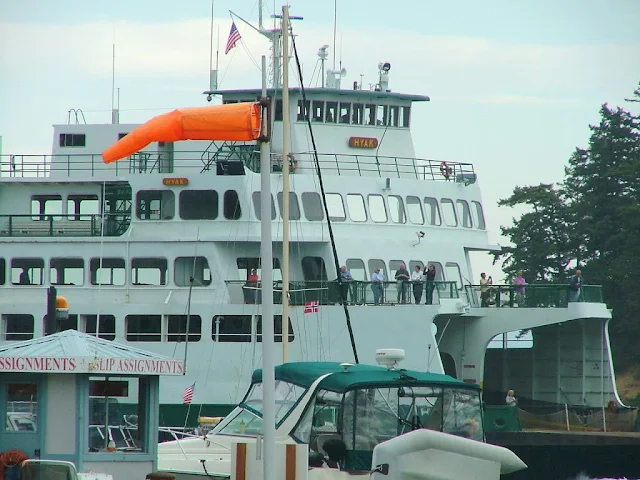 |
| Friday Harbor |
#2 Hike Turtleback Mountain
When we began lugging our bikes with us on our boat, a new world of adventure presented itself. Few boaters carry bicycles; if they did, it would certainly make getting to this trailhead much easier. However, walking a mile down the highway to the trailhead is not too bad.
When viewing Orcas Island across the water, you will notice several summits. The tallest to the east is Mt Constitution, and much shorter to the west is Turtleback. The easiest boat access is at the top of West Sound. Tie up to or anchor near the county dock, which is just to the west of the West Sound Marina. Follow Deer Harbor road 1.25 miles west to Wild Rose Ln. One block up Wild Rose Ln is a small parking lot and the Turtleback Mountain Preserve trailhead. Hiking up the trail, you will soon be rewarded with outstanding views of the islands. You may get a glimpse of your boat far below.
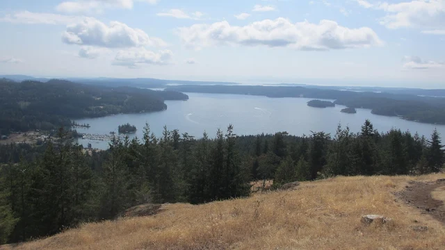 |
| West Sound from Turtleback Mt. trail |
#3 Visit Jones Island
At 188 acres, Jones Island packs a lot into one great place to visit. A good-sized dock, excellent protected anchorage, anchor balls, four distinctly different campgrounds, running water, apple orchard, mowed lawns, and grazing deer. Easy hiking trails. What's left to want? How about a pea gravel dinghy-friendly beach and only two miles to Deer Harbor for provisions.
 |
| Tread lightly on Jones so you don't mess up someone's nap. |
Jones is located between Orcas and San Juan Island about five miles west of Friday Harbor. I recommend stopping by for a day visit even if you don't plan on spending the night. Hike the waterfront trails, soak up the restful ambience. It is very likely you will walk among the small semi tame pygmy deer Jones is known for.
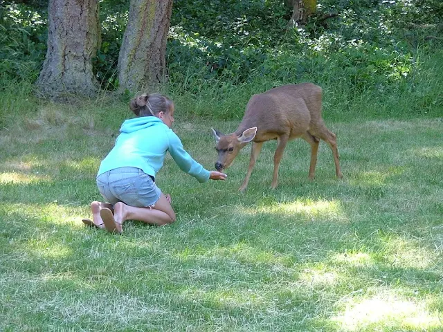 |
| Jones Island Deer |
#4 Visit Roche Harbor.
At Roche Harbor, you may take a complimentary slip for a few hours or anchor and dinghy over to one of three dinghy docks. Explore the manicured gardens of Hotel De Haro. Hike to the Afterglow Vista mausoleum and spend an hour or two discovering the unique sculptures at the 20-acre San Juan Islands Sculpture Park and nature reserve on the edge of Westcott Bay. Before you cast off, resupply at the grocery store. If you can spend the night, don't miss the evening color guard and flag-lowering ceremony, punctuated with a cannon firing sure to wake you up if you are napping at sunset.
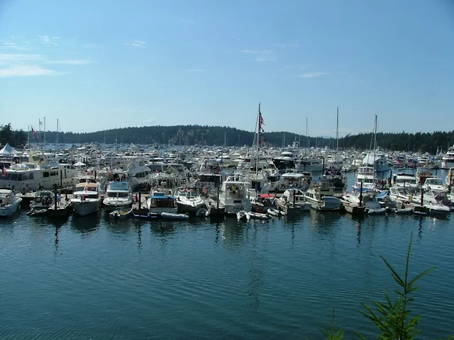 |
| Roche Harbor Marina |
#5 Anchor at English Camp and hike up Youngs Hill.
Just a mile around the corner from Roche Harbor is Garrison Bay, where the English made their camp during the 13-year Pig War, a semi-formal standoff between the Americans and the English. Anchor or tie up to the small dinghy dock. Visit the interpretation center and learn about the war and the pig that became the only casualty after rooting around in the wrong garden.
Next, bring your water bottle and hiking shoes for a grueling 1-hour trudge up Youngs Hill. Head through the parking lot and follow the trail, always uphill. Eventually, you will reach the summit and be treated to a splendid view of Mosquito Pass, Haro Strait, Vancouver Island, and possibly your boat far below.
 |
| View from summit of Youngs Hill |
#6 Hike to Turn Point Lighthouse.
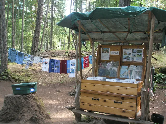 |
| San Juan tee shirts for sale |
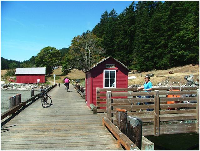
"Four miles due north of Roche Harbor is Stuart Island, home to Turn Point lighthouse, the farthest northwest point in the continental United States. You can anchor or tie up at the park dock in Prevost or Reid Harbors.
For a much shorter walk, you can tie up (short term) at the county dock at the far north end of Prevost Harbor. The walk or bike ride up the gravel county road is about 1.5 miles. If you hike from either Marine Park dock, add another 1.5 miles (one way).
At the old lighthouse, there is a museum with lots of pictures. If local volunteers are available, you may get a free guided tour. Boundary Pass Traders maintain an honor system self-serve kiosk along the road where you can buy souvenir cards and screen-printed T-shirts. Simply choose your purchases, take them with you, and then send your payment in the mail. As a bonus, while out at the lighthouse, you may spot Orcas, aka Killer whales, rounding Turn Point."
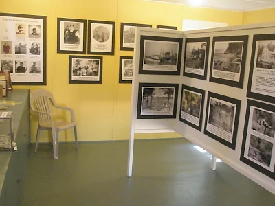 |
| Turn Point Lighthouse museum |
#7 China Caves are for the children in us.
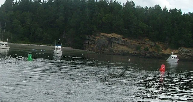 |
| Narrow business entrance to Shallow Bay with China Caves in background |
 |
| China Caves |
#8 Matia Island rainforest trail.
This jewel in the San Juans is often overlooked by cruisers heading to the more popular Sucia Island. Matia Island is just two and a half miles east of Sucia but may as well be in another world. The small anchorage holds two buoys and has room for four small boats at the dock. Onshore is a short dinghy-friendly beach and a two-site camp area.
Nearby is the usual composting toilet. What is so special is the level one-mile trail that circles the south portion of the island. Campfires are not allowed on Matia, and a sign says no pets. Within seconds of entering the quiet forest, the trail immerses you in nature. Massive moss-covered boulders, tall mature trees, thick mosses, and ferns so envelop you that you find yourself whispering and walking carefully so as not to disturb what the island offers. Five minutes in and you forget about your boat, only a few hundred feet away.
Not a legend, but real history tells of a hermit who once lived on Matia. He would row his skiff to Eastsound for provisions. One day he never returned, presumably lost at sea. An apple tree near a freshwater spring is his legacy. We have looked for evidence of his cabin but only found what may be a few foundation stones near the spring. Even after many visits, the hour or two spent walking Matia is always the most pleasant and relaxing part of my San Juan cruise."
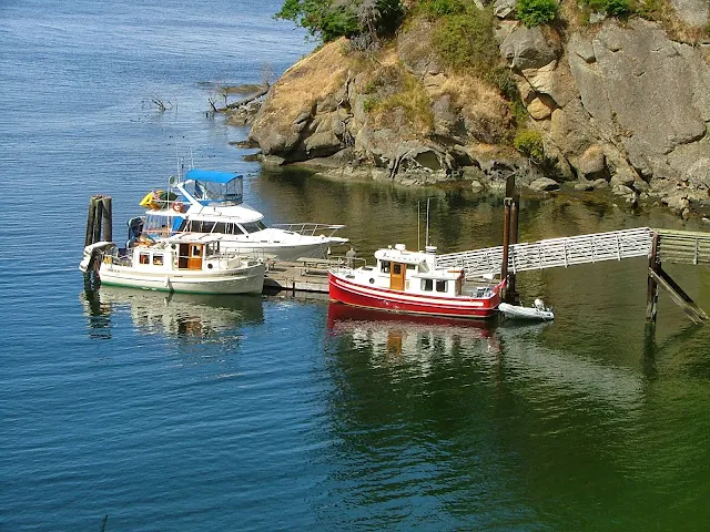 |
| Old wooden Matia float is due for replacement. |
#9 Patos Island lighthouse tours.
About five miles north of Sucia Island is Patos Island, sometimes referred to as the most northern of the San Juans. Patos has a protected anchorage, a campground on shore and just like Stuart Island, Patos has a working lighthouse with volunteers offering tours.
At Patos you can climb the stairs and see the fresnel light lens up close. The walk out to the lighthouse is ten minutes along a mostly concrete trail. If lighthouses thrill you, this is the one to go see.
#10 Inati Bay and Lummi Island Campground
Lummi Island is technically not one of the San Juan Islands, but those of us coming from Squalicum Harbor in Bellingham must go right by it or around it to get anywhere. Lummi is quite large and only inhabited on the northern third. The southern two-thirds are mountains with rocky cliffs right down to the water.
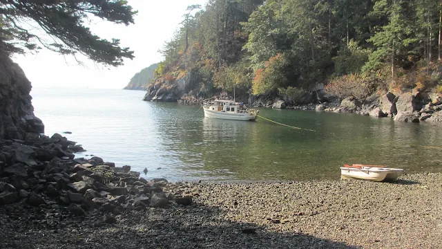
We have found that when we get a late start but don't want to risk darkness or if we just want a place to hide out from nasty weather, Inati Bay is perfect. The very protected cove holds a dozen or so anchored boats and is about eight miles from Bellingham, making it a great place to drop the anchor for the night. The easiest way to find Inati Bay is to use your chart; it is marked, but just know that Inati Bay is on the east side of Lummi Island, two miles from the southern tip.
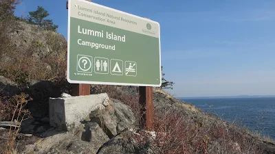
Lummi Island Campground is not much more than an indent in the cliffs with a gravel beach barely one or two hundred feet long. There is room for only one boat, or two if they are rafted together, and you must run a line to shore or stern anchor to check your swing. Onshore, there is a hiking loop and four or five campsites along with pit toilets.
Mostly visited by kayakers, I don't recommend anyone anchor here unless you strive for maximum privacy and your own personal beach. We have stayed here several times and enjoyed it immensely, but I would not attempt it during poor weather or with questionable ground tackle. There will be no second chances should you drag or break out. If the weather is questionable, simply run a mile up to Inati Bay where you will have no problems.
Like Inati, Lummi Island Campground is on your chart on the east side of Lummi Island. It is about one mile from the southern tip."
#11 Vendovi Island Preserve
"Vendovi Island is located about one and a half miles due south from Lummi Island and was a private 200+ acre island that was acquired by the San Juan Preservation Trust, presumably to protect it from future development.
Currently, there is a small rocky breakwater bay with a seventy-foot dock. You are free to walk the island's three main trails and have lunch at the old family picnic area. The wild puffins nesting in the holes of the breakwater are sure to entertain you. This is day use only; overnighting or anchoring is not allowed. You should visit the San Juan Preservation Trust website to check on current hours. The flora is great here, and the trails are in fine shape, but we see much of that everywhere we go. The real attraction is the puffins."
#12 Eagle Bluff on Cypress Island
Continuing mostly westward from Vendovi Island while dodging the few Rosario Strait boats and occasional big swells, we come to the north end of Cypress Island. Cypress, like Lummi, is not a San Juan Island simply because it is in another county, or as some say, "On the other side of Rosario.
At Pelican Beach
There are four or five anchor buoys and ten or so campsites along the shore and the trailhead to Eagle Bluff. The trail takes you to a high, prominent cliff overlooking Rosario Strait. On a clear day, you can see all the way to Deception Pass and much of the San Juans and the surrounding area. On one visit, we watched young eagles staging mock fights in the thermals and updrafts. Below, you can make out boats as they struggle with currents in Obstruction and Peavine Pass.
Due to the cliff at the summit, this is not a safe place for young children or pets. Please be sure to keep them safe. You can make the hike and be back on the boat in two hours, but bring water and lunch. Have a campfire on the beach and then sleep on the boat; you will have earned it. The trail to Eagle Bluff is closed until July 15 each year to protect young eagles."
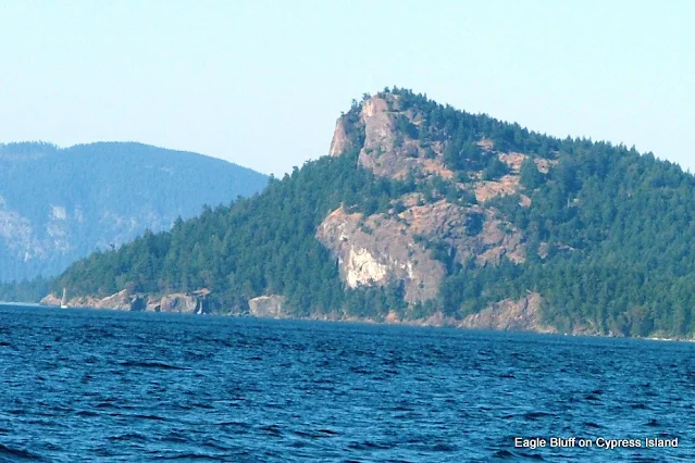 |
| Eagle Bluff or Eagle Cliff is nearly 600 feet tall. 1.3 mile trail is on the other side. |
#13 Goat Island and Fort Whitman
"I hesitated to include Fort Whitman in this list because it is on the far edge of what I consider the San Juan cruising area. However, it would be totally wrong to leave out one of the best and yet least-known exploration places in the entire area.
Goat Island with Fort Whitman is located at the far south end of Swinomish Channel. It is two miles past La Conner, actually in Skagit Bay. If you were coming from the Deception Pass direction, you would find Goat Island about seven miles from the pass or Cornet Bay.
Goat Island is small, at less than 100 acres, but the army built a gun battery there in the early 1900s with four six-inch guns to protect against enemy ships foolish enough to attempt sneaking through Deception Pass. The concrete structure is overgrown but open to explore. Back in the woods are the ruins of fire control lookouts and other buildings.
Fort Whitman was built to be hidden from the water. A hundred years of growth completed the deception. Anchor your boat close to the island near the side of the channel by the pilings. Dinghy ashore and then bushwhack westward. Look for trails others have left. It's only a five-minute walk. Bring a flashlight and your imagination; this place is spooky."
 |
| Fort Whitman on Goat Island |
#14 Rosario Beach and the Maiden of Deception Pass
 |
| Sharpe Cove |
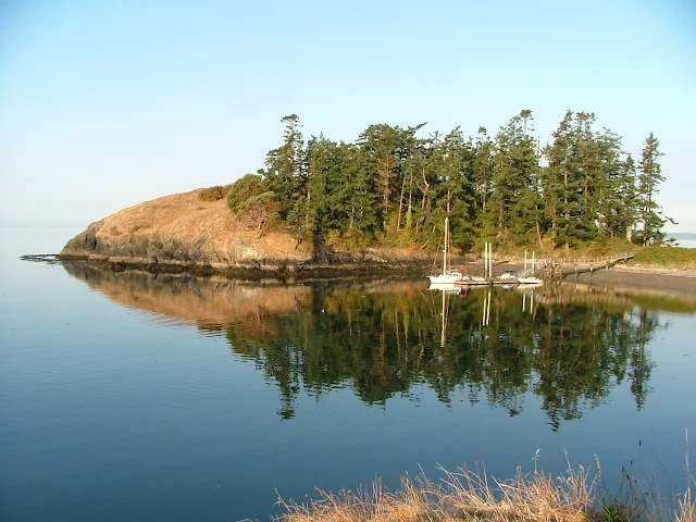
I name some places as 'drive-by' because boaters, not knowing what is there, simply drive by and perhaps miss out. Bowman Bay, and specifically Sharpe Cove, fits this description.
When heading outbound from Deception Pass, Sharpe Cove is the last little bit of land on the north side before you are thrust out into the Strait of Juan De Fuca. Sharpe Cove has a small two- to four-boat dock. At the top of the gangplank is the 24-foot-tall, two-sided, and two-faced Maiden of Deception Pass holding a salmon over her head. The Samish Indian Nation erected the story pole to inspire future generations. Just beyond the maiden are the renowned Rosario tidepools, with guided tours managed by Walla Walla University. Good news for non-boaters, Rosario and the Maiden are accessible by vehicle to Deception Pass State Park visitors.
 |
| The Maiden of Deception Pass |
#15 Victoria and Butchart Gardens
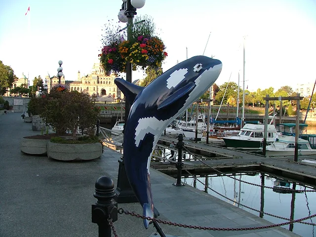
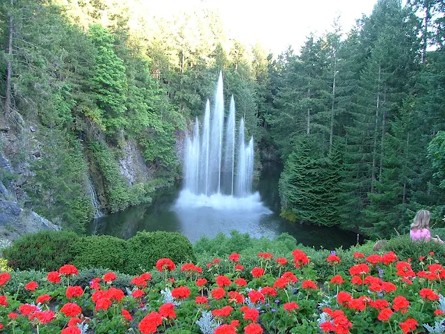
What we do is spend the night in a slip at Roche. We try to ride an ebb tide in Haro Strait to Victoria, and for Butchart, we leave an hour or so before the flood tide for a lift most of the way. When going to Victoria, you must go straight to the inner harbor to check in. When going to Butchart Gardens, you must first go a little out of your way to Sidney to check-in. As an in-between plan, we have gone to Victoria, got a slip in front of the Empress Hotel, and then ridden a double-decker tour bus out to the gardens. You should check your weather forecast and be prepared to scrap your plans if high winds or waves are forecast. It is no fun being tossed around miles from shore, and having to stay at Jones Island or Roche Harbor is actually a very good trade-off.
 |
Butchart Garden dinghy entrance with five free-to-use buoys |





No comments:
Post a Comment
The comment box was recently restored after being misplaced for a few years. Feel free to offer comments. Use the e-mail box to ask questions.