ATTENTION!

This site has oodles of information about boating and the San Juans, it helps to use the search box BELOW to find what interests you.
Search - "things to do" or try "places to go"
search - Sucia Island
search - Friday Harbor
search - hiking or bicycling
try - kayak - try CAMPING - try Anchoring

++++ ============================= All Posts Below

Current Posts Below
Showing posts sorted by relevance for query docks. Sort by date Show all posts

3/15/2020

16 public floats and docks you should know about in the San Juan's

          Obstruction Pass           Blakely's                   Deer Harbor          Roche Harbor                 
          Friday Harbor               Jackson Beach           Hunter Bay           Prevost Harbor
          Washington Park           La Conner                 Eastsound             Odlin Park
          West Sound                   English Camp           Orcas Landing      Olga

     When visiting the San Juan's many of us  head for the great marine state parks and for good reason, that's where the floats, campgrounds and amenities are located that vacationers desire.
   
    However,  if you want to get off the boat and see something other than campers and boat people you have two choices. #1 dinghy ashore somewhere or #2 find a public dock and head out.  This list and description of San Juan area docks excludes the state parks because most marine state parks are landlocked or waterlocked leaving visitors with no opportunity to explore beyond the park.


Sixteen  public docks organized and listed in no particular order.

     Obstruction Pass, this county float and boat ramp is located just inside Obstruction Pass on the southern tip of Orcas Island.  Nearby pass traffic wakes make this a punishing place to tie up even for just the two hours allowed, however rendezvousing with friends on shore or heading out on bicycles for a strenuous ride to the top of mount Constitution may be just what's needed to round out a perfect cruise. Tip: For longer visits, anchor nearby after dropping off passengers and bikes, then drag dinghy up onto float or shore. Your boat will thank you when you return.


Obstruction Pass county dock Blakelys fuel dock
Obstruction Pass county dock in red circle at top
Blakely's at bottom

     Blakely's is a conveniently located fuel dock about halfway between everywhere we go in the San Juan's. They are just inside Peavine Pass on Blake Island. On shore is a small store and deli bar famous for ice cream cones to savor on the lush waterfront lawns. Grazing deer share the lawn so watch your step. The dock is rather long with plenty of room on both sides to tie up big and little yachts and still not interfere with those getting fuel. They offer overnight marina slips in a very protected tiny cove. The island and roads are private so boaters may not leave the resort property.
Blakely island fuel dock and taxi
Fuel and store dock at Blakelys is long and you may tie up on either side to avoid wind or current issues.


     Deer Harbor,  on the west end of Orcas Island at the end of the road is diminutive Deer Harbor community and  marina.  You may purchase fuel and snacks, get ice and rent a slip. The county dock is actually the same dock as the fuel float. Simply tie up out of the way just past the fuel dispenser.  The county section is painted yellow and accommodates several runabouts or one large yacht. This is an excellent jump off point for kayakers heading for Jones Island or dropping off people catching the San Juan Transit mini bus. The bay out front is calm and rogue wakes are few, anchoring room is abundant, restrooms, showers and laundry are on wharf.

Deer Harbor on Orcas Island, fuel dock, showers, laundry, public county dock
If you squint, looking under the main wharf at Deer Harbor, you can see the yellow painted county dock.

2/25/2023

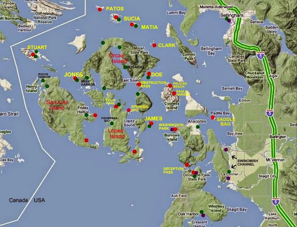
Map locating Boat Ramps, Docks, Marine Parks and boat launching ramps serving the San Juan Islands


Map of San Juan Island Area
With selected Parks, Docks, and Trailer Boat Ramps

Map of the San Juan Islands showing launching ramps, parks and docks


 •  Boat Ramps = Purple    Parks = Red  •  Docks = Green
Most docks (floats) are in parks, resorts, marinas and may be used for overnight camping. Boat launching ramps have long term parking.  Parks without docks have anchor buoys or areas suitable for anchoring.

The facilities listed, are in my opinion, most useful for cruisers, which means lots of private resorts are not shown because they don't cater to transient boaters.

Click on the picture and then enlarge it to see dot colors better!

Note on trip planning:
I don't recommend taking your boat on a ferry and launching somewhere in the islands.  However if you must, there are county ramps on all four  islands served by the ferries except Shaw.  Many private resorts have ramps but they are inferior at best, nonfunctional at worst. The one exception is Jackson Beach Park  (Port of Friday Harbor) near Friday Harbor on San Juan Island. Jackson has a good double ramp and float and you can park for free up to 72 hours.
The mainland ramps I recommend are Washington Park, Deception Pass Park or Squalicum Harbor (#1 choice most trips is Squalicum Harbor in Bellingham)

9/20/2021

Where are the Boat Ramps for your San Juan Islands Cruise Vacation?


          Taking your boat for a camping vacation cruise isn't expensive or difficult if you know the places to go and what to do. If you're going to camp aboard I recommend that you start out in Bellingham, all the places to travel are close by. But if you need a campground for your home base you should reserve a site at Washington Park in Anacortes and launch your boat at the park ramp..
Recommended #1 best  #6 last      #1 being the very best in my opinion  Oak Harbor is ranked #6 simply because they are farther away.
  1. Squalicum Harbor in Bellingham  -  unlimited free parking, fresh water rinse hoses, guest docks, restaurants (you will be glad you began and ended your trip here) (updated 10/1/21) I just became aware that Squalicum Harbor has changed their free parking to FIVE days maximum. This is bad news for some of us that like to take 7-10 day cruises. I recommend calling them.  Cornet Bay requires payment but at least has  much longer parking. 
  2. Cornet Bay at Deception Pass State Park  -  lots of pay to park, guest docks, nice place and float to hang out.
  3. La Conner (south end Swinomish Channel) city ramp, float, on street parking, cheap fees, guest docks.
  4. Washington Park in Anacortes  -  limited pay parking, double ramps with float but open to swell and waves from Geumes Channel,  no guest docks,  very nice on site campground, easy bike ride or hike to ferry.
  5. Twin Bridges (north end Swinomish Channel) County ramp, limited pay parking, small float that's dry at low tide, security risk area  NOTE: It's just a little further to La Conner and well worth it!
  6. Oak Harbor  -  free ramp, $2/day parking, guest docks nearby, full marina services nearby, long walk to town!
  • Cap Sante in Anacortes is not listed because they have a sling, not a ramp, Cap Sante would be second choice if you want to sling your boat in. Guest docks and big RV or trailer pay parking lot. (you can spend a lot of bucks here)

San JUan Islands map showing boat ramps at Cornet Bay, Squalicum Harbor, Twin Bridges, Oak Harbor, Washington Park, La Conner,

Click on picture to make it bigger!
For first timers, see articles titled  "San Juan Islands for First Timers"
Click below


9/26/2017

Twenty Marine Parks - Twenty Public Docks - Five Boat launching Ramps in the San Juan Islands


Map of San Juan Island Area
With selected Parks, Docks, and Trailer Boat Ramps
Map of San Juan area parks, docks, trailer boat launch ramps
The  boat ramps (purple) are all on the mainland


 •  Boat Ramps = Purple    Parks = Red  •  Docks = Green

Most docks (floats) are in parks, resorts, marinas and may be used for overnight camping. Boat launching ramps have long term parking.  Parks without docks have anchor buoys or areas suitable for anchoring.

5/16/2020

Ten Best Parks of the San Juan Islands


Ten best San Juan Island parks
      Picking the best of anything is asking for an argument but I thought folks planning a visit would benefit from the discussion.

     Let's start by listing my choices in order of best first, first because they have overnight docks,  followed by some pros and cons and a few real world comments.  (hopefully I haven't omitted your favorite)  Keep in mind, we go to all the parks and don't dislike any but  there is no doubt some parks are five star and some are not depending on what we are doing or the weather during that particular cruise.
     For a more detailed review of the San Juan area marine parks including maps try this post.  marine parks
    • parks with docks
      • Jones Island   
      • Matia
      • Fossil Bay on Sucia 
      • James Island
      • Stuart Island  (Prevost & Reid Harbor)
      • Sharpe Cove and Cornet Bay at Deception Pass
    • parks without docks
      • Saddlebag Island
      • Pelican Beach
      • Turn Island
      • Eagle Harbor
      • Cypress Head
      • Patos
      • Sucia   (Echo and Shallow bays)
      • Spencer Spit
      • Odlin County Park  (has 2 hr dock)
      • Clark Island
      • Doe Island
      • Obstruction Pass
      • Sidney Spit Marine Park (Canada) (has overnight dock)
      • Washington Park  (launching ramp only dock)
      • San Juan County Park
      • Shaw Island Park
    1. Jones Island is my number one choice and here's why.
                    Pros:
      • bigger but not biggest dock
      • protected bay 
      • great dinghy beach with a couple tidepools
      • anchor buoys and lots of room to anchor
      • running water and four nice nearby composters
      • hiking the many loop trails at Jones never gets boring
      • tiny deer, many tame, are unique to Jones
      • dock is very close to camp sites for evening fires
      • close to Deer Harbor for supplies
                    Cons:
      • crowds sometimes
      • long ways back to the mainland
      • open to north wind
      • no bicycle trails
         2.   Matia Island never disappoints us.

                 Pros:
      • very small intimate dock for four boats
      • usually room when we arrive
      • small protected bay holds about four more boats
      • great gravel beach
      • multiple coves for beachcombing
      • puffins, seals and eagles and great sunsets
      • unique rain forest one mile or less loop trail
      • somewhat close to Squalicum Harbor (2-3 hours)
      • restroom at top of gangplank
      • Matia is a peaceful quiet special place

    click here for the rest

    3/10/2018

    Victoria Cruise Itinerary and Customs at Roche Harbor

    Note: this  is a very old post I am re-posting so some prices will be off.

    Suggested Cruise to Victoria BC with Whale Watching
     and San Juan Islands Stop Overs
    This article is for first timers to the San Juan Island area and has the answers you may be looking for.  Timeless advice to make your first trip a fun success.
    • places to launch and stay on your boat
    • distances between stops
    • customs and immigration
    • alternate planning
    • what to expect
    • basic boating information 
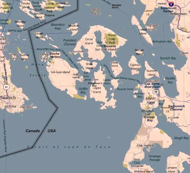
    Study this map and familiarize yourself with names and places. 
     (Find Victoria, Roche Harbor, Swinomish Channel, Deception Pass)
    Map showing Victoria Canada, San Juan Islands, Roche Harbor, Friday Harbor, Squalicum Harbor, Anacortes


    Lets start this Cruise at Cornet Bay in Deception Pass State Park
    (Your going to Canada and back, did you remember to bring your passports and Children ID's? the rules are changing)


    Cornet Bay boat ramp in Deception Pass park

    Boat launch at Cornet Bay (Deception Pass)

    Day one, you arrive at Deception Pass and its probably late in the day and your tired, so lets plan on spending the night right here  on the boat securely tied to the dock at Cornet Bay.  You will pay a launch fee and $10/day parking, plus 50 cents a foot for spending night at dock. Pay at the self serve kiosk. If your not sure of when your coming back simply estimate, leave a note explaining, the ranger will understand.  The ramp is very good, all tide. The parking is huge, you will not have a problem.
          There is a park store, but you should have done your provisioning in Anacortes.


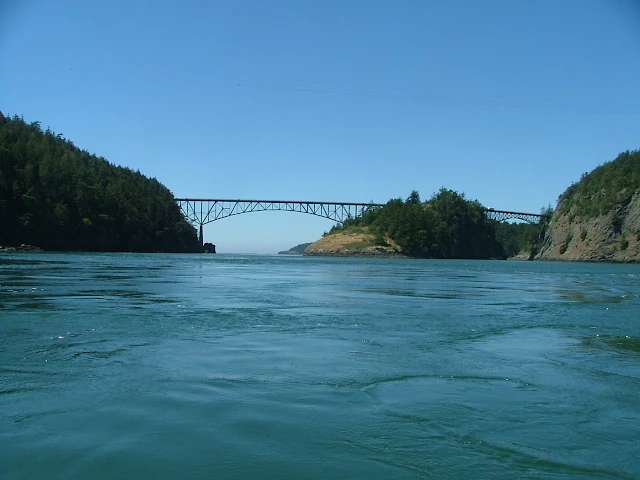
    Deception Pass bridge

    Heading westward facing an incoming current, (another ten minutes and we wouldn't have the speed to overcome the 7+ mph current)

    Day two, leg #1, our destination is Friday Harbor, but first you must time the pass.  You should already be familiar with the tide levels and  times at Deception Pass (download a page from any of of dozens of sites including NOAA) so cast off at high or low tide. You can be  half an hour early or late, this gives you a one hour window. (it takes just ten minutes to reach the pass from the dock)  If you are catching a falling tide (current is going out to sea) you can be very late but standing waves may scare you and the crew as you take a fast sled ride and shoot out into the Strait of Juan De Fuca.  If you are late and  head out on a rising tide, your boat may not have enough speed to overcome the in rushing torrent, and your stuck until the next slack water. The pass is not a problem, it is narrow with fast water for only about 250 feet, but slow sailboats can  meet their match every four to six hours.


    read more

    10/21/2015

    Where are the BIG grocery stores on Lopez, Orcas, San Juan Island?

           When you cruise somewhere with no local knowledge, you must bring it with you or make do as best you can. That's how you avoid buying $5 wine for $20, and getting outdated perishables.

            Just about all little landings have snack bars and minimally stocked shelves, and I admit I buy lots of stuff from these guys and so should you.  If we don't support them with our purchases they will not stay in business. When they are gone, everyone loses.  

            But,  what about the other products that the little guys simply don't have?


    • Lopez Village
    • Friday Harbor
    • Eastsound
    • Cap Sante
    • La Conner
    • Roche Harbor
    These places have major stores with everything we want.

    Lopez Village:  This is a hard one to get to from a dock, but you can dinghy ashore, here's a link to get you provisions.  Anchoring and Getting ashore at Lopez Village
    The store is about a one block easy walk.  You can walk from the Islander in Fisherman Bay, but its further than I want to carry groceries.  You can bicycle from Odlin Park in twenty minutes.


    Friday Harbor:   The marina will let you park in a slip or at the breakwater while you walk up to Kings Market. It's about two blocks right on the main street, you cant miss it. This is a big and busy place and so close you can run up from the boat when your cooking breakfast and need eggs.

    Eastsound:  It's kind of a long run up East Sound to Eastsound but the store is big and only one block to walk from the county dock.  Note: the dock is small, you may not get to park the mother ship and may have to anchor and dinghy over. One time we dragged the dinghy up on to the dock because there was no room in the water, you can also beach the dinghy and climb up a trail.   Don't worry, you will get to the store one way or another.  BTW - Eastsound has a good assortment of places to eat, yum.

    La Conner:  There are three public docks scattered along the city waterfront,  all right on main street.  (these docks are not the marina, which is a little longer walk)  Once on shore, walk to the  left on the main drag to the stop sign and then follow the only main street to the right.  Follow this street about one block to the towns grocery store, it's pretty big, keeps long hours and is only two blocks from boat at worst.   
    Chart of Laconner public docks and boat ramp
    The above map shows the five tie up floats at La Conner and the red dot is the grocery store, (no, not the dot marking the boat ramp under the bridge)

    Cap Sante (Anacortes):  The store is a full size Safeway and is directly across the street from the marina.  Call the harbor master to arrange for a short term shopping slip.  If you are transiting Swinomish Channel, its just a small detour into Cap Sante to provision.

    Roche Harbor:   Lastly, don't forget Roche Harbor for groceries.  The store is right at the top of the marina gangway.  You can get a free slip assignment for shopping or anchor out and dinghy over to one of several dinghy docks.  You could even walk upstairs while getting fuel.  The Roche Harbor store is the smallest of the bunch but is complete and stuffed to the gills.


    More Stores: Yes, but those are the biggies with complete inventories.  The smaller stores include Blakely's, Rosario, Deer Harbor, West Beach, Shaw Landing, Orcas Landing, Cornet Bay at Deception Pass, and that's pretty much all of them. 

    10/05/2021

    Places to go in the San Juan Islands

    Places to go and things to do in the San Juan Islands.  All places listed are accessible by boat, some by vehicle also.

    • Hikes:  Pretty much every park has easy to lengthy hikes so instead of making a long list you may follow this link to all the parks  All the parks
      • Eagle Bluff on Cypress (Start at Pelican Beach)
      • Afterglow Mausoleum at Roche Harbor
      • Turn Point Lighthouse on Stuart Island
      • Young Hill at English Camp
      • China Caves from Fossil Bay
      • Vendovi Preserve on Vendovi Island
      • Fort Whitman on Goat Island
      • Turtleback Mountain, begin at West Sound county dock
      • Click here for >> Detailed instructions for the hikes listed above
                
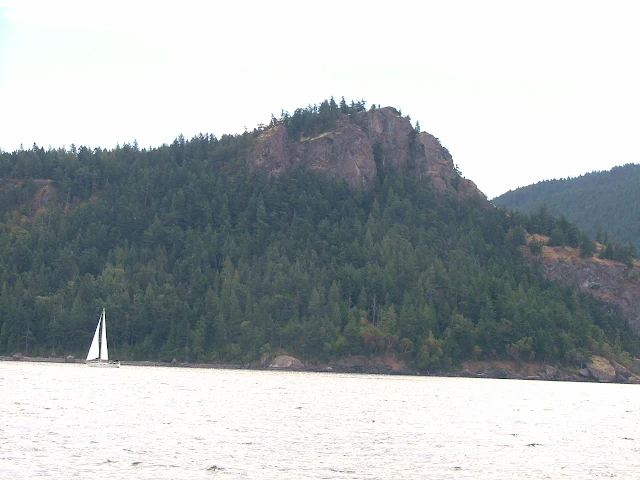
    Eagle Bluff on Cypress Island
    Eagle Bluff (Cliff) from Rosario Strait


    • Dining/eats:  I have never reviewed restaurants and won't here.  However a newbie to the San Juans has no idea what to expect or where to go so here goes some locations.
      • Blakely's: Just inside Peavine Pass has a small deli bar
      • Eastsound: It's a one block walk from the dock to downtown with many bistros, shops.
      • Rosario: Dock, restaurants
      • Lopez Village - Fisherman Bay: Restaurant at Islander resort or for Dinghy beach landing at Lopez Village
      • Friday Harbor: many places are walking distance from complementary tie ups in marina
      • Deer Harbor: Deli on dock, restaurants on shore
      • Roche Harbor: several restaurants on shore, complementary dock
      • West Beach: north shore on Orcas, deli in store on dock
    • Groceries, shopping:  The best advice here is to bring what you can before you head out, but the San Juans are not without good grocery stores.  You just need to know where they are.  This comprehensive post has them all >> Where are all the big stores?
    • Fuel:  Gas and diesel are readily available.  I would arrive with full tanks but not to worry if you don't.  This link will take you to all of them  >>  fuel docks
    • Museums and points of interest: 
      • Whale Museum in Friday Harbor is just up a flight of stairs from the marina office
      • Turn Point Lighthouse museum on Stuart Island
      • Patos Island Lighthouse Museum on Patos
      • Moran mansion has a third floor museum at Rosario Resort
      • English Camp at Garrison Bay on San Juan Island
      • Sculpture Garden at Roche Harbor
      • There are Saturday Markets at Lopez Village, Friday Harbor and Eastsound

    3/12/2017

    Marine Parks of the San Juan Islands and Surrounding Area


    Below is the marine parks list
                 followed by reviews, charts, and pictures
                             in the order listed.
            This is not all the parks, just the ones you may want to make part of your cruising. It's unlikely you can visit all in one trip and still do a decent job of sightseeing. You should plan multiple visits to the San Juans.
    Many people choose Jones as their favorite for just hanging for a few days, so Jones is first.
    For hiking, Sucia, or Pelican Beach on Cypress Island are the best, but all the parks have hiking trails.
          Some parks are in a convenient location when you need to spend the night and you're between destinations, Saddle Bag, Eagle Harbor, and Odlin would fit this description.  Most parks with docks have picnic tables on the floats, which are very handy for extending your living area, socializing, and meeting other boaters.
            For marinas/etc. where you can get fuel and provisions try this list >> Marinas - fuel - beer and ice - slips for rent

    • Jones Island
    • James Island
    • Clark Island
    • Doe Island
    • Obstruction Pass
    • Pelican Beach
    • Eagle Harbor
    • Cypress Head
    • Matia
    • Patos
    • Sucia
    • Stuart Island  (Prevost & Reid Harbor)
    • Spencer Spit
    • Odlin County Park
    • Washington Park
    • Deception Pass Park
    • Saddlebag Island
    • Sidney Spit Marine Park (Canada)
    Click here to go to complete description and maps of above listed parks

    6/27/2015

    Puget Sound is not the San Juan Islands, but if you want to try cruising somewhere new, it's a logical choice.

          Puget Sound is different things to different folks.  If you read a few articles  or listen to more than one traveler you will likely come away with some overlapping opinions. Lots of people think the San Juans and Puget Sound are the same.  They are not.  On your noaa chart, there is a place labeled Puget Sound, it's offshore from Seattle all the way up to Whidbey Island.  Virtually every body of water is named something.  Names sometimes include a descriptive hint, such as bay, passage, inlet, cove, strait, and of course sound. Did I miss any besides canal, and channel? Oh yeah, bank, shoal, flats...

           Some of us consider, Puget Sound (as an area) to encompass everything salty, from the Strait of Juan De Fuca south.  So this means both sides of Whidbey Island are included, but not the northwest side that faces the San Juans and Vancouver Island, or Anacortes, or Bellingham. I like to think of Bellingham as on Bellingham Bay and Anacortes as up Guemes channel a bit from Rosario Strait. So where does that put Olympia?

         We started in Olympia, at Swantown Marina, and so should you.  There are numerous ramps scattered around the area, but nothing compares to the Port of Olympia facilities, they have the welcome mat out more than any (boating) city we have ever visited, bar none.  I haven't forgotten the praise I lavish on Squalicum Harbor in Bellingham, but the entire waterfront at Olympia is boater friendly, which bumps them to the head of my list.

           At Swantown, is a two lane all tide ramp, open 24/7 with a long term parking lot for only $3/day.  Transient moorage is abundant, both at the ramp and a short walk away, at the old town waterfront.  Don't make a mistake and think of Olympia as simply a place to splash the boat and take off from.  Plan your trip to include one or more nights or days at the dock, and bring your bikes, you will be glad you did.

          Rather than gush over Olympia, let's get going north. On this trip our turnaround point is Lake Washington.  This means we will wander a circuitous course to Seattle, visiting as many Marine State Parks as we can.  At Seattle we will go through the Ballard Locks, through Lake Union (Lake Union is the downtown area you see from the freeway) and into Lake Washington to spend the night anchored at Seward City Park.  All total we will visit eleven parks, bike and hike most of them, spend seven nights at docks, one at anchor, and motor about 175 miles.  Wow-- when I write the specifics it sounds rushed, but we relaxed the entire time.

           Day One: We are in the water and on our way at 5pm, this may seem late to get going, but we only have 8 miles, maybe 16, to our first nights stop.  We ran the 8 miles to Hope Island State Park, but all the buoys were taken so we continued to the dock at  Jerrel Cove State Park, another easy 8 miles, and with plenty of daylight, why not?  You sail-boaters should know that we encounterrd a low 31 foot fixed bridge providing vehicle access to Harstine Island. You can avoid the bridge by taking the long way around Harstine. Jerrel Cove has two docks, and across the way is a private marina with a store and transient space.  The park is well kept with onsite rangers, car campers, a mile or two of trails that are rideable, and of course you can head out onto the island roads and ride to your hearts content.  Perhaps I should remind you that, unlike most of the San Juan destinations, all of the places we spent the night are car accessible.  This means you can plan a Puget Sound rendezvous with friends or family to re-supply or switch out crew members.
    Jerrel Cove Park float
    Jerrel Cove at low tide, the ramp is as steep as we have ever seen.


    Day two: click here

    4/28/2019

    First Timers Guide to the San Juan's

    Matia Island, San Juan Islands travel cruise itinerary
    Matia Island
     

      From time to time I refresh my thinking and remember our first visit more than twenty years ago. Specifically what a pain it was not knowing the simplest answers to questions many of us take for granted today. This post is written to help new cruisers headed to the San Juan's needing the same simple answers we needed.

         I define the San Juan cruising area not by county or even country, but rather by places we want to visit and spend some time. But that also means, places we have the capability to get to without too much effort or time.  So that being stated, I think of Port Townsend and Deception Pass Park (Cornet Bay), and Swinomish Channel as our loosely defined southern boundary.  I think of Vancouver BC and Nanaimo as our northern most point, and everything in between Vancouver Island and the mainland completing the east west box. Keep in mind, with a day or two extra, you can run down to Olympia or up to Princess Louisa Inlet, but for this discussion, we are sticking to the core San Juan Island area and what you need to get there.


    Basics

    • You need a boat, but you can rent a sail or powerboat in Anacortes or Bellingham if you prefer, and it doesn't take much experience to qualify.
    • Size matters, bigger is more comfy, costly and feels imminently safer in a storm. As size goes up, so do your skill requirements. Once past about thirty five feet you will find you don't fit at some docks and fuel burns at over twenty five gallons an hour. Smaller is  better at times. Eighteen foot ski and fishing boats or day sailors are very easy to get in and out at virtually all places but with all your food and gear, you will be crowded on board.  Above all - don't let your lack of a perfect boat cause you not to go. Take what you have, you can make it work.
    • Bring a dinghy, even a two person inflatable kayak is okay.  You need a way to get to shore where there are no docks. You don't have to carry the dinghy on board, you can tow it everywhere you go. Yes you can beach your runabout and let the tide leave you dry but bringing a dinghy is so much easier.
    • Sleep on board, at anchor, at the dock, or in the many park campgrounds. (there are about twenty marine campgrounds, you can camp at a different park every night) If preferred, you can spend every night at a marina or resort and sleep on shore.
    • The best weather will be in July and August, but the shoulder seasons have less people and okay weather too.
    • I suggest you plan a week, but you can make a weekend work.  If you have a comfortable all weather boat, spend the summer.
    • If you rent, don't forget you have to park your car(s) If you trailer, plan on a daily parking fee of around $12.  (Squalicum Harbor in Bellingham is free, even long term)
    • See this posting for launch ramps. ---launch ramps with long term parking  This is probably the only real planning decision you need to make before you go, but we have changed our planned take off point as we drove up the highway.  Do not start your San Juan cruise down south in Olympia, Seattle or Everett or Port Townsend or Port Angeles. If you do you will spend much of your time motoring long distances (both ways) My advice is to start in Bellingham or Anacortes using one of the ramps from the list above.
    • You need with you on the boat, a chart, or you will get lost, count on it. You should have a list of parks, marinas and resources preferably marked on your navigation chart. Get this chart. Noaa # 18421  -  We use noaa chart # 18421 you can see it by clicking here or anywhere charts are sold.  Navigation charts do not show what's on shore, (roads, city's, marinas, parks, etc) so we carry a highway map as well.
    • Don't run out and buy an expensive chart plotter. At minimum, you need a paper chart, a  portable GPS and a compass, your smart phone will probably do.  All boats need a depth sounder or you are risking an expensive grounding.

    • Sample itinerary:  #1. Begin at Squalicum Harbor in Bellingham (open 24/7).  2. Head for Friday Harbor and get a slip for your first night or every night (they take reservations).  3. Use Friday Harbor as your base, returning every night to your own slip with power, water, restrooms, on shore restaurants and entertainment. This plan will work for virtually all boaters regardless of  gear, experience or creature comfort requirements. None of the Marine State Parks have reserve-able docks or anchor buoys, everything is first come first gets it. This means you should plan on anchoring and using your dinghy,  it also means when someone pulls out you may grab the spot at the dock. Rafting is the term  used when several boats tie together at anchor or the dock.
    • Sample itinerary:  #2. Begin at Squalicum again but this time head for Matia or Sucia. Next, Jump over to Stuart and then Roche Harbor or Jones, then to Friday Harbor, then Fisherman Bay. This itinerary will make sure you have a shower and food store available (Roche and Friday) when you really need and want both.  
    • Fuel is readily available but you should try to have a minimum range of seventy five miles just to be sure should you encounter adverse conditions.
    • How many days you spend at each park is up to you, your car and trailer will be waiting in the free parking lot when you circle back to Bellingham.

    • Get my San Juan Islands Cruise Guide, it  has all the parks, marinas, fuel, resources, phone numbers, etc. and is written specifically for visitors coming by boat. My companion book, the San Juan Islands Travel Guide is written for visitors coming by car or boat.
                  San Juan Islands Cruise Guide     -----   San Juan Islands Travel Guide
             Don't be cheap, the books cost less than a meal and will pay for themselves in saved frustration,  making your cruise a real success.
    • Lastly, I can't address everything you may want to know in a single post, so I suggest you search this site and read some more articles. There are several with detailed day by day itineraries. Next, after becoming more knowledgeable about what and where you want to go and do, set aside a week and go. It really is that easy. The central cruising area is small enough that you can completely change your plans on the fly. You don't need reservations, you don't need a plan, you don't even need to bring food, just grab your gear and boat and hit the road. OH - bring some cash for, fuel and park fees and that food I just said you don't need.
    If you happen to see us on Kraken somewhere, please say hello. We hope to be anchored in Fisherman Bay for the Lopez Island 2019 4th of July show.

    John and Linda
                  feel free to use the e-mail contact form with your questions


    9/26/2023

    Deception Pass - How to Navigate Strong Currents and Dangerous Waves

    Deception Pass, located in Deception Pass State Park in Washington, is notorious for its strong tidal currents and swirling eddies. The pass can be treacherous for boaters and kayakers. Here are some tips for navigating safely through the Pass:
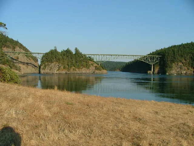
    Deception Pass bridge, Canoe Pass on left
    Looking inbound at what actually is two separate bridges.
    You can see narrow slot of Canoe Pass on left side, Deception Pass on right side.

    First, let's understand that in the San Juans, Puget Sound, Gulf Islands, pretty much everywhere, there are nasty places where you can get into trouble if you are prone to doing stupid things.  Driving into a storm or wild surf with breaking waves is a mistake for most of us regardless of our boat or skill level.

    That being said, the rising/falling  tides cause currents.  Large tide ranges usually mean faster currents. Narrow passes or jutting headlands tend to intensify things. Add to that, strong winds and storms and you get places to avoid on your vacation cruise.  

    Deception Pass is very narrow, but only narrow for a short section directly under the bridge.  Consequently, the high current speed and accompanying swirlies and waves are confined.  As you approach the bridge you notice your speed or lack of it rapidly changing making you acutely aware or your boats agility's.  Most sailboats don't have the top speed needed to overcome normal pass conditions on a calm summer day. The water may be mostly flat, whirlpools minimal, no waves and yet the boat stalls out under the bridge with the skipper wishing his 6.75 mph boat could make 7 for just another hundred feet.  Of course going the other way the same boat will whisk through at a breath taking 12 mph.

    If the current and wind oppose each other and this is very common, the conditions will be pretty much the same except with increasing wind there will be standing waves directly under the bridge for a short distance.  These waves could range from not much to something that buries the bow and sheets across the deck into the cockpit, making an open boat a very big mistake and a wet thrill ride for sailboaters.  

    Slack water: There is no way for me to predict what you will face, that is up to you but slack water happens four times every 24 hrs when the tide changes from incoming to outgoing and vice versa.  Normally during slack water it is flat, the whirlies go away and you can paddle a dinghy around Pass Island.  Keep in mind though that a far away storm can still send swells and waves your way, so no guarantees.  Slack water may last just five minutes before a change is noticeable, up to an hour before things reverse and really get going again.  You can figure that if you missed the window by three hours, then you really didn't care. Powerful, capable boats generally don't pay much attention except when stormy weather is afoot, then even the big boys watch out.

    Pass Island: Deception Pass is actually two passes and two bridges separated by Pass Island.  Canoe Pass on the north is quite narrow, not wide enough for boats to safely pass each other. There is a S curve causing limited sight distance and probably should not be attempted by anyone reading this article.  From time to time excursion jet boats will run through Canoe Pass and competent boaters looking for a thrill will shoot through but it is not worth the risk of life or vessel.  On the other hand, I have taken my dinghy and circled Pass Island many times taking pictures but only during slack water.  I remember vividly once stalling out in Canoe Pass with my 2.5 hp outboard, unable to make headway.  I moved back and forth for a minute trying to gain a little ground.  When I gave up and prepared to turn around I was shocked to see how the waves had grown behind me.  A chill of fear hit me because to turn around I would be broadside for a bit and in a very bad place mere feet from cliffs and in an S turn no less.

    Cornet Bay:  Less than a mile inside the pass is Cornet Bay. At Cornet Bay is a large boat ramp, transient docks, restrooms, showers, long term parking, fuel and a convenience store.  Cornet Bay is a great place to start and end your cruise or just hang out while waiting for pass conditions to improve.

    Bowman Bay, Sharpe Cove: Is just a short half mile outside the pass.  There is a small dock and protected bay where you can wait for pass conditions to swing your way.

    Swinomish Channel:  Fog and bad weather sometimes plague Deception Pass and the Strait of Juan De Fuca.  Sometimes, even in summer the weather gods wont line up with the best planned vacation.  If that happens, simply go another way.  Swinomish Channel is about four or five miles from Deception Pass, back towards Seattle.  Going through the eleven mile channel pops you out near Anacortes and very handily avoids, waves, currents and sometimes pea soup fog.  Along the way you can visit La Conner, walk the boardwalk, or even spend the night at one of three city docks or the county marina.
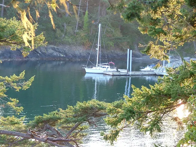
    Sharpe Cove float at Deception Pass Park, Bowman Bay
    Tiny Sharpe Cove dock, outside Deception Pass

    Deception Pass outbound, view from Cornet Bay
    Deception Pass on left, current beginning to speed up, directly under bridge about 5mph 
    Cornet Bay docks and boat ramps
    Cornet Bay transient floats, 3 day max.

    In this article I have tried not to downplay risk nor make it seem that the pass doesn't deserve your utmost respect, it does.  Just make it part of your trip, time you passage for near slack water and have a great cruise.


    more Deception Pass insights > Almost losing our battle with the pass


    7/29/2015

    What's new at Stuart Island Lighthouse

    First I need to tell you that as of this posting date, Boundary Pass Traders is still in business selling T-shirts along the road to Stuart Island Lighthouse.  For those of you that don't know, Boundary Pass Traders is a local family business, they have two unmanned sales kiosks complete with fresh water.(after hiking up the hill you will appreciate a drink) They sell screen printed t-shirts on the honor system.  One booth, (more like an opening in the trees that resembles an upscale homeless camp) is next to the schoolhouse at the top of the long grueling hill coming up from Reid Harbor.  The other and newer location is at the intersection of the road coming from the county dock.  This means if you walk from the state park you will stroll by both, but if you walk from the county dock at Prevost Harbor, you will only see the one.  Moving along - You  make your choice from ten or more San Juan Island themed shirts, and then when you get home, mail them a check in the provided envelope. (or pay online) that's right, they trust you! We picked out an adult size replacement shirt for our youngest son, (think "Pirates of the San Juans")  to replace his stretched out, frayed, and faded child size he picked out many years ago.
    Decked out outhouse at Stuart Island lighthouse
    Volunteers at Stuart Island Lighthouse keep a pretty spiffy privy

    more - click here

    1/02/2012

    Step by Step guide and Itinerary for making that Dream Boat Trip to the San Juan Islands

         This cruise itinerary is for the first timer with the boat on a trailer. The novice skipper with family for crew will find this article contains just what's needed to get going on that long talked about trip to the San Juans. While this is a step by step action plan to follow, some skippers do not need all the steps and prodding and so they should skip ahead to      Day #1.  for the daily itinerary  

    For the rest of us, these steps are important, so I've numbered them.
      Before you go

    1. Right now, go put two marks on the calendar. Mark the day of departure from home and one week or so later mark the day your returning. Do it now or forever hold your peace and admit your not really going boat camping in the San Juans.
    2. Go to your local chandlery or go online and purchase a big color map or chart of the San Juans. I'm not telling you which one, it doesn't matter, just big and one you like to look at.
    3. Got the map? Good now nail it to the wall where you can see it all the time. Do it now!  OK, the hardest part is over, you have now made a commitment to yourself and crew. Your really going.  Kick back a little, relax, do some day dreaming.  Your trip (cruise, vacation, what ever you want to call it) is already well underway. By now you should be  getting into the  excitement that comes with planning and preparations.    Note:   Don't let worry and stress build up, your really going to enjoy this outing and it will be easy, trust me  (heh, heh, heh)  Relaxing good times should be part of the  process that started when you made the X on the calendar. Remember, on this cruise there are no deadlines to meet, no times to beat, no "sorry no vacancy's" to worry about. You are on your own schedule to do as you please. What could be better besides a gourmet chef and staff.  Study the map with your crew, locate Friday Harbor, Jones Island, and Squalicum Harbor in Bellingham. Do some internet searches, read peoples reviews.
    4. Start compiling a list of supply's and provisions that you think you need. Click here for help with that list >>  Cruisers Packing List this list may be a little too much, so pick and choose.
    5. Start making a list of boat and trailer, must do's (like greasing the wheel bearings) I mention wheel bearings because there are a few "must do's" that will potentially ruin your plans, having a bearing go out from your neglect is avoidable, so are boat motor issues. We once went with an untested, worrisome diesel motor, and sure enough it quit, but because of suspected problems I had mounted an outboard bracket and brought my trusty 7.5 hp Honda along which not only saved the trip, but allowed us to extend it a few days.  Another time with a different boat I towed a dinghy which sole purpose was to carry a spare outboard just in case.   Another mistake not to make is inadequate packing for inclement weather, (hope for warm sunny days, but plan for cold windy rain).  Don't forget seasickness pills (Dramamine)  or other medication, one persons needs could ruin the trip. There must some other must do's that are particular to your family??? Spare tire for trailer! Hmm!
    6.  #5 was a downer, lets lighten up.  You need to bring an ice chest if your boat has none, maybe two, plan on ice lasting 3-4 days and then resupply time.  For a food menu, you should plan to eat well, especially if you have bad weather when hot food hits the spot and improves spirits. Sandwiches are easy to prepare and bring lots of trail mix and snacks.  You will need lots of water, don't plan on any being available once you shove off. We bring our water in 5 gallon jugs and pour it into smaller bottles
    7. You will need a propane cook stove and fuel bottles to last entire trip (propane is $7+ in the islands)
    8. Garbage:  I need to mention it now after suggesting you bring all the junk food.  Your little boat will quickly become overrun with trash, bring bags, the outside islands have no garbage service. Think about all that convenience food packaging material I just told you to bring.  Some of the packaging may be left at home. Prepare things in advance and freeze meals ready to go as they thaw (2-4 days in ice chest)
    9. Under boat equipment, the list is very subjective so lets just list a few must haves.  PFD's all around and all coastie required equipment (whistle, type 4, fire ext., registration, lights, etc) Plus I think you need a minimum of two anchors and extra rode, extra fuel if your tank is small.  Your boat should have a range of 75 miles. The rule is 1/3 outbound, 1/3 to get back, 1/3 for reserve. It could be 25 miles between fuel stops, so a 75 mile range gives a good cushion. Many boaters simply tie 5 gallon jugs on deck.  If your boat is open and it really rains hard, bring a tarp and ropes to lash it down. You may sleep on shore so a tent is needed. You need a hand bilge pump and a bucket (they look like a big suction tube and flex hose.
    10. Bring a GPS,  You can get by without one but they are fun and really are useful. Some phones have apps available. Bring your cell phone (they work good almost everywhere) Bring the map or chart nailed on the wall or better yet go buy a real navigation chart with depths and rocks all located.  Bring a compass (hand held is OK) Bring a vhf marine radio (you can buy a portable battery one for about $100.   
    11. The boats loaded your ready to go. Don't forget to tell someone where your going, and when to call for help if you don't check in as planned. That person could be a friend or relative that doesn't panic over  icky weather reports.  They should call the San Juan County Sheriff or Coast Guard if needed, or someone you have prearranged to call, 911 works too. Remember, your plans may change as the week progresses, but you can check in with a cell phone call most of the time.
    Time to go 
    San Juan Island trip itinerary
    The blue line indicates general route, red dots are overnight stops. 80 miles

    Squalicum Harbor map
    Squalicum Harbor Marina - red dots = boat ramp, restaurant, showers, parking, guest docks
    1.   Day #1  Your destination is Squalicum Harbor in Bellingham. (not Anacortes) Squalicum has the best boat ramp around, and free long term parking for your trailer and tow rig. Cap Sante in Anacortes has a sling and pay to park.  You can arrive and take right off but I would plan to spend the first night at the guest dock or in your parked rig. Do not cast off unless you are sure you will have enough light to make it to your anchorage or marina. Navigating in the dark is risky business and requires more of you than you bargain for, and may easily become a really stressed vacation.  Its still daylight until around 9pm, so if you arrive around  6pm there is plenty of time to get the boat launched, go shopping, eat in a restaurant, hang out.  The marina has bathrooms, showers, lots and lots of parking.  If your the worrier on this trip and need to talk to people, you can call them during regular business hours.  The launch fee and guest dock payments are made at a self serve kiosk, you could arrive at midnight, its a 24 hour deal.  No stress, just show with your boat.
    2.   Day #2   In the morning, you can eat at the restaurant overlooking the marina next to the bathrooms, (the food is good and priced right) jump in the car and run to Walmart or just cast off at sun up. I like to walk around and talk to other boaters coffee cup in hand.
    3. Your destination is Echo Bay at Sucia Island, its about 20 miles so you will have plenty of time even if you hang around Squalacum until early afternoon.   If you get there a little earlier you will have time to hike and explore, or maybe first go to Fossil bay where you may get a spot at the dock.  Of course tying up to an anchor buoy or the dock requires a fee whereas                                                                                   anchoring is free.
    4. Sucia Island Chart
      Sucia Island with Echo Bay and Fossil Bay marked with red dots
    5.   Day #3   On this day you may want to stick around Sucia for some exploring, fishing, or kayaking if it suits you. You could easily spend several days just hiking.  
    6. Lets up anchor at noon, our destination is Jones Island, a distance of only 12 miles.  On the way to Jones you may want or need to stop at West Beach resort/marina on Orcas.  West beach is right on the way and wont add much time or distance to this leg.  At West Beach you can get fuel, waffle ice cream cones, ice and groceries. West Beach is just past Point Doughty on Orcas (check your chart/map and find pt Doughty) Did you bring binoculars, they will be helpful in spotting some far off places across the water and West Beach is one of those places? Once again, like Sucia, if you get to Jones early you may get a space at the dock, but you can always snag a buoy or anchor for free. Jones is pretty small but about perfect, you can beach comb, explore, kayak or hike trails, circling the island in about an hour.
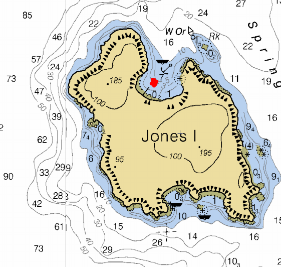
    7. Jones Island
      Jones Island chart
      Jones Island
    8. Plan to stay a day or two at Jones it could easily be your favorite stop, it is mine.
    9.   Day #4   But it could be day 5 or 6 if your getting into the boat traveling thing.
    10. Once again there is no need to take off early, but by now you may have noticed that currents play a big roll in passage times, and fuel used. I check my current charts and then ignore them mostly, but at least I know what to expect. Leave Jones Island in your wake and set course for Friday Harbor, no need to rush, its only 5 miles and they never turn boaters away. You can make a reservation for a slip in advance but there really is no need and its nice to not have a rigid schedule.  You can also just stop by for a few hours for free and walk around town, buy souvenirs and provisions and then move on.  I recommend on your first trip that you spend the night at Friday Harbor, visit the Whale Museum, hang around town and waterfront goings on, eat at the many places, and above all by now you will be wanting a shower, which is available right on the docks.  When you arrive near the breakwater, you can call the Harbormaster on the radio or use your cell phone, or simply tie up at the outer dock, sometimes they have a little harbormaster shed office out on the end and you can talk across the water.  It's all very simple and low key, even after hours  when the security people will take care of you. One visit we rented a slip for two nights while we bicycled around San Juan Island.
    11. Friday harbor 
      Friday Harbor chart
      Friday Harbor 
    12.   Day #5    Check out time is after lunch sometime so again, no rush. Set course for Rosario in East Sound on Orcas Island.  The distance is about 11 miles and you may end up with a modest current either for or against your plans, you may want to arrange your transit according to favorable currents.  See current guide info right here  >> Current Atlas  <<    Around Friday Harbor is a lot of boat traffic and you will see more than one ferry for sure, don't worry, just use your common sense.  On your way to Rosario you may want to take a little side trip over to Olga for a short stop over at the public dock, (Olga is also on Orcas just south of Rosario) when you get to Rosario you will be able rent a slip, hang on a buoy or anchor out. Rosario resort has some nice grounds, restaurants, provision store, fuel, and tours of the Mansion turned museum. Because you will probably have time to kill I would seriously consider showing up later in the day or making your visit a two hour stop over and then move on to another stop for the night.
    13. Rosario picture 
      Rosario resort picture
      Rosario (Mansion/Museum is in lower left, marina restaurant at top
    14. An alternate stop would be past Rosario at East Sound where they have a public dock.
    15. Another alternate stop just a little further, but heading more toward your car at Squalicum would be Pelican Beach on Cypress Island.  Pictorial  >> Pelican Beach pictorial  << Pelican Beach has about 4 or 5 buoys and we have always been able to squeeze in and anchor.  In a pinch you can run half a mile down to Eagle Harbor where they have 18 or so buoys. BTW Cypress is DNR land so everything is free (no buoy or camping fees) If your into hiking this is probably the best around. The beach is a favorite for kayakers from Bellingham and Anacortes, expect to enjoy good conversation around the many campfires lining the beach.
    16. Pelican Beach map here  
      Pelican Beach chart
      Pelican Beach on northeast end of Cypress Island

    17.   Day #6   Today's destination is Squalicum Harbor and head for home. Its about 15 miles so it will take a some time.  By now you should have a pretty good idea of your boats ability to get around and deal with wind and currents. Bellingham Bay seems to go on forever, especially when the elements are lined up against you. 
    18. If you have time for a quick lunch stop on the way, you should really consider dropping hook in Inati Bay on Lummi Island
    19. Inati bay map 
      Lummi Island, Inati Bay chart
      Inati Bay on southeast side of Lummi Island
    20.   Plan your departure from Cypress so you arrive back at Squalicum with time to load up and head for home, or I recommend you plan one more night on the boat at the visitor/guest docks at Squalicum Harbor.  This way you will be showered, fed and refreshed in the morning and have the whole day to load up and drive towards home. In my opinion driving home in the dark after a long last day of boating is no way to wind up a relaxing vacation.
    That's it
    • I hope I was able to give you the incentive, motivation and pertinent information to get going on that first trip to the San Juan Islands.  My recommendations are by no means all that there is to see and do. Please do some research and modify my suggestions to suit your situation, for instance it is entirely possible to stay at resorts and eat in restaurants every night. The more budget minded may choose to anchor out everywhere.  (yes you can anchor next to the docks at Friday Harbor and then paddle over to their dinghy dock, no charge) You may also start and end at Cap Sante, La Conner, Deception Pass, or even start out far far south in Olympia like we did once.