ATTENTION!

This site has oodles of information about boating and the San Juans, it helps to use the search box BELOW to find what interests you.
Search - "things to do" or try "places to go"
search - Sucia Island
search - Friday Harbor
search - hiking or bicycling
try - kayak - try CAMPING - try Anchoring

++++ ============================= All Posts Below

Current Posts Below
Showing posts with label Bowman Bay. Show all posts

9/26/2023

Deception Pass - How to Navigate Strong Currents and Dangerous Waves

Deception Pass, located in Deception Pass State Park in Washington, is notorious for its strong tidal currents and swirling eddies. The pass can be treacherous for boaters and kayakers. Here are some tips for navigating safely through the Pass:
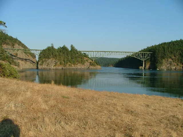
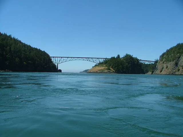
Deception Pass bridge, Canoe Pass on left
Looking inbound at what actually is two separate bridges.
You can see narrow slot of Canoe Pass on left side, Deception Pass on right side.

First, let's understand that in the San Juans, Puget Sound, Gulf Islands, pretty much everywhere, there are nasty places where you can get into trouble if you are prone to doing stupid things.  Driving into a storm or wild surf with breaking waves is a mistake for most of us regardless of our boat or skill level.

That being said, the rising/falling  tides cause currents.  Large tide ranges usually mean faster currents. Narrow passes or jutting headlands tend to intensify things. Add to that, strong winds and storms and you get places to avoid on your vacation cruise.  

Deception Pass is very narrow, but only narrow for a short section directly under the bridge.  Consequently, the high current speed and accompanying swirlies and waves are confined.  As you approach the bridge you notice your speed or lack of it rapidly changing making you acutely aware or your boats agility's.  Most sailboats don't have the top speed needed to overcome normal pass conditions on a calm summer day. The water may be mostly flat, whirlpools minimal, no waves and yet the boat stalls out under the bridge with the skipper wishing his 6.75 mph boat could make 7 for just another hundred feet.  Of course going the other way the same boat will whisk through at a breath taking 12 mph.

If the current and wind oppose each other and this is very common, the conditions will be pretty much the same except with increasing wind there will be standing waves directly under the bridge for a short distance.  These waves could range from not much to something that buries the bow and sheets across the deck into the cockpit, making an open boat a very big mistake and a wet thrill ride for sailboaters.  

Slack water: There is no way for me to predict what you will face, that is up to you but slack water happens four times every 24 hrs when the tide changes from incoming to outgoing and vice versa.  Normally during slack water it is flat, the whirlies go away and you can paddle a dinghy around Pass Island.  Keep in mind though that a far away storm can still send swells and waves your way, so no guarantees.  Slack water may last just five minutes before a change is noticeable, up to an hour before things reverse and really get going again.  You can figure that if you missed the window by three hours, then you really didn't care. Powerful, capable boats generally don't pay much attention except when stormy weather is afoot, then even the big boys watch out.

Pass Island: Deception Pass is actually two passes and two bridges separated by Pass Island.  Canoe Pass on the north is quite narrow, not wide enough for boats to safely pass each other. There is a S curve causing limited sight distance and probably should not be attempted by anyone reading this article.  From time to time excursion jet boats will run through Canoe Pass and competent boaters looking for a thrill will shoot through but it is not worth the risk of life or vessel.  On the other hand, I have taken my dinghy and circled Pass Island many times taking pictures but only during slack water.  I remember vividly once stalling out in Canoe Pass with my 2.5 hp outboard, unable to make headway.  I moved back and forth for a minute trying to gain a little ground.  When I gave up and prepared to turn around I was shocked to see how the waves had grown behind me.  A chill of fear hit me because to turn around I would be broadside for a bit and in a very bad place mere feet from cliffs and in an S turn no less.

Cornet Bay:  Less than a mile inside the pass is Cornet Bay. At Cornet Bay is a large boat ramp, transient docks, restrooms, showers, long term parking, fuel and a convenience store.  Cornet Bay is a great place to start and end your cruise or just hang out while waiting for pass conditions to improve.

Bowman Bay, Sharpe Cove: Is just a short half mile outside the pass.  There is a small dock and protected bay where you can wait for pass conditions to swing your way.

Swinomish Channel:  Fog and bad weather sometimes plague Deception Pass and the Strait of Juan De Fuca.  Sometimes, even in summer the weather gods wont line up with the best planned vacation.  If that happens, simply go another way.  Swinomish Channel is about four or five miles from Deception Pass, back towards Seattle.  Going through the eleven mile channel pops you out near Anacortes and very handily avoids, waves, currents and sometimes pea soup fog.  Along the way you can visit La Conner, walk the boardwalk, or even spend the night at one of three city docks or the county marina.
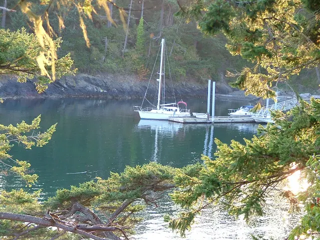
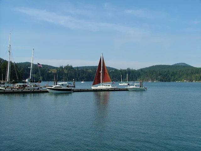
Sharpe Cove float at Deception Pass Park, Bowman Bay
Tiny Sharpe Cove dock, outside Deception Pass

Deception Pass outbound, view from Cornet Bay
Deception Pass on left, current beginning to speed up, directly under bridge about 5mph 
Cornet Bay docks and boat ramps
Cornet Bay transient floats, 3 day max.

In this article I have tried not to downplay risk nor make it seem that the pass doesn't deserve your utmost respect, it does.  Just make it part of your trip, time you passage for near slack water and have a great cruise.


more Deception Pass insights > Almost losing our battle with the pass


11/18/2012

Bowman Bay, Sharpe Cove, and Rosario Beach at Deception Pass State Park are not a - drive by- dock on the way to the San Juan Islands

       Lots of boaters know where Bowman Bay is located but just go right on by without stopping.  It's an easy place to skip because you're always on your way to somewhere, somewhere else. Most of the time for us we're heading through Deception Pass and then onto the San Juan's or going the other way with La Conner, or Puget Sound in mind.  With this knowledge we decided to make Bowman Bay our primary destination. We would spend a night or two, explore the anchorage areas, hike the trails,  have a campfire if possible and see what the place has to offer.
Dock at Sharpe cove in Bowman Bay
This tiny spit protects and marks the far end of Bowman Bay although on the chart it's listed as Sharpe cove.
          For starters it offers Deception Pass with fantastic scenery as your constant backdrop, how can you go wrong?  On this mini cruise we timed our arrival at the pass so that we would not encounter opposing  current and have a window all afternoon to make it through. Our partially disabled boat pushed by an outboard (get-er-home kicker) had a top speed of 5 mph, so once committed to shooting the gap so to speak, we knew we weren't coming back, at least not for awhile.

Bowman Bay trail in deception pass park
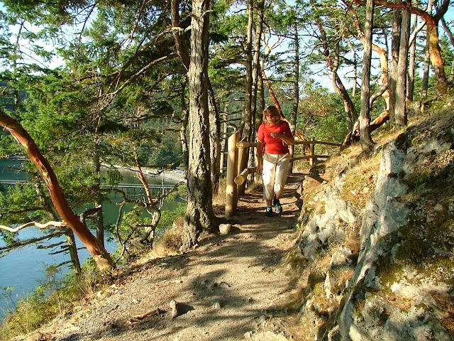
The trail runs along the shore for all of Bowman Bay, or you may hike up to the bridge and beyond to explore the rest of Deception Pass Park

Bowman Bay is part of Deception Pass State Park.  It's on the outside of the pass, on the north side of the bridge, so this means it is subject to the whims and tantrums of the Strait of Juan De Fuca. To clarify -- fog, waves and swells may be part of the cruise, but on our visit, flat waters and lots of balmy sunshine were the order of the day.

The bay really consists of two distinct areas, the further in more protected waters are opposite the campground and offer a half dozen or so anchor buoys just a dinghy ride from shore.

At the other end of the bay is a nice but smallish float hidden and protected by a little hook of a point. (Sharpe Cove) We chose the float so we could easily access the park bathrooms and walk to the beach for a campfire. To make room and keep our 5 1/2 foot keel out of the mud we tied up with half the boat hanging out past the end of the dock.

From our float location we walked all the way to the other end of the bay and out onto a grassy knoll called Lighthouse Point, (there is no lighthouse, but there is a flashing green, 4s nav aid)  for a fantastic view of Deception Pass and the bridge.  The hike took several hours and we were suitably tired afterwards but this was by no means a tough or experts only hike. The only comment I want to offer is be sure to give yourself enough time to enjoy, explore, and get back before dark. There are a few spots you don't want to try without a flashlight if it gets dark on you.

Bowman Bay in Deception Pass Park
The wharf is for walking only, no boats may tie up. Anchor buoys are beyond wharf, campground is to right.


Deception Pass bridge from Lighthouse Point
From Lighthouse Point you can see that the Deception Pass bridge is really two bridges with Pass Island in the middle. Because of its S curve shape, narrow Canoe Pass on the left is all but invisible, but still easily navigable during slack water.

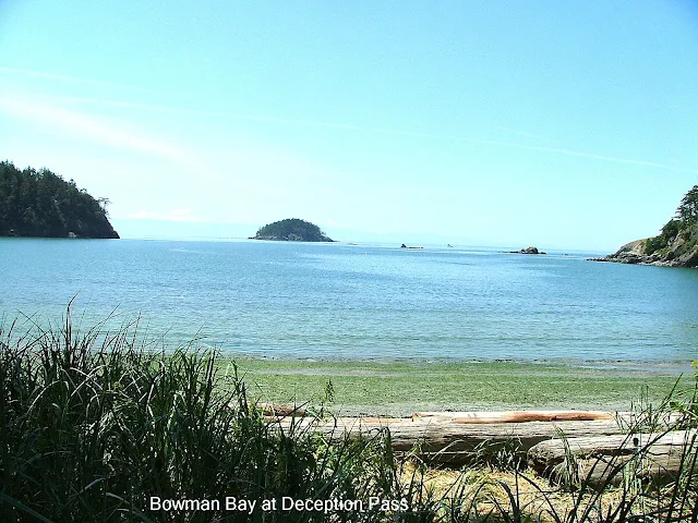
Deception Island from Bowman Bay
This was taken from the campground at Bowman Bay looking out at the Strait of Juan De Fuca. That  far off woodsy bump in the middle is  Deception Island.  Sharpe Cove with its little float is around the small point on right side. Rocks out there are charted and  easily avoidable but must be respected.


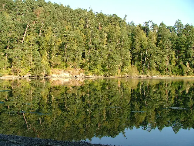
Lottie Bay in Deception Pass park
It's hard to believe that the still and reflective waters of Lottie Bay are only a third mile from Deception Pass, and no you should not bring your boat in here, dinghy or kayak yes - but not your deep draft yacht.


Maiden of Deception Pass, Rosario Beach, Sharpe cove, Bowman Bay
The Maiden of  Deception Pass is as much a landmark as carved wood can be and is located at the top of the gangway leading from the float at Sharpe Cove.  Beyond is Rosario Beach famous for tide pooling and driftwood.

Strait of Georgia
On a clear day you would see Vancouver Island, but this wasn't bad.
In the morning after a leisurely coffee and stroll exploring the tide pools on the Rosario Beach side of the point, Linda contemplates, what I don't know. The tide was rising and the current at the pass  would be flowing inward for several hours.  We reluctantly cast off and steered into the current. In minutes we were under the bridge and on our way to our slip at Shelter Bay in La Conner, and then home.  Bowman Bay is no longer that place we just fly by on our way to somewhere else.