ATTENTION!

This site has oodles of information about boating and the San Juans, it helps to use the search box BELOW to find what interests you.
Search - "things to do" or try "places to go"
search - Sucia Island
search - Friday Harbor
search - hiking or bicycling
try - kayak - try CAMPING - try Anchoring

++++ ============================= All Posts Below

Current Posts Below
Showing posts with label La Conner. Show all posts

Oct 14, 2022

Leaving for La Conner this morning!

New Bombay motor sailor anchored at Cypress Island in the San Juan Islands
Windrose, aka "Rosey" has made it to the San Juans
In good company anchored at Jones Island

I wrote this post ten years ago.  It is about a tsunami-damaged boat we rescued following the Fukushima Japan earthquake of 2011.  Windrose was pummeled but not quite sunk as her slip was destroyed around her in 

Crescent City, CA.


As I write this post, Rosey's journey back is finally almost complete.  

Today will be another white knuckle trip up the interstate for six hours, and then Monday we will be slinging her into Swinomish Channel.  After a day or so rigging we will be heading to Hood Canal to visit Camp Parsons Boy Scout Camp to pick up our son. Next week we expect to make it to San Juan Island with three bicycles on board so we can do a little bike riding. Right now I am preparing to download some tide forecasts and somehow appease the fog gods to lay off the Strait of Juan De Fuca. I'm still short a trusted GPS, the radar is not tested, and my brand new Humminbird was shipped off for repairs and won't be back in time. So we will be dependent on our eyes, good looks, and the antique spinning sounder that makes a whirring sound. I think we will be just fine, but don't count on us to make any appointments on time, which is what I would say if we were on a modern newer boat with all systems functioning.
7/22/12


Read about Rosey here  > Rosey's first trip after arriving at her new home in the San Juans

Read about Rosey's tsunami nightmare and repair here  >  Bombay Pilothouse Project

Mar 15, 2020

16 public floats and docks you should know about in the San Juan's

          Obstruction Pass           Blakely's                   Deer Harbor          Roche Harbor                 
          Friday Harbor               Jackson Beach           Hunter Bay           Prevost Harbor
          Washington Park           La Conner                 Eastsound             Odlin Park
          West Sound                   English Camp           Orcas Landing      Olga

     When visiting the San Juan's many of us  head for the great marine state parks, and for good reason, that's where the floats, campgrounds and amenities are located that vacationers desire.

    However,  if you want to get off the boat and see something other than campers and boat people you have two choices. #1 dinghy ashore somewhere or #2 find a public dock and head out.  This list and description of San Juan area docks excludes the state parks because most marine state parks are landlocked or waterlocked leaving visitors with no opportunity to explore beyond the park.

Sixteen public docks, organized and listed in no particular order.


     Obstruction Pass, 

This county float and boat ramp is located just inside Obstruction Pass on the southern tip of Orcas Island.  Nearby pass traffic wakes make this a punishing place to tie up even for just the two hours allowed, however rendezvousing with friends on shore or heading out on bicycles for a strenuous ride to the top of Mount Constitution may be just what's needed to round out a perfect cruise. Tip: For longer visits, anchor nearby after dropping off passengers and bikes, then drag the dinghy up onto the float or shore. Your boat will thank you when you return

Obstruction Pass county dock Blakelys fuel dock
Obstruction Pass county dock in red circle at top
Blakely's at bottom

     Blakely's 

Blakely's is a conveniently located fuel dock about halfway between 

everywhere we go in the San Juan's. 

They are just inside Peavine Pass on Blake Island. On shore is a small store and deli bar famous for ice cream cones to savor on the lush waterfront lawns. Grazing deer share the lawn so watch your step. The dock is rather long with plenty of room on both sides to tie up big and little yachts and still not interfere with those getting fuel. They offer overnight marina slips in a very protected tiny cove. The island and roads are private so boaters may not leave the resort property.
Blakely island fuel dock and taxi
Fuel and store dock at Blakelys is long and you may tie up on either side to avoid wind or current issues.

     Deer Harbor

 Deer Harbor is on the west end of Orcas Island at the end of the road is diminutive Deer Harbor community and marina. 

 You may purchase fuel and snacks, get ice and rent a slip. The county dock is actually the same dock as the fuel float. Simply tie up out of the way just past the fuel dispenser.  The county section is painted yellow and accommodates several runabouts or one large yacht. This is an excellent jump-off point for kayakers heading for Jones Island or dropping off people catching the San Juan Transit minibus. The bay out front is calm and rogue wakes are few, anchoring room is abundant, restrooms, showers and laundry are on the wharf.
Deer Harbor on Orcas Island, fuel dock, showers, laundry, public county dock
If you squint, looking under the main wharf at Deer Harbor, you can see the yellow painted county dock.

Nov 18, 2012

Bowman Bay, Sharpe Cove, and Rosario Beach at Deception Pass State Park are not a - drive by- dock on the way to the San Juan Islands

       Lots of boaters know where Bowman Bay is located but just go right on by without stopping.  It's an easy place to skip because you're always on your way to somewhere, somewhere else. Most of the time for us we're heading through Deception Pass and then onto the San Juan's or going the other way with La Conner, or Puget Sound in mind.  With this knowledge we decided to make Bowman Bay our primary destination. We would spend a night or two, explore the anchorage areas, hike the trails,  have a campfire if possible and see what the place has to offer.
Dock at Sharpe cove in Bowman Bay
This tiny spit protects and marks the far end of Bowman Bay although on the chart it's listed as Sharpe cove.
          For starters it offers Deception Pass with fantastic scenery as your constant backdrop, how can you go wrong?  On this mini cruise we timed our arrival at the pass so that we would not encounter opposing  current and have a window all afternoon to make it through. Our partially disabled boat pushed by an outboard (get-er-home kicker) had a top speed of 5 mph, so once committed to shooting the gap so to speak, we knew we weren't coming back, at least not for awhile.
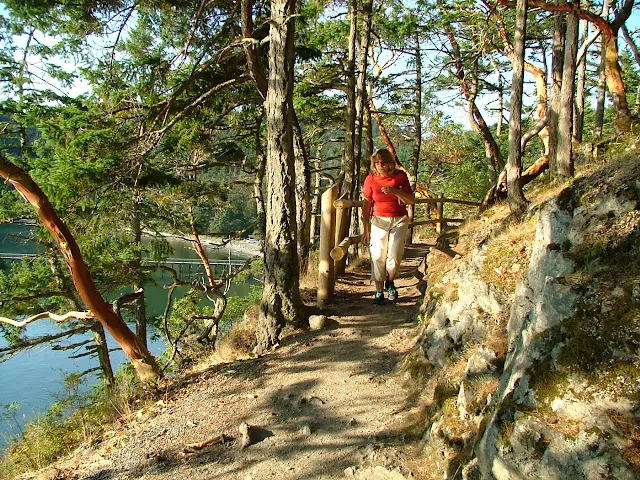
Bowman Bay trail in deception pass park
The trail runs along the shore for all of Bowman Bay, or you may hike up to the bridge and beyond to explore the rest of Deception Pass Park

Bowman Bay is part of Deception Pass State Park.  It's on the outside of the pass, on the north side of the bridge, so this means it is subject to the whims and tantrums of the Strait of Juan De Fuca. To clarify -- fog, waves and swells may be part of the cruise, but on our visit, flat waters and lots of balmy sunshine were the order of the day.

The bay really consists of two distinct areas, the further in more protected waters are opposite the campground and offer a half dozen or so anchor buoys just a dinghy ride from shore.

At the other end of the bay is a nice but smallish float hidden and protected by a little hook of a point. (Sharpe Cove) We chose the float so we could easily access the park bathrooms and walk to the beach for a campfire. To make room and keep our 5 1/2 foot keel out of the mud we tied up with half the boat hanging out past the end of the dock.

From our float location we walked all the way to the other end of the bay and out onto a grassy knoll called Lighthouse Point, (there is no lighthouse, but there is a flashing green, 4s nav aid)  for a fantastic view of Deception Pass and the bridge.  The hike took several hours and we were suitably tired afterwards but this was by no means a tough or experts only hike. The only comment I want to offer is be sure to give yourself enough time to enjoy, explore, and get back before dark. There are a few spots you don't want to try without a flashlight if it gets dark on you.

Bowman Bay in Deception Pass Park
The wharf is for walking only, no boats may tie up. Anchor buoys are beyond wharf, campground is to right.


Deception Pass bridge from Lighthouse Point
From Lighthouse Point you can see that the Deception Pass bridge is really two bridges with Pass Island in the middle. Because of its S curve shape, narrow Canoe Pass on the left is all but invisible, but still easily navigable during slack water.

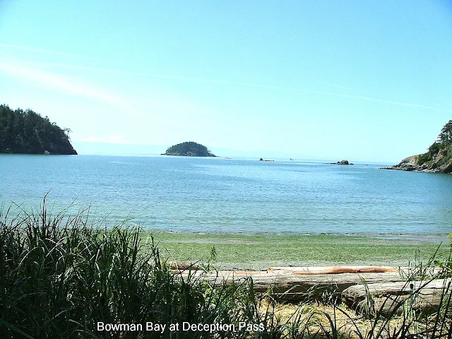
Deception Island from Bowman Bay
This was taken from the campground at Bowman Bay looking out at the Strait of Juan De Fuca. That  far off woodsy bump in the middle is  Deception Island.  Sharpe Cove with its little float is around the small point on right side. Rocks out there are charted and  easily avoidable but must be respected.


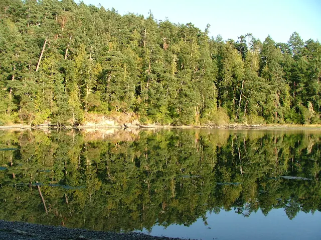
Lottie Bay in Deception Pass park
It's hard to believe that the still and reflective waters of Lottie Bay are only a third mile from Deception Pass, and no you should not bring your boat in here, dinghy or kayak yes - but not your deep draft yacht.


Maiden of Deception Pass, Rosario Beach, Sharpe cove, Bowman Bay
The Maiden of  Deception Pass is as much a landmark as carved wood can be and is located at the top of the gangway leading from the float at Sharpe Cove.  Beyond is Rosario Beach famous for tide pooling and driftwood.

Strait of Georgia
On a clear day you would see Vancouver Island, but this wasn't bad.
In the morning after a leisurely coffee and stroll exploring the tide pools on the Rosario Beach side of the point, Linda contemplates, what I don't know. The tide was rising and the current at the pass  would be flowing inward for several hours.  We reluctantly cast off and steered into the current. In minutes we were under the bridge and on our way to our slip at Shelter Bay in La Conner, and then home.  Bowman Bay is no longer that place we just fly by on our way to somewhere else.