ATTENTION!

This site has oodles of information about boating and the San Juans, it helps to use the search box BELOW to find what interests you.
Search - "things to do" or try "places to go"
search - Sucia Island
search - Friday Harbor
search - hiking or bicycling
try - kayak - try CAMPING - try Anchoring

++++ ============================= All Posts Below

Current Posts Below
Showing posts with label boating. Show all posts

11/28/2014

Pictures by Land and Sea Around Matia Island in the San Juan's


      A few years back, I  hiked the trail from Pelican Beach to the top of Eagle Bluff on Cypress Island, taking pictures every few minutes along the way.  The resulting pictorial is a pretty good synopsis for those that can't make the journey themselves. See the Eagle Bluff Pictorial hike here.  I decided to do the same thing on Matia, but with a little change up. First I hiked the trail snapping away with wild abandon, then I jumped in the dinghy and hugged the shore continuing taking pictures while I circled the island. Then I deleted most of what I had. The results are  below, you decide if it was worthwhile.
Matia Island picture
The blue marker on the far left marks Rolfe cove, and where we  begin our visit to Matia

First off, exit the dock!
The little four boat float, may be full, but there are two buoys and room for a few boats to anchor.  In a pinch you can anchor in the much larger cove at the other end of the island and do this hike/dinghy tour in reverse.


Hiking boating Matia Island
Boater park fees are  a great deal for what we get in return.


Matia Island in the San Juans
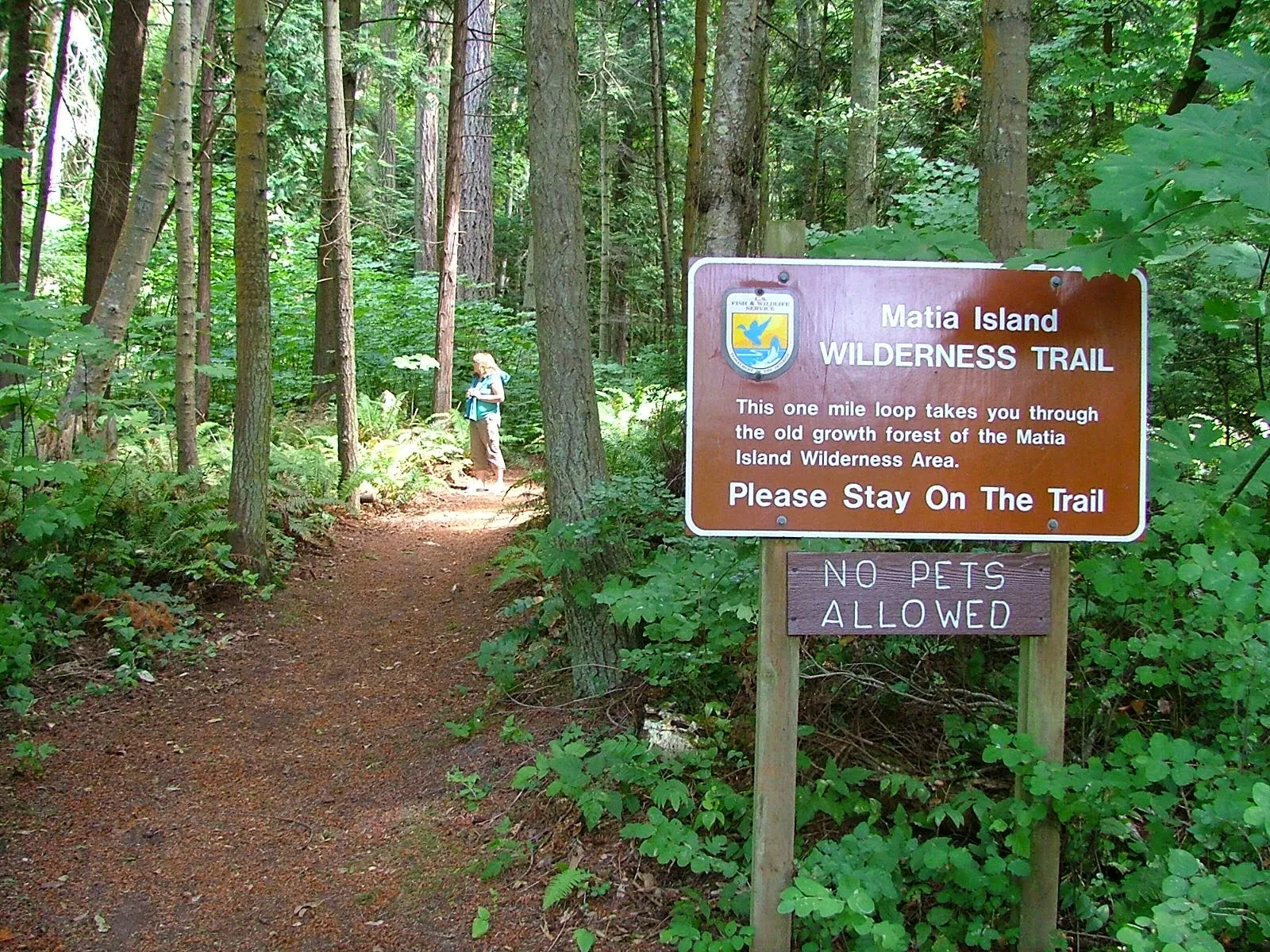
The trail starts at the top of ramp beyond the small picnic campground area.  Matia is unique in that fires are not allowed anywhere, and pets are restricted from trail system.
click where it says read more for the rest of the picture tour!

11/18/2014

Swinomish Channel Nightmare in the Daytime

      We came across this boat during our 4th of July hike to Fort Whitman on Goat Island. They were barely stuck when we first saw them, but within a few minutes it was clear they weren't  getting off until the tide came back up.  I can't imagine the port prop and shaft survived,

boat aground in Swimnomish channel
If this is you, our hearts go out to you, it must have been a rotten day. (make a comment, tell us what happened below, if you want to)

Swinomish channel Fort Whitman
One of four gun emplacements at  Fort Whitman on Goat Island.

Here is the link to the  Fort Whitman posting  > Fort Whitman - Goat Island


9/02/2014

At Last Pictures of Bimini in a Bag are posted

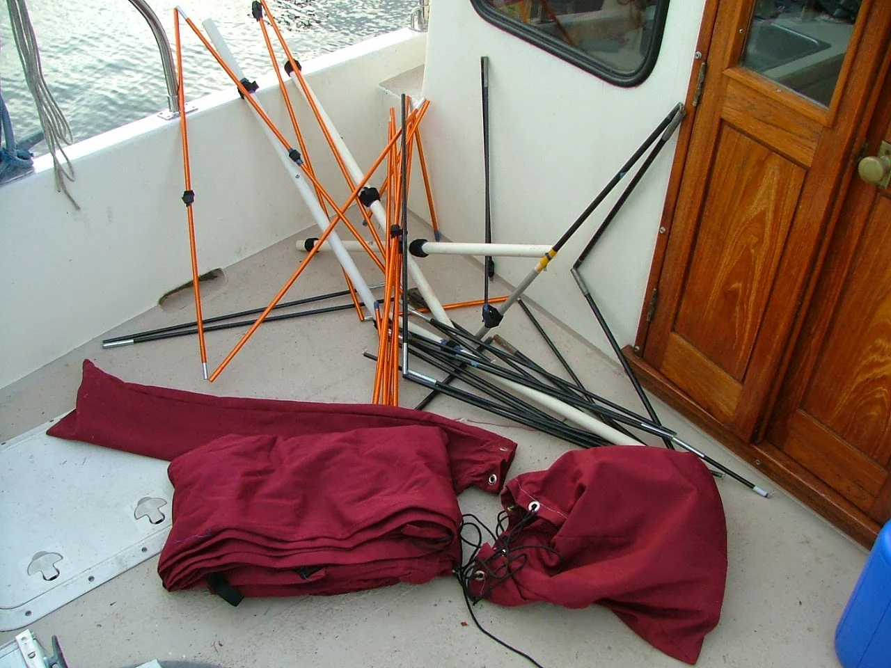
     Not all of us can just go out and order a $5000 bimini and have it magically appear installed on our boat. So the mother of invention leads us once again down the path of necessity and creates a "Bimini in a Bag"

Do it your self bimini top #1
"Bimini in two bags"
fits under the v-berth

Do it your self bimini top #2
Organized chaos
is the secret behind many good things.


Do it your self bimini top #3
Rainy day at Roche Harbor and the new bimini was priceless


Read the full description and many more pictures in the long posting titled  "Doing it yourself page" over on the right side menu bar or just click here  >>   doing it yourself ideas


7/24/2014

Boating Time and SEAL Pup Time Everywhere in the San Juan Islands

        You have probably noticed that new pups are out with their moms on all the rocks and reefs.

If you get too close they slip into the water so there is no doubt they prefer we keep our distance.

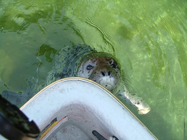
         Of note though, we have on two occasions this summer come across lost or abandoned pups.  At Inati Bay a pup spent much of the evening and next morning crying.  It swam to each arriving boat and then attempted to suckle the hull circling the boat all the while crying and trying to nurse.  Apparently from under water bottom paints may be confused for moms.

          At Matia, we noticed a pup doing the same thing.  As each new boat came to the dock or anchored out, the pup swam to it.  We dinghied around the island and saw hundreds of moms with pups in the water and hauled up on rocks.  When we returned  to Rolfe Cove the pup came to our dinghy and suckled the fiberglass hull, it was really sad looking up at us with big watery eyes while making sucking sounds on the boat and then on the wood oar.

         That evening as the sun went down we saw the pup work its way up onto the beach beneath the gangplank.  It was there in the morning, still by itself..  We called the marine mammal stranding hotline to report it, but who knows what happened.

        We talked to the volunteer on the phone and they said sometimes people getting too close will cause pups and moms to separate and then become lost.

lost seal pup begging
We didn't attempt to touch this little guy, but it sure seemed like he wanted to be cuddled

Seal pup looking for its mother
The sucking sounds were unmistakable as he worked his way around the boats again and again.

Seal pup left on beach without mother
Settling in for the night as the sun set.

7/10/2014

Seven People - Seven Bicycles - One little boat for our 4th of July at Roche Harbor

Seven People - Seven Bicycles - Two Kayaks - One  Dinghy,
and it was raining lightly.
True our 26 foot trawler is bigger than a 16 foot ski boat but 7 bikes and riders filled us to the top.

kraken at Orcas Landing with a full load of bicycles and people

       We just returned from a week long Canada cruise where we tied two bikes on the roof.  With only two of us on board, the bikes never got in the way.  Next we added two more bikes, two kayaks, and two more people for a Lopez and San Juan ride. We still managed to all find seats, but the bikes ended up on the front deck, and we looked through  handlebars and seats to steer. 
(the above pic is a coffee pit stop at Orcas Landing with everyone and everything and its raining)

dinghy dock at roche Harbor

         At Roche we add three more.  We have seven bikes now (four out front and three in the cockpit) For seating, we break out two folding chairs and fill the dinette.  Kraken seemed to list a little to starboard (the dinette side) but what the heck.  
This pic is at the end of the long dinghy dock at Roche Harbor.

Bicycling the San Juans by boat is alive and well.
  • two crossed from  Spencer Spit to Lopez Village
  • two pedaled from Roche Harbor to Lime Kiln and back
  • three pedaled from Odlin Park, around Lopez and took a ferry ride back to Friday Harbor
  • three pedaled from Smallpox Bay around San Juan Island
  • thankfully, other than the skipper and mate, all slept on shore in campgrounds
Does anyone know an easy way to get off black tire marks?

3/29/2014

A reminder for me again! Murphy's Law!

        My dinghy, just like many others is mounted on snap davits across the transom and stood on edge for travel.  This has been my preferred system for many boats and even more dinghies. To tilt and raise the dinghy up and out of the water I have two nylon lines attached to cleats on the far side.  I wrap one line around each wrist and then with a heave, I lean back and pull the dinghy up onto its side. Next with the dinghy balanced in a somewhat neutral position I carefully tie off both lines by wrapping around the stern rail and back to the dinghy cleat.  For lowering the dinghy I wrap the lines several times around the rail creating a friction brake, then effortlessly let out enough line to set her back in the water.

   So far so good, but here's the reminder part. Last week while lowering the dinghy, my cleated lines somehow became loose, I didn't see it in time and the dinghy fell without any braking wraps. I had one hand on a line but was unable to hold it, so it whistled through my grasp taking with it a bunch of my flesh leaving me with a painful rope burn.  To  add insult, after the dinghy fell I discovered my oars were about to slide out of their poorly knotted  lines as well. Some regulars may remember these are the same lines I managed to wrap around the prop at Jones Island last year.  I'll save the procrastination post for later.

     There are lessons and reminders here.

  • Even though I think I tie great knots and cleat well, I failed.
  • I should have a redundant tie off system.
     This experience got me thinking, what else is about to trip me up?
  • loose bolt/nuts
  • cotter pins not spread enough
  • zincs, corroded fasteners
  • belts, hoses, clamps, 
  • electrical connections, battery condition/quality
  • are my flares expired, where is my whistle?
  • anchor shackle pin seizing wire
  • fuel system, (this is a big potential problem area) fuel stabilizer 
  • waste system (that reminds me, I think the vent is plugged)
  • fresh water chlorination, (oh yeah, forgot that too)
  • diesel exhaust smell in the clothes closet, still not addressed!
  • hatch seal
  • dock lines are still a mish mash of old ropes and  one fender is flat
  • telescoping boat pole is jammed at five feet
I put this list together in a few minutes, so there is plenty I missed.
No preaching this time,  but I hope I got some of you thinking.

5/30/2013

Does the law require non-swimmers to wear life jackets (pfd) in the San Juan's - No it does not, but some folks on some boats must wear pfd's.

Oh boy, let's argue.
                  Seriously, you should be conversant with and follow pfd rules, they make sense and save lives.  This article is a semi-non serious look at the actual usage on board cruiser vessels.

        First of all I'm not trying to make an argument but make a point of different thinking. (just for fun)
Here goes -
        If, and I mean if only one life jacket is worn on board, most would say it should be worn by a clumsy non swimmer because they will most likely need it. In this intellectually challenged exercise I suggest that the one and only life jacket should be worn by the most capable person because no one else on board is likely to be able to save him.
       
             The most capable person will have to save himself when no one else is able, hence he should wear the life jacket.  Because >> When the most capable person is gone the rest may perish, when the most capable person needs help, who will help him. So with this way of thinking we must preserve the most capable so that the less capable may then be helped.

       Was that clear? OK try this scenario  -- The skipper gets knocked overboard (crazy crew screws up) and is unconscious in the water without a pfd.  By the time the clueless crew can recover (if ever) him/her, its too late.    Now the remaining persons on board are at greater risk without the numero uno.

        Next scenario  --The clumsy helpless crewman trips and goes in the drink without a pfd. The immensely capable skipper springs into action, rescues the klutz in minutes and saves the day.

        My backwards conclusion is that in the first scenario the skipper may have survived had he been wearing the only pfd, but the klumsy klutz crew probably would have survived without a pfd due to the skill of the skipper.

        What! What is he suggesting, that the skipper gets the only pfd? Outrageous! Blasphemy! What about the Master's responsibility to ship, crew and passengers - Keel haul the laggardly sot.

      On a serious note:
        Look around the docks where all the boats are coming and going and you invariably see the women and children  (even pooches) bundled up in the latest good looking approved flotation apparel. Makes sense, right? - save the hapless and helpless from succumbing to a maritime accident lurking around the next slip or piling. Look closely and many times you see the person stepping (we never jump do we) from boat to dock or dock to boat, handling lines, pushing off, keeping track of passengers, other boats, etc, etc, is not wearing a pfd. All the passengers that are seated and doing nothing are properly belted in, but the one person really in harm's way, the one person all others depend on, the one person the others may not be able to save - is not wearing a pfd at all.

       I need to end this tirade by saying that simply having pfd's on board may keep the regulators happy but won't help the unfortunate skipper over the side, while his helpless family watches him struggle.

        There are certain times (docking-working on deck) when all crew and skipper should be wearing safety gear - and that is just good seamanship.

Sobering thought!
discussion for wearing pfd's


3/20/2013

Traveling to Butchart Gardens by Boat - Itinerary - Canada/USA Customs - Anchor in Tod Inlet

         For  us, one of the best parts about cruising the San Juan's is not having to make any reservations or depend on anyone else.  After a quick stop at the store for food, we just go, and then let the  relaxing begin the moment we cast off. Four days, five days, ten days, I quickly leave everything behind, (including the wine and Hershey bars by mistake) all my thoughts are of traveling and  carefree times.

          However, many times my plans are waylaid by life's little curves and family events. Life curves that I have little control over, and family that - well that just takes precedence over my cruise plans.

          Case in point, it took me four years and three tries to finally see in person the flag lowering ceremony held each balmy summer evening at Roche Harbor.  One time I missed the cruise altogether, and another time a boat dragged anchor into us just minutes before the cannon went off. When I did get to witness the entire show it was just by happenstance that we were there, for I had given up and mostly forgot about the cannon firing sundown ritual.  So when this baby replica of a middle age artillery piece blasted a hole in my thoughts, and its muzzle flash lit up the manicured lawn, I was taken by surprise to say the least. Oh I may have yelled or screamed just a little but no one heard me. The blast was not really deafening but very loud never the less, took me by surprise and captured everyone's attention.  Then the returning echoes bouncing off Henry Island from across Roche Harbor drowned out all evidence of my heavy breathing and rapid heart beat.  What did he just babble? (how to relax?)

click below to read about Butchart Gardens!

11/09/2012

Submarines have right of way! And the Coast Guard the Navy and anyone with big guns

They got lots of guns around them too. woohoo!


Cutting across the entrance to Hood Canal  on our way to Port Ludlow we were suddenly stopped by Coast Guard and Navy patrol boats.  They were all business insisting we stop and wait, the submarine soon came by at about 10 knots, all the the while they kept the patrol boat between us and the sub as if we may be a threat. (or they were camera shy)

The sub had 12 to 15 boats running interference for it as it headed out. All done very efficiently.

BTW afterwards from somewhere we got hit with a big big wake.


Crossing paths with a submarine was an unexpected treat. The next day we cruised up Hood Canal past the Navy base but failed to see anything worth reporting except maybe a huge sign saying lethal force authorized.  We kept our distance.

10/27/2012

VHF Marine Radio Etiquette Rules to follow and how to entertain other boaters

We talked about radio use before, but lets do it again because some of us need to lighten up.

Marine radio rules and regs for us to follow

Some of us when calling (hailing) our good buddy's say the boat name they are calling (usually some descriptive name like "barfing good times for all" or "I think I heard enough already" or this true one "om pa pa - om pa pa" try listening to that three times ) three or four times in a row, and if that's not tedious enough they say it clearly, plainly, slowly, enounciatingly, pronounciatingly, excruciatingly perfect. Enough already again, just say it once, normally -- are you in love with saying the boats name or something? Besides you just talked to them five minutes ago, why should all of us have to listen to your ten minute hailing speech again. And then, all you have to say is something like, "Hey Joe, do you want french or thousand Island dressing?"


Now I know its proper to repeat three times when hailing -- but give it a break.

Here are some pet peeves and tongue in cheek ideas:
  • Is your radio set on low power when you call Joe, no one in the next state wants to hear you.
  • How about staying on 68 or 69, 71,72, if you're going to keep calling every five minutes.
  • If they don't respond, wait awhile longer than thirty seconds before trying again, unless the world is ending it wont matter.
  • Try using your cell phone.
  • If your making us all listen to your party plans, how about an open invitation.
  • Sticky mikes happen a lot,  check yours if your not hearing anything. The easiest way is with another radio. (call for a radio check)
  • Just say the name once--pleeease, unless it really does sound  better to repeat repeat
Okay, I've cooled off some, ranting can be therapy, let's continue.
  • Transmit on low power unless, a mayday call (radios have a high/low switch).
  • Hail on channel 16 and then agree to switch to 68,69 or others for chit chat.
  • Keep your chit chat short, others are waiting and we only have a few channels for recreational use.
  • Btw, radio use (all channels) is supposed to be for operational purposes not chit chat and exchanging dinner recipes. This rule is widely ignored,
  • Btw, did you know your required to monitor 16 if you have a radio?
  • Be polite and concise, then get off. 
  • Hold the mike close but don't yell.
  • You can say over but you dont need to, most know when its over.
  • Over.
  • Roger.
  • Roger dodger.
  • Standing by on 16, 69, pins and needles.
I'm good, I'm done.


Another radio post here >>marine-radios-do-you-need-one?


10/03/2012

Swinomish Channel thin water or "A Rising Tide Floats All Boats"

         "A rising tide lifts all boats."  Ever heard this old saying or something like it?  Most of us have seen a derelict boat on shore somewhere, half submerged, half part of the driftwood. Those boats are long past rising on a flood tide.

           Lets think about when that boat went aground.  Did the skipper intentionally run-aground?  Doubtful, maybe a storm, maybe mechanical failure, possibly.  In all likelihood someone made a decision or series of decisions that eventually led to grounding and eventual loss of the vessel. I suppose you are now thinking, that's so obvious, and your post is boring me, get to your point.  Okay,

         Okay, here is a real life boating decision I made that others may relate to.  When planning our departure time from Shelter Bay on Swinomish Channel I consulted my tide forecasts noting that low tide would be around noon.  I also noted that numerous skippers have reported shoaling and groundings within the buoyed channel near Goat Island where I was headed.  So my decision was to delay departure and time my transit so that I would arrive at the problem area, at or after low tide.

          Now some may think that was dumb thinking, intentionally looking for thin water, and waiting until the water was the thinnest, of course your going to get into trouble. But they're wrong, I was thinking if I do run aground, the rising tide would soon release us and away we go.  If on the other hand, we went ahead and left early and still ran aground on a falling tide, we could suffer damage as the water fell further, our stranded boat with its five and half foot deep keel could tip over and when the tide rose we could down-flood before the boat righted and essentially become another derelict.

           So my decision to wait a few hours may easily have resulted in another enjoyable outing, versus who knows!

         Very very sad proof of what happens when you run aground on a falling tide  Nightmare on Swinomish Channel

          Lets see, how does the saying go?  "all skippers have run aground, or will run aground, and the rest are liars" or something like that.

        While were on the subject of decisions and choices. I would be remiss if I didn't expand a little beyond driving my boat into the dirt, but I will avoid lecturing. You can just add your own thoughts while glancing over the list below.

Decisions and Choices we make
  • PFD's "life jackets," everyone has them, but do you insist wearing them at certain times?
  • fire extinguishers?
  • anchors
  • routine maintenance
  • alcohol/drugs
  • second skipper (huh) can others besides you run the boat when you fall overboard
  • checklist(s)
  • float plan
  • non swimmers
  • handling fuel on board
  • first aid and medicines
  • emergency plan, supply's
  • go or no go into poor conditions
  • wake or no wake (huh)
Try adding to this list, I'll bet you can.

It's October and I'm going out this weekend, how about you?
Swinomish channel thin water

8/01/2012

How many hp does it take to battle the current getting to the San Juans?

We are tied up in slip F23 at Friday Harbor for our second night and since we have free wifi I thought I would let you know what is going on right now.

Rosey in her slip at Friday Harbor marina
Guest slip at Friday Harbor


I can proclaim Rosey has made it to the San Juans, but the story is far from told.
As you know we started in La Conner and made a 160 mile detour into Hood canal.
At our farthest turn around point Roseys old engine chose to quit and we were forced to return to LaConner using our 7.5 hp Honda dinghy motor. After some discussion and a good nights sleep in our rented slip we decided to push on to San Juan Island at a maximum 4 mph and hope the wind would help out. The trip to Friday Harbor took about eleven hours overall. We had some following wind boost in Lopez sound, but when we turned the corner into Upright Channel things came to life and we had fantastic sailing right to the marina breakwater, at times our gps showed us 7.1 mph. Every tack required un-hooking jib sheets from handle bars, next time I load bikes I will try to improve the system.

Yesterday we rode our bicycles to Cattle Pass Point Lighthouse and then over to Lime Kiln Park, a distance of about 35 miles.  We had to walk up some of the hills and several jerks honked at us. None us of were really in shape, but today we feel good with no soreness so it worked out fine

Today we plan to head back with a stop at Spencer Spit and then spend the night at James Island while we wait for flood tide tommorrow morning, hopefully the current will  whisk us all the way to LaConner because our 4 mph speed is stopped dead by an opposing wind and current.

Spencer Spit on Lopez Island in the San Juan's
Spencer Spit
Rosey anchored at James island in the San Juan's
Anchored at James Island


So the answer to the "how many horsepower" question is 7.5 hp, but were not back to La Conner yet.
John
(for anyone that is curious - I switched to a 15 hp Honda and gained one mph in top speed and one mph in cruising speed - imho 15 hp is the correct outboard auxiliary power for a boat like Windrose (seven ton +-)

one week later from home:

OK, update time, first off, the four boat dock at James Island was full so we had to anchor out and dinghy to shore at the kayak campground for our campfire to cook hot dog and s'mores. Anchoring was a real chore, we tried setting the hook three times in two locations before I felt good enough to sleep through a tide change. We ended up with a Bahamian set using our grapple anchor for number two. Plus at Linda's urging I set Roseys antique sounder alarm at two fathoms, I slept like a rock until daylight. We waited for the current change and upped anchor around noon, as soon as we came around the end of James the kicker quit. For a moment I considered raising sail but decided trying to claw off a lee shore was a bad move. We had about a thousand feet before we would be in trouble, and knowing we could quickly drop three hooks I concentrated on fixing the kicker problem asap. Turned out the primer bulb was sucking air because the hose barb was broken halfway through, with a little realigning of the hose it started up and never quit again, but the problem obviously needs attention before we depend on it again. Once clear of James with the wind still on our beam we loosened both sails and made quick work of Rosario Strait. The wind held steady and the helping current up Guemes channel boosted us along at over 5mph right into Swinomish channel where the wind quit, but the current and kicker carried us up to LaConner in short order. With only one half mile left to reach Shelter Bay the current did an about face. Under Rainbow bridge I let the motor idle in neutral so I could measure the current with the gps, astonishingly we were already being swept back at 2 mph and losing fast. We quickly spun around and ran at wot to regain our lost ground and make it into the protected channel leading to our moorage. Luckily we gave our selves just enough time to make it, an hour or so later would have been a nightmare current possibly forcing us to anchor in the channel somewhere waiting for the current change.

Sunrise in saratoga passage sailing the san juan's
Sunrise from shore from Langley on Whidbey Island in Saratoga Passage

All systems running before engine gave up
see the old spinning flashing light depth sounder? (very nostalgic)

navy blockade off Hood canal for submarine
Stopped by Navy for submarine while crossing to Port Ludlow

Lonely Rosey is only guest at Pleasant Harbor on Hood Canal, btw hot showers, wifi come with slip fee

Camp Parson Boy Scout Camp at Jackson Cove on Dabob Bay (Hood Canal)
 We anchored at Camp Parsons and went ashore for the Campfire on Jaidens last night of summer camp. Our primary reason for making trip up Hood Canal was to pick up Jaiden  and then head north to our planned bicycle trip around San Juan Island. In the morning after all the scouts had departed in their many cars we discovered Rosey's engine had given up for good. With only our 7.5 kicker and three gallons of gas our options were limited.  With the help of Quintin in Portland via cell phone, google maps, and an upcoming beer festival for incentive. We were directed five miles to Seabeck where I anchored and took the dinghy to shore.  I then hitched a ride with some local fisherman to Home Depot, purchased four five gallon gas cans and returned with enough fuel to complete our journey.


Our first trip with Rosey is behind us now, we spent twelve days, covered over two hundred sea miles, 35+ bicycle miles, got held up by a nuclear sub, what a great time.


   Here is a follow up about Roseys not starting that morning.  It turned out the shut down lever was still pulled out due to a weak spring or whatever, and after an aggravating but sorta adventurous ordeal I discovered the  issue, pushed the lever, and she started up and has ran fine ever since. So operator error or something like that hits again.   


5/16/2012

Best Dinghy Beaches (and worst) in the San Juan Islands

     What makes a good dinghy beach? Scroll to the bottom for my number one and number two choices when sailing the San Juan Islands

        At first I was just going to list some features good dinghy beaches share, then I realized San Juan newcomers  may need or want a warning to help in trip planning. So lets be clear, just because a beach is considered a good dinghy beach does not mean it is worthy of a visit and conversely, if someone says the beach is no good for dinghy's does not mean you should not plan a stop over. Forewarned is forearmed or something like that.

       In my opinion a good dinghy beach allows you to get to shore and back to the boat with a minimum of fuss and bother.
In no particular order, lets make a list of likes and dislikes.

  • not getting feet wet getting into and out of dinghy is really nice.
  • ditto for all tide levels, so the angle (slope) of the beach is crucial
  • gravel versus mud is a no brain-er 
  • sand is better than mud, but both track into dinghy and back to the boat (gravel doesn't track)
  • something nearby to tie the painter to, like a massive old log
  • a cool view of my boat when I turn around
  • a nearby restroom is handy
  • not smelling like dead seaweed is a plus
  • fires permitted and driftwood is always nice for evenings
  • nearby tide pools for exploring
  • security is something some spots lack (theft of dinghy or contents)
  • free roaming dogs! or other wildlife
  • how about a lack of bugs and bird droppings
  • what about western view of the setting sun
  • protection from weather driven waves
click on -read more- to find my two best dinghy beach choices

4/09/2012

Mooring Buoys in Parks are for you to use but watch out!

Not much needed here, except a few comments.

Of course  buoys  are first come first served and you are not allowed to tie your dinghy to one as a way to reserve or save it. But what are you going to do if you find one with a dinghy tied to it? Set it free! No of course not.

Which brings up road rage or should we coin a new term? how about -water rage- or -cruiser rage- boat rage- island rage-   For the most part, boaters seem to leave their rage on shore, but if you pay much attention to the vhf you may think otherwise.

Back to buoys, mooring buoys are supposed to have a blue stripe, and most of the parks are close enough, putting a stripe on an old tire is a little tough.
mooring buoy's in the San Juan Island's

Around the populated areas you may find lots of buoys, most are likely to be private, none are OK to use without permission.


A word to the wise, don't trust buoys any further than you can tow them.
Some are not maintained and break loose when you are asleep or ashore.
Some may be in shallow water, or even be on the ground at low tide (check your depth) or have lots of rope, and flotsam dangling from them.  (yes, park buoys)


I think when you hook onto a buoy where you plan to leave valuable property tied up,  you should back down as if you were setting your anchor, but that's just me.  >> read this post  Anchor Buoy breaks free at Jones Island
Some other time we can talk about cleats and rotten old floats.

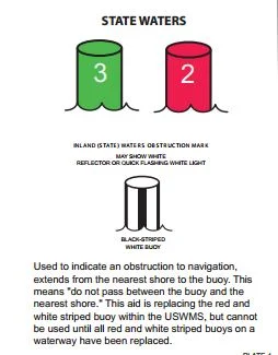
Navigation Aids (buoys and markers) red/green lights

    In keeping with this sites mission, I thought just a few (all I know) bits of information are in order.
If you're an old salt, skip right past this post, but first timers or part-time first mates may find something useful.

      Aids to navigation are the road signs of  our waterways, and just like driving a car down the highway you wouldn't think of not knowing or understanding some basic safety rules. Consider a three year old driving toward you on the road,  he can't reach the brakes, he can't read the stop sign, he doesn't know which side of the road to drive on.  Now picture yourself driving your shiny new boat in a busy waterway or dangerous channel.  No brakes, check!, confusing striped buoys, check!, parallel park a boat, oops, check!.  You owe it to other boaters to understand a few rules,or at the very least have lots of liability insurance. Speaking of insurance, does your insurance cover damage to your boat and passengers and the mega monster and passengers that you hit?


     The three R's (3 aaarrr's) rrr. is a  nautical mnemonic you should memorize  "Red, Right, Returning" That's it, everyone knows it, everyone uses it, so should you.
Another cool nautical mnemonic for you is, "a good red wine is port" which will remind you that all boats running lights will have a red on the port side bow, which leaves green for the starboard side bow

    3R's "red, right, returning" means to me, keep the red buoys on my right when returning from sea. So this means keep the green ones on your left. Returning from sea would also be heading up river.  As a practical usage, one would approach and enter a strange marina keeping the red markers on his right. See, already you're keeping off the rocks.  Of course there are a few places where local conditions dictate other rules.  For example, Swinomish Channel has red buoys on the right at both ends of the passage.

    What good is knowing which side of a boat (or big ship) the red and green lights are on?  I'll tell you why but first you need to turn off the sun and go boating at night, next when you see a red light coming at you adjust your course so you don't collide. OK, now what if its a green light is coming towards you? OK, now what if the green light changes to red and then back to green? What if the light is both green and red? I'm just a little confused and so are others. Out on the water these are the signals that boaters use to tell others what their intentions are, and there is no confusion if you remember a few rules.
Remember this  "a good red wine is port"   It means the red light is on the left side (port) of the boat.  Following normal rules of the road you would meet other boats keeping to the right, just like on the highway, so you pass each other red to red (port to port).  OK when you see a red, then green, then red changing again, and again, it means they are turning back and forth. A steady red/green at the same time means the other vessel is more or less pointed at you. OK, now when you wander back and forth steering your boat like a drunken... you can imagine what message your lights are sending out over the dark waters. 

      Some wisdom learned the hard way:
 When navigating in darkness and the lights you are watching go out (as in you can't see them suddenly) it may mean something is in the water between you and the lights, let's see what could be blocking the view. A headland, another boat, a reef or rock, a piling, your crews head. What it means is you better stop or slow down and figure out immediately why the lights are blinking.

Just for fun I looked up some other sayings:

When all three lights I see ahead,
I turn to Starboard and show my Red:
Green to Green, Red to Red,
Perfect Safety -- Go Ahead.

Red over Red The Captain Is Dead
Vessel not under command


Danger Signal: Blast quick five To stay alive
This is the danger signal, to be given if you think there is confusion or imminent danger of a collision.
It's also the signal the ferry boat will blast at you if you're being stupid.

"I wonder if there's any red port wine left," OK, I got it now, red on left and port means left.


Below are  a few buoys that need to be understood
navigation buoys aids and what they mean


The top band marks the preferred channel


navigation buoys aids and what they mean

Safe water, the above buoys  may be passed on either side

navigation buoys aids and what they mean
Stay away, these buoy mark rocks and bad things.
(check your chart)


The below buoys are your sign posts,
 odd numbers on green, even on red, 
the same numbers are on your chart.
Red Right Returning  3rrr's
navigation buoys aids and what they mean in the san juan's
The above striped marker demands your attention, slow down or stop
 until you figure out where you are.

Many times individuals will make a buoy/marker out of a jug or old fender.
Do yourself a favor and use caution, there is a reason for the marker, and watch out for a trailing line if its floating free, you don't need something wrapped around your propeller.


If you had a chart, you would be able to spot nav. aids on chart
 and figure out where you are and what to do.
I use NOAA chart number 18421, it has an 80,000 scale. I prefer this chart because it shows most of the area I like to cruise on one chart. You may wish to have a larger scale and more charts
here is the url for noaa chart 18421  http://www.charts.noaa.gov/OnLineViewer/18421.shtml
here is the noaa index for other charts in the Pacific Coast area http://www.charts.noaa.gov/OnLineViewer/PacificCoastViewerTable.shtml


By the way, if you're using your chart for trip planning purposes you may like non navigation charts/maps better.  We find a fish-n-map chart inexpensive and very useful.
Our favorite for planning is a full color waterproof laminated tourist map with topo lines, but does not show depth or rocks.


A warning some boaters don't heed,

Please don't take off anywhere with just your chart plotter or portable gps, iphone, or whatever gadget is popular today. You really need to have a hard copy chart or map. (and a compass too)  If it just sits rolled up in the corner that's fine. You probably don't use your whistle, flares, pfd's, or any number of emergency items either, but you still carry them.



1/21/2012

How to Bicycle Between San Juan Island, Lopez Island, Shaw and Orcas Island Without a Car

Bicycling the San Juan Islands
       
  For most people, bicycling the San Juan's means arriving with your bike and gear in a car on a Ferry.


But it doesn't have to be this way. Savvy cyclists leave their cars in Anacortes and ride the ferry to the San Juan Islands.  Once in the islands bicycle travel is the way to go.


First let's explore a likely scenario for those without a boat, bear with me, this will get a little wordy:


      You drive to Anacortes and find a place to park for free for a week, maybe more. Or park at the ferry terminal long term parking lot for about $40 per week. Next, jump on the ferry paying a small nominal fee for one passenger and bicycle for a lift to Friday Harbor on San Juan Island, or Orcas, or Lopez, or Shaw.  FYI: foot passengers and bicyclists never need reservations or need to wait in line like car travelers.
So far so good!


      The day is still early, start touring (ride your bike). At the end of the day you will end up in a motel, B&B, campground, or any number of resorts.  You probably will be well advised to have some reservations lined up in advance. Oh, and bring a pocket full of cash because restaurants and beds aren't free. The next day tour around some more then jump on the free for foot passengers Ferry to other Islands and repeat. Eventually you will end up back in Anacortes where your car is waiting for the drive home.


      This is a great plan if you are into minimalist and don't have a boat, but there are a few weaknesses; number one, where is all my extra gear that I take when I travel, oh yeah its back in the car parked in Anacortes while I'm gallivanting around on an island with nothing but my pocket full of cash and what fits in my bike bags. (not good for some of us) Excellent plan if your a hard core bicyclist. Number two doesn't matter, I'm still back on number one.


Ok, here's the boating/bicycling scenario:  

1/16/2012

WHY own A BOAT? and for me "Why a Sailboat" when what I really want is to go camping somewhere in the San Juan Islands


      Why a boat? is a fair question, and one usual quick answer is, "why not a boat"
Aha! got me again, remember if you don't like the answer, ask a better question.  Okay, how about this question,  "why take a boat for a cruise instead of taking a car and camping?" Now were getting somewhere;
WHY A BOAT?
Spending most of our lives on land, a boat, at least for me, offers wide open spaces, freedom, and much more. The journey is my desire, my wish, my goal, the destination is simply a mark on the chart, a mere way point in life. The boat is at once a complicated machine I must master, or at least control, and yet a simplistic drifting raft,or racing hydro-foil will also fill the bill. While journeying by water my mind is filled with the pressing matters at hand, what course is safe, what hazards lay ahead, are we drifting toward that menacing lee shore,  will we clear the point, should we tack now or risk thin water, what is that new sound? motion? vibration? Looking ahead I see a rock, a quick glance at the gauge hints at the waters depth, the rock is gone, now it appears to one side, as we glide closer I see it has eyes and a nose. I feel a mariner's connection, and an urge to wave, but no response is forthcoming. Anxiously checking the depth again, I'm ready to start the motor; The wind shifts, the sails fill, a little gust, and the lines pull taut. Looking up the mast to the top, I see the wind-vane has changed direction and is  pointing 90 degrees to starboard. The sails hanging like billowy white clouds floating above the boat are spilling wind, I let out the main sheet, and slack the jib.  click on read more...

1/02/2012

Step by Step guide and Itinerary for making that Dream Boat Trip to the San Juan Islands

     This cruise itinerary is for the first timer with the boat on a trailer. The novice skipper with family for crew will find this article contains just what's needed to get going on that long talked about trip to the San Juans. While this is a step by step action plan to follow, some skippers do not need all the steps and prodding and so they should skip ahead to      Day #1.  for the daily itinerary  

For the rest of us, these steps are important, so I've numbered them.
  Before you go

  1. Right now, go put two marks on the calendar. Mark the day of departure from home and one week or so later mark the day your returning. Do it now or forever hold your peace and admit your not really going boat camping in the San Juans.
  2. Go to your local chandlery or go online and purchase a big color map or chart of the San Juans. I'm not telling you which one, it doesn't matter, just big and one you like to look at.
  3. Got the map? Good now nail it to the wall where you can see it all the time. Do it now!  OK, the hardest part is over, you have now made a commitment to yourself and crew. Your really going.  Kick back a little, relax, do some day dreaming.  Your trip (cruise, vacation, what ever you want to call it) is already well underway. By now you should be  getting into the  excitement that comes with planning and preparations.    Note:   Don't let worry and stress build up, your really going to enjoy this outing and it will be easy, trust me  (heh, heh, heh)  Relaxing good times should be part of the  process that started when you made the X on the calendar. Remember, on this cruise there are no deadlines to meet, no times to beat, no "sorry no vacancy's" to worry about. You are on your own schedule to do as you please. What could be better besides a gourmet chef and staff.  Study the map with your crew, locate Friday Harbor, Jones Island, and Squalicum Harbor in Bellingham. Do some internet searches, read peoples reviews.
  4. Start compiling a list of supply's and provisions that you think you need. Click here for help with that list >>  Cruisers Packing List this list may be a little too much, so pick and choose.
  5. Start making a list of boat and trailer, must do's (like greasing the wheel bearings) I mention wheel bearings because there are a few "must do's" that will potentially ruin your plans, having a bearing go out from your neglect is avoidable, so are boat motor issues. We once went with an untested, worrisome diesel motor, and sure enough it quit, but because of suspected problems I had mounted an outboard bracket and brought my trusty 7.5 hp Honda along which not only saved the trip, but allowed us to extend it a few days.  Another time with a different boat I towed a dinghy which sole purpose was to carry a spare outboard just in case.   Another mistake not to make is inadequate packing for inclement weather, (hope for warm sunny days, but plan for cold windy rain).  Don't forget seasickness pills (Dramamine)  or other medication, one persons needs could ruin the trip. There must some other must do's that are particular to your family??? Spare tire for trailer! Hmm!
  6.  #5 was a downer, lets lighten up.  You need to bring an ice chest if your boat has none, maybe two, plan on ice lasting 3-4 days and then resupply time.  For a food menu, you should plan to eat well, especially if you have bad weather when hot food hits the spot and improves spirits. Sandwiches are easy to prepare and bring lots of trail mix and snacks.  You will need lots of water, don't plan on any being available once you shove off. We bring our water in 5 gallon jugs and pour it into smaller bottles
  7. You will need a propane cook stove and fuel bottles to last entire trip (propane is $7+ in the islands)
  8. Garbage:  I need to mention it now after suggesting you bring all the junk food.  Your little boat will quickly become overrun with trash, bring bags, the outside islands have no garbage service. Think about all that convenience food packaging material I just told you to bring.  Some of the packaging may be left at home. Prepare things in advance and freeze meals ready to go as they thaw (2-4 days in ice chest)
  9. Under boat equipment, the list is very subjective so lets just list a few must haves.  PFD's all around and all coastie required equipment (whistle, type 4, fire ext., registration, lights, etc) Plus I think you need a minimum of two anchors and extra rode, extra fuel if your tank is small.  Your boat should have a range of 75 miles. The rule is 1/3 outbound, 1/3 to get back, 1/3 for reserve. It could be 25 miles between fuel stops, so a 75 mile range gives a good cushion. Many boaters simply tie 5 gallon jugs on deck.  If your boat is open and it really rains hard, bring a tarp and ropes to lash it down. You may sleep on shore so a tent is needed. You need a hand bilge pump and a bucket (they look like a big suction tube and flex hose.
  10. Bring a GPS,  You can get by without one but they are fun and really are useful. Some phones have apps available. Bring your cell phone (they work good almost everywhere) Bring the map or chart nailed on the wall or better yet go buy a real navigation chart with depths and rocks all located.  Bring a compass (hand held is OK) Bring a vhf marine radio (you can buy a portable battery one for about $100.   
  11. The boats loaded your ready to go. Don't forget to tell someone where your going, and when to call for help if you don't check in as planned. That person could be a friend or relative that doesn't panic over  icky weather reports.  They should call the San Juan County Sheriff or Coast Guard if needed, or someone you have prearranged to call, 911 works too. Remember, your plans may change as the week progresses, but you can check in with a cell phone call most of the time.
Time to go 
San Juan Island trip itinerary
The blue line indicates general route, red dots are overnight stops. 80 miles

Squalicum Harbor map
Squalicum Harbor Marina - red dots = boat ramp, restaurant, showers, parking, guest docks
  1.   Day #1  Your destination is Squalicum Harbor in Bellingham. (not Anacortes) Squalicum has the best boat ramp around, and free long term parking for your trailer and tow rig. Cap Sante in Anacortes has a sling and pay to park.  You can arrive and take right off but I would plan to spend the first night at the guest dock or in your parked rig. Do not cast off unless you are sure you will have enough light to make it to your anchorage or marina. Navigating in the dark is risky business and requires more of you than you bargain for, and may easily become a really stressed vacation.  Its still daylight until around 9pm, so if you arrive around  6pm there is plenty of time to get the boat launched, go shopping, eat in a restaurant, hang out.  The marina has bathrooms, showers, lots and lots of parking.  If your the worrier on this trip and need to talk to people, you can call them during regular business hours.  The launch fee and guest dock payments are made at a self serve kiosk, you could arrive at midnight, its a 24 hour deal.  No stress, just show with your boat.
  2.   Day #2   In the morning, you can eat at the restaurant overlooking the marina next to the bathrooms, (the food is good and priced right) jump in the car and run to Walmart or just cast off at sun up. I like to walk around and talk to other boaters coffee cup in hand.
  3. Your destination is Echo Bay at Sucia Island, its about 20 miles so you will have plenty of time even if you hang around Squalacum until early afternoon.   If you get there a little earlier you will have time to hike and explore, or maybe first go to Fossil bay where you may get a spot at the dock.  Of course tying up to an anchor buoy or the dock requires a fee whereas                                                                                   anchoring is free.
  4. Sucia Island Chart
    Sucia Island with Echo Bay and Fossil Bay marked with red dots
  5.   Day #3   On this day you may want to stick around Sucia for some exploring, fishing, or kayaking if it suits you. You could easily spend several days just hiking.  
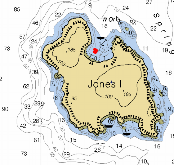
  6. Lets up anchor at noon, our destination is Jones Island, a distance of only 12 miles.  On the way to Jones you may want or need to stop at West Beach resort/marina on Orcas.  West beach is right on the way and wont add much time or distance to this leg.  At West Beach you can get fuel, waffle ice cream cones, ice and groceries. West Beach is just past Point Doughty on Orcas (check your chart/map and find pt Doughty) Did you bring binoculars, they will be helpful in spotting some far off places across the water and West Beach is one of those places? Once again, like Sucia, if you get to Jones early you may get a space at the dock, but you can always snag a buoy or anchor for free. Jones is pretty small but about perfect, you can beach comb, explore, kayak or hike trails, circling the island in about an hour.
  7. Jones Island
    Jones Island chart
    Jones Island
  8. Plan to stay a day or two at Jones it could easily be your favorite stop, it is mine.
  9.   Day #4   But it could be day 5 or 6 if your getting into the boat traveling thing.
  10. Once again there is no need to take off early, but by now you may have noticed that currents play a big roll in passage times, and fuel used. I check my current charts and then ignore them mostly, but at least I know what to expect. Leave Jones Island in your wake and set course for Friday Harbor, no need to rush, its only 5 miles and they never turn boaters away. You can make a reservation for a slip in advance but there really is no need and its nice to not have a rigid schedule.  You can also just stop by for a few hours for free and walk around town, buy souvenirs and provisions and then move on.  I recommend on your first trip that you spend the night at Friday Harbor, visit the Whale Museum, hang around town and waterfront goings on, eat at the many places, and above all by now you will be wanting a shower, which is available right on the docks.  When you arrive near the breakwater, you can call the Harbormaster on the radio or use your cell phone, or simply tie up at the outer dock, sometimes they have a little harbormaster shed office out on the end and you can talk across the water.  It's all very simple and low key, even after hours  when the security people will take care of you. One visit we rented a slip for two nights while we bicycled around San Juan Island.
  11. Friday harbor 
    Friday Harbor chart
    Friday Harbor 
  12.   Day #5    Check out time is after lunch sometime so again, no rush. Set course for Rosario in East Sound on Orcas Island.  The distance is about 11 miles and you may end up with a modest current either for or against your plans, you may want to arrange your transit according to favorable currents.  See current guide info right here  >> Current Atlas  <<    Around Friday Harbor is a lot of boat traffic and you will see more than one ferry for sure, don't worry, just use your common sense.  On your way to Rosario you may want to take a little side trip over to Olga for a short stop over at the public dock, (Olga is also on Orcas just south of Rosario) when you get to Rosario you will be able rent a slip, hang on a buoy or anchor out. Rosario resort has some nice grounds, restaurants, provision store, fuel, and tours of the Mansion turned museum. Because you will probably have time to kill I would seriously consider showing up later in the day or making your visit a two hour stop over and then move on to another stop for the night.
  13. Rosario picture 
    Rosario resort picture
    Rosario (Mansion/Museum is in lower left, marina restaurant at top
  14. An alternate stop would be past Rosario at East Sound where they have a public dock.
  15. Another alternate stop just a little further, but heading more toward your car at Squalicum would be Pelican Beach on Cypress Island.  Pictorial  >> Pelican Beach pictorial  << Pelican Beach has about 4 or 5 buoys and we have always been able to squeeze in and anchor.  In a pinch you can run half a mile down to Eagle Harbor where they have 18 or so buoys. BTW Cypress is DNR land so everything is free (no buoy or camping fees) If your into hiking this is probably the best around. The beach is a favorite for kayakers from Bellingham and Anacortes, expect to enjoy good conversation around the many campfires lining the beach.
  16. Pelican Beach map here  
    Pelican Beach chart
    Pelican Beach on northeast end of Cypress Island

  17.   Day #6   Today's destination is Squalicum Harbor and head for home. Its about 15 miles so it will take a some time.  By now you should have a pretty good idea of your boats ability to get around and deal with wind and currents. Bellingham Bay seems to go on forever, especially when the elements are lined up against you. 
  18. If you have time for a quick lunch stop on the way, you should really consider dropping hook in Inati Bay on Lummi Island
  19. Inati bay map 
    Lummi Island, Inati Bay chart
    Inati Bay on southeast side of Lummi Island
  20.   Plan your departure from Cypress so you arrive back at Squalicum with time to load up and head for home, or I recommend you plan one more night on the boat at the visitor/guest docks at Squalicum Harbor.  This way you will be showered, fed and refreshed in the morning and have the whole day to load up and drive towards home. In my opinion driving home in the dark after a long last day of boating is no way to wind up a relaxing vacation.
That's it
  • I hope I was able to give you the incentive, motivation and pertinent information to get going on that first trip to the San Juan Islands.  My recommendations are by no means all that there is to see and do. Please do some research and modify my suggestions to suit your situation, for instance it is entirely possible to stay at resorts and eat in restaurants every night. The more budget minded may choose to anchor out everywhere.  (yes you can anchor next to the docks at Friday Harbor and then paddle over to their dinghy dock, no charge) You may also start and end at Cap Sante, La Conner, Deception Pass, or even start out far far south in Olympia like we did once.