• Navigate with Confidence
    • • Plan your route and itinerary
    • • Use tides and currents to your advantage
    • • Explore Marine Parks
    • • Discover boat-in spots from Sucia’s anchorages to the trails of Stuart and Jones Island
    • • Experience the Islands
    • • Visit bustling Friday and Roche Harbors
    • • Find serene, secret coves • Your adventure begins now!
New Feature
Below every post is a satellite view hot link - You may drag image to your area and/or
use the plus button to zoom in all the way or click street view when enabled.

++++ ============================= All Posts Below

Current Posts Below
Note: The first few posts below are for first timers and stay on top — New posts are scattered throughout the website — use the search box or look in archives on the left side to find your interests

Jun 15, 2023

What is the Best Dinghy for Cruisers in the San Juan Islands? The Dinghy Dilemma!

   What is the best dinghy for cruising in the San Juan Islands?      

  The best dinghy for San Juan Islands cruising is usually a rigid inflatable boat (RIB), which offers stability, durability, and good performance with an outboard. RIBs handle rough water, rocky beaches, and longer distances better than soft inflatables, though they are heavier and harder to stow, making trade-offs between convenience and performance important.

Most cruisers choose between a lightweight inflatable and a more capable RIB. However, we use a rigid twin hull and keep an inflatable as backup.

 We all know asking "What's the best dinghy?" is a loaded question;

 Boaters can be passionate when it comes to  equipment choices.  Based on my own frugal, sailing/boating should be affordable philosophy, "The best dinghy is the one you already own."  Whoa now, let's start listing exceptions.  I don't mean too small, too big, leaky, unsafe, etc., etc.   I mean a basic dinghy that only has to float you and your stuff to shore.

Do you really need a expensive dinghy?

    In keeping with this blogs purpose to help first timers get to the San Juans, let's talk reality.

     Here are ten or more irrefutable truths about dinghies.

  • You must have a dinghy to go ashore at most parks because you can't count on there being room at the dock. Many docks have room for only four boats. Many parks have no dock.
  • You don't need a dinghy if you only go to resorts and marinas.
  • You will probably tow your dinghy everywhere you go.
  • You may not use it at all (it at makes you wish you left it at home).
  • If you need it you will be thankful you brought it with you.
  • There is no place you will go that you can't tow your dinghy along.
  • Dinghies may be major status symbols among some groups.
  • Towing a dinghy slows you down and uses fuel
  • You may run over your tow line and foul your prop or rudder (use a floating tow line).
  • Certain people have a hard time climbing into or out of a dinghy alongside their boat.
  • Children need a dinghy.

     Okay, that list is far from complete but it highlights some points. Yes, you need a dinghy, even if you can beach your boat, there are simply too many limitations and problems with beaching your water-borne camper.  Let's say for example you rush to shore to use the bathroom at one of the great State Parks.  In the ten minutes you're ashore, a falling tide could leave you high and dry.  With a dinghy, you simply pick it up and carry it back to the water. You need a two or three-person dinghy, a one-person craft can't ferry others to shore. When using dinghies, a multi-hull catamaran style such as a Livingston is very stable, rows well, beaches easily, and can carry big cargoes, however, when towed they track to one side, hunt back and forth, forcing you to keep them on a very short leash. A conventional V hull dinghy is tipsy crawling over the bow on the beach, carries less cargo, but rows very nice and will tow directly behind you on a long or short leash.  Inflatables can carry enormous loads, some (not all) row poorly, and some create so much drag they are almost impossible to tow. Just about all dinghies can be outfitted with an outboard motor, but you really don't need one for simple cruising in the San Juan Islands unless you plan on doing miles of shoreline exploring.


        In the summer season, you probably won't see any big dinghy capsizing waves, but storms and adverse winds can churn up anywhere, anytime.

My dinghy floats when swamped, but not with the outboard, with the outboard bolted to the transom it's straight to the bottom or at least as far down as my tow line is long. Inflatables may be swamped without damage or sinking, which is something to think about if your main boat is not up to the challenge, and could itself be sunk somehow.

Livingston Dinghy, one of five best shore boats used in the San Juan Islands
Our Livingston dinghy is nine feet long and a tad bit overloaded
Two man inflatable kayak for cheap shore boat in the San Juan Islands
This inflatable was $69 and holds two people
This inflatable stows on deck, or deflated stows below and carries three people. 
      How about two dinghies?

If you have children that take off with the dinghy, they are effectively leaving you stranded on the boat or ashore. 

 Well, that's not going to happen you may say.  I say, "What if they get hurt ashore and call you on the phone or radio for help? What do you do? What if they take off in the dinghy and it gets dark, what do you do? (swim)"

Several years past I sent my bored and restless son (in the dinghy) to shore at dusk, telling him to invite himself to one of the many campfires we could see from the boat.  He met some other boaters with kids and before you know it it was after 10:00 pm and very dark.  His mother and I started to wonder what to do as we were stranded and had no way to communicate with him. After a few minutes, I took a strong flashlight and blinked it into the darkness in the direction we thought he was last seen.  A short while later he appeared at our transom asking if we wanted him or something.  This little non-event made me realize how handy a second dinghy would be, so we bought an inflatable kayak to stow below, just in case.


10/13/13 update worth noting
I'm selling the new sailing dinghy

4/17/17

 update on converting the 9'  Livingston dinghy to sailing

 >> go to the do-it-yourself page and scroll way way way down to see the finished conversion << The dinghy conversion section is before the Bimini top on the cheap instructions and after the Boat acronyms if that helps you find it.


9/13/20 

another dinghy update. Last winter I plunked down about a grand in boat bucks and bought a new inflatable. 

My criteria were as follows.

 First, it must be light enough for me to muscle it around onto and off of the cabin roof by myself. It must have two seats. I must be able to inflate and deflate it on the boat. I bought a 9.5-foot boat with aluminum seats, a plywood transom, and a high-pressure inflatable floor.  Without seats, oars, or pumps, the rolled-up package is about 4 feet long, 1.5 feet in diameter, and weighs in at 73 pounds.

Standing on the cabin roof, I was able to fully inflate the new boat and slide it into the water.  Dragging it back up was much more work, even with the two of us.  Then we drove around for three days with the inflated boat on the roof. All in all I like the new boat and am happy with my choice.

Testing complete, we deflated our new dinghy, rolled it up, and headed for the San Juans.

  At the last minute before heading up the freeway, I put the Livingston back on its swim step snap davits.  I know my plan was to replace the Livingston with something more seaworthy but I decided to bring the new and the old anyway.

Our reality is that we don't go exploring anymore like we used to. We anchor and paddle to shore, we don't use the outboard either.  For us, we need the rigidity of a hard hull when boarding, beaching or stowed on the transom davits.

In the San Juans, we never inflated the new dinghy and used the Livingston as usual.  Now the new inflatable is sitting collecting dust in my boat shed. I used it once for one hour. I still have high hopes to somehow justify my purchase. I hope mice and squirrels don't chew on it in the meantime.


Click below to see a satellite view of  James Island

Jun 1, 2023

Worst Places and Attractions in the San Juan Island Cruising Area.

  What places should you avoid when cruising the San Juan Islands?  

  Some San Juan Islands locations are popular but offer little beyond anchoring. Places like Blind Bay lack public access, docks, or shoreline landing, while Eagle Harbor has limited facilities and difficult dinghy access despite many buoys. This article highlights spots that may disappoint boaters and suggests better nearby alternatives with trails, beaches, and amenities. 

While perusing  San Juan articles, I came across a comment that recommended going to Spencer Spit.  My first thought was. That's bad advice. Why would they give bad advice?  I thought some more and decided, #1 Maybe they don't know any better.  #2 Maybe just for them, it was an okay visit. #3 Perhaps I am wrong.  And that is how I came to create this negative San Juan Islands article.

Not every popular stop in the San Juan Islands is worth your time.

San Juan Islands places to avoid.

Some well-known stops attract boaters mainly because they are easy to anchor in, not because they offer good access or amenities. Blind Bay provides little beyond open anchorage, while Eagle Harbor’s muddy shoreline and limited facilities make landing difficult. Nearby alternatives like Pelican Beach offer better access, trails, and overall cruising experience. 

It is more than a little subjective to name off so-called second-rate or low-rated anything.  But if you think about it, we have no problem talking up all the really great places, so for the very same reasons, we should also talk about the crappy ones.  And at the very least, explain why or what makes them such so that you may decide for yourself where to hang out.

So here's a no-no list followed by explanations for their inclusion.  Keep in mind, these reviews are from a boater's perspective.  My goal here is to save cruisers some frustration or disappointment when using their limited time and resources to visit less-than-great destinations.

How to Plan an Unforgettable San Juan Islands Vacation Cruise

   How do you plan an unforgettable San Juan Islands cruise?  

Planning an unforgettable San Juan Islands cruise is easier than most people think. It starts by setting a firm date, choosing a launch point, and keeping your itinerary flexible. Popular starting locations include Cornet Bay, Squalicum Harbor, and Washington Park, with routes shaped by tides, weather, and interests. Allow time for parks, harbors, and spontaneous stops to make the trip memorable. 

Embarking on any adventure begins with making a firm decision to go and setting the date. Follow these easy steps for the boat trip of a lifetime.

Washington Park launch ramp in Anacortes on Guemes Channel
Washington Park ramp

1.   Setting the Perfect Date

       Choosing the right time for your trip requires careful consideration. We have traveled throughout the San Juans from early spring to late fall, and each month offers a unique experience. July and August offer the best weather and blooming flowers but also attract the most visitors. May and June may bring cooler and wetter days, but they also offer excellent sailing winds and the chance to see newborn fawns. September and October may bring foggy days, especially near Deception Pass and the Strait of Juan De Fuca, but you might be rewarded with fewer crowds and wonderful weather. Keep in mind that early spring and late fall may find some businesses and parks closed or partially operational. It's essential to make inquiries to ensure it doesn't affect your plans.


2.     Where to Start: 

      The answer to this question varies for each boater, but there are a few common options. If you're coming by boat from Seattle or the Puget Sound area, you'll need to go around Whidbey Island through either Admiralty Inlet and Port Townsend or Deception Pass. Many skippers prefer Deception Pass due to calmer waters and no commercial shipping. The Deception Pass route also allows for a visit to Cornet Bay or a detour through Swinomish Channel to explore La Conner and Anacortes. Although Port Townsend is an option. Personally, I recommend choosing La Conner or Cornet Bay.


3.      Trailering Boat Arrival Options: 

       Most boaters arrive with their boats on trailers. To find suitable ramps for launching, you can refer to this comprehensive list: (http://www.sailingthesanjuans.com/p/taking-your-boat-for-camping-vacation.html). However, only three ramps are typically preferred: Squalicum Harbor in Bellingham, Cornet Bay at Deception Pass Park, and Washington Park in Anacortes. Cap Sante Marina in Anacortes offers a travel lift hoist but no ramp. Washington Park is the closest to the San Juans and allows for a quick start, but parking may be limited during peak times. Parking at Cornet Bay and Squalicum Harbor is always readily available. We have utilized all three ramps multiple times, and our choice depends on our destination and who accompanies us. Sometimes, dropping off children at Washington Park is convenient if they need to return home early. Personally, I enjoy the Deception Pass area, so if our agenda is clear, Cornet Bay is our preferred choice. Note: I do not recommend taking a ferry to the islands with plans to launch at any of the county ramps. The ramps are inferior, and most don't allow overnight parking. An exception may be small skiffs or kayakers.


4.      Rest After Travel: 

        If you've traveled a long distance and then rigged and splashed the boat, chances are you are exhausted, and it is getting late. It's advisable to spend the first night at a nearby dock or location. Both Cornet Bay and Squalicum Harbor offer transient docks next to the launch ramps. Note that Washington Park only offers a launch dock and is not suitable for overnight stays. Anchoring out front in exposed Guemes Channel, while very doable, will not be much fun due to the many wakes. Nearby welcoming places like James's Island, Cypress Head, or Saddlebag Island, located about four miles away, offer great options depending on your route. Keep in mind that anchoring requires a dinghy to reach the shore. Alternatively, last summer, we tried inflatable paddleboards instead of a dinghy, 
but their usefulness as a full-time dinghy substitute is still uncertain.

5.      Planning Your Itinerary:

      Your itinerary doesn't have to be rigid, with specific stops for each minute or day. It's more enjoyable to have a rough idea and a list of preferred stops. For example, you might want to have a late lunch and buy ice and groceries at Friday Harbor, but you can do the same at Lopez Village, Roche Harbor, or Eastsound. Consider visiting stores when your ice melts on day two or three and take the opportunity to enjoy a hot shower. Most villages and marinas offer groceries, fuel, and shower facilities. Don't worry about being turned away as ample anchorage is available throughout the islands. Consider saving fuel and time by following a great circle route and avoiding backtracking. Visit the outer points early while you still have ice and snacks, and then recharge in the villages. Allowing seven days for your trip is ideal, as anything less might feel rushed, while more time will be well spent.

6.      Additional Excursions: 

       Don't miss out on Butchart Gardens and Victoria; both can be day-only overnight additions to your San Juan Islands trip. While reservations aren't necessary, make sure to carry your passports for re-entry into the US.

7.      Easy Five Island - Ten Stopover Itinerary:

Day 1: Launch at Cornet Bay in Deception Pass Park, spend the night at the transient dock.

Day 2: Run to Jones Island, spend the night at anchor or dock.

Day 3: Run to English Camp, hike up Young Hill, have lunch at Roche Harbor, and return to Jones.

Day 4: Run to Friday Harbor, have lunch and showers, buy groceries, and return to Jones.

Day 5: Run to Stuart, hike to the lighthouse, and dock or anchor for the night.

Day 6: Run to Sucia, anchor or dock for the night in Fossil Bay, and hike to China Caves and Ewing Cove.

Day 7: Swing by Pelican Beach On Cypress and/or Saddlebag Island for a short hike.

 Then run through Swinomish Channel, have lunch at La Conner, and arrive in time for a beautiful Sunset back at Deception Pass, spend the last night at the Cornet Bay dock.

Weekend Getaway or 2-3 day itinerary >>> Mini outing in the San Juans

By following these guidelines, you'll be well-prepared to embark on an unforgettable boat trip through the stunning San Juan Islands. Enjoy the breathtaking beauty and create lasting memories. Most of all, you will have fun.

If you really want to take advantage of tides and currents, consider this guide


Click below to see satellite view of  Cornet Bay moorage and ramp

Apr 24, 2023

I signed up with ChatGPT


Not sure, but I think this is not artificial intelligence.


baby owl looking for a meal
Baby owl looking for a meal


I still have high hopes and expectations.


At first, I thought, oh-boy, ChatGPT can write articles about the San Juan’s for me so I jumped in without any idea what to do or how to do it.

I randomly chose James Island for my experiment and entered into the chat box, “create essay about James Island State Park, WA”

I have pasted below the exact response created. Please take note, there are a bunch of errors and inaccurate reporting’s. Those of us familiar with James will spot the egregious miss-information right away. At the end of the essay, I noted some mistakes.

My Instructions for ChatGPT: “create essay about James Island State Park, WA”

Results:


James Island State Park is a breathtaking destination located in the state of Washington. The park, which spans 554 acres, is situated on the Strait of Juan de Fuca, offering visitors stunning views of the Olympic Mountains and the surrounding islands. In this essay, we will explore the history, features, and attractions of James Island State Park.


The History of James Island State Park


James Island State Park has a rich history that dates back to the early 1900s. The island was initially used as a quarantine station for people with communicable diseases, such as smallpox and tuberculosis. In 1918, the United States Public Health Service took control of the island and built a hospital to treat patients with these diseases.

The island's ownership changed hands several times over the years, with the state of Washington acquiring it in 1978. The state then designated it as a state park in 1993, opening it up to the public.

Features of James Island State Park


James Island State Park is a unique destination that offers visitors a wide range of features and amenities. The park is home to a vast network of trails that wind through old-growth forests, meadows, and along the shoreline. Visitors can explore the park's natural beauty by hiking, biking, or horseback riding.

The park's shoreline is also a popular attraction, with a long sandy beach perfect for swimming, sunbathing, and beachcombing. Visitors can also enjoy boating and fishing in the surrounding waters, which are abundant with marine life.

The park has several picnic areas, complete with picnic tables and barbeque pits, making it a great spot for a family outing or a gathering with friends. The park also has a playground and a basketball court, providing visitors with even more recreational opportunities.

Attractions at James Island State Park


One of the main attractions at James Island State Park is the historic lighthouse, which was built in 1918 to guide ships through the Strait of Juan de Fuca. The lighthouse is not open to the public, but visitors can view it from the shore or from the water.

Another popular attraction at the park is the James Island Marine State Park Campground. The campground has 12 campsites, all of which are located on the water's edge, offering stunning views of the surrounding islands and mountains. The campsites are equipped with picnic tables, fire pits, and vault toilets, providing visitors with a comfortable camping experience.

Conclusion


In conclusion, James Island State Park is a beautiful destination that offers visitors a wide range of features and attractions. From its historic lighthouse to its sandy beaches, the park has something for everyone. Whether you're looking for a relaxing day on the beach or an adventurous hike through the forest, James Island State Park is sure to provide you with an unforgettable experience.


Okay, where do I start? After quickly reading the disappointing results I re-did (re-submitted) my instructions with no changes and got a different but also error prone yet nicely written essay that challenged my recent memory of James Island.


I’ll list some mistakes.

1. No lighthouse, nada, none, major goof

2. Water’s edge campsites ??? maybe water view is a better choice.

3. Breathtaking stunning views of Olympic Mountains, not sure but doubtful there is any view . I'll take a look next time I'm there.

4. Situated on Strait of Juan de Fuca, no, Rosario Strait.

5. Hospital for quarantine, this was way before I was born but where is the old foundation or pilings.

6. Vast trail network, no, there are some trails but vast is a huge stretch.

7. Biking is not going to happen, neither is horseback riding.

8. Playground and basketball court, again, no such thing on James.

Okay, that’s enough. When I re-submitted, I got some more goofy information. But, after much more submission tweaking and some obvious subtractions, I got a reasonable essay or article suitable for reading.


I did similar test submissions for other favorite San Juan locations and got pretty much the same poor results. Since ChatGPT searches the internet for its information, I must assume that this bad error prone text is out there potentially misleading all of us. The scary part is that the ChatGPT writing is actually good, making the misinformation very believable.

I am sure I will rewrite this short-sighted impulse driven post, but I think for the time being we should be careful what we believe lest we go looking for a lighthouse that is not there.


Meanwhile you can search James Island in this sites home page search box and get some actual real first hand information you can use right now. Most likely this post will come up first in the results - oops!


Click below for a satellite view of James Island State Park

Apr 1, 2023

The day Kraken nearly sank at the ramp

   We began taking on water, and then panic set in. Why are we sinking?  

    It was the first boat trip of the year, following an unrelenting and bitterly cold winter. Kraken, our steadfast vessel, had endured the season on her trailer, tethered to shore power with two electric heaters standing guard against the frost. Eager to embark on the long-awaited adventure, I followed my usual launch routine. After backing her down the ramp, launching smoothly, and tying off to the float, I set to work.


Kraken at the float with Christmas Snowmen display on the roof

First, I started the motor. Then, I flipped on all the switches, checked for water exiting the exhaust, and gave the manual bilge pump a couple of precautionary strokes.

 That’s when I noticed something unusual. Eight hearty pulls on the pump produced nearly half a gallon of water per stroke before it finally sucked air. "No big deal," I thought. "It’s probably just rainwater that collected in the bilge over the winter."

Reassured, I tidied the dash, switched on the sounder and radio, and prepared to enjoy the trip ahead. But curiosity got the better of me, and I decided to test the bilge pump one more time. To my horror, another eight to ten strokes brought forth a steady stream of water. My stomach dropped. This wasn’t residual rainwater—we were actively taking on water. Nearly ten gallons had already made its way in. The realization hit me like a cold wave: We’re sinking. Our trip was over before it even began.

I called out to Linda, my ever-steady partner, and told her to hold everything. “We’re taking on water. We need to get Kraken back on the trailer immediately.” 

Adrenaline coursing through me. I turned off the motor, grabbed the truck keys, and prepared to haul her out. In the sudden hush, Linda’s voice cut through: 

“I hear water running.”

Her words stopped me in my tracks. She opened the cabinet door beneath the sink, and there it was—water streaming down the inside of the hull. It was three or four feet above the waterline, an odd place for a leak to emerge. Something wasn’t adding up. Leaning closer, Linda pointed to the source: “It’s coming from the water filter.”

Without a moment’s hesitation,

 I flipped off the water pump switch, and just like that, the stream of water ceased. Relief washed over me as swiftly as the panic had set in. The trip wasn’t over after all—though we’d likely pumped all our fresh water overboard in the chaos.

Upon closer inspection, I discovered the culprit: the water filter canister under the sink had splintered at the bottom, likely a casualty of the winter freeze. With the fresh water tank now dry, our onboard supply was gone, but thankfully, we had an extra five-gallon container with us. We made do and carried on with our trip, albeit with a newfound appreciation for preparation.

When we returned home, I replaced the broken filter and vowed to prevent this from happening again. 

That winter, I installed a lightbulb beneath the sink to keep the chill at bay.

I’m not sharing this story to impart any profound message or lesson. It simply makes me chuckle now—how a seemingly routine launch escalated into a nerve-wracking ordeal before turning into a small adventure we’ll never forget. Sometimes, the scariest moments on the water make for the best tales once you’re safely ashore.


Click below to see a satellite view of   Obstruction Pass

Mar 30, 2023

Quick distance chart from where you are to where you want to be in the San Juan Islands

    What are the boating distances between key destinations in the San Juan Islands?   


   Boating distances in the San Juan Islands are shorter than many expect, with most popular destinations 5 to 20 nautical miles apart. For example, Friday Harbor to Roche Harbor is about 10 miles, and Sucia Island is roughly 15–20 miles away from Friday Harbor but fairly close to Squalicum Harbor. This handy chart helps boaters estimate travel time, fuel needs, and daily route planning. 


Every skipper needs to know how far it is from A to B.

      Here's a handy chart with the work already done, the distances are via the shortest route.

                                  First published 7/30/2016   

Chart showing distance in miles between the san Juan's popular stops

Note: The shortest route may not be the fastest or best route when currents and other issues are taken into account!
These numbers are approximate, and were derived by simply clicking "measure route" on a chart. Since making this chart I have come across several u-tube videos with distances that don't agree with  mine. Be sure to not rely on others and do your own calculations. 


When you are rushing from place to place, be very careful around unfamiliar surroundings so that you don't get a surprise.  The best advice is to slow down and keep watch.  Follow this link to learn of some shockers.  > Eight nasty surprises


Feb 25, 2023

Boat Ramps Parks of the San Juan Islands

   Where are boat ramps, docks, and marine parks located in the San Juan Islands?  

   This San Juan Islands map shows the locations of key boat ramps, public docks, and marine parks used by cruisers. Ramps are primarily on the mainland at Washington Park, Deception Pass, and Squalicum Harbor, while docks and parks are spread throughout the islands, helping boaters quickly plan launch points, routes, and overnight stops. Most boaters launch from the mainland, not from within the islands.


Map of the San Juan Island Area

With selected Parks, Docks, and Trailer Boat Ramps

Map of the San Juan Islands showing launching ramps, parks and docks for all your boating needs
 •  Boat Ramps = Purple    Parks = Red  •  Docks = Green

How to Use This Map for Trip Planning

Boat ramps (purple), docks (green), and parks (red) are arranged to help visualize routes and stopovers. Most reliable launch ramps are on the mainland, while island locations focus on docking and anchoring. This layout allows boaters to plan efficient routes without backtracking or relying on limited island launch facilities. 

Most docks (floats) are in parks, resorts, marinas and may be used for overnight camping.

 Boat launching ramps have long-term parking.  Parks without docks have anchor buoys or areas suitable for anchoring.

The facilities listed, are in my opinion, most useful for cruisers, which means lots of private resorts are not shown because they don't cater to transient boaters.


Click on the picture and then enlarge it to see dot colors better!

Note on trip planning:

 I don't recommend taking your boat on a ferry and launching somewhere in the islands. However if you must, there are county ramps on all four islands served by the ferries except Shaw. Many private resorts have ramps but they are inferior at best, nonfunctional at worst. The one exception is Jackson Beach Park (Port of Friday Harbor) near Friday Harbor on San Juan Island. Jackson has a good double ramp and float and you can park for free up to 72 hours.

The mainland ramps I recommend are Washington Park, Deception Pass Park or Squalicum Harbor (#1 choice most trips is Squalicum Harbor in Bellingham)

Dec 23, 2022

What happens when a big boat drags anchor and slams into you?

   What causes anchor dragging, and how can you prevent it in places like Roche Harbor?   

    Anchor dragging is often caused by poor holding ground, insufficient scope, or shifting wind and current. In busy areas like Roche Harbor, boats may drag when anchors fail to set properly, or conditions change overnight. Preventing it requires proper scope, a well-set anchor, and checking swing room to avoid nearby boats.

The quick answer is, "Nothing good." This is a short synopsis of what happened to us on the 4th of July in the San Juan Islands at Roche Harbor 

Full marina on the 4th of July at Roche Harbor in the San Juan Islands

     In about thirty minutes the Roche Harbor staff will be lowering the flags and firing the cannon. 

Several times in past years, circumstances or poor planning have caused me to miss the ceremony. The firing of the cannon is what I really want to see. The belching smoke, the jagged dagger of flame, the explosive echo’s ricocheting across Roche Harbor. I anticipate a fantastic kick off for my best fireworks ever. Finally, the stars have aligned for me, and on the fourth of July at that. This is already a great trip. The kids will stay on the boat while Linda and I paddle ashore.  The lowering of the flags and cannon firing will be at sundown.

      I am in the cockpit tending to the dinghy, anxiously waiting to leave. When I look over at the boat anchored near us, I sense that it looks different. It is about thirty-five or forty feet long and easily over fifteen feet tall at the upper bridge.  The wind has been steadily increasing for the past hour and I suspect this apartment size power boat is catching the wind and straining at the anchor lines which would make him appear to move a little closer to us. I ask Linda, “Do you think that boat is getting closer?” As I’m watching, I become sure it is half the distance it was when I first noticed. Now I know for sure, we have a problem, the boat is only ten feet away. There is nothing I can do. The other boats anchor has broken out and it is dragging into us. The last ten feet closes rapidly, and suddenly he is against us. I hold him off long enough to grab a fender and place it between us saving us both from damage. I am yelling and banging on his hull with my fist trying to get their attention, but Linda tells me she saw all of them leave earlier. 

Nov 11, 2022

Eight places in the San Juans where you should watch for shallow water, reefs and rocks

   Where are the most dangerous rocks and shallow areas in the San Juan Islands?  

  •   Swinomish Channel
  •   Fisherman Bay 
  •   Prevost Harbor entrance  
  •   Sucia Island approaches

Shallow water, shifting tides, and misleading shortcuts can quickly put a boat aground. Dangerous rocks, reefs, and shallow areas in the San Juan Islands are usually near shore and often charted, but still easy to hit if you cut corners.

Most groundings happen in places that look safe.

    "I only worry near shore because that is 

where the shallow water is." 

Okay, I don't remember exactly what I read but you get the idea. Understanding San Juan Islands boating hazards helps you avoid reefs, shallow water, and common grounding mistakes. In the San Juan's we are pretty much always near shore (it's not that big an area) so should we worry all the time? No! We should pay attention using our heads and our tools.

      All the rocks, reefs and shallows are marked on charts, the especially egregious places have buoys, signs, sticks and posts out in the water.  

 Of course with storms, high tides, poor maintenance, things go missing, so we are back to paying attention and using the old noggin.


       Once not too long ago we were motoring in flat mirror perfect water at about 7 knots in twenty feet of depth.  Up ahead I saw a disturbance (some itty bitty ripples) I glanced at my chart plotter and saw nothing alarming, nevertheless as we neared the ripples I braked and prepared to go full astern.


         While watching the depth gauge,  suddenly -- there it was -- the depth dropped to six and then four -- and we came to a halt. (no we didn't hit) I stopped, turned and went around the shallow spot.


Worst places in the San Juans for rocks and running aground
on watch

Here is a list of potential problem spots where you could easily relax your vigilance and get hurt.


read more - click here

Nov 6, 2022

Top Things to do and Places to go in the San Juan Islands

   What are the best things to do and places to visit in the San Juan Islands?  

  The Islands are best experienced by combining visits to marine parks, time in small towns, and time on the water.

   The best things to do in the San Juan Islands include visiting marine parks like Sucia and Jones Island, exploring towns such as Friday Harbor, and enjoying boating, fishing, hiking, and wildlife viewing. Popular destinations combine scenic anchorages, walking trails, and shore access, making it easy to plan a balanced trip with both relaxation and activity.

Explore hidden coves  and discover the best things to do in your boat while cruising the Salish Sea  

The difference between a truly wonderful vacation and a ho-hum boat ride is the memorable experiences and special places visited along the way.  These are some of our favorite haunts and things to do.  Maybe some will become your favorites as well.  

Matia Island one-mile loop trail

  This easy one-mile loop immerses you deeply into the shaded forest the minute you take your first steps. Towering trees, oversized ferns, and thick mosses line the trail.  Our first walk many years ago was so serene and calming that even our young kids were quiet and talked in whispers.  Matia Island pictorial

Pygmy deer on Jones Island  

The northwest is full of wildlife and deer are everywhere, or so it seems sometimes.  However, apparently, the many deer on Jones Island have developed to a much smaller size. Even the older bucks with big racks are only about waist-high.  Many of the deer are tame, and some are downright annoying.  One time a deer met me at the water's edge as I came ashore in the dinghy.   Several times deer have joined us around our campfires looking for handouts and letting the kids rub their heads and pet them.  I remember once a spike kept crowding too close to the fire, he was intent on getting at a bag of corn curls. It is against park rules to feed the animals so I don't know how they learned to expect treats from boaters.  Jones Island deer

Deception Pass State Park

While Deception Pass isn't located within San Juan County, any boating enthusiast would be remiss not to include it in their cruising itinerary. In fact, Cornet Bay, with its well-facilitated ramp, serves as a prime launch point for those embarking on their nautical adventures. But, here's a piece of advice – don't just launch and rush through; take the time to savor the breathtaking scenery.

Consider planning part of your voyage around the four daily occurrences of slack tide. At slack tide, the turbulent waters temporarily calm, providing an excellent opportunity for exploration. A mere quarter-mile beyond the pass, still within the park's boundaries, you'll discover Sharpe Cove. Here, you can moor your vessel at the floating dock, and at the head of the ramp stands the remarkable Maiden of Deception Pass.

Maiden of Deception Pass at Sharpe Cove

Oct 14, 2022

Leaving for La Conner this morning!

  What is it like to restore and cruise a project boat to the San Juan Islands?  


  Taking an old rescue boat to the San Juan Islands is not for the faint of heart.

Restoring and cruising a project boat to the San Juan Islands involves repairing damage, improvising systems, and solving problems underway. After rebuilding a tsunami-damaged vessel, the journey from La Conner through Swinomish Channel to Friday Harbor included engine failure, improvised propulsion, and long travel days, showing both the challenges and rewards of hands-on cruising. 


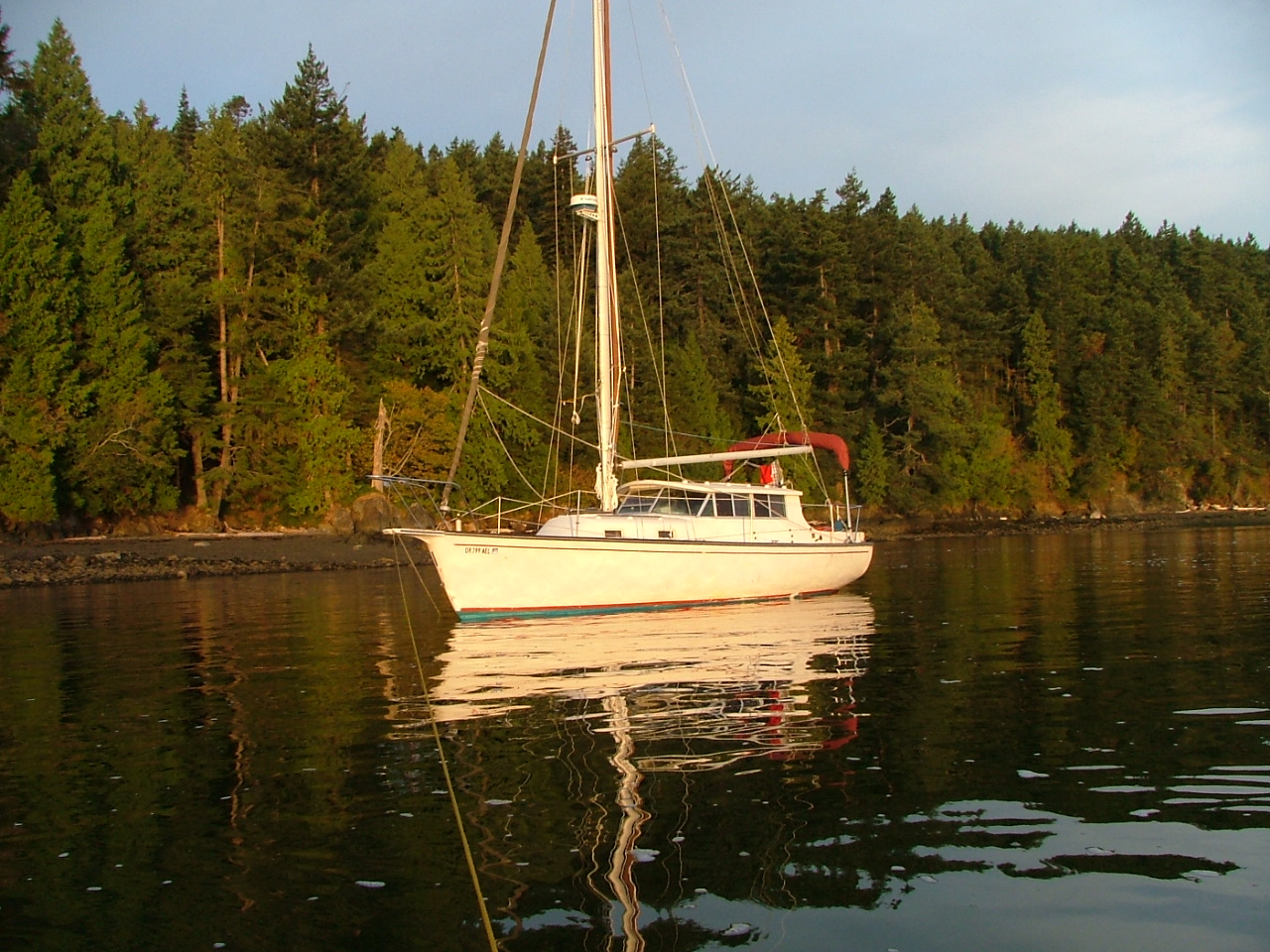
New Bombay 31 motor sailor"Rosey" anchored at Pelican Beach on Cypress Island
Windrose, aka "Rosey" has made it to the San Juans
Windrose aka Rosey is peacefully anchored at Jones Island in the San Juan Islands
In good company anchored at Jones Island

I wrote this post over ten years ago.  It is about a tsunami-damaged boat we rescued following the Fukushima Japan earthquake of 2011.  Windrose was pummeled but not quite sunk as her slip was destroyed around her in 

Crescent City, CA.


As I write this post, Rosey's journey back is finally almost complete.  

Today will be another white-knuckle trip up the interstate for six hours, and then on Monday, we will be slinging her into Swinomish Channel.  After a day or so of rigging, we will be heading to Hood Canal to visit Camp Parsons Boy Scout Camp to pick up our son. Next week we expect to make it to San Juan Island with three bicycles on board so we can do a little bike riding. Right now, I am preparing to download some tide forecasts and somehow appease the fog gods to lay off the Strait of Juan De Fuca. I'm still short a trusted GPS, the radar is not tested, and my brand new Humminbird was shipped off for repairs and won't be back in time. So we will be dependent on our eyes, good looks, and the antique spinning sounder that makes a whirring sound. I think we will be just fine, but don't count on us to make any appointments on time, which is what I would say if we were on a modern newer boat with all systems functioning.

7/22/12


Read about Rosey here  > Rosey's first trip after arriving at her new home in the San Juans

Read about Rosey's tsunami nightmare and repair here  >  Bombay Pilothouse Project

Sep 17, 2022

Visit Olga on Orcas Island and ride your bikes up Mt Constitution or Moran Park

  What can you do when visiting Olga on Orcas Island by boat?  

  Visiting Olga on Orcas Island offers access via a small quiet dock to scenic roads, and nearby attractions like Mount Constitution. Boaters can dock, explore by bike or on foot, and enjoy a less crowded side of the island. Visits are limited to three days and payment is made at a kiosk. 

Olga is one of the quietest places to visit on Orcas Island.

Olga offered us an empty dock. 

So we gladly accepted.

 On other visits, the float was full, so we turned away, vowing to return when there was room.  The private mooring field is peppered with so many buoys it demands full attention when slipping through.

Kraken at Olga dock in the San Juan Islands
Olga public dock has room for about three boats on each side, all buoys are private.

Kraken at Olga dock on Orcas Island
The dinghy's at Olga belong to locals, there is no access to the beach except, a nasty slippery, very steep, and thorny trail in brush under ramp.

Olga dock on Orcas Island
The sign says it all


       On shore at the top of the Olga ramp is a flagpole, and a memorial bench. 

There are a couple blocks, if that, of roads to walk, some say private drive, keep out.  There is no bathroom.  The old store across the street was closed up many years ago, and the property is for sale, but the little post office is in business.  Up a moderately steep hill about 1/4-1/3 mile is a restaurant on the main road. Some other boaters made the hike and reported good food.  Other than private homes, most which look like second homes, there is no other business.  That's it for Olga.  I'm glad we finally stopped by Olga, but except for a nice dock to tie up to, and a pleasant little bay to paddle and dinghy sail, what can I say.


       On a much more positive note, I rode my bicycle around a little, and after checking my maps I realized that Olga is the shortest and most convenient starting point for a grueling ride to the top of Mt Constitution.  7 miles versus 7.5 starting at Rosario.  I did not make the ride due to being late in the day, but I plan to come back and give it a try.


         Next time we are in the area and need a place to spend the night, I'm sure we will stop again.
Oh, and we saw a little baby deer on the beach, way to go Olga!


Note: I am reluctant to review or report on businesses that may or may not be around in the future when readers might come across my post, not realizing the information is sadly outdated or just plain incorrect.

That being said, I have heard that a coop has reopened (2023/2024?) the old store/deli at the top of the gangplank in Olga. I have also been told that there is a new restaurant in West Sound, across from the county dock.  

To the best of my knowledge, the San Juans are still subject to tides, currents, puffins and the occasional seal pup and orca in unexpected places.


Click below for a satellite view of Olga

Aug 8, 2022

Creating maximum space at the dock and general good manners.

  How do you maximize space when docking or anchoring in crowded harbors?  

  Maximizing space at docks and anchorages comes down to efficient line handling, proper fender placement, and minimizing swing radius. Boats that are tied too loosely or spaced poorly waste valuable room. Using correct spring lines, tightening scope, and positioning fenders evenly allows more boats to fit safely without contact or unnecessary gaps.

Full load of tourists watching Orca killer whales in  Haro strait, off shore from LIme Kiln park
This is offshore from Smallpox Bay in Haro Strait

   Having just returned from a 200 mile sweep around the San Juan's, I am fresh with observations and thoughts on how to improve the experience.


Everyone knows that dock space is first-come, first-served and not to expect room for one more when you arrive.  

However, there is room for more if you try using some common sense.  Somewhere in the mountain of state park dock rules and regs is the suggestion to locate boats close together.  Spacing boats fifteen feet apart is not helpful and yet it is common. Tying ones dinghy to the float instead of rafting it is another obvious inconsiderate ploy that effectively exclude others.  By the way, did they pay for the extra dinghy footage?


Speaking of dinghy's

Many parks have designated dinghy docks but I see people with fifteen foot inflatables, complete with 50hp outboards, consoles, windshields and bimini's, side tied at the dinghy  dock forcing real dinghy's to make do as best they can.  What is really annoying is when you realize the offending dinghy belongs to the fifty five footer tied to the same float.


Speaking of  bigger or smaller boats

 A considerate skipper will let his longish bow area stick out beyond the end of the float, so his fifty-five feet only uses forty feet of dock.  Stop! I know this trick is a bad idea in some locations and for some boats. Obviously, I'm not suggesting being foolish, I'm suggesting being thoughtful and considerate.


 While we are talking about considerate  activities

 how long is long enough or too long to run a generator?  During my latest visit we were treated to a generator running for eight hour stretches.  It was during the daytime and it was fairly quiet but come on, at least get off the dock and anchor out a ways. I was anchored out myself, it must have been no fun at all for the people close by.


I spend some of my non-San Juan boating time around jet skis, water skiers, tubers, newbies, loud music and alcohol-fueled people enjoying the water. 

 As such, I expect close encounters, big wakes and general on-water mayhem.  But not in the San Juan's, the San Juan's attract an older more refined, mature crowd. We have miles of room to navigate, there is really no reason for close encounters. Jet skis are outlawed and proper boating is the norm.  On this visit, a thirty-five footer at high speed overtook us and passed by so close they would have hit us if I had turned unexpectedly.  I had no time to react, their wake rolled us so violently that one crew was thrown out of their seat and some of our belongings came crashing off shelves and out of cabinets breaking on the cabin sole.  I regret I did not get a picture or name of the offending boat.  I am not embarrassed that acting on reflex, I cussed them over the radio.  Then after realizing in my haste I may not have keyed the mike, I did it again clearly to make sure they heard.  I hope they heard me but my antenna was down with the inflatable on the roof so my range was greatly reduced.  I apologize for my last paragraph, I'm still reeling when I think about the incident.

     On an up note, at Jones Island, as we were anchoring, a skipper at the float yelled over to us that he was leaving in a few minutes. We aborted lowering the hook and moved over. Thank you very much.

     Also at Jones

We thought we lost a cell phone, trail mix, and passports in a dry bag at our campsite, only to find it two days later, where a raccoon had stashed it in the bushes, unharmed but chewed on.

Jul 6, 2022

My get home system is finally put to use.

  What is a boat “get-home” system,   and does it actually work in an emergency?  

  Yes, a small outboard can move a heavy displacement boat, though with limited steering and fuel range. Mounted off-center and behind the rudder, control is reduced, and response is slow, but it may (hopefully) provide enough thrust to get-er-home.

More than a decade ago, I installed an outboard bracket to carry the dinghy motor on the back of Kraken, my 44-year-old Nordic Tug. 

 The transom-mounted bracket allows me to store the 5hp Honda and easily transfer it to and from the dinghy.  Thinking way ahead, I mounted the bracket down low  so that if I ever needed an emergency push or trolling kicker, I would simply lower the motor, connect the fuel line, and away we'd go.

get-er-home system put to use


Well, it finally happened. 

 Last month, the tug made a strange sound, so I shut off the motor and began drifting.  Because I had forgotten how the mechanism worked and fiddling with it while hanging over the transom was very uncomfortable, it took me a few minutes to get the prop in the water and the fuel line connected.  After about ten pulls, the motor came to life and we were ready to go.

Holding the cowling 

Facing backward, I pointed it at what I guessed was straight ahead.  I shoved the gearshift into forward and twisted the tiller to a medium-fast idle.  At first, we didn't move, but then it was apparent we were actually making headway.  Because I was hanging over the back and couldn't see where we were going, I yelled to Linda, asking if we were pointed okay, or if I should try steering.  Her answer was not helpful.

I made my way inside the cabin and determined we were indeed headed for a mud flat.  I turned the wheel and observed an agonizingly slow response.  The gps showed we were making 4 mph, but our smallish rudder is designed to have the force of the diesel engine pushing our 18" prop wash against it. The outboard is far over on one side and actually behind the rudder.  Nevertheless, we began turning away from the shallows.

So,  the system worked.  I can't say I am impressed with the performance, but it will beat using the canoe paddle that I keep on board.  The two-gallon fuel tank will be very limiting and I am aware that the outboard can't be lowered with the dinghy on its davits.  

I know others have get-home plans and motors, and I thought some might benefit from hearing my experience.

Oh, and Kraken, as always, it was fine.


May 2, 2022

San Juan Islands Cruise Starting at Cornet Bay in Deception Pass State Park

  What is a good boating itinerary from Cornet Bay through Deception Pass to the San Juan Islands  

  A typical San Juan Islands itinerary from Cornet Bay begins by transiting Deception Pass and heading north toward destinations like Friday Harbor, Jones Island, or Sucia Island. Distances are manageable, with many stops within 10–25 miles, allowing flexible daily runs and a mix of parks, harbors, and anchorages. 


This post first appeared on this website in  2011. Parking and launching fees at Cornet Bay have since gone up a little.

       Camping, traveling, vacation rentals, condo's, and resorts on a budget, 

Is it even possible? 

Yes, it is. Inexpensive (cheap) vacations are possible if you "go by boat" or yacht, as some say. The trick is to already own the yacht and then camp on it at all the great places.  Think of it like going to RV parks, only without the garish over-the-top  land schooners parked in the best spots.

            If you are a newbie to the San Juan Islands boating group, you may ask, Why is Deception Pass State Park Your Ideal Starting Point?

The Simple answer is that this Washington park has the best all-weather, all-tide launching ramp and long-term parking lot. Plus,  Deception Pass is one of the places to see that you should not miss, and the Cornet Bay dock is a wonderful place to overnight or just hang out for a few days.

Detailed satellite map of San Juan Islands showing Rosario strait, Anacortes, Friday Harbor, James Island, Deception Pass

Satellite  view showing Cornet Bay marina docks and Deception Pass

The Google photos above with labels will help you to orient yourself. Because slow boats must time their passage through the pass, you may find yourself spending the night at the dock.  I always plan to spend the first night at the dock because after driving six hours, rigging and launching my sailboat, it's late and I'm tired.  My crew can fish, hike and race around in the dinghy while I take a break.  The next day, I'm ready to go, and cast off at slack tide which may be at noon or 9am.  The time doesn't matter, I'm on vacation time now.


The launch fee is around $6, parking is $10/day and staying at the dock is 50 cents a foot. The ramp has three or four lanes with floats. Trailer parking is abundant and long-term.  You can anchor out for free, anytime, anywhere. There is a fist of quarters shower that short times you in the bathroom.  Lots of locals and campers come down to fish off the floats, but boats tying up have priority. Try explaining that to a fisherman.


It is a very short run out the pass, under the bridge and into the Strait of Juan De Fuca, where high seas or fog may cause you to change your plans, if so, just head the other way to Swinomish Channel.  If you have never cruised the channel before, do it for sure, it only adds about 15 miles to your trip and is well worthwhile.  Or when you come back a week or so later, use the channel, but try to work it into your plans.  FYI, your boat will need to make 10 mph or better to overcome the worst of pass current, otherwise you will have to time it like the rest of us.  Of course with a favorable current you can rush on through, but the standing waves can be pretty big at times and an open bow boat will seem like a poor choice. The pass is narrowest directly under the bridge, so you will have a fast current for only a very short distance.


Cornet Bay moorage and boat launching ramp at Deception Pass

Dock and ramp at Deception Pass State Park (Cornet Bay)

You should run through Deception Pass for the beauty of it.

  Next door is Canoe Pass.

 And while navigable, Canoe Pass should only be used at slack water, it is very narrow  and sight distance restricted right under the bridge.  It is a little creepy when the whirlpools turn on and begin spinning you towards the rock cliff face.  Sometimes, we take our 9' dinghy with its 7.5 hp motor around Pass Island and wave to the gawkers on the bridge, but when the flood or ebb starts cascading, a tiny little dinghy has no business in either pass.

         When you come back a week or so later and are ready to head home you can wait for slack water outside the pass at the dock in Sharpe Cove or Bowman Bay. 

           I always spend my last night at the dock and get a good rest for the long drive home.

Here's a link to the marine parks locating map  marine parks maps etc. click here


View from bridge of Deception Pass at slack water with replica pirate ship firing canon.


Tall ship ghosting through the pass at high slack water (photo taken from the bridge)

 In 60 minutes standing waves 3-6 feet tall may form and the current will be 5-8 mph


Swinomish Channel is itself a very picturesque not to miss 

part of all great cruises.

I would be remiss to not point out that most boats can transit the pass a good deal before or after slack water, slack water is simply zero current like in the picture.  Also, don't forget that Swinomish Channel is just around the corner and avoids the pass altogether.  


Click below for a satellite view of Deception Pass