• Discover boat-in spots from Sucia’s anchorages to the trails of Stuart and Jones Island
• Experience the Islands
• Visit bustling Friday and Roche Harbors
• Find serene, secret coves • Your adventure begins now!
New Feature
Below every post is a satellite view hot link - You may drag image to your area and/or use the plus button to zoom in all the way or click street view when enabled.
++++ ============================= All Posts Below
Current Posts Below Note: The first few posts below are for first timers and stay on top — New posts are scattered throughout the website — use the search box or look in archives on the left side to find your interests
Where are the most dangerous rocks and shallow areas in the San Juan Islands?
Swinomish Channel
Fisherman Bay
Prevost Harbor entrance
Sucia Island approaches
Shallow water, shifting tides, and misleading shortcuts can quickly put a boat aground. Dangerous rocks, reefs, and shallow areas in the San Juan Islands are usually near shore and often charted, but still easy to hit if you cut corners.
Most groundings happen in places that look safe.
"I only worry near shore because that is
where the shallow water is."
Okay, I don't remember exactly what I read but you get the idea. Understanding San Juan Islands boating hazards helps you avoid reefs, shallow water, and common grounding mistakes. In the San Juan's we are pretty much always near shore (it's not that big an area) so should we worry all the time? No! We should pay attention using our heads and our tools.
All the rocks, reefs and shallows are marked on charts, the especially egregious places have buoys, signs, sticks and posts out in the water.
Of course with storms, high tides, poor maintenance, things go missing, so we are back to paying attention and using the old noggin.
Once not too long ago we were motoring in flat mirror perfect water at about 7 knots in twenty feet of depth. Up ahead I saw a disturbance (some itty bitty ripples) I glanced at my chart plotter and saw nothing alarming, nevertheless as we neared the ripples I braked and prepared to go full astern.
While watching the depth gauge, suddenly -- there it was -- the depth dropped to six and then four -- and we came to a halt. (no we didn't hit) I stopped, turned and went around the shallow spot.
on watch
Here is a list of potential problem spots where you could easily relax your vigilance and get hurt.
What is it like to restore and cruise a project boat to the San Juan Islands?
Taking an old rescue boat to the San Juan Islands is not for the faint of heart.
Restoring and cruising a project boat to the San Juan Islands involves repairing damage, improvising systems, and solving problems underway. After rebuilding a tsunami-damaged vessel, the journey from La Conner through Swinomish Channel to Friday Harbor included engine failure, improvised propulsion, and long travel days, showing both the challenges and rewards of hands-on cruising.
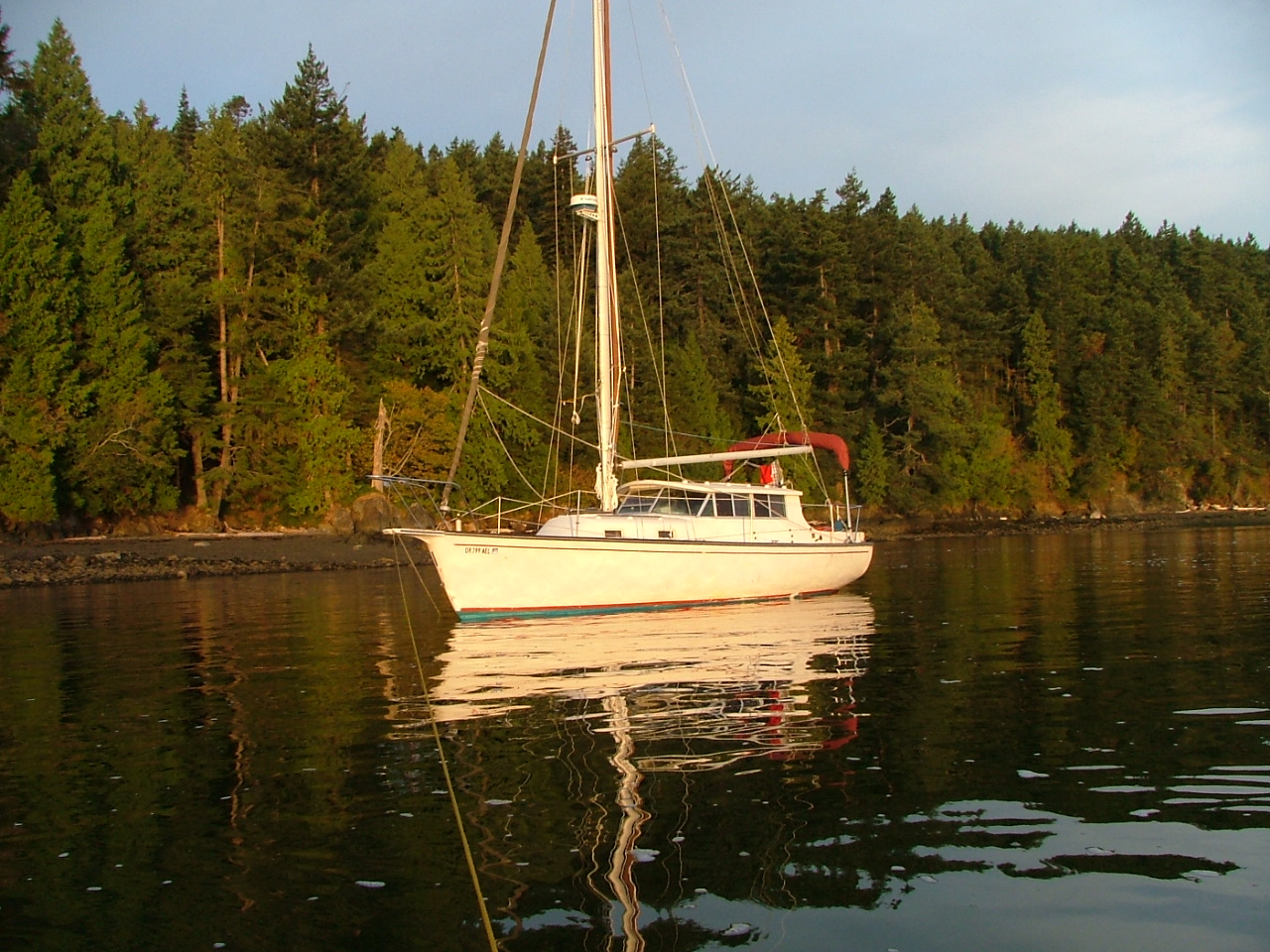
Windrose, aka "Rosey" has made it to the San Juans
In good company anchored at Jones Island
I wrote this post over ten years ago. It is about a tsunami-damaged boat we rescued following the Fukushima Japan earthquake of 2011. Windrose was pummeled but not quite sunk as her slip was destroyed around her in
Crescent City, CA.
As I write this post, Rosey's journey back is finally almost complete.
Today will be another white-knuckle trip up the interstate for six hours, and then on Monday, we will be slinging her into Swinomish Channel. After a day or so of rigging, we will be heading to Hood Canal to visit Camp Parsons Boy Scout Camp to pick up our son. Next week we expect to make it to San Juan Island with three bicycles on board so we can do a little bike riding. Right now, I am preparing to download some tide forecasts and somehow appease the fog gods to lay off the Strait of Juan De Fuca. I'm still short a trusted GPS, the radar is not tested, and my brand new Humminbird was shipped off for repairs and won't be back in time. So we will be dependent on our eyes, good looks, and the antique spinning sounder that makes a whirring sound. I think we will be just fine, but don't count on us to make any appointments on time, which is what I would say if we were on a modern newer boat with all systems functioning.
What can you do when visiting Olga on Orcas Island by boat?
Visiting Olga on Orcas Island offers access via a small quiet dock to scenic roads, and nearby attractions like Mount Constitution. Boaters can dock, explore by bike or on foot, and enjoy a less crowded side of the island. Visits are limited to three days and payment is made at a kiosk.
Olga is one of the quietest places to visit on Orcas Island.
Olga offered us an empty dock.
So we gladly accepted.
On other visits, the float was full, so we turned away, vowing to return when there was room. The private mooring field is peppered with so many buoys it demands full attention when slipping through.
Olga public dock has room for about three boats on each side, all buoys are private.
The dinghy's at Olga belong to locals, there is no access to the beach except, a nasty slippery, very steep, and thorny trail in brush under ramp.
The sign says it all
On shore at the top of the Olga ramp is a flagpole, and a memorial bench.
There are a couple blocks, if that, of roads to walk, some say private drive, keep out. There is no bathroom. The old store across the street was closed up many years ago, and the property is for sale, but the little post office is in business. Up a moderately steep hill about 1/4-1/3 mile is a restaurant on the main road. Some other boaters made the hike and reported good food. Other than private homes, most which look like second homes, there is no other business. That's it for Olga. I'm glad we finally stopped by Olga, but except for a nice dock to tie up to, and a pleasant little bay to paddle and dinghy sail, what can I say.
On a much more positive note, I rode my bicycle around a little, and after checking my maps I realized that Olga is the shortest and most convenient starting point for a grueling ride to the top of Mt Constitution. 7 miles versus 7.5 starting at Rosario. I did not make the ride due to being late in the day, but I plan to come back and give it a try.
Next time we are in the area and need a place to spend the night, I'm sure we will stop again. Oh, and we saw a little baby deer on the beach, way to go Olga!
Note: I am reluctant to review or report on businesses that may or may not be around in the future when readers might come across my post, not realizing the information is sadly outdated or just plain incorrect.
That being said, I have heard that a coop has reopened (2023/2024?) the old store/deli at the top of the gangplank in Olga. I have also been told that there is a new restaurant in West Sound, across from the county dock.
To the best of my knowledge, the San Juans are still subject to tides, currents, puffins and the occasional seal pup and orca in unexpected places.
How do you maximize space when docking or anchoring in crowded harbors?
Maximizing space at docks and anchorages comes down to efficient line handling, proper fender placement, and minimizing swing radius. Boats that are tied too loosely or spaced poorly waste valuable room. Using correct spring lines, tightening scope, and positioning fenders evenly allows more boats to fit safely without contact or unnecessary gaps.
This is offshore from Smallpox Bay in Haro Strait
Having just returned from a 200 mile sweep around the San Juan's, I am fresh with observations and thoughts on how to improve the experience.
Everyone knows that dock space is first-come, first-served and not to expect room for one more when you arrive.
However, there is room for more if you try using some common sense. Somewhere in the mountain of state park dock rules and regs is the suggestion to locate boats close together. Spacing boats fifteen feet apart is not helpful and yet it is common. Tying ones dinghy to the float instead of rafting it is another obvious inconsiderate ploy that effectively exclude others. By the way, did they pay for the extra dinghy footage?
Speaking of dinghy's
Many parks have designated dinghy docks but I see people with fifteen foot inflatables, complete with 50hp outboards, consoles, windshields and bimini's, side tied at the dinghy dock forcing real dinghy's to make do as best they can. What is really annoying is when you realize the offending dinghy belongs to the fifty five footer tied to the same float.
Speaking of bigger or smaller boats
A considerate skipper will let his longish bow area stick out beyond the end of the float, so his fifty-five feet only uses forty feet of dock. Stop! I know this trick is a bad idea in some locations and for some boats. Obviously, I'm not suggesting being foolish, I'm suggesting being thoughtful and considerate.
While we are talking about considerate activities
how long is long enough or too long to run a generator? During my latest visit we were treated to a generator running for eight hour stretches. It was during the daytime and it was fairly quiet but come on, at least get off the dock and anchor out a ways. I was anchored out myself, it must have been no fun at all for the people close by.
I spend some of my non-San Juan boating time around jet skis, water skiers, tubers, newbies, loud music and alcohol-fueled people enjoying the water.
As such, I expect close encounters, big wakes and general on-water mayhem. But not in the San Juan's, the San Juan's attract an older more refined, mature crowd. We have miles of room to navigate, there is really no reason for close encounters. Jet skis are outlawed and proper boating is the norm. On this visit, a thirty-five footer at high speed overtook us and passed by so close they would have hit us if I had turned unexpectedly. I had no time to react, their wake rolled us so violently that one crew was thrown out of their seat and some of our belongings came crashing off shelves and out of cabinets breaking on the cabin sole. I regret I did not get a picture or name of the offending boat. I am not embarrassed that acting on reflex, I cussed them over the radio. Then after realizing in my haste I may not have keyed the mike, I did it again clearly to make sure they heard. I hope they heard me but my antenna was down with the inflatable on the roof so my range was greatly reduced. I apologize for my last paragraph, I'm still reeling when I think about the incident.
On an up note, at Jones Island, as we were anchoring, a skipper at the float yelled over to us that he was leaving in a few minutes. We aborted lowering the hook and moved over. Thank you very much.
Also at Jones
We thought we lost a cell phone, trail mix, and passports in a dry bag at our campsite, only to find it two days later, where a raccoon had stashed it in the bushes, unharmed but chewed on.
AFriday Harbor Marina map is right here. For first-timers to the Marina, it is really handy to know where your assigned slip is in a maze of fairways and other boaters.
Even regular visitors can forget where G-dock is or which side are the odd-numbered slips!
Does anyone see the dinghy dock? (It's at the end of A-dock)
Tip #1 Ask for a slip close to land, that quarter-mile walk gets old real fast!
Tip #2 If your visit includes loading and unloading passengers and gear, save yourself a long walk and use the loading dock below the marina office. (just motor past the fuel pier) The side-facing land is for public use. The other side is for VIP's
Tip #3 Call the "Friday Harbor Master" for slip assignment, call on channel 66 or use your cell phone. Or simply tie up to breakwater "A" when you arrive.
How do you find your slip and navigate the docks at Roche Harbor Marina?
Roche Harbor Marina is larger and more spread out than it first appears, with separate dock areas, fuel dock access, and multiple slip sections. Using this marina map helps locate assigned slips, understand dock layout, and identify key features like the main guest dock and fuel dock, making your arrival smoother and reducing confusion.
Thanks to Roche Harbor Resort for letting us use their area map, it also shows where the Mausoleum and Sculpture Garden/Park are located.
Our 2019 cruise guide has this updated map and the new Friday Harbor map as well. It's pretty helpful when getting a slip assignment to be able to
What are the best boat ramps to use when launching for the San Juan Islands?
Most experienced boaters do not launch from the islands. The best boat ramps for accessing the San Juan Islands are located on the mainland.
Squalicum Harbor in Bellingham
Cornet Bay at Deception Pass
Washington Park in Anacortes
La Conner along the Swinomish Channel.
These ramps offer reliable launching, parking, and access routes, while most island ramps are limited or unsuitable for overnight parking.
Taking your boat for a camping vacation cruise isn't expensive or difficult if you know the places to go and what to do.
If you're going to camp on the boat or on shore, I recommend that you start out in Bellingham or Deception Pass State Park. But if you need or want a campground with a launch ramp for your home base, you should reserve a site at Washington Park in Anacortes.
Boat ramps with parking:
#1 Squalicum Harbor in Bellingham
Lots of parking, fresh water rinse hoses, guest docks, restaurants, nice showers (you will be glad you began and ended your trip here) (updated 10/1/21) I just became aware that Squalicum Harbor has changed their free parking to FIVE days maximum. This is bad news for some of us that like to take 7-10 day cruises. I recommend calling them. (they used to stick longer term in the overflow gravel lot) Cornet Bay requires payment but at least has longer parking.
#2 Cornet Bay at Deception Pass State Park
lots of pay to park, guest docks, showers, nice place to hang out before, after and during your vacation. Only minutes from Anacortes.
#3 La Conner (south end of Swinomish Channel)
single lane city ramp, float, on street parking, cheap fees, nearby guest docks. Current to deal with.
#4 Washington Park in Anacortes
limited pay parking, double ramps with float but open to swell and waves from Geumes Channel, no guest docks, showers, very nice on-site campground, easy bike ride or hike to ferry.
#5 Twin Bridges (north end Swinomish Channel)
County ramp, limited pay parking, small float that's dry at low tide, security risk area NOTE: It's just a little further to La Conner and well worth it!
#6 Oak Harbor
free ramp, $2/day parking, guest docks nearby, full marina services nearby, long walk to town! long ways to San Juans for slow boats.
#7 Cap Sante in Anacortes
should not be listed because they have a sling, not a ramp, Cap Sante would be a second choice if you want to sling your boat in. Guest docks and big RV or trailer pay parking lot. (you can spend a lot of bucks here)
Note: Taking your boat and trailer by ferry to the islands is probably a bad idea because ramps and parking are inferior or not available. However, launching a skiff you can muscle around off the beach at a county park with no float is very doable.
Click on picture to make it bigger!
For first timers, see articles titled "San Juan Islands for First Timers"
Click below First Timers Itinerary
Click below for a satellite view of Squalicum Harbor
Note: Things change, you should check dates on all information before setting out.
I just read a website that says we can go back and forth after July 21st. This is undoubtedly subject to change with current conditions and remember what the US says and Canada says may differ so check with both sides before you cross over.
Interestingly, the last time I had a passport problem (expired) and could not find the answer online. I simply called the office in Friday Harbor and talked directly with an agent. He gave me the straight and current poop in a simple phone call. It made me realize how much I had gotten away from talking to people who actually run the show. Now if I can get certain people to quit texting for hours on end when picking up the phone is more expedient anyway.




%2Bfor%2Bthe%2BSan%2BJuans-1.JPG "San Juan Islands map or boat ramps")