• Navigate with Confidence
    • • Plan your route and itinerary
    • • Use tides and currents to your advantage
    • • Explore Marine Parks
    • • Discover boat-in spots from Sucia’s anchorages to the trails of Stuart and Jones Island
    • • Experience the Islands
    • • Visit bustling Friday and Roche Harbors
    • • Find serene, secret coves • Your adventure begins now!
New Feature
Below every post is a satellite view hot link - You may drag image to your area and/or
use the plus button to zoom in all the way or click street view when enabled.

++++ ============================= All Posts Below

Current Posts Below
Note: The first few posts below are for first timers and stay on top — New posts are scattered throughout the website — use the search box or look in archives on the left side to find your interests
Showing posts with label cruising. Show all posts

Jul 14, 2023

San Juans Itinerary for a Nine Day Trip

    What is a good nine-day itinerary for cruising the San Juan Islands?   

  A good nine-day San Juan Islands itinerary includes a mix of marine parks, scenic anchorages, and moorages such as Friday Harbor and Roche Harbor. Matia Island, Sucia Island, and Jones Island are popular stops. 

    This extended cruising plan allows time for hiking, exploring, and adjusting routes based on weather and currents rather than rushing between destinations.

Suggested Itineraries for a first-time boat trip to the

 San Juan Islands


(Updated (2014) alternate itinerary with Echo Bay and Sucia Island as 1st stop)
click here  Sucia Trip Intinerary


(For a  shorter itinerary on your first cruise and with different island stopovers (click here) 


      This article is designed to get you going on that first boating sailing trip to the San Juan Islands in Washington State.


Below is a snapshot map of your dreamed-about vacation land (or water) 


map of San Juan Island area showing passes and the Canada USA border


The map above identifies many  (not all) common names and places


Take a moment to familiarize yourself with some locations you may have read about.


You may want to follow this link and take a quick look at the detailed marine parks list and then come back to the suggested itinerary below,

 "MARINE PARK LIST AND MAPS"  


Friday Harbor is just one of many places where cruisers can access towns and shore amenities. For more options, see our list of public-use docks around the San Juan Islands.  “public-use docks around the San Juan Islands”


click here to read the rest of this post

Oct 14, 2022

Leaving for La Conner this morning!

  What is it like to restore and cruise a project boat to the San Juan Islands?  


  Taking an old rescue boat to the San Juan Islands is not for the faint of heart.

Restoring and cruising a project boat to the San Juan Islands involves repairing damage, improvising systems, and solving problems underway. After rebuilding a tsunami-damaged vessel, the journey from La Conner through Swinomish Channel to Friday Harbor included engine failure, improvised propulsion, and long travel days, showing both the challenges and rewards of hands-on cruising. 


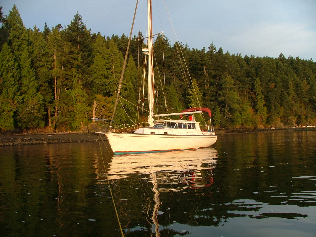
New Bombay 31 motor sailor"Rosey" anchored at Pelican Beach on Cypress Island
Windrose, aka "Rosey" has made it to the San Juans
Windrose aka Rosey is peacefully anchored at Jones Island in the San Juan Islands
In good company anchored at Jones Island

I wrote this post over ten years ago.  It is about a tsunami-damaged boat we rescued following the Fukushima Japan earthquake of 2011.  Windrose was pummeled but not quite sunk as her slip was destroyed around her in 

Crescent City, CA.


As I write this post, Rosey's journey back is finally almost complete.  

Today will be another white-knuckle trip up the interstate for six hours, and then on Monday, we will be slinging her into Swinomish Channel.  After a day or so of rigging, we will be heading to Hood Canal to visit Camp Parsons Boy Scout Camp to pick up our son. Next week we expect to make it to San Juan Island with three bicycles on board so we can do a little bike riding. Right now, I am preparing to download some tide forecasts and somehow appease the fog gods to lay off the Strait of Juan De Fuca. I'm still short a trusted GPS, the radar is not tested, and my brand new Humminbird was shipped off for repairs and won't be back in time. So we will be dependent on our eyes, good looks, and the antique spinning sounder that makes a whirring sound. I think we will be just fine, but don't count on us to make any appointments on time, which is what I would say if we were on a modern newer boat with all systems functioning.

7/22/12


Read about Rosey here  > Rosey's first trip after arriving at her new home in the San Juans

Read about Rosey's tsunami nightmare and repair here  >  Bombay Pilothouse Project

Sep 17, 2022

Visit Olga on Orcas Island and ride your bikes up Mt Constitution or Moran Park

  What can you do when visiting Olga on Orcas Island by boat?  

  Visiting Olga on Orcas Island offers access via a small quiet dock to scenic roads, and nearby attractions like Mount Constitution. Boaters can dock, explore by bike or on foot, and enjoy a less crowded side of the island. Visits are limited to three days and payment is made at a kiosk. 

Olga is one of the quietest places to visit on Orcas Island.

Olga offered us an empty dock. 

So we gladly accepted.

 On other visits, the float was full, so we turned away, vowing to return when there was room.  The private mooring field is peppered with so many buoys it demands full attention when slipping through.

Kraken at Olga dock in the San Juan Islands
Olga public dock has room for about three boats on each side, all buoys are private.

Kraken at Olga dock on Orcas Island
The dinghy's at Olga belong to locals, there is no access to the beach except, a nasty slippery, very steep, and thorny trail in brush under ramp.

Olga dock on Orcas Island
The sign says it all


       On shore at the top of the Olga ramp is a flagpole, and a memorial bench. 

There are a couple blocks, if that, of roads to walk, some say private drive, keep out.  There is no bathroom.  The old store across the street was closed up many years ago, and the property is for sale, but the little post office is in business.  Up a moderately steep hill about 1/4-1/3 mile is a restaurant on the main road. Some other boaters made the hike and reported good food.  Other than private homes, most which look like second homes, there is no other business.  That's it for Olga.  I'm glad we finally stopped by Olga, but except for a nice dock to tie up to, and a pleasant little bay to paddle and dinghy sail, what can I say.


       On a much more positive note, I rode my bicycle around a little, and after checking my maps I realized that Olga is the shortest and most convenient starting point for a grueling ride to the top of Mt Constitution.  7 miles versus 7.5 starting at Rosario.  I did not make the ride due to being late in the day, but I plan to come back and give it a try.


         Next time we are in the area and need a place to spend the night, I'm sure we will stop again.
Oh, and we saw a little baby deer on the beach, way to go Olga!


Note: I am reluctant to review or report on businesses that may or may not be around in the future when readers might come across my post, not realizing the information is sadly outdated or just plain incorrect.

That being said, I have heard that a coop has reopened (2023/2024?) the old store/deli at the top of the gangplank in Olga. I have also been told that there is a new restaurant in West Sound, across from the county dock.  

To the best of my knowledge, the San Juans are still subject to tides, currents, puffins and the occasional seal pup and orca in unexpected places.


Click below for a satellite view of Olga

Jan 9, 2020

Farmers Markets on San Juan Island - Saturday Markets on Lopez Island, Orcas Island Saturday Market

   Where and when are Saturday Markets in the San Juan Islands?   

   Lopez, Orcas and San Juan Island, all have regular scheduled markets in the summer months.

If your running out of things to do and places to go when cruising the San Juans, try Saturday Markets, Farmers Markets and Craft Fairs.

 At Friday Harbor on San Juan Island you will find every Saturday morning,

 April through September the "San Juan Island Farmers Market" is held at the Brickworks Plaza. Bring your appetite for breakfast or lunch and feast on the island cuisine, then bring home locally made arts and crafts.

Friday Harbor San Juan Island, farmers market

Tie up in a slip, or anchor out and use the dinghy dock, its a very short walk.


In Lopez Village on Lopez Island look for the "Lopez Farmers Market" next door to the community center. Open 10am to 2pm mid May into September every Saturday. Plan on having lunch and picking up some local produce and seafood. Local crafts people and artists will be  displaying their work.


Lopez Village Lopez Island in the San Juan's, farmers markets

Berth at a slip in Fisherman Bay and walk about a half mile to Lopez Village.
OR go by dinghy and land right in town -  here's how >>> Lopez Village by dinghy


Don't miss the "Orcas Island Farmers Market" in Eastsound on the Village Green, Open every Saturday from 10am to 3pm  May through October.  Crafts, arts, food, gardeners, museum and history booths, you will find just what you need. 
Eastsound county dock on Orcas Island, farmers markets
Eastsound county dock

Village Green in Eastsound on Orcas Island, music festivals, farmers markets,
Music festivals on the green

Use the county dock at Madrona Point or anchor out, and dinghy to the dock, 
its just a block or two to Eastsound.

Anacortes, Bellingham, and LaConner should be on your short list of 
things to do & places to go!

At Anacortes the Farmers market 

is at 611 R Ave in Anacortes, just a few steps from Cap Sante Boat Haven, and runs 9am until closing every Saturday beginning in May.
Don't miss the "Waterfront Festival," normally held in June

Bellingham boasts a Farmers Market 

that is just a one mile walk from Squalicum Harbor at Depot Market Square, Railroad and Chestnut streets, open 10am to 3pm April thru Christmas.

Lastly, La Conner on Swinomish Channel 

has several public docks downtown where moorage is on a first come basis. As of this writing there is no established close by Saturday Market, but they have an extensive menu of shops jus steps away on main street. Visit the La Conner Chamber website calendar 


Click below to see a satellite view of  La Conner and Swinomish Channel

Feb 28, 2019

San Juan & Gulf Islands Current Atlas - Strait of Georgia - Haro - Rosario - Juan De Fuca

  What is a San Juan Islands current atlas or map?  

 Re-posted  because currents in the San Juan's are part of every day and every cruise.

If you are serious about working the San Juan currents to your advantage, you will want to purchase this current atlas, which is produced by the Canadian Hydrographic Service.


  The Atlas is available at West Marine as well as many retailers for about $30

Straight of Georgia - Juan de Fuca Rosario Strait and the entire San Juan's area current atlas

To use the Atlas without doing any math, you will also want to purchase an annual page index such as Washburne's Tables for about $7 (you will need a new one each year)
Some geniuses have posted their own yearly index tables online that you may copy for free.
(try this one  http://code.borsboom.io/current-atlas-tables/) We simply copy and print the online index table for the dates we are on the boat and then use the same dog-eared current atlas.


The Current Atlas consists of about 80 pages, each page is identical, 
except for the direction and size of the arrows.  

 Below is a scan of part of one page from the current atlas.
This is confusing so I had to read the next section more than once.
  Each page represents the current direction and velocity forecast for one hour of that day. All days and all hours are forecast, some conditions repeat repeat repeat, that's why there are 80 pages and not 8,760, and why you need a page index each year to locate the correct page.  You will only need one Current Atlas (used or new) but you will need a page index for the date of your cruise.  An old index table such as the "2009" pictured above is of no use unless your yacht is a time machine.


The page below, was the forecast for July 13, 2011 at 6:00 pm.  If you wanted to see the forecast for 5pm, 7pm, or another day, you would look at a different page. (this is similar to tide tables, except with drawings)


San Juan Islands current chart or atlas

 The biggest arrows represent current velocity over 2.5 mph, the smallest, under .25 mph. 
The arrows point the direction of flow.

Notice the whirlpool (eddy) south of Victoria and off San Juan Island. Notice the current flowing south on east side of Orcas and north on west side of Whidbey.
When cruising, having this information handy can save you time and fuel and make the difference whether you get to your planned destination. For instance a boat heading north up Haro Strait near San Juan Island will get a big boost, however by checking the next several hours one would see that the free ride is going to end soon and the train will come roaring back.  As a rule of thumb the currents flow north on a flood tide and south on ebb tides but as you can see, rules have exceptions.  This forecast is just before the flood tide reverses and becomes ebb, an apt description would be "confused" The confusion will soon end, get your ticket to ride, its free.

San Juan Islands current chart

This is what the currents looked like on July 13th at 7:49 am, also July 14th at 8:39 am and July15th at  9:26 am.  As you can see, your vessel will get a free ride south just about everywhere, but each day at a slightly different time. When planning your passages and your cruise it would be very helpful to consult the Current Atlas first, a simple free ride one week will be the wrong direction the next week. You may want to choose a different departure date.


While we are on the subject of currents, 


Picture in your mind these big arrows meeting opposing winds and you should then visualize big, steep (dangerous) waves slamming your boat.  Then after a few hours the current changes, and all is well in Camelot once again.
 this post should be read if big waves bother you  >>>wind-versus-current-and-predicting waves
Lately, I have made it part of my cruising to use as little fuel as possible, one cruise we covered about 120 miles over 8 days and used 6 gallons of gas, and most of the fuel was used battling an opposing current between Jones Island and James Island. Unfortunately, my schedule dictated the time.


Dec 13, 2018

How to Secure Your Yacht Like You Want To Keep It Forever

What is the best way to tie up your boat?

Set the brake, turn towards the curb, leave it in reverse and tie the reins with a quick-release knot.  Seriously, the boat should never get loose, period.

These familiar-sounding hints may work for cars and horses, but not boats.  

Dock lines are important, it seems like an obvious observation, but I’m astounded at how many times I see boaters tying up as if they didn’t care about what may be their 1st or 2nd  most valuable possession, spouses and children excluded of course (for some).  Some skippers treat their vessels as if it were a horse, just throw the line around the hitching rail and she be there, arrr, when I come back must be their logic. In their defense, some of these cowboys have never had their boats anywhere but on their trailer, some may not have dock lines.


Enough with the excuses, every secure boat needs four or more lines going from the boat to the float. 

 I know, people make exceptions sooner or later, such as, “It was just a five minute stop over to get ice, or the water was so smooth,” that’s fine, you’re the skipper and it’s your call.


Four or more huh?  Let's see, one bow line, one stern line, one spring line to stop forward surges, one spring line to stop backward surges. More lines are needed for nasty conditions, such as big swells hitting you all night and day, passing boat wakes, high winds. The condition of your vessel or the docks puny cleats and deteriorating condition are all clear signs that you may need more lines.


Learn from others or suffer the expense of learning yourself is a good piece of advice. 

I have on one occasion experienced a brand new line chafe through and part in only one night while tied to an exposed outside float. A new line that rubs on a smooth rounded fiberglass gel coat will lose the battle in one night if it is snapped taught constantly by your boats surging.  Plus the gel coat will suffer in case anyone cares. 

The answer is loose lines

Shock absorbing snubbers, chafe protection padding or hoses, more lines for when the first one breaks, or park somewhere else. Of course, for short time periods, you can order your crew to stand there and hold the boat off while you buy the beer and ice. 

Don't forget to have oversized fenders, but even that won't save your boat if you park somewhere you shouldn't.


how to securely tie your boat using fore and aft spring lines

Ahoy!


Click below for a satellite view of Deer Harbor

Apr 18, 2015

Five Reasons for Taking the Boat Camping in the San Juan's

      Boat camping gives you access to places you can’t reach any other way.   

The rewards are access, mobility, scenery, quiet nights, and a sense of adventure.

Boat camping lets you reach remote coves, small islands, and marine parks that road travelers never see. You’re not competing with crowds—you’re going where only boaters can go.

I was ready to unleash a fiery rant about the absolute misery of car camping and the soulless monotony of tropical cruises—just to prove, once and for all, why boat camping is the superior way to vacation. But after letting the idea simmer for a bit, I had to admit the truth: I actually like car camping. And I won’t lie—lounging on a tropical cruise has its perks too. Maybe you feel the same way? There’s something undeniably appealing about a change of pace, a chance to hit the reset button, to escape from whatever it is we need escaping from. After all, isn’t that what life and adventure is really about?


         So rather than list potential horrible road trip issues, let's concentrate on what a boat camping trip promises.


       For starters, the cynic in me has already thought, "no promises."

         OK, enhanced expectations:  (satisfies me)

  • relaxation  (doing nothing at all, nothing!) 
  • change up in daily grind
  • play with boat, meet and hang with other boat people
  • be with friends and family
  • do a little hiking-fishing-sailing-reading-writing
       We can make this list go on and on, but you get the gist.
      

       Relaxation, or being stress-free, is key to a successful vacation, and worrying about where we will spend the night (on a road trip) is a major stress factor.  You can say get a reservation, but there are many times, when reservations are not in the cards or severely limit what you do. On a boat there is always a place to anchor.


 One major difference between car camping and boat camping that is lost to non-boaters is the freedom to come and go, anywhere, anytime, and never having to worry about a "sorry no vacancy sign" or the all-too-common "campground full sign."

  When boat camping, there are no check-in or check-out times, there are no camp hosts, no registration clerks. Docks at parks have some common-sense rules but are not reserved, and first-come, gets it.  You will never, and I stress this, "EVER" be sent away.  Oh sure, it may be crowded somewhere from time to time, but there will always be room to anchor. (The dinghy rides just get a little longer) When boat camping, unlike a road trip,  you never need to stress out over getting a place to stay. Just go, you will have a spot when you arrive, and you can count on it.  However, if you (not me) must ruin things, you can stress out over arriving in the dark, or other dumb self-inflicted pain, but that's another discussion.


So, what is the best reason for going boat camping?

 Easy, we go boat camping to relax and get away from 
it all!
Boat camping in the San Juan's


Click below to see satellite view of Fossil Bay, Sucia

May 30, 2013

Does the law require non-swimmers to wear life jackets (pfd) in the San Juan's - No it does not, but some folks on some boats must wear pfd's.

       What is required is not what we see every day on the water.  We have all seen bad boating habits and know the sometimes, tragic results.     

Oh boy, let's argue.

                  Seriously, you should be conversant with and follow PFD rules; they make sense and save lives.  

This article is a semi-non-serious look at the actual usage on board cruiser vessels.

        First of all I'm not trying to make an argument but make a point of different thinking. (just for fun)
Here goes -

        If, and I mean if only one life jacket is worn on board, most would say it should be worn by a clumsy non-swimmer because they will most likely need it.  I don't challenge that, but -

. In this intellectually challenged exercise I suggest that the one and only life jacket should be worn by the most capable person because no one else on board is likely to be able to save him.
       
             The most capable person will have to save himself when no one else is able, hence, he should wear the life jacket.  Because >> When the most capable person is gone the rest may perish, when the most capable person needs help, who will help him? So, with this way of thinking, we must preserve the most capable so that the less capable may then be helped.

       Was that clear? OK, try this scenario  -- The capable skipper gets knocked overboard (crazy crew screws up) and is unconscious in the water without a pfd.  By the time the clueless crew can recover (if ever) him/her, it's too late.    Now, the remaining persons on board are at greater risk without the numero uno.

        Next scenario  --The clumsy, helpless crewman trips and goes in the drink without a pfd. The immensely capable skipper springs into action, rescues the klutz in minutes, and saves the day.

        My backwards conclusion is that in the first scenario the skipper may have survived had he been wearing the only pfd, but the klumsy klutz crew probably would have survived without a pfd due to the skill of the skipper.


        What! What is he suggesting, that the skipper gets the only PFD? Outrageous! Blasphemy! What about the Master's responsibility to ship, crew, and passengers - Keel haul the laggardly sot.

      On a serious note:
        Look around the docks where all the boats are coming and going, and you invariably see the women and children  (even pooches) bundled up in the latest good-looking approved flotation apparel. Makes sense, right? - save the hapless and helpless from succumbing to a maritime accident lurking around the next slip or piling. Look closely and many times you see the person stepping (we never jump do we) from boat to dock or dock to boat, handling lines, pushing off, keeping track of passengers, other boats, etc, etc, is not wearing a pfd. All the passengers that are seated and doing nothing are properly belted in, but the one person really in harm's way, the one person all others depend on, the one person the others may not be able to save, is not wearing a PFD at all.

       I need to end this tirade by saying that simply having PFDs on board may keep the regulators happy, but won't help the unfortunate skipper over the side, while his helpless family watches him struggle.

        There are certain times (docking-working on deck) when all crew and skipper should be wearing safety gear - and that is just good seamanship.

Sobering thought!
discussion for wearing pfd's


Click below for a satellite view of Port Townsend

Mar 20, 2013

Traveling to Butchart Gardens by Boat - Itinerary - Canada/USA Customs - Anchor in Tod Inlet

      What is the best part of cruising the San Juan Islands?        


The best part of cruising the San Juan Islands is the total independence and freedom your boat provides.
  • No reservations needed: No rigid schedule, just drop the hook in a quiet cove or snag a park buoy whenever you arrive.
  • You're the captain: You get to come and go as you like.
  • Total flexibility: If the weather shifts or you just feel like exploring, you can change your plan and head wherever the day looks best.

  After a swift pit stop at the store to grab provisions, we set off, and just like that, the relaxation begins the moment the lines are cast off. Four days, five days, ten days—it hardly matters. Time bends and stretches with the tides, and I leave the world behind in an instant. Well, almost everything. The wine and Hershey bars? Tragically, mistakenly forgotten. But with the wind in my face and the horizon ahead, my thoughts drift only to the simple joy of the journey—unburdened, untethered, and blissfully carefree.

Yet, as any seasoned traveler knows, the best-laid plans are at the mercy of life’s unpredictable whims and, of course, family obligations. Some detours are mere nuisances; others, unavoidable. And sometimes, they come with a lesson in patience.

Take, for example, my quest to witness the flag-lowering ceremony at Roche Harbor—a seemingly simple ambition that took me four years and three thwarted attempts to fulfill. One year, I missed the cruise entirely. Another time, just minutes before the cannon signaled sundown, a wayward boat dragged anchor into us, throwing my evening plans overboard.

When I finally did witness the ceremony, it was purely by accident—I had long since abandoned the notion of seeing it firsthand. And so, as the baby cannon, a miniature yet mighty relic of medieval artillery, erupted into the evening air, it caught me utterly off guard. A fiery muzzle flash illuminated the perfectly manicured lawn, and before I knew it, a startled yelp may or may not have escaped my lips—not that anyone could hear it over the booming report. The sound wasn’t quite deafening, but it was certainly enough to send my heart into a gallop.

Then came the echoes, rolling like thunder across Roche Harbor, ricocheting off Henry Island, and sinking any evidence of my momentary shock. In the end, the ceremony was every bit as grand as I’d imagined—perhaps even more so, given the journey it took to get there.

Yes, cruising the San Juans is all about freedom and relaxation.


click below to read about Butchart Gardens!

Aug 12, 2012

Things to do - Get off the boat -There are places to go - Bring Bicycles on your next Cruise to the San Juan Islands

     What's there to do in the San Juans?       

Bicycling the San Juans, may not describe our cruise last month, but we did bring three bicycles, and we did knock off about forty miles on San Juan Island.


At Friday Harbor with three bicycles, and yes the jib sheets caught on the handlebars on every tack.


      Last January I posted a short blog laying out a possible bike/hike/cruise scenario/itinerary that you could use as a planning building block for your own cruise. 

Bikes in the San Juans  Below is a quick summation of what we actually ended up doing.

      Our San Juan Island trip started at Shelter Bay La Conner on the Swinomish Channel. 

 We had just returned from a week long cruise into Hood Canal and after one night in our slip we cast off again at 5:30 am trying to beat the falling tide which would leave us trapped at the dock. With just inches or less to spare we sneaked across our shallow entrance shoal and slid into Swinomish Channel, and rode the remaining outgoing current all the way into Padilla Bay. 

 After a day of on and off winds and then really great afternoon sailing winds we arrived at 5pm and hailed the Friday Harbor Harbor Master 

staking claim to a slip for the next two nights.  A casual stroll around town, and live local music drifting down from the city's seawall  gathering esplanade contributed to a very relaxing evening on board. Not having tides or currents dictating our bicycling schedule allowed us to sleep in the next morning. Finally with hot coffee in hand, (okay, in the cup) I wandered up to Kings Market and purchased hash browns, eggs and some yummy impulse items to bring back to the boat for a late breakfast.


      Definitely before noon, (but not much) we walked our bikes off the floats and headed uphill, of course it's always going to be uphill when you start at sea level.
 We used a folded and wadded up, photocopied not to scale scrap of map for guidance and headed for Cattle Point. 

The roads were without bike lanes, but drivers were respectful and we had an easy ride to American Camp and then on to Cattle Point Lighthouse. 

 Fortunately the weather was clear and with no fog we had  views all the way to Vancouver Island and across the strait of Juan De Fuca. The Olympic mountains hung in the distance completing our postcard views.  Viewing Cattle Pass from up high was a thrill and brought into perspective what was previously a cockpit level chart image.  It was easy to see why the Americans chose this location to set up their cannons. From our vantage point we could scan the water route all the way back to Turn Island where our boat lay just around the corner.


      We brought cookies and water for lunch, and learned next time to bring lots more water and less cookies.


      There is no road right along the coast so we rode part way back to Friday Harbor before turning towards 

Lime Kiln Park.

 We encountered a few long steep grades which required walking for some of us. The cliff side views are stunning and it is somewhat difficult to ride safely while scanning the waters for Killer Whales.  I learned right away to stop if I wanted to really take in the sights. 

We followed a circle route taking us by the Lavender Gardens and back to town on a different road.

      I forgot and left my camera on  the boat so no pictures, sorry.  The next day we were fortunate to not have any soreness brought on by being out of shape and suddenly biking like we were still children. 

On the way back to La Conner we stopped by Spencer Spit for an afternoon hike, and then anchored at James Island.

 We hung around in the morning waiting for the rising tide which we rode almost all the way to Shelter Bay.

      This cruise, in spite of motor problems (our diesel quit and forced us to use our 7.5 kicker for the entire trip) turned out to be one of our best, longest, and most enjoyable.  I highly recommend planning a bicycle/cruise to any of the San Juan Islands.


Click below for a satellite view of Lime Kiln, Whale Watch Park

Aug 1, 2012

How many hp does it take to battle the current getting to the San Juans?

   What is the minimum HP needed to power a 31 foot motorsailer?   

It all depends on the current and wind, is the simple answer.

We are tied up in slip F23 at Friday Harbor for our second night and since we have free wifi I thought I would let you know what is going on right now.


Rosey in her slip at Friday Harbor marina
Guest slip at Friday Harbor

I can proclaim Rosey has made it to the San Juans, but the story is far from told.
As you know, we started in La Conner and made a 160-mile detour into Hood Canal.
At our farthest turnaround point, Rosey's old engine chose to quit and we were forced to return to La Conner using our 7.5 hp Honda dinghy motor. After some discussion and a good night's sleep in our rented slip, we decided to push on to San Juan Island at a maximum 4 mph and hope the wind would help out.


 The trip to Friday Harbor took about eleven hours overall. We had some following wind boost in Lopez Sound, but when we turned the corner into Upright Channel

 things came to life and we had fantastic sailing right to the marina breakwater, at times our gps showed us 7.1 mph. Every tack required unhooking jib sheets from handlebars. Next time I load bikes, I will try to improve the system.


Yesterday we rode our bicycles to Cattle Pass Point Lighthouse and then over to Lime Kiln Park, a distance of about 35 miles.  We had to walk up some of the hills, and several jerks honked at us. None of us were really in shape, but today we feel good with no soreness so it worked out fine


Today we plan to head back with a stop at Spencer Spit and then spend the night at James Island while we wait for flood tide tomorrow morning.

 Hopefully, the current will whisk us all the way to La Conner because our 4 mph speed is stopped dead by an opposing wind and current.


Spencer Spit on Lopez Island in the San Juan's
Spencer Spit
Rosey anchored at James island in the San Juan's
Anchored at James Island


So the answer to the "how many horsepower" question is 7.5 hp, but were not back to La Conner yet.


(for anyone that is curious - I switched to a 15 hp Honda and gained one mph in top speed and one mph in cruising speed - imho 15 hp is the correct outboard auxiliary power for a boat like Windrose (seven ton +-)


one week later from home:

OK, update time, first off, the four boat dock at James Island was full, so we had to anchor out and dinghy to shore at the kayak campground for our campfire to cook hot dogs and s'mores.


 Anchoring was a real chore, we tried setting the hook three times in two locations before I felt good enough to sleep through a tide change. We ended up with a Bahamian set using our grapple anchor for number two. Plus, at Linda's urging, I set Rosey's antique sounder alarm at two fathoms,


 I slept like a rock until daylight. We waited for the current change and upped anchor around noon, as soon as we came around the end of James, the kicker quit. For a moment, I considered raising sail, but decided trying to claw off a lee shore was a bad move. We had about a thousand feet before we would be in trouble, and knowing we could quickly drop three hooks, I concentrated on fixing the kicker problem asap.


 Turned out the primer bulb was sucking air because the hose barb was broken halfway through, with a little realigning of the hose, it started up and never quit again, but the problem obviously needs attention before we depend on it again. 


Once clear of James with the wind still on our beam, we loosened both sails and made quick work of Rosario Strait. The wind held steady, and the helping current up Guemes channel boosted us along at over 5mph right into Swinomish channel


 where the wind quit, but the current and kicker carried us up to La Conner in short order. With only one half mile left to reach Shelter Bay the current did an about face. Under Rainbow bridge I let the motor idle in neutral so I could measure the current with the GPS. Astonishingly, we were already being swept back at 2 mph and losing fast.


 We quickly spun around and ran at wot to regain our lost ground and make it into the protected channel leading to our moorage. Luckily, we gave ourselves just enough time to make it, an hour or so later would have been a nightmare current possibly forcing us to anchor in the channel somewhere waiting for the current change.


Sunrise in saratoga passage sailing the san juan's
Sunrise from shore from Langley on Whidbey Island in Saratoga Passage

All systems running before engine gave up
see the old spinning flashing light depth sounder? (very nostalgic)

navy blockade off Hood canal for submarine
Stopped by Navy for submarine while crossing to Port Ludlow

Lonely Rosey is only guest at Pleasant Harbor on Hood Canal, btw hot showers, wifi come with slip fee


Camp Parson Boy Scout Camp at Jackson Cove on Dabob Bay (Hood Canal)

We anchored at Camp Parsons and went ashore for the Campfire 


on Jaiden's last night of summer camp. Our primary reason for making the trip up Hood Canal was to pick up Jaiden and then head north to our planned bicycle trip around San Juan Island. In the morning, after all the scouts had departed in their many cars, we discovered Rosey's engine had given up for good. With only our 7.5 kicker and three gallons of gas, our options were limited.  With the help of Quintin in Portland via cell phone, Google Maps, and an upcoming beer festival as an incentive. 


We were directed five miles to Seabeck, where I anchored and took the dinghy to shore.  I then hitched a ride with some local fishermen to Home Depot, purchased four five-gallon gas cans, and returned with enough fuel to complete our journey.


Our first trip with Rosey is behind us now. We spent twelve days, covered over two hundred sea miles, 35+ bicycle miles, and got held up by a nuclear sub. What a great time.


   Here is a follow-up about Roseys not starting that morning.  It turned out the shut down lever was still pulled out due to a weak spring or whatever, and after an aggravating but sorta adventurous ordeal, I discovered the  issue, pushed the lever, and she started up and has ran fine ever since. So operator error or something like that hits again.   


Click below for a satellite view of Shelter Bay in La Conner

Jan 16, 2012

WHY own A BOAT? and for me "Why a Sailboat" when what I really want is to go camping somewhere in the San Juan Islands

   Why take a Boat to the San Juan Islands?   

"Why a boat?" is a fair question. The usual quick answer? "Why not a boat?"

Aha—got me again. But if you don’t like the answer, ask a better question.

Okay, how about this: "Why take a boat for a cruise instead of driving and camping?" Now we’re getting somewhere.

Why a Sailboat?

We spend most of our lives on land. A boat, at least for me, offers wide open spaces, freedom, and something more—an escape from the ordinary. The journey itself is my desire, my wish, my goal. The destination? Merely a mark on the chart, a waypoint in life.

A boat is both a complicated machine I must master and a simple drifting raft—a vessel of endless potential. Whether slicing through the waves, steering an underwater wing, or gliding lazily with the current, the experience is the same. The past and future dissolve; I am completely immersed in the present.

Underway at sea, my mind is filled with the pressing matters at hand. What course is safe? What hazards lie ahead? Are we drifting toward that menacing lee shore? Will we clear the point, or should we tack now and risk thin water? What is that new sound? That strange motion? That unfamiliar vibration?

I spot a rock ahead. A glance at the depth gauge tells me we have room—but then the rock disappears. Now it reappears, just off the bow. As we close the distance, I see it has eyes, a nose, and whiskers.

A mariner's connection stirs within me, and I fight the urge to wave. No response is forthcoming.

Anxiously, I check the depth again, hand poised near the motor. Then—the wind shifts. The sails fill. A sudden gust tightens the lines. I glance up the mast; the wind vane swings 90 degrees to starboard.

The sails, hanging like billowy white clouds, spill wind. I ease the mainsheet, adjust the jib. The telltales stream flat. Our trim is perfect.

The boat picks up speed, slicing cleanly through the smooth green water. We’re in the groove now—fairly flying. Our rolling wake is a fleeting marker of where we've been, an open message that tells little but still points our course for all to see.

No longer in the current’s unrelenting grip, we’ll soon clear the point and escape the deadly, ship-wrecking lee shore. No need for the motor—we’ll sail into the cove and anchor in time for a shore hike, a hearty dinner, and a sunset campfire on the beach.

But then—the sails luff. The wind shifts, then dies altogether.

I trim the sheets, but the telltales hang limp. The boat slows.

I glance toward the looming shore. Check the depth again. We may not make the cove after all.

Should I switch to the iron Jenny?

Looking for hazards, I scan the water. More heads have turned toward me now, watching. The connection feels stronger. This time, I give a dismissive wave—they know what’s happened. They know the wind has abandoned me.

Without it, we lose headway. Then, steerage.

Drifting backwards now, ever so slowly, the boat inches closer to the rocky shore. Closer to certain doom.

I check the depth again.

Kelp and seaweed float around us—pockets of debris from the last storm, drifting aimlessly in little flotillas of waste.

Then—suddenly—a slap of halyards against the mast.

The rigging strains, flexes. A swell rolls beneath us, nudging the boat with unseen force.

I scan the water. What caused the commotion? What set off the alarms?

Then I see it—a small boat, far off in the distance. Its wake reaches us in a series of gentle ripples, each one fainter than the last. A message sent. A message received. Then, silence.

I check the depth and glance toward the shore.

And I wait.

An hour later, nestled in the cove, the burnt orange sun silently slips below the horizon, marking the end of a wonderful day. A glass of fine Pinot or a cool drink rests in my hand as I sit by the campfire on the beach. My trusty yacht is peacefully anchored 150 feet offshore, or perhaps tied tranquilly to the dock just a few steps away.

Later, after dark, while waiting for sleep to overtake me, my thoughts drift to the day gone by—and to what tomorrow will bring.

Why not a Sailboat?

Update: In all fairness and disclosure, we switched to a trawler.  I miss sailing, but I also appreciate the simplicity and ease of not sailing.


Click below to see Victoria BC

Sep 18, 2011

10 things Experts say you need for Sailboat Cruising

What does every cruiser need in the San Juans?


I came across this article/list and thought it was worth posting.

1. Sailing Knife and Marlinspike

Carry a
knife and marlinspike on your belt at all times (not in your pocket, and
not down below in your bag). You need it ready to use in an instant. A
knife will cut through sailing rope or free a Genoa sheet wrapped around
your leg. The marlinspike helps pry open strands of rope for splicing.
Folding knives with a 3" blade and marlinspike are fine, but require two
hands to open and close. A better choice would be a straight blade,
rigging knife with a 3" blade and a separate marlinspike in a sheath.


Always secure a knife with a lanyard to your belt. This keeps it
attached to you even if it slips out of your hands. This can be critical
if you have to go aloft or slip over the side with a rope wrapped
around your leg (this has happened more than once to sailing crews offshore!)


2. Personal Flotation Device (pfd) and Sailing Harness

Pack your own PFD and sailing harness. Do not rely on the sailboat you
crew aboard to have a spare. Try on several inflatables and find one
that's easy to adjust and comfortable. Simulate sailing motions when you
put it on. Squat down, lean over, raise your arms above your head, and
pretend you are grinding on a sailing winch. It must hug your body and
give you comfort at all times; otherwise, you will not wear it!
Purchase
a separate sailing safety harness. Better, find an inflatable PFD with
an integrated harness. Make sure it has oversize D-rings rated to a
breaking strength of at least 4,000 pounds. A separate harness should
mold to your body like a glove. Again, do not rely on the sailboat you
will board to provide you with a safety harness that fits your body.
Ask
the sailing skipper if there are tethers already onboard. The tether
attaches to your harness D-ring and then clips onto a jackline ( a long
piece of line or webbing that runs from bow to stern). If you need to
make your own, use webbing or three-strand sailing rope. Make one tether
4' long and the other 6' long. Attach strong one-handed clips with a
breaking strength of at least 4,000 pounds to the end. Attach the other
end to the harness D-rings with an oversized snap-shackle. Attach a
lanyard to the snap shackle for quick-release, in case your tethers get
hung up, and you need to shed them fast.


3. Caps and Hats

You
need protection from the sun, the cold, and rain. Double everything you
pack for cats and hats. You can expect to lose at least one hat over
the side on each trip. Pack two peaked caps, a good brim hat, like those
made by Tilley, and two or more knit watch caps. A good brim hat
provides more protection in the Tropics than slathering sunscreen on
your face and neck.
At nighttime, even in summer, the sea weather
will cool more than you ever thought possible. A good watch cap will
keep you warm. Those made by a company like Under Armour are microfibers
that breathe and provide comfort without sweating (which will cause
your body to cool!).


4. Foul Weather Gear

Pack a full
set of foul weather jacket and bib-pants. Match the jacket and pants to
the type of sailing. Use lighter gear for tropics and heavy gear for
cold weather passages. Go for the "breathable" type fabrics that protect
you, but allow air to circulate next to the skin to help lower
perspiration.Ask the sailing skipper if you should bring sea-boots.


5. Under Garments

Pack
thick, heavy socks to wear with sea boots. These protect your heels to
ward off blisters. Under layers should be considered part of any foul
weather gear offshore equipment. You need garments that wick the sweat
from the skin to keep you dryer and prevent cooling. In warm or cold
weather, go with the modern microfiber synthetics for superior comfort

beneath your foulies.


6. Sailing Gloves

Unless you
sail all the time, your hands will not be used to handling the sailing
ropes of synthetic material common on sailing yachts. These can cause
blisters or "rope burn", where the line runs out fast between your
hands, peeling away the skin.
Purchase full length sailing
gloves--also called "3/4 length"--that cover all except the tips of your
fingers. These offer the best protection when working sailing sheets,
halyards, and boat anchoring rode.


7. Oversized Plastic Freezer Bags

Crazy
as it sounds, zip-lock type bags are worth their weight in gold. Pack
10-20 of these. Use them to segregate clothes so you don't have to dig
in a bag (i.e. one for socks, one for underpants, one for t-shirts) Use
them for dirty clothes to cut down on odors. Seal wet clothes inside
until you have a chance to dry them. Fill them with valuables like your
wallet and cellphone. Zip up snacks inside for late-night watches or
quick meals when it gets rough.
Make any zip-lock type bag more compact or keep foods fresh longer with these three easy steps:
1. Seal all except one-half inch of the bag. Press as much air out of the bag as possible
2. Insert the straw into the opening. Seal the bag next to the straw with your fingers.
3. Suck on the straw to remove the rest of the air. Seal the bag as you withdraw the straw.


8. Personal Grab-Bag

If
you need to leave the boat in an emergency, you need one bag that you
can grab-and-go. Use one of your zip-lock bags for storage. Include your
wallet, keys, passport, visa, cellphone, and a separate notepad with a list
of emergency contact names and phone numbers (this should include your
insurance policy # and phone numbers, doctor's name and numbers, pharmacy
numbers), cash, travelers' checks, and at least 10 days of medications.


9. Seasick Medications

Pack
some form of seasickness prevention for any offshore trip. More than 66% of
all sailors experience some form of seasickness (mild to severe) in
rough weather. You must be able to stand watches, help with sail changes
or reefing, and work with the sailing crew, even when you aren't
feeling your best.
Use the mildest type of seasick remedy that
gives the maximum effect. Start with natural, non-medication forms of
seasick prevention (ginger, emotional freedom technique (EFT),
wrist-pressure bands). Next, consider over-the-counter types of
medication. If necessary, use prescription medications.
Check with
your doctor before taking any type of seasick medication--even the
natural forms. Each individual has a different body chemistry, and you
want to be on the safe side. Start your medication at least 24 hours
before you set sail so that it will be in your bloodstream before you
leave the pier. Keep hydrated at all times to lessen the onset of
seasickness.


10.Hand and Head-band Lights

Carry your
own flashlight. Buy one of the small high-intensity lights that come in a
sheath. Look for those with pop-on, pop-off red filters. You need red
filters to keep your night vision in tact. In addition, purchase a
head-band type light with the same features--high intensity white light
with a toggle for red filtered light.
Use the head-band light for
hands free chart navigation, engine space maintenance, and to check sail
trim at night. Pack at least three changes of batteries for each type
of light. Buy a plastic soap dish, place the batteries inside, and strap
them shut with heavy-duty rubber bands.


Use these ten sailing
tips to know the absolute essentials you need to pack for any offshore
sailing trip. You will be able to enjoy your time underway worry-free,
with the knowledge that you are ready for whatever comes you way!
================
Courtesy of:  Captain John teaches sailing skippers the
skills they need to learn to sail like a pro!  

Click below to go to Orcas Landing ferry dock