• Navigate with Confidence
    • • Plan your route and itinerary
    • • Use tides and currents to your advantage
    • • Explore Marine Parks
    • • Discover boat-in spots from Sucia’s anchorages to the trails of Stuart and Jones Island
    • • Experience the Islands
    • • Visit bustling Friday and Roche Harbors
    • • Find serene, secret coves • Your adventure begins now!
New Feature
Below every post is a satellite view hot link - You may drag image to your area and/or
use the plus button to zoom in all the way or click street view when enabled.

++++ ============================= All Posts Below

Current Posts Below
Note: The first few posts below are for first timers and stay on top — New posts are scattered throughout the website — use the search box or look in archives on the left side to find your interests

Jul 21, 2013

Jones Island Mooring Buoy Breaks Away

Can you trust the state-maintained anchor buoys?     

I would like to but, who is  really responsible for the safety of your boat?

  Wow, it almost got us! Well not really but maybe it almost got someone.

We visited Jones one night right after the Fourth of July, and we anchored between the park buoys.

 We set our anchor well and stern tied to shore.  During the night, it really kicked up, the wind came from the north, blowing straight into the cove.  We were up at 3 am checking things, it wasn't until mid-morning that things calmed down.


Bid deal you say!


One week later, we were back at Jones, and we anchored in exactly the same place, but the park buoy we anchored behind was gone, it was laying, along with a bunch of rusty chain up at the top of the gangplank.


Flashback to the night a week earlier and I remember a rather large yacht tied up in front of us, and we were worried about ourselves dragging onto the beach.

  No one even considered that a park buoy would give way and set a vessel onto us.  BTW, at Roche Harbor some years ago, a big Bayliner dragged into us. We know firsthand how difficult things can get when boats don't stay where you want.
Anchor buoy washed ashore at Jones Island with missing pin

Here's the buoy, The shackle pin is missing.  It's hard to see in the picture, but the chain inside the tube is also ready to give way.  SURPRISE!

I have suggested before that before leaving an expensive boat tied to one of these things, one should back down on them just like setting your anchor. Hopefully that's what the last visitor did to this one.

It's interesting that the parks dept. installed new pilings and floats at Jones Island but ignored the obvious deteriorated chains.


Much later, I happened to be talking with a park ranger and mentioned buoy maintenance, and he said they were handled by a different department. Oh well! I guess that explains it.  I'm backing down even harder.


Jul 11, 2013

Anchoring at Roche Harbor for the Fourth of July

     How do you have a drama free 4th of July cruise in the San Juan Islands?    

 All great cruises have things in common.
  • planning and preparation
  • safety, comfort, and ambience
  • simple itineraries and activities
  • relaxing pace with friends and family

     Our plan was to leave La Conner the morning of the fourth, and then stop for kayaking in Deception Pass. 

Next, walk around Friday Harbor, grab some ice cream and make it to Roche about five o'clock.


Arriving at Roche we were not shocked or surprised that the place was really crowded. 

 Being a believer that you can always find room for one more boat, we took a quick tour of the rafting lines and decided to find a place to squeeze in out in the bay. After anchoring and checking out our swing and the swing of those around us I upped anchor and chose another nearby spot, this time very close to shore, but also with a better view. I set two hooks side by side to keep us off the near by rocks should the wind come up. One anchor would have been fine but I slept better for the extra five minutes' work.
The fireworks, as promised were very well done, the wind conveniently spun us around so that our cockpit faced the show and the smoke blew away from us.   All in all no complaints.

Sunset at roche harbor
This pic although lacking something, does convey it was sunset.

Roche Harbor dinghy dock is overrun
Our dinghy is the odd one with the cool wood seat and centerboard trunk.

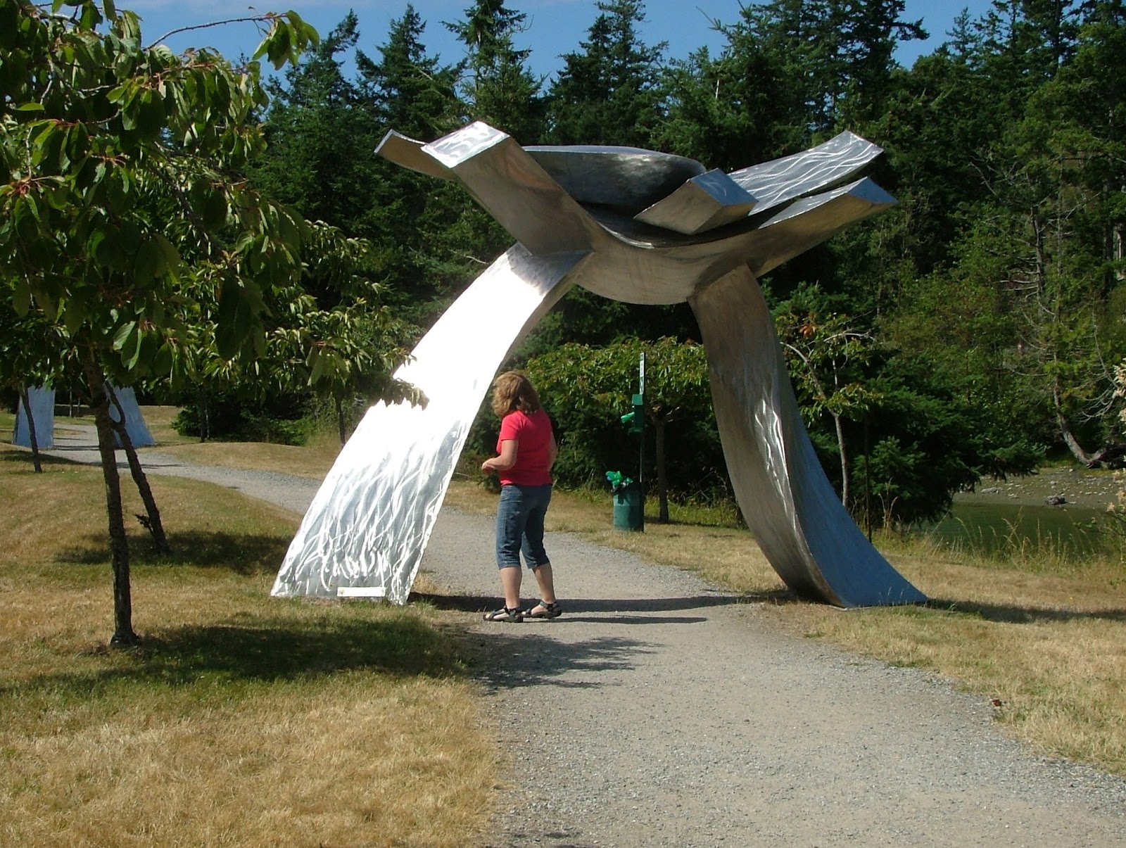
One of many artworks and sculptures at Roche Harbor
Roche sculpture along foot path by county dock

Crowded 4th of July at Roche Harbor
More sculpture

No rust, must be stainless steel.


Seeing a price tag with a sculpture brings out the art critic and connoisseur; feel free to purchase.


We finished the cruise with a stop over and hike at Stuart followed by a hot dog roast and  windy night anchored at Jones. 

The next day we ran over to hike and sail Sucia where we spent a  rather noisy evening at the dock on Fossil Bay.

 The fourth day, after a quick hike on Matia, and a drive by of the salmon pens at Deepwater Bay (Cypress), we were back at our slip in La Conner.


This was a pleasant, low key enjoyable little trip of about 110 miles.
(I really like my new laptop gps)  read about laptop gps here
BTW, the news Wed. night (three days after arriving back home) was that one of the 85 foot for sale yachts we were all ogling on the fourth burned and sunk at the dock at Roche.  It's really shocking (a little scary too) to see news pictures of a yacht you had just admired, and now sunk with just its charred stern above water next to the dock.


Click below to see a satellite view of Roche Harbor

Jun 24, 2013

How Long is Your Painter? Does it reach all the way to shore?

What is a Painter anyway?

You know, that short little rope tied to the front of your dinghy!

Echo Bay on Sucia Island

This may look like an unpleasant circumstance waiting for our return, but it is exactly what we planned.


Let me explain.  When we arrived many hours earlier at a much lower tide, we beached the dinghy and walked away just like so many other times. Knowing the rising tide would float our boat, and we were going for an all-day hike I ran my line up to the permanent driftwood pile, above the high water mark.

  It's true the dinghy will eventually float free and may wash up on shore, but the weather is fine and wakes are frowned upon in Echo Bay.


If I were really worried, I could have deployed a light anchor that does not dig in, then when we returned, I would have simply hauled it all to shore, dragging the anchor with it.

So what, you might say?

The point is, when you outfit your shore boat, you should anticipate needing a really long rope just in case you need it. My current dinghy has a fifty-foot floating line, and if I can't reach something solid, I go find a dog-bone-shaped rock and carry it to where I want to tie up. Some skippers carry a small dinghy anchor and rode, then simply carry it up the beach. And some carry their dinghy, but we don't anymore.

Having your dinghy float away doesn't always mean you will lose it, forcing you and your crew to swim out to your boat.  In popular anchorages, someone will probably come to your rescue.

Now, this next point is very important.  Conditions at the shoreline may change from flat, glassy water to two-foot waves in just minutes. A far-off storm can send waves your way, or a ship may pass by. The resulting pounding waves may flood your dinghy or seriously damage it.  With this in mind, there will be times and places where you should carry your dinghy up the beach to safety. It is very reassuring knowing your shore boat will be there waiting for you when you return.


Click below to see a satellite view of Sucia Island


Jun 23, 2013

How to launch at the Port of (fill in name) and the importance of having alternate plans

What is the best way to make a San Juan Islands boat trip?

How about some tongue-in-cheek answers:
  • Never pee into the wind, check.
  • Never tug on Superman's cape, check.
  • Never buy a lottery ticket for an investment, check.
  • Never say never, check,  err-uncheck, err? 
  • Never depend on the marina, check, check, and double-check.

Kraken on way to San Juans
Rest stop on way to La Conner for launching, and then on to the San Juans

In preparation for this season's cruises, I called ahead to the Port of Skagit County in La Conner to arrange for a travel lift launch. 

 Good news, I'm told by the very nice lady on the phone, "We have a forklift that lifts 11,000 pounds, and we are open until 6:30 pm."  Okay great, I'm thinking, we can get there around 3 pm and we only weigh 8500, perfect, oh yeah, how much?  "Only $20 or $25 if they have extra work."  Fantastic, for only $25, I don't have to dunk my trailer brakes in salt water. This is too good. (and it was)


Reality, or what really happened:
First the ports forklift  can only lift 5,000 lbs, and they didn't want to even try.  Second, they don't have a travel lift, but a  light duty overhead tram with a sling, and again they would not try.
My options are -- go away.


Next, at 3 pm we parked on the main drag outside the still-open La Conner Chamber of Commerce, where I asked about private boat yards and was supplied with the telephone numbers for two marinas with big travel lifts. A quick phone call determined both businesses were willing to sling my boat for about $125 if I came back tomorrow.  I begged for compassionate emergency service, explaining I just drove for six hours depending on the port's promises only to hear, "Do you want to reserve a slot tomorrow? We have customers today."  "No thanks," I said.


Plan B, we quickly drove over Rainbow Bridge to Shelter Bay Marina to check out the boat ramp, only to find it high and dry with a falling tide that still had two more hours to go.


Plan C, we quickly drove back over Rainbow Bridge to the La Conner city ramp located almost directly under the bridge. 

 I asked a fisherman, who was fueling his boat out of a tank in the back of his pickup, how far the ramp extended. "To the end of the dock," was his answer.  Keeping in mind the tide was falling, I went to the far end of the float and, with a boat hook, began probing six feet down while moving up the ramp. Once, many years ago, I backed off the end of a ramp, dropping the trailer about two feet, then it got hung up on the end of the concrete. So, better safe than sorry, now I always probe or somehow determine I will have plenty of ramp under water.


With about two hours of falling tide water still ahead, a thirty five foot trailer and boat, a thirty foot float with a six foot depth in the middle, fours hours of daylight left, I said lets launch, and began rigging fenders and dock lines while the fisherman finished filling his boat with fuel.  When his pickup cleared the single-lane ramp, I backed down, and she floated free.  Five minutes later, my rig is locked up and parked in the city-provided spaces, and we are on board, motoring towards our waiting slip in Shelter Bay.


Total cost - launching and parking, $2.50 per day. Total frustration - not too much.
There is no moral here. My advice as always is, give yourself plenty of time for plans B, C, D....
BTW, I spent a full hour hosing and flushing my trailer with fresh water after retrieving it from the ramp parking lot later that day.
In the fall I will likely reverse the procedure, but try to do it near high tide.
I will probably mention something here unless it is really boring.


Click below to see a satellite view of Deception Pass and Cornet Bay launch ramp

Jun 12, 2013

Where is Cypress Head Campground and why should you camp there?

    Cypress head is on the southeast side of Cypress Island in Bellingham Channel.    

There are quite a few campsites and trail access to all of the Cypress Islands trail system.

With a cove on both sides of the head, you should be able to find some protection when anchored in one or the other.

Cypress Head campground, cypress Island with view of Bellingham Channel

Cypress Head campground, cypress Island with north view towards Lummi Island

Cypress Head campground, cypress Island cliffside gravel campsite

The camping sites at Cypress Head have the best view I have ever seen, but exposure to wind goes with the view.

Cypress Head campground, cypress Island anchor buoys

One side of the head has mooring balls, the other side nothing, but I would choose the side without a swell for an overnight visit.

 Cypress Head is on the east side of Cypress Island on Bellingham Channel.  It is a short kayak paddle from Guemes Channel or Washington Park in Anacortes

For those with an aversion to crossing Rosario Strait, Cypress Head, Pelican Beach and Saddlebag Island are your go-to choices.

Jun 8, 2013

What can boaters do when faced with persistent San Juan Islands fog and Rosario Strait must be crossed?

     The easy answer is to wait it out, but simply going around Cypress Island works well, too.    

persistant fog bank blocking Thatcher Pass

This is a view down Guemes Channel across four mile wide Rosario Strait at what would be Thatcher Pass if you could see it.


That wall of white is creeping up the tip of Cypress Island.
You can navigate through the soup and wonder about ferries or turn like that cruiser did, and run around

 behind Cypress Island to cross Rosario Strait over to Peavine or Obstruction Passes.

 The detour adds only a little bit of time and three miles extra travel, but misses today's fog bank. This is a common situation. Further south at Lopez or Cattle Pass, or Deception Pass, it will likely be the same.


Here is a link to a foggy article that may enlighten some > Dealing with fog in the San Juans


Jun 5, 2013

Some pictures to Share to make you smile

      Ready to Drop Anchor?    A Photographic Tour of the San Juan Islands  and some others!     


Rainbow outside wheelhouse
Kind of a miserable day but a bright future

left side
right side
new Canadian family on the move
Family out for a cruise


More cruising pictures worthy of viewing - click here > Lots of great San Juan images

May 30, 2013

Does the law require non-swimmers to wear life jackets (pfd) in the San Juan's - No it does not, but some folks on some boats must wear pfd's.

       What is required is not what we see every day on the water.  We have all seen bad boating habits and know the sometimes, tragic results.     

Oh boy, let's argue.

                  Seriously, you should be conversant with and follow PFD rules; they make sense and save lives.  

This article is a semi-non-serious look at the actual usage on board cruiser vessels.

        First of all I'm not trying to make an argument but make a point of different thinking. (just for fun)
Here goes -

        If, and I mean if only one life jacket is worn on board, most would say it should be worn by a clumsy non-swimmer because they will most likely need it.  I don't challenge that, but -

. In this intellectually challenged exercise I suggest that the one and only life jacket should be worn by the most capable person because no one else on board is likely to be able to save him.
       
             The most capable person will have to save himself when no one else is able, hence, he should wear the life jacket.  Because >> When the most capable person is gone the rest may perish, when the most capable person needs help, who will help him? So, with this way of thinking, we must preserve the most capable so that the less capable may then be helped.

       Was that clear? OK, try this scenario  -- The capable skipper gets knocked overboard (crazy crew screws up) and is unconscious in the water without a pfd.  By the time the clueless crew can recover (if ever) him/her, it's too late.    Now, the remaining persons on board are at greater risk without the numero uno.

        Next scenario  --The clumsy, helpless crewman trips and goes in the drink without a pfd. The immensely capable skipper springs into action, rescues the klutz in minutes, and saves the day.

        My backwards conclusion is that in the first scenario the skipper may have survived had he been wearing the only pfd, but the klumsy klutz crew probably would have survived without a pfd due to the skill of the skipper.


        What! What is he suggesting, that the skipper gets the only PFD? Outrageous! Blasphemy! What about the Master's responsibility to ship, crew, and passengers - Keel haul the laggardly sot.

      On a serious note:
        Look around the docks where all the boats are coming and going, and you invariably see the women and children  (even pooches) bundled up in the latest good-looking approved flotation apparel. Makes sense, right? - save the hapless and helpless from succumbing to a maritime accident lurking around the next slip or piling. Look closely and many times you see the person stepping (we never jump do we) from boat to dock or dock to boat, handling lines, pushing off, keeping track of passengers, other boats, etc, etc, is not wearing a pfd. All the passengers that are seated and doing nothing are properly belted in, but the one person really in harm's way, the one person all others depend on, the one person the others may not be able to save, is not wearing a PFD at all.

       I need to end this tirade by saying that simply having PFDs on board may keep the regulators happy, but won't help the unfortunate skipper over the side, while his helpless family watches him struggle.

        There are certain times (docking-working on deck) when all crew and skipper should be wearing safety gear - and that is just good seamanship.

Sobering thought!
discussion for wearing pfd's


Click below for a satellite view of Port Townsend

May 27, 2013

How many Anchors do you need for cruising in the San Juan Islands when Visiting the Marine Parks?

      The quick and easy answer is, "You need the same amount anywhere you go."    

No help so far, okay, let's talk about a scenario that could be any of us.

You arrive at your first night's anchorage, a quiet little protected bay with a rocky bottom.

What a great vacation, hot dogs over a campfire onshore, some wine or beer, a really restful night's sleep, rich coffee in the morning, and then when you try to raise the anchor, your hooked to the biggest rock in the world. After hours of pulling from all directions, you finally give up and cut the line, ouch, 250 bucks worth of anchor and rode, gone.  Oh well, you're not going to let a lost anchor spoil a perfect vacation and off you go to the next idyllic spot in the San Juan's.
Now it really hits home, the dock is full, no one offers to or wants to raft your boat.  So you think, that's okay, I'll just go ashore in the dinghy, find an anchor-shaped rock, bring it back to the mother ship, and tie it to what's left of the cut rode. Except the rode is too short, and you need to stay on board to keep circling in the boat because no one in your crew (wife and children) is qualified to run the boat while you're rock hunting.  So your current ex-spouse rows to shore, and .... see where this is going?


What should happen is you break out a spare anchor and rode that's stored and ready to deploy once you tie off the bitter end.

  Your admiring first spouse and children think you're a hero.


OK, dinghy scenario.  Your youngest children who have just mastered rowing are off somewhere nearby while you snooze or read a book.  Little do you know, but they just lost both oars, and the wind is quickly
Click below to read more

May 6, 2013

Solo Circumnavigation Under Sail Without an Engine No Less

     It's true—I have officially joined the ranks of solo sailors.     

But before my head swells too much, I must admit my grand voyage was merely a circumnavigation of Coon Island. Still, I did it solo and without a motor.

I cast off that melancholy mid-morning, just after breakfast, heading south. Almost immediately, I was met with a 1.5 mph adverse current that began dragging me backward. Fortunately, my 30-year-old, new-to-me 9.5-foot sailing dinghy performed admirably in the light airs, overcoming the current with ease. Soon, I was past the point of no return, rounding the tip of Coon Island while carefully avoiding the sunken breakwater barge.

Once around the point, my trusty vessel was suddenly caught in a swirling vortex that might have rattled a less experienced sailor.

 The tiller went unresponsive as we spun through several dizzying 360-degree turns. Desperate to regain control—and trying not to get clocked in the head—I used my free hand to tame the boom and backwind the mainsail. At last, we broke free from the barge’s swirling eddies and were off, rail down, on three or four swift tacks along the island’s western edge.

Just minutes after breakfast and with no food or water aboard, I was already nearing my final turn. Ahead lay a telling downwind romp back to the dock I had departed from a mere 1,500 seconds earlier

 Easing the mainsheet and slacking the outhaul, there was nothing left to do but bask in well-earned glory as I coasted toward the dock from the opposite direction of my departure.

As I handed my dock line to an admiring power boater, I was met with a warm greeting:

"I see your problem—you’ve got a loose nut on the end of your tiller."


One of two Coon Island floats, on shore are composting toilets, shelter, fire rings, and a few campsites.

       Coon Island is in the Multnomah Channel, a side shoot off the Columbia River. The entire half-mile-long 23-acre island  is a county park  (JJ Collins Marine Park)  and my favorite place to overnight near my home in Portland.


       Now that I have become infected with the circumnavigation bug, I am setting my sights on bigger and more challenging goals. This summer in the San Juans I will attempt Jones Island on July 5th, but I'm not promising any biggies such as Sucia, and of course, Orcas is just a dream for my 9.5 sailing dinghy. (Maybe for Orcas, I'll bring my 2.5 hp Suzuki kicker, and a sandwich)
Loose nut indeed!
the rest of the story (I've sold the sailing dinghy and why I did it)


Apr 16, 2013

What is "Current Set" - The San Juan's and Puget Sound are full of potential Catastrophes - Ignornace is Bliss

     "Current set" is the direction water is flowing, and not paying attention to the current set can bite the unwary.         

Boaters deal with currents all the time, especially around docks, floats, pilings and buoys.  But we tend to ignore or not be aware of the current set out in the straits and large water bodies.  

  Is it really a close call if you don't know about it?  If a catastrophe almost happens, is it worthy to note?


        When your boat is drifting towards a lee shore, but still has two hours before running onto the rocks is it a big deal?
      Ignorance really is bliss, that's for sure.


         I don't know how many times I have almost sunk, no one does. "We don't know what we don't know."


      I know this though -- one time in medium fog, slowly crossing Rosario Strait heading into Thatcher Pass, we were all staring out the front and not paying attention to our sideways set (side drift) when out of the corner of my eye I caught a movement that turned out to be rocks coming at us fast. (full flood must have been 3+ knots) The current was forcing us sideways straight onto the rocks of tiny Pointer Island. I swung hard over and pushed her to full throttle, our outboard barely pulled us away with one hundred feet and two or three seconds to spare. I shuddered thinking of my family on board and almost quit boating right then and there.


       Another time, just after leaving Sidney Spit to cross Haro Strait, when suddenly out of the dense fog loomed the green aid marking Mandarte Island.  Once again I had not paid enough attention to the current set and was almost swept onto the rocks.


       And again, once we ran out of gas in the "Narrows," and the current quickly whisked us towards an anchored construction barge under the new Tacoma Bridge.
 Quick action switching tanks averted an unpleasant incident with just minutes to spare.


     So, I have admitted to three times that I know of, where my inattention to currents has almost had disastrous results.  How many more are there that I don't know about? I don't know.


     My problem is, I tend to watch where the boat is pointed or where I want to go and not where we are really going. Of course, being disoriented in fog makes it worse.


     Ignorance is bliss, but it's no way to skipper a boat.


Fast water at cattle pass in the San Juan Islands

You wouldn't cross in front of a ship making 6 knots.
So why pass barely upstream of rocks in a 6-knot current?


Click below for a satellite view of Saddlebag Island State Park

Apr 6, 2013

Roche Harbor 4th of July reservations at the Marina

      Do you need reservations for holidays at Roche Harbor Marina?    

Yes you do, so I will be anchoring along with hundreds of others.

I called the Roche Harbor Master to see if a slip was open for the 4th of July


The answer was NO.
I was told they hold a lottery in February and I missed it, rats.  Looks like I'll be anchoring out this year.

Some marinas have a three day minimum on the 4th
Just thought I would pass this along.
BTW, this was 2013. I imagine 2026 is the same.


John


Click below for a satellite view of Roche Harbor

Mar 20, 2013

Traveling to Butchart Gardens by Boat - Itinerary - Canada/USA Customs - Anchor in Tod Inlet

      What is the best part of cruising the San Juan Islands?        


The best part of cruising the San Juan Islands is the total independence and freedom your boat provides.
  • No reservations needed: No rigid schedule, just drop the hook in a quiet cove or snag a park buoy whenever you arrive.
  • You're the captain: You get to come and go as you like.
  • Total flexibility: If the weather shifts or you just feel like exploring, you can change your plan and head wherever the day looks best.

  After a swift pit stop at the store to grab provisions, we set off, and just like that, the relaxation begins the moment the lines are cast off. Four days, five days, ten days—it hardly matters. Time bends and stretches with the tides, and I leave the world behind in an instant. Well, almost everything. The wine and Hershey bars? Tragically, mistakenly forgotten. But with the wind in my face and the horizon ahead, my thoughts drift only to the simple joy of the journey—unburdened, untethered, and blissfully carefree.

Yet, as any seasoned traveler knows, the best-laid plans are at the mercy of life’s unpredictable whims and, of course, family obligations. Some detours are mere nuisances; others, unavoidable. And sometimes, they come with a lesson in patience.

Take, for example, my quest to witness the flag-lowering ceremony at Roche Harbor—a seemingly simple ambition that took me four years and three thwarted attempts to fulfill. One year, I missed the cruise entirely. Another time, just minutes before the cannon signaled sundown, a wayward boat dragged anchor into us, throwing my evening plans overboard.

When I finally did witness the ceremony, it was purely by accident—I had long since abandoned the notion of seeing it firsthand. And so, as the baby cannon, a miniature yet mighty relic of medieval artillery, erupted into the evening air, it caught me utterly off guard. A fiery muzzle flash illuminated the perfectly manicured lawn, and before I knew it, a startled yelp may or may not have escaped my lips—not that anyone could hear it over the booming report. The sound wasn’t quite deafening, but it was certainly enough to send my heart into a gallop.

Then came the echoes, rolling like thunder across Roche Harbor, ricocheting off Henry Island, and sinking any evidence of my momentary shock. In the end, the ceremony was every bit as grand as I’d imagined—perhaps even more so, given the journey it took to get there.

Yes, cruising the San Juans is all about freedom and relaxation.


click below to read about Butchart Gardens!

Jan 24, 2013

What is the Cheapest Chart Plotter Available - My new laptop GPS is awesome and not expensive

        The less costly of anything is what you already own.     


That kind of thinking is how your home laptop becomes a new gps and plotter. Plus, now you have a really large screen compared to the costly units at the marine stores.


Not too long ago, I posted that I needed a new GPS, but couldn't remember why I needed a new one.  Sound familiar?

(update) I remember now, the cursor quits moving while it redraws charts, and sometimes it takes a while to catch up, so it's not really broken just too slow.

        Anyway, I've been shopping gps units and have been shocked and irritated at the manufacturer's high prices and total arrogance.


This is the way I see it! 

  • They sell us a product that does the same thing a highway unit does (mostly) for ten times the price. 
  • They then make us buy maps separately because the pre-loaded chart shows the shoreline as a straight line, and small islands are skipped completely. 
  • Then, to top it off, they quit supporting (selling chips) for older units, forcing us to buy all new stuff and start all over again.

And the stuff they make us buy is all in one units called mfd's (multifunction displays) as if giving it a fancy name makes it a good idea.  

  • Well, most of us have tripped and broken a few eggs, and when they are all in one basket, you know what happens.  If that was too to hard grasp, it means they all broke. It means when your MFD quits, you have lost your gps, your sounder, maybe your compass, certainly your chart. Why buy a paper chart when you have a  $5,000 chart plotter? Oh yeah your knot meter too, but who cares how fast you are going when you are lost. Did I mention radar, yeah, for another 5k+, you can get it in the same basket.

  • They're laughing all the way to the bank while we just gobble up their over priced dumb products.

And this is what I did:

  • I bought a GPS antenna (usb) and chart plotter program for my laptop, total cost $99.  Of course, I already had a  $350 lap top  with a 15 inch screen BTW. (awesome detail)

It came with a DVD with every NOAA chart published

  • Every chart is the most recent, updated published
  • It works great and has all the details the others choose to spoon-feed us $350 at a time because NOAA is where the charts come from in the first place.
  • As a bonus, I got chart number one (free online anyway) just a click away as well as tide prediction, coast pilot, all part of a full feature chart plotter navigation suite.
  • And even better, I have a copy loaded onto  my home   computer  with  a    27 inch screen so I can cruise around when I'm not on the boat.
  • and if it quits, I can send it back to Dell (the laptop) or pick up a new one and load the program on as many computers as I want
Now here's the downside: (none) okay, it is not 3D.
  • I still need a separate sounder. (Have two, that's a good thing)
  • and a standalone compass. (got it) Another good thing
  • I'm afraid I will be keeping my charts handy in case my laptop screen goes blue or battery goes dead. 
  • Redraw times are instantaneous, darn.
  • I still plan to keep my handheld ( you know, eggs in a basket and all).

I'm worried someone will break into my boat, thinking I have a fancy chart plotter hidden away.

  • I won't have any discontinued phone numbers for shore-side businesses in my expensive discontinued chart plotter.
  • I'm sure there must be more negatives.
  • OK, here's one:  my laptop is not designed for saltwater use. Hmmm? you know it cost $350, and that's not counting converting to boating units. (I think the boat unit conversion is multiply  7X, or is it 10X?)

Installation was a snap:
Just plug in the usb antenna and set on the ledge by the window, open the laptop, and power up.
In about five seconds the red menu box turns black, meaning satellites are detected and locked on.

One last point:
It works while in the car, but there are no detailed highway maps, only main highways on charts. I guess NOAA figures boats will stay in the water.

        I am really excited about this new toy (I mean tool)(nav aid)(gps)(chart plotter)
$99 chart plotter,  that's less boat bucks  than, than, than, well it's less than anything I can think of except an LED bulb I just bought for $ 8 plus shipping.

 I think you can download the SeaClear program for free if you're tech-savvy. (I bought what someone had put on a disk)
http://www.sping.com/seaclear/

Update: I have switched to a different FREE online program called "openCPN." and still use my $19.99 usb antenna. It works fine and I am a happy camper again.


Click below for a satellite view of Cap Sante, Anacortes


Jan 12, 2013

Radio Use - call letters for fun and amusement


       Just for fun I've copied some of those letters and words the experts use. You know the ones we can hear really clear so they don't need to spell it out, but do it anyway!


BTW Sailing the San Juans is alive and well but it's January and 22 degrees outside right now.


PHONETIC TABLES
For the pronunciation of letters and figures by radiotelephony or by voice over a loud hailer.
LETTER SPELLING TABLE
Letter Code Word Pronunciation
A Alfa AL FAH
B Bravo BRAH VOH
C Charlie CHAR LEE (or SHAR LEE)
D Delta DELL TAH
E Echo ECK OH
F Foxtrot FOKS TROT
G Golf GOLF
H Hotel HOH TELL
I India IN DEE AH
J Juliett JEW LEE ETT
K Kilo KEY LOH
L Lima LEE MAH
M Mike MIKE
N November NO VEM BER
O Oscar OSS CAH
P Papa PAH PAH
Q Quebec KEH BECK
R Romeo ROW ME OH
S Sierra SEE AIR RAH
T Tango TANG GO
U Uniform YOU NEE FORM (or OO NEE FORM)
V Victor VIK TAH
W Whiskey WISS KEY
X X-ray ECKS RAY
Y Yankee YANG KEY
Z Zulu ZOO LOO
Note: The Boldfaced syllables are emphasized.

Now for fun, spell out your boats name and say it loud and clear as if your  ( Alpha 
Sierra Sierra )  was on the line.
 Our current new old boat is  >>> Kilo-Romeo-Alfa-Kilo-Echo-November
What's yours?
If mastering radiotelephony talk was easy - try using flags!


Click below for a satellite view of Spencer Spit State Park

Dec 31, 2012

Sobering thought worth thinking about

 Are boating or cruising accidents in the San Juans avoidable?

Yes, accidents don't just happen, acts of god happen.  In boating, operator error is a major offender.

Common mistakes:

  • poor decision-making due to inexperience
  • inadequate knowledge of the area
  • failing to understand currents and tides
  • alcohol abuse
  • operator inattention or distraction


Disaster narrowly avoided:

Crossing Rosario Strait and heading into
 Thatcher Pass

We were all staring out the front and not paying attention to our sideways set (side drift) when out of the corner of my eye I caught a movement that turned out to be rocks coming at us fast. (full flood must have been 3+ knots) The current was forcing us sideways straight onto the rocks of tiny Pointer Island. I swung hard over and pushed her to full throttle, our outboard barely pulled us away with one hundred feet and two or three seconds to spare. I shuddered thinking of my family on board and almost quit boating right then and there.


While we’re talking currents, I am sure you know that your boat will be dragged sideways whilst you drive forward when crossing a channel or fast water. 

 It is very easy to not pay enough attention to the currents “set and drift” and what’s on the side of your boat.

 Let’s put it simply, if you’re driving forward and looking forward, you will miss what you’re actually heading for sideways.   It is easy when close to hazards to allow yourself to be dragged into them because you are looking where you want to go, and not watching where you are really going.    

  Disasters take only seconds to happen.

I have located Pointer Island in Rosario Strait below. The link will take you to it and show you where we would have been.


Dec 9, 2012

What Does Stuart Island Have to Offer the Boating Traveler?

       Stuart Island has more to offer than the typical San Juan Island destination    

Discover the Unique Charm of Stuart Island

  • Bicycle the Island Roads: Explore the island's scenic countryside
  • Camp on Shore: Stay at several rustic campgrounds.
  • Reid Harbor: Camp, anchor, or tie to the dock.
  • Prevost Harbor: Camp, anchor, or tie to the dock.
  • Short-Term Docking: Use the county dock for quick visits.
  • Turn Point Lighthouse: Hike to the historic lighthouse and visit the museum.
  • Pioneer History: Visit two historic schoolhouses.
  • Local Souvenirs: Buy T-shirts at Boundary Pass Traders.
  • Orca Watching: Spot whales from Turn Point.

If you can find the time to visit Roche Harbor, then you can certainly pop over to Stuart, less than four miles away.

,


Click on the link below, then scroll  way, way, way, down to Stuart Island for details, a chart, and photos of Stuart Island


Take this link to the parks page


Nov 18, 2012

Bowman Bay, Sharpe Cove, and Rosario Beach at Deception Pass State Park are not a drive-by dock on the way to the San Juan Islands

    Where is Rosario Beach?    

Rosario Beach is inside Deception Pass Park. For many boaters, it's simply a drive-by place because it's on the way to somewhere else.  

 Lots of boaters know where Rosario Beach and  Bowman Bay are located, but just go right on by without stopping.

  It's an easy place to skip because you're always on your way to somewhere, somewhere else. Most of the time, for us, we're heading through Deception Pass and then onto the San Juans or going the other way with La Conner, or Puget Sound in mind.  With this knowledge, we decided to make Bowman Bay our primary destination. We would spend a night or two, explore the anchorage areas, hike the trails,  have a campfire if possible, and see what the place has to offer.

Dock at Sharpe cove in Bowman Bay
This tiny spit protects and marks the far end of Bowman Bay, although on the chart it's listed as Sharpe cove. The reflection is terrific, this view is the payoff when going ashore sometimes.

          For starters it offers Deception Pass with fantastic scenery as your constant backdrop, how can you go wrong?  On this mini cruise we timed our arrival at the pass so that we would not encounter opposing  current and have a window all afternoon to make it through.  

Our partially disabled boat pushed by an outboard (get-er-home kicker) had a top speed of 5 mph,

 so once committed to shooting the gap so to speak, we knew we weren't coming back, at least not for awhile.


Bowman Bay trail in deception pass park
The trail runs along the shore for all of Bowman Bay, or you may hike up to the bridge and beyond to explore the rest of Deception Pass Park

Bowman Bay is part of Deception Pass State Park.  It's on the outside of the pass, on the north side of the bridge,

 so this means it is subject to the whims and tantrums of the Strait of Juan De Fuca. To clarify -- fog, waves, and swells may be part of the cruise, but on our visit, flat waters and lots of balmy sunshine were the order of the day.


The bay really consists of two distinct areas, the farther in more protected waters are opposite the campground and offer a half dozen or so anchor buoys just a dinghy ride from shore.


At the other end of the bay is a nice but smallish float hidden and protected by a little hook of a point. (Sharpe Cove) We chose the float so we could easily access the park bathrooms and walk to the beach for a campfire. To make room and keep our 5 1/2 foot keel out of the mud, we tied up with half the boat hanging out past the end of the dock.


From our float location, we walked all the way to the other end of the bay and out onto a grassy knoll called Lighthouse Point (there is no lighthouse, but there is a flashing green 4s nav aid)  for a fantastic view of Deception Pass and the bridge.  The hike took several hours and we were suitably tired afterwards, but this was by no means a tough or experts-only hike. The only comment I want to offer is to be sure to give yourself enough time to enjoy, explore, and get back before dark. There are a few spots you don't want to try without a flashlight if it gets dark on you.


Bowman Bay in Deception Pass Park

The wharf is for walking only, no boats may tie up. Anchor buoys are beyond wharf, campground is to right. (I think the wharf is headed for removal and may be closed)


Deception Pass bridge from Lighthouse Point

From Lighthouse Point you can see that the Deception Pass bridge is really two bridges with Pass Island in the middle. Because of its S curve shape, narrow Canoe Pass on the left is all but invisible, but still easily navigable during slack water if you are a thrill seeker.


Deception Island from Bowman Bay

This was taken from the campground at Bowman Bay looking out at the Strait of Juan De Fuca. That  far off woodsy bump in the middle is  Deception Island.  Sharpe Cove with its little float is around the small point on right side. Rocks out there are charted and  easily avoidable but must be respected.


Lottie Bay in Deception Pass park

It's hard to believe that the still and reflective waters of Lottie Bay are only a third mile from Deception Pass, and no you should not bring your boat in here, dinghy or kayak yes - but not your deep draft yacht.


Maiden of Deception Pass, Rosario Beach, Sharpe cove, Bowman Bay

The Maiden of  Deception Pass is as much a landmark as carved wood can be and is located at the top of the gangway leading from the float at Sharpe Cove.  Beyond is Rosario Beach famous for tide pooling and driftwood.


Strait of Georgia
On a clear day you would see Vancouver Island, but this wasn't bad.

In the morning after a leisurely coffee and stroll exploring the tide pools on the Rosario Beach side of the point, Linda contemplates, what I don't know. The tide was rising and the current at the pass  would be flowing inward for several hours.  

We reluctantly cast off and steered into the current. In minutes we were under the bridge and on our way to our slip at Shelter Bay in La Conner, and then home.  Bowman Bay is no longer that place we just fly by on our way to somewhere else.


Click below for a satellite view of Deception Pass and Sharpe Cove 

Nov 9, 2012

Submarines have right of way! And the Coast Guard the Navy and anyone with big guns

Who has the right of way in the San Juans?

  • Ships
  • Bigger boats
  • Coast Guard
  • Submarines
  • The ones with the big guns


Cutting across the entrance to Hood Canal  on our way to Port Ludlow we were suddenly stopped by Coast Guard and Navy patrol boats. 

 They were all business insisting we stop and wait, the submarine soon came by at about 10 knots, all the the while they kept the patrol boat between us and the sub as if we may be a threat. (or they were camera shy)  We were almost becalmed, barely moving but they told us to furl our sails anyway.


The sub had 12 to 15 boats running interference for it as it headed out. All done very efficiently.

BTW afterwards from somewhere, we got hit with a shockingly big big wake.

 Notice the jib sheet is hooked (again) on the handle bars. What a pain that was.


Crossing paths with a submarine was an unexpected treat. The next day we cruised up Hood Canal past the Navy base but failed to see anything worth reporting except maybe a huge sign saying "lethal force authorized".  We kept our distance.


Click below to see Port Ludlow satellite view