• Navigate with Confidence
    • • Plan your route and itinerary
    • • Use tides and currents to your advantage
    • • Explore Marine Parks
    • • Discover boat-in spots from Sucia’s anchorages to the trails of Stuart and Jones Island
    • • Experience the Islands
    • • Visit bustling Friday and Roche Harbors
    • • Find serene, secret coves • Your adventure begins now!
New Feature
Below every post is a satellite view hot link - You may drag image to your area and/or
use the plus button to zoom in all the way or click street view when enabled.

++++ ============================= All Posts Below

Current Posts Below
Note: The first few posts below are for first timers and stay on top — New posts are scattered throughout the website — use the search box or look in archives on the left side to find your interests

Apr 5, 2014

Practicing What I Preach

What is the best plan for a San Juan Islands Cruise       


 One way to plan a cruise to the San Juans

     Many times on this site, I have suggested that the most important planning thing to do is set a date, and the rest of the cruise will come together, that philosophy has not changed.  But that doesn't mean you can ignore important details, expecting them to magically fall in place.  Someone still has to grease the wheel bearings, apply for passports, order techie toys, and mow the lawn.
     
      
       So, we put the big X on the calendar, and the plan is evolving. I can't believe I used to actually stress over vacation details.  I wonder if I should enter the blind dinghy race on the day of the 4th.  hmmm!
     
     Just put a big X on the calendar and then sit back and let your cruise plan unfold (bad word choice, sounds too much like unravel) just sit back and let your plan develop.  In our case, with some prodding (one poke) from my oldest daughter, I agreed to go to Roche Harbor for the 4th of July.  No big X date on exact arrival but the 4th is the 4th, so I figured  we would arrive in the general area a few days earlier.


     Now, some months later,  the plan is starting to come together.  I have a day planned for bike riding on San Juan Island.  I have a  campfire night planned on shore at Jones for smores and hot dogs.  I have a toss up day to get Ice Cream at Blakely's or Friday Harbor, and it looks like if I can make my Livingston Dinghy sail properly, I will have the day of the 4th to sail around Roche Harbor, dodging anchor lines and other dinghies.  Yesterday, another daughter announced she and her friends had camping reservations on San Juan Island, also over the 4th of July, and that I could give her, her friends, and their bicycles a ride over to Lopez on the 2nd, and then they would ride the ferry back that evening.  The plan for Saturday after the 4th is still open, but I know it will fall in place just like always.


       So, we put the big X on the calendar, and the plan is evolving, as I said, I used to stress over vacation details. 


Just in case someone needs an exhaustive checklist to stress out over when making plans, take a look here.

Cruisers - Mother of all Packing lists!   <<< click there


Mar 29, 2014

A reminder for me again! Murphy's Law!

     What can go wrong on a San Juan Islands cruise?        

My dinghy, just like many others is mounted on snap davits across the transom and stood on edge for travel. 

 This has been my preferred system for many boats and even more dinghies. To tilt and raise the dinghy up and out of the water I have two nylon lines attached to cleats on the far side.  I wrap one line around each wrist and then with a heave, I lean back and pull the dinghy up onto its side. Next with the dinghy balanced in a somewhat neutral position I carefully tie off both lines by wrapping around the stern rail and back to the dinghy cleat.  For lowering the dinghy I wrap the lines several times around the rail creating a friction brake, then effortlessly let out enough line to set her back in the water.


   So far so good, but here's the reminder part. Last week while lowering the dinghy, my cleated lines somehow became loose, I didn't see it in time and the dinghy fell without any braking wraps. I had one hand on a line but was unable to hold it, so it whistled through my grasp taking with it a bunch of my flesh leaving me with a painful rope burn.  To  add insult, after the dinghy fell I discovered my oars were about to slide out of their poorly knotted  lines as well. Some regulars may remember these are the same lines I managed to wrap around the prop at Jones Island last year.  I'll save the procrastination post for later.


     There are lessons and reminders here.

  • Even though I think I tie great knots and cleat well, I failed.
  • I should have a redundant tie off system.
     This experience got me thinking, what else is about to trip me up?
  • loose bolt/nuts
  • cotter pins not spread enough
  • zincs, corroded fasteners
  • belts, hoses, clamps, 
  • electrical connections, battery condition/quality
  • are my flares expired, where is my whistle?
  • anchor shackle pin seizing wire
  • fuel system, (this is a big potential problem area) fuel stabilizer 
  • waste system (that reminds me, I think the vent is plugged)
  • fresh water chlorination, (oh yeah, forgot that too)
  • diesel exhaust smell in the clothes closet, still not addressed!
  • hatch seal
  • dock lines are still a mish mash of old ropes and  one fender is flat
  • telescoping boat pole is jammed at five feet

I put this list together in a few minutes, so there is plenty I missed.
No preaching this time,  I have some things to take care of.

Feb 15, 2014

Understanding the Rule of Twelfths Formula for Tide Predictions in the San Juan Islands

How does the rule of twelfths work?


"The Rule of Twelfths"

I have read this little tool rule many times by different authors and each time have come away confused and surprised at how such a simple idea can come out so convoluted and nonsensical.

 I wrote my clearly understandable version below and tried it on Linda who knows and understands the rule only to hear  "Your writing is  confusing, why did you say tidal range?"

Using the Rule of twelfths when anchoring
phooey

"The Rule of Twelfths"


 First, lets think in terms of where we will apply this tool.  For me it is when I need to anchor and I don’t know how far the tide is going to drop or rise.

  Will my keel touch bottom in two hours, will the anchor drag while we sleep?  These important questions need answering before setting the hook.


       To employ the rule you must know some approximate facts first. 

#1, what is the tidal range in the area, ie. if the tide book states high tide is 8.5 feet and low tide is 1.5 feet, the total range the water rises or falls is 7 feet. As you know every day is different and varies by area so our first fact is just an approximation.  #2, we need to know what time high or low tide is forecast.  These two facts are all we need to know and we can arrive at the anchorage and make a good estimate of what to expect.


       Most areas have a six-hour duration from low tide to high tide so we need to think in terms of six one-hour segments.

 During the first hour, the water rises or falls slowly. During the second hour, the rise or fall picks up speed.  During the third and fourth hours, the water is moving at its fastest rate, and the fifth and sixth hours are slower and mirror hours one and two.  That’s the cycle that is repeated regardless of area or total range.  Slow at first, picking up speed, very fast, then slow down, and come to a stop, in six hours and then repeat.


       So now we have a six hour period broken into one-hour segments,

 it’s time to assign a value to each hour and the following is the backbone of the Rule of Twelfths  123321, (each number represents one hour) yes they do add up to twelve. In the first hour after slack water, the water will move 1/12 of the range, in the second hour the water will move 2/12 of the range, or double the first. In the third hour the water moves 3/12 of the entire range. So this means that three hours after slack, or three hours  before the next slack, the water has moved a total of 6/12 or halfway through its range.  We already know that at the halfway point the tide is moving at its fastest and is halfway in or out, so no surprise there.

  When we arrive at an anchorage exactly halfway between high and low tide, all we need to know is the total range and we can easily determine how much more or less to expect. 

 Where this tool helps most is during the second hour or fifth hour, referring back to our rule of 123321 we see the fifth-hour totals 10/12, and the second hour total 3/12 of the range. By reducing fractions we easily understand that in the fifth hour, the tide has moved 5/6 of the range and only has about 1-2 feet still to go. In the second hour the tide has only moved  1/4 the range and so still has about 4-5 feet to move.


       Armed with this knowledge you can easily determine how much the water will rise or fall and anchor where the depth is best for your boat. 

 So remember 123321 

 and know the tidal range in your area, and what time high or low tide is forecast. The rest is just fractions.


       As a practical matter, I don't park the boat with just a foot of clearance under my goodies unless I have a good reason, such as I'm at a dock at low tide and I know what's coming.

  Swinging at anchor with only a foot to spare is asking for it in some locations. 

 For you naysayers consider what happens to your boat when a big swell comes your way, that's right it is followed by a trough.  Well not only does a one foot trough take away your clearance, but it slams you violently on the bottom to tell you so.


       So, even though the Rule of Twelfths is a fun exercise, and I recommend everyone understand the ups and downs of tides, (ha) I still look for lots of depth at low tide, set my anchors very well, and sleep even better.
Here is a link to the NOAA tide tables  > NOAA tide tables


Click below for a satellite view of American Camp

Feb 5, 2014

My shore power cord got so hot the plastic plug melted and had to be pried off the connection

How hot should your shore power plug get?  

Red flag warning: the plug and cord should never be hot

        On New Year's we went for another cold-weather outing, and the oil stove worked flawlessly now that I know to pay better attention to the burner.


      Now, about the hot wire,  and a warning for all of us who know better.  My 30-amp power plug got so hot that it partially melted the plastic, and I had a really hard time removing the plug from the receptacle on the boat.  


        The heat was caused by two things #1, the plug terminals must not have made a good connection so I'm not getting 30 amps, instead, I'm getting heat.   #2 the electric heater and battery charger in the boat probably combine for too much power draw, and with the cold weather, I'm lucky I caught it before - poof - a different kind of snoot appeared where the boat is/was. My advice to myself is to check both ends of every cable connection for heat. What worries me are the buried connections I can't get to.
Here's proof it can happen  - Clickety click   >>  >>  fire damage

Fire and smoke damage in our San Juan Islands boat

This picture shows smoke damage.  My first thought was that I could simply clean the surfaces.
Think again, skipper -- some surfaces clean really well and some become etched.  Smoke is extremely corrosive, and in a closed boat fire, flames may not be present, but the smoldering fire pressurizes and forces smoke into and behind every nook and cranny.  Nothing escapes, not the field glasses, not the radio,  not the switches or panel or any electrical terminals.
      Within six months of this fire, all electrical switches and contacts failed.  Wires survived, but all had to be re-cut and new terminals crimped.  (The adjuster totaled the boat)
The cause of the fire was an overheated extension cord.  You can see the orange cord in the picture. So regrettable and preventable.


Click below to see a satellite view of Washington Park and Cap Sante in Anacortes


Dec 2, 2013

Thanksgiving cruise - Wake up something's wrong

Do boats need smoke and fire alarms?

I think so.

We went for a two-night cruise in icy weather just before Thanksgiving, and had a great time, well, except for,
        "Wake up, wake up, somethings wrong."
I don't remember much, but I do remember that my eyes were burning, and the cabin was full of nauseating diesel fumes and a light haze, which apparently woke her, so she could wake me.
The emergency was that the oil stove (Dickinson Bristol) was huffing and puffing, sending soot but mostly fumes with every huff/puff out of every crack in the stove.   She said, is that supposed to do that?  Then she pointed and asked if flames were supposed to be shooting out there, down under the oven door by the sheet metal.

I don't know, I said, I just need to go back to sleep.
So, in a blurry daze, I shut the oil valve off and sneaked a peek under the cast iron lid. It still had a flame, the stove was scorching hot,  the insides were cherry red, and soot was built up and hanging in three inch long strings everywhere inside.  I know, I shouldn't have looked because it may have gone up in a ball right then, but I wasn't thinking clearly
I wonder why it was hard to wake me up, was it fumes, low oxygen, or the wine at dinner?
I lifted the lid and looked in the stove the other day, and yep its still a mess.
Later, when I figure out what went wrong and what to do about it, I'll add to this post.
Update 1/3/14
I think the problem was caused by too much fuel and no fan resulting in a too rich burn that sooted up the chimney, ultimately blocking the flue. The solution after cleaning up a huge soot mess all over the decks and cabin and cleaning out the stove passages was to reduce the fuel flow. (this required pulling the stove to get at the valve and was when I discovered a loose set screw) I reset the valve for less flow on low and now monitor the flame plus use the fan  to keep it burning clean.  Over New Years it burned 30 hrs non stop with perfect results.  The loose set screw caused too much fuel, but the real problem was me not turning on the fan to keep a clean burn.  I like oil and pulling from my main tank, but gee whiz what a mess.
Story about a soot belching diesel stove

Update: It's been a few years, I tossed out the diesel stove and installed a Propane unit.  Boy! what an improvement in our quality of life onboard.   I wrote a step by step article on the conversion.  The article is in the do it yourself  page under the boaters' quick menu at the top right side,   or copy and paste this url   https://www.sailingthesanjuans.com/p/doing-it-your-self-page.html

and then scroll to the right spot near the end


Click below for satellite view of Inati Bay on Lummi Island

Nov 19, 2013

What is Proper Dock and Float Etiquette at our State Marine Parks in the San Juan Islands

      Is it okay to raft at park docks? What is the fee?

Rules and regulations - Fees and good manners

We were having a lively discussion about whether a boater should pay .60 cents a foot for their entire boat's length, or just the portion in front of the float. All we managed to do was come up with more unanswered scenarios.


  • If you have a sixty-footer parked at a forty-foot float, do you pay for forty or sixty?
  • If your twenty-footer is forced to hang out ten feet because some lunkhead is hogging the dock, do you have to pay for ten or twenty feet? (Half the boat is probably too much in some places)
  • If a clown doesn't pull down to the end of the float and leaves seven feet of unusable space, forcing you to anchor, should he have to pay for that seven feet he has wasted
  • What if the same bozo parks his thirty-five-footer in the middle of a fifty-foot float and wastes seven and half feet of space at each end, should he pay for the fifty feet he is really hogging?
  • Should the park ranger get involved in policing float etiquette?
  • Is it ok to move someone's pride and joy seven feet without their permission?
  • How about the dinghy taking up space floating at the back end? Should it be counted too?
  • When two comedians are rafting at the dock, and the sign says "no rafting," do they pay 60 cents per foot per boat, or just the dock side boat, or the bigger boat

Seriously though, please be considerate and try to maximize dock space, some of our San Juan floats only hold two boats on each side, and our bigger or littler friends may easily wipe out more than they need to. There is not a boat out there that can't hang out a little at the pointed end, and that may make the difference in getting another boat squeezed in at the other end.  You can be thanked or cursed, you're the skipper.


  • What if a boat's sprit overhangs another's dinghy? Do they split the 60 cents a foot that they are sharing?
  • If the anchor buoy you're tied to and already paid for breaks loose and floats away, can you get your fee back?
  • If a sailboat rafts with a power boat, who supplies fenders?

Full dock at Reid Harbor dock on Stuart Island in the San Juans


Click below for a satellite view of Prevost Harbor

Oct 10, 2013

Deception Pass Whirlpools in your Nightmares, Standing Waves and Currents

    Should you navigate Deception Pass in a dinghy?    

Don't do it without careful precautions and being fully aware.  

 I have avoided posting potentially scary pics.  I don't want people with vivid imaginations to have runaway thoughts and fears.   But recently, I spent half an hour in Deception Pass playing with the currents, letting them spin the boat while we watched whirlpools develop and subside all around us.

      We would run up a few hundred feet and then drift back, letting the boat spin and wander.

       As you know, when the tide changes, so do the pass and the water conditions.  The changes happen in minutes and even seconds, so be forewarned that you can easily get into trouble here in any number of ways.  I'm not going to argue or defend the safety point or even seamanship. Thirty minutes earlier, the water was so nice you could safely paddle a canoe. Thirty minutes later, well, that's another story too.

        My photography skills are lacking and water pics seem to always come out flat-looking so I will describe the picture below.  What you see is a swirling rotation about thirty feet across. Placid, calm water on one side of the swift flowing current is slowing the flow and throwing off one whirlpool after another. The whirls are both big and little and move with the current for about a hundred feet from creation to disappearance.  At this particular spot, there are 3-5 visible at any one time eliciting ewes and awes from us as we yell and point out, especially big ones to each other.  The inner whirl in this pic is funnel-shaped, about 10 feet across and very pronounced, dropping about 12-18" in the center.  The white center is taking in air and continues down under water just like a land-borne tornado funnel.  The wispy white air bubble tail is clearly visible below the surface for quite a distance.

Navigating Deception Pass currents, waves and whirlpools

With the motor quietly idling and the boat drifting we not only watch hundreds of whirlpools form and die but we can hear sucking sounds the particularly big ones emit.  

Of course, the conversation always touches on how a swimmer would be affected, with or without a PFD.  Next comes the kayak and dinghy what-ifs. On this day, a standing wave began to form while we dallied about.


Some standing waves look a lot like a whirlpool on its side, only without the funnel.  You can see the water well up from deep down, roll over at the surface, and then dive back down.  When the action gets severe, a nasty roller just sits there in one spot. If a small boat (kayak) gets sideways in any wave, it's liable to be rolled over, but in a fast-flowing pass, it is best to be somewhere else.

This standing wave was developing unnoticed by us and was still mostly flat.

 As we drifted sideways over the beginning stages, our keel got hooked, and we violently lurched to one side, heeling enough to slide the coffee cups on the table, and snapping my attention back to the fact that we really were in the middle of Deception Pass and should be serious.

Having enough fun and games, and acutely aware that the tourists watching from the bridge were by now probably making bets on our ultimate demise, I pushed her into forward gear, gunned the diesel and made a broad swinging pass back through the standing wave spot, and then for good measure, turned and ran right down whirlpool alley straddling or bisecting every whirly in sight.  An hour later or with storm conditions, the pass may not be navigable, but on that transit, all that happened was a little wake-up action.

Another perfect July day at Deception Pass

Oct 8, 2013

My new Sailing Dinghy is for sale, yes sale, not sail

       Is a good sailing dinghy a good shore boat?    


In my opinion, NO!


Dinghy Shore Boat Lesson Learned!

I was sure this purchase would work out, so sure I was ready to get rid of the Livingston, but Linda said I better hang on to it just in case. She was right, and I'm glad I still have the Livingston.


After a summer of cruises to our usual hangouts and a quick trip to Butchart Gardens, I have given the new sailing dinghy the proverbial boot.  And as a final insult I removed the snap davits and re-installed them on the Livingston, done and done.


All the problems with the sailing dinghy individually are not a big deal, but when taken as a whole package, it simply was an intolerable situation.


read more >>>>

Sep 26, 2013

This sites purpose and why I write about the San Juan Islands

sailingthesanjuans


Before ever going boating in the San Juans, 

I thought about it a lot.

Before I ever set foot on a boat in the San Juan Islands, I spent countless hours imagining it. The excitement, the adventure—but also the uncertainty.

What was the right boat for these waters? Where would we launch? Where would we park? Where could we safely spend the night, fuel up, or navigate the infamous currents?

And then, there was Deception Pass. A swirling cauldron of water that had claimed more than its fair share of unsuspecting mariners. What about the whirlpools, the unpredictable weather? Was this a reckless idea? Was I endangering my family with some romanticized dream of island cruising?

The list of doubts and questions felt endless. And yet, at some point, the only way forward was to take that first, scary step.


Our first trip was, in hindsight, nothing short of a disaster when compared with what we do today.  We launched in Olympia—because, well, that’s where we thought people launched for a trip to Victoria and the San Juans. Turns out, that was just mistake number one.

Then came the fog. Not the gentle mist that adds a touch of mystery to the morning. No, this was an impenetrable wall that swallowed our little boat whole as we blindly ventured across the Strait of Juan de Fuca.

We were completely unaware of the monster we were sailing into: a massive flood tide, a battlefield of fifteen to twenty-foot waves that tossed us like a toy in a bathtub. And Tacoma Narrows? We nearly lost everything under that bridge when the fuel ran dry, the current dragging us toward a barge with no mercy.

We had prepaid reservations at Roche and Friday Harbor, only to abandon them when our plans unraveled. We burned through fuel at an agonizing rate, averaging under 10 mph at barely 3 mpg. Every stop at a fuel dock felt like highway robbery.

On paper, it sounds like a nightmare. And, to be fair, there were moments when it truly was. But if you ask each member of that first crew (my family), you’ll hear different stories. Some might shake their heads and say we were lucky to survive. Others, like myself, will tell you that despite it all, it was one of the greatest adventures of our lives.

My kids? Some have moved on to other adventures. Others have carried the torch, returning to the San Juans by boat, by car, by bicycle or on foot—finding their own way to these magical islands.


It wasn’t long before I realized something: For first-time boaters and those traveling from out of the area, reliable information was shockingly hard to find.

That’s why we launched in Olympia that first trip—because we simply didn’t know any better. The marina at Swantown said we could park for free, so we did. We thought it was close enough to the San Juans. After all, wasn’t Puget Sound, the San Juans, Juan de Fuca, and Hood Canal all one big interconnected body of water?

And Deception Pass? We saw it as a dangerous roadblock to be avoided at all costs. We had never heard of the Swinomish Channel or Squalicum Harbor. Had no clue that wonderful little Jones Island even existed.

So, for my own enjoyment—and hopefully to help others—I began writing about the places we visited and the lessons we learned and this website, Sailingthesanjuans was born.

I don’t claim to be an expert, even if I occasionally sound like one. My advice is just that—my opinion, formed through trial and error. If you’re a budget-conscious trailer boater navigating these waters with family in tow, maybe some of what I’ve shared will help you avoid the mistakes we made.

Over time, I’ve also come to realize that many—perhaps most—of my readers may never actually set foot or boat in the San Juans. So, I do my best to make these stories entertaining, adding photos where I can, hoping that in some small way, I can bring a piece of these islands to anyone who dreams of them.

Whether you sail them, drive them, or simply imagine them—the San Juans are worth dreaming about.


Sucia Island satellite image in the San Juan Islands
Sucia Island, look closely, you can see boats anchored in every favorite hole. There is always room for one more.

Sep 9, 2013

Needless Expense to be Avoided

     Do props have to be spinning to get bent?   


Bending brass Props

I hope I can save someone else the expense that I just brought upon myself. Some of you will recognize yourselves, but others will think, "What an idiot, anyone knows that." So all of the latter can just run along. This tip is for newbies and those who simply forgot. (that's me)


This weekend I went exploring (gunkholing) in extremely thin murky water

.  I was running slower than dead slow with the transmission in neutral except for little short one second shifts into gear to keep inching along.
The water was flat calm, which gave me confidence that I could simply back out, wrong thinking.

My thoughts were that if I bumped bottom, it would not matter at such a slow speed.  I also figured that with the prop not spinning I couldn't possibly do any damage. Wrong, wrong, wrong. And I know from past lapses in memory, and errors in judgment that what happened could, and probably would, happen again. See Murphy's Law post.

I bumped at a speed much slower than I dock at

 much, much slower, but with four and a half tons of mass, we slid and scraped before grinding to a stop.  Then, as near as I can tell, the prop was on top of a rock, and even though it wasn't turning it still got a little bend in the brass right at the tip. It probably happened when I leaned over the transom looking for rocks
After a close inspection, I found some fiberglass fibers exposed at several places along the bottom of the keel that need to be tucked in and repaired.
So what should I have done? Easy, I should have anchored and jumped in the dinghy with oars. The problem was, in the murky water, I couldn't see rocks that were only two feet below the surface, but I didn't know that I couldn't see, until crunch.
The other solution would be to quit gunkholing, and those of that persuasion know that it isn't going to happen soon.


So the advice is, Don't let your toys touch bottom. Or, 

if you don't want to pay, don't play.

Elmo looking at Krakens four bladed propellor

If you look closely, you can see the leading edge of the prop is wrinkled a little.  Left over from my heating it and flattening the bend.   My big keel apparently wasn't big enough to protect it from sitting on a rock.


Click below to see a satellite view of Olga on Orcas Island

Aug 29, 2013

Princess Louisa Inlet - Chatterbox Falls - Skookumchuck Narrows - Malibu Rapids - Bad weather

     How we toured Princess Louisa Inlet and Malibu Rapids.    


Next summer our primary boat trip will be up to the Desolation Sound area, which we may skip and just go to Princess Louisa inlet.

There, I've taken my own advice and nailed it to the wall. Well actually I don't nail plans to the wall,  I have a pirate chart there. Posting on this blog will have to do.

Nail down that trip!    (Read my advice to myself)

No I don't have a chart yet, at least not a navigable one for the laptop, but I said I was going and that's the hard part. I really do feel a sense of relief  now that I have made the decision.


My next step is to make a mark on the calendar, oh boy, I'm hesitating, I don't know what date to go.

I need a calendar quick before my trip falls apart.
Chart - map showing sunshine coast from Vancouver to Malibu Rapids and Princess Louisa Inlet
If I did my homework correctly, that red mark near the top is where
 Chatterbox falls and Princess Louisa Inlet is located


Anyone interested in a cruise up here will want to go to Active Captain and read the reviews.

My plan so far is to trailer the boat to Squalicum Harbor in Bellingham and then run the 135 or so miles up the coast to Jervis Inlet.  

I think 2-3 weeks is a good time frame, but family plans may interfere.
Read about the trip here >Malibu Rapids and Chatterbox Falls intinerary


Update: We did the trip in one week, including a bad weather layover in Vancouver.

Click below to see a satellite view of Princess Louisa Inlet and Malibu Rapids

Aug 3, 2013

Some Foggy Pictures of Rosario Strait and Thatcher Pass in the San Juan Islands

       Is there summer fog in the San Juan Islands?      

Yes, and the best thing you can do is run with extreme caution or wait it out at the dock. 

How to deal with fog in Rosario Strait.

In my opinion, the most important decision you can make when caught in the fog is to slow down to the point you can stop in the distance you can see.  If you must risk navigating in fog, wear pfd's, turn on nav. lights, sound the horn or bell as required, stay out of high traffic and shipping lanes, watch your compass and sounder, listen to Ch 16, and periodically announce your position to others.

These pictures were from late July, so they are in the middle of a normal season. Don't let them scare you away, just be aware, plan ahead, and enjoy your outing.

Rosario Fog bank from the top of Eagle bluff on Cypress Island in the San Juans

This is looking southward at Rosario Strait, taken from the top of 

Eagle Cliff 

on Cypress Island, Thatcher Pass is the first inlet on the right, Lopez Pass is further down a ways past James Island. Notice the fog is in the middle of the strait. This is a light fog, probably only a mile or so wide, but if you were in your boat on either side of Rosario, it would look like a solid wall of white. This fog formed in about thirty minutes. In another few minutes, it could be almost gone or much, much, well, you know.


Fog in Rosario Strait as seen from James Island in the San Juans

This is Rosario Strait from James Island (basically Thatcher Pass) looking across towards Cypress,  and up Guemes Channel.

 We cast off and entered this fog thirty minutes after the picture was taken. Two miles out we could no longer see James Island behind us, but we could see Anacortes in front of us. The ferry was really laying on the horn which is a little unnerving. See the boat at far left just entering the bank. This is the other side of the same fog bank as the previous picture, but from a sea level view.


Rosario Strait fog off of James Island in the San Juans

This picture is looking towards Deception Pass and we are in the middle of Rosario Strait, up around Bird Rocks. 

I think the pass is behind what looks like a low white mountain to the right of the railing stanchion. I wanted to go through the pass and on to La Conner, but changed my mind after crossing over and finding the fog tight against the shore from Skyline Marina south. We were finishing up a relaxing five-day cruise, and I saw no reason to add a foggy finish. Notice how nice the water is on Rosario. Just two weeks earlier at this exact same place, we were slammed on the beam for forty-five minutes while crossing in warm sunny weather. We eventually took refuge by ducking behind Allan Island.  

You can have fog, you can have sunshine, flat water or big seas, and as a bonus, you could have it all together or any combination in a one-hour crossing.


The purpose of this posting was to suggest that you be prepared for whatever comes your way.  On this trip we simply went a different way home. For others, perhaps a good gps and lots of Dramamine is the answer.


Click below to see a satellite view of James Island

Jul 23, 2013

Butchart Garden by Sea

    How easy is it to go to Butchart Gardens by boat?     It is so easy and close that you can make it as a day trip and not spend the night.  But I suggest that you spend the night so you can tour the gardens after dark. Plus, they have a fireworks display on Saturday nights.

Not part of the San Juan's or even the Gulf Islands, 

Butchart Gardens should be on everyone's bucket list.

         I'll cover some of what I think are important elements for this adventure, but leave your trip planning to you.

  • We stayed at Jones Island the night before as our jump off point, but Roche or Stuart are closer. I wanted to be near to our Haro Strait crossing just in case some weather or other issues came up. Nothing did.
  • We planned our nine-mile 1 1/2 hour crossing of Haro Strait to match up with low wind forecasts and slack tide waters.
  • Port of Sidney was our obvious Canada check-in place.
  • We did have a Canadian chart in our plotter, a larger scale would have been nice but certainly not worth paying for.
  • You really should have a dinghy or kayak, but a dinghy motor is not needed. You only paddle a quarter mile or much less from where you anchor.
  • I planned to get to the garden early enough to anchor by 5pm, and then tour on the same day (before dark), and then again after dark.
  • Tod Inlet is big; you will have no problem finding a place to anchor.
  • Coming back, we carefully listened to the weather report for Haro Strait and took off at 6:30 am the next morning to beat out high winds. We never felt any wind or waves.
  • Checking back in at Roche Harbor less than 24 hours after we left was simple and quick.
  • It would have been very easy to extend this Canada visit to multiple days and destinations, but we had other plans back in the San Juans. for us, this Butchart visit was simply a quick overnighter. We will be back.
        Crossing Haro Strait was a cake walk, we followed our gps pointer straight to Sidney. 
 We had no discernible current set to counter, no swell to deal with. 

 The Port of Sidney customs dock is the first float when you clear the marina breakwater.

 No other boats were there, so we glided in, tied up, and picked up the phone to check in.  Check-in took a few minutes, they asked for our names, ages, boat name, and when we were leaving. Oh, and of course, they ask about firearms.  They give you a long number which you write on a piece of paper and tape to your boat window.  That's it, you are free to go.
We were in awe at the beauty and flowers at the Sidney Marina, not to mention all the very expensive big yachts.

Old customs phone for checking in at Sidney marina
For customs, just pick up the phone.
More pictures and story>>>

Jul 22, 2013

Did you know you can land your Dinghy at Lopez Village?

    How do you get to shore at Lopez Village? 

What you need to know is that there is a short stretch of public beach directly opposite the village.  And, there is a public stairway running from the beach to the village.


That's the good part, the bad part is that anchoring the mother ship directly offshore subjects you to all the wake action of boats going to and from Fisherman Bay.


The solution is to anchor inside Fisherman Bay or take a slip at one of the marinas and run back outside in the dinghy.

 The property on each side of this beach is private, but the stairs are public. There is one other access place that I will locate in a minute. What this means is that you may anchor your boat and then come ashore by dinghy right in the middle of Lopez Village. You won't have to walk from one of the resorts, almost a mile away in Fisherman Bay.

 
Lopez Village public beach access stairway

 The beach beyond this stairway in the background is private, but you may land your dinghy here and find yourself in the center of Lopez Village. It's only a hundred feet to the restrooms and free showers. The grocery store is a five-minute walk.


Screen shot of Fisherman Bay with Lopez Village access marked with red dot

This is a Google images snapshot of popular Fisherman Bay on Lopez Island. The red dot is located where the public stairs and beach are located. 

You don't need to walk over a mile from Fisherman Bay to get groceries.

The village is adjacent to the stairs, so you can get ice cream and fudge with minimal effort. The grocery store is about a one-block walk. Btw, only fifty yards from the stairs is the public restroom with free hot showers. Suggested donation is $2, the water is really hot, and there is no timer that shuts off in the middle of your rinse, now how welcome is that?

If you have a navigation chart, you will find the stairs are almost directly opposite the red dolphin nav. aid in marking the submerged spit at the bay entrance. (This means you will drive your boat within a couple of hundred feet of the stairs, you can't miss them.)

The other beach access is south of the red dot (toward Fisherman Bay), about 1-2 blocks, it's a low-bank gravel parking lot with about fifty feet of frontage. There are no signs. The stretch between the two accesses is not a public beach. Be sure to drag your dinghy all the way up and tie it to the stairs.  At the highest tides, the beach is pretty much gone. 


Click below for a satellite view of  the Lopez Village beach access stairway

Jul 21, 2013

This Years Baby Deer Crop in the San Juans is alive and well on Lopez Island


     San Juan Islands animal pictures    

Baby fawn trapped on wrong side of fence
We came across this little guy while riding bikes around Lopez Island, a minute later it joined up with its twin and trotted off.

If you would like to see more of the fauna in the San Juan Islands, click here >More animals pics

Jones Island Mooring Buoy Breaks Away

Can you trust the state-maintained anchor buoys?     

I would like to but, who is  really responsible for the safety of your boat?

  Wow, it almost got us! Well not really but maybe it almost got someone.

We visited Jones one night right after the Fourth of July, and we anchored between the park buoys.

 We set our anchor well and stern tied to shore.  During the night, it really kicked up, the wind came from the north, blowing straight into the cove.  We were up at 3 am checking things, it wasn't until mid-morning that things calmed down.


Bid deal you say!


One week later, we were back at Jones, and we anchored in exactly the same place, but the park buoy we anchored behind was gone, it was laying, along with a bunch of rusty chain up at the top of the gangplank.


Flashback to the night a week earlier and I remember a rather large yacht tied up in front of us, and we were worried about ourselves dragging onto the beach.

  No one even considered that a park buoy would give way and set a vessel onto us.  BTW, at Roche Harbor some years ago, a big Bayliner dragged into us. We know firsthand how difficult things can get when boats don't stay where you want.
Anchor buoy washed ashore at Jones Island with missing pin

Here's the buoy, The shackle pin is missing.  It's hard to see in the picture, but the chain inside the tube is also ready to give way.  SURPRISE!

I have suggested before that before leaving an expensive boat tied to one of these things, one should back down on them just like setting your anchor. Hopefully that's what the last visitor did to this one.

It's interesting that the parks dept. installed new pilings and floats at Jones Island but ignored the obvious deteriorated chains.


Much later, I happened to be talking with a park ranger and mentioned buoy maintenance, and he said they were handled by a different department. Oh well! I guess that explains it.  I'm backing down even harder.


Jul 11, 2013

Anchoring at Roche Harbor for the Fourth of July

     How do you have a drama free 4th of July cruise in the San Juan Islands?    

 All great cruises have things in common.
  • planning and preparation
  • safety, comfort, and ambience
  • simple itineraries and activities
  • relaxing pace with friends and family

     Our plan was to leave La Conner the morning of the fourth, and then stop for kayaking in Deception Pass. 

Next, walk around Friday Harbor, grab some ice cream and make it to Roche about five o'clock.


Arriving at Roche we were not shocked or surprised that the place was really crowded. 

 Being a believer that you can always find room for one more boat, we took a quick tour of the rafting lines and decided to find a place to squeeze in out in the bay. After anchoring and checking out our swing and the swing of those around us I upped anchor and chose another nearby spot, this time very close to shore, but also with a better view. I set two hooks side by side to keep us off the near by rocks should the wind come up. One anchor would have been fine but I slept better for the extra five minutes' work.
The fireworks, as promised were very well done, the wind conveniently spun us around so that our cockpit faced the show and the smoke blew away from us.   All in all no complaints.

Sunset at roche harbor
This pic although lacking something, does convey it was sunset.

Roche Harbor dinghy dock is overrun
Our dinghy is the odd one with the cool wood seat and centerboard trunk.

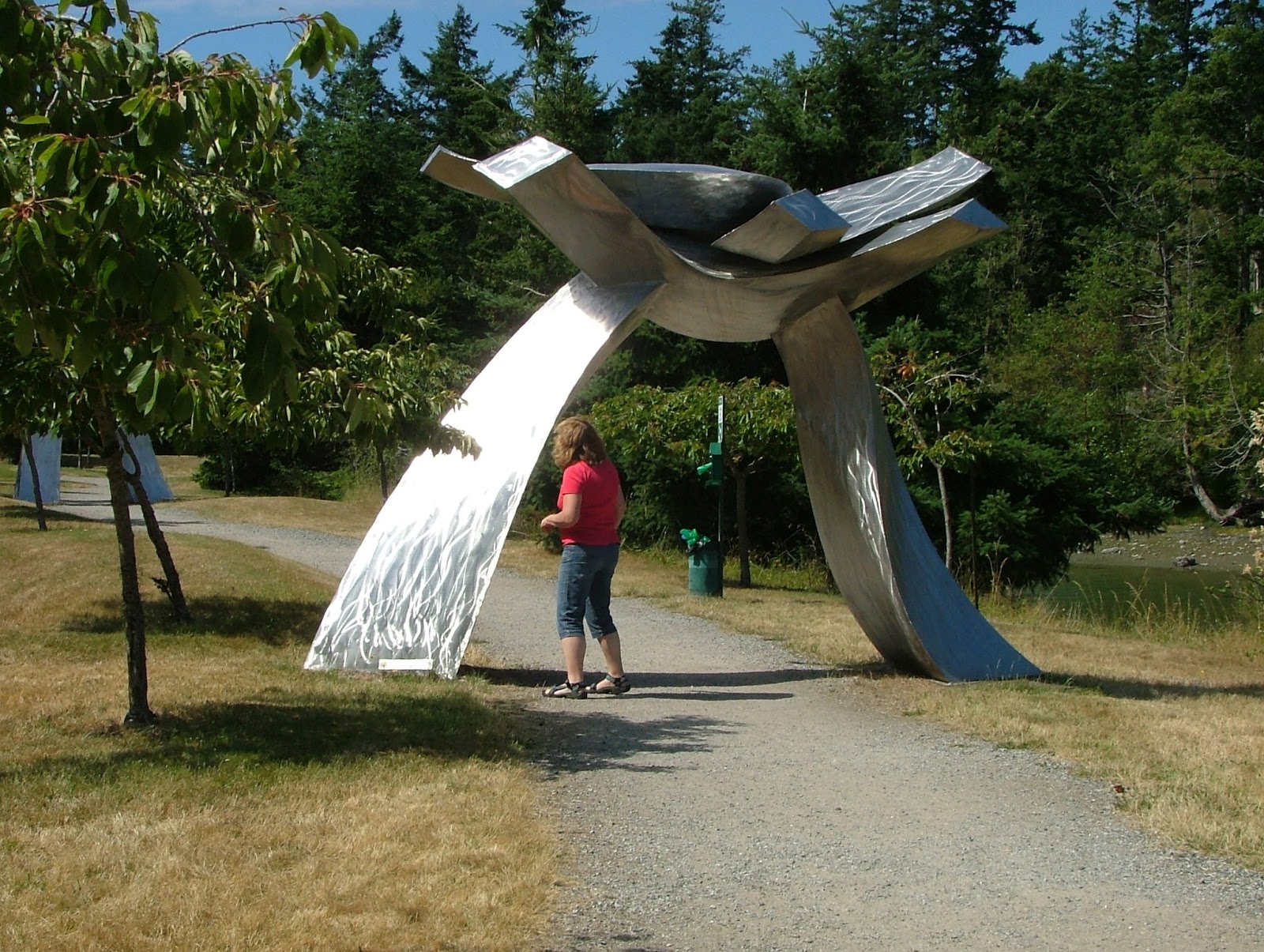
One of many artworks and sculptures at Roche Harbor
Roche sculpture along foot path by county dock

Crowded 4th of July at Roche Harbor
More sculpture

No rust, must be stainless steel.


Seeing a price tag with a sculpture brings out the art critic and connoisseur; feel free to purchase.


We finished the cruise with a stop over and hike at Stuart followed by a hot dog roast and  windy night anchored at Jones. 

The next day we ran over to hike and sail Sucia where we spent a  rather noisy evening at the dock on Fossil Bay.

 The fourth day, after a quick hike on Matia, and a drive by of the salmon pens at Deepwater Bay (Cypress), we were back at our slip in La Conner.


This was a pleasant, low key enjoyable little trip of about 110 miles.
(I really like my new laptop gps)  read about laptop gps here
BTW, the news Wed. night (three days after arriving back home) was that one of the 85 foot for sale yachts we were all ogling on the fourth burned and sunk at the dock at Roche.  It's really shocking (a little scary too) to see news pictures of a yacht you had just admired, and now sunk with just its charred stern above water next to the dock.


Click below to see a satellite view of Roche Harbor

Jun 24, 2013

How Long is Your Painter? Does it reach all the way to shore?

What is a Painter anyway?

You know, that short little rope tied to the front of your dinghy!

Echo Bay on Sucia Island

This may look like an unpleasant circumstance waiting for our return, but it is exactly what we planned.


Let me explain.  When we arrived many hours earlier at a much lower tide, we beached the dinghy and walked away just like so many other times. Knowing the rising tide would float our boat, and we were going for an all-day hike I ran my line up to the permanent driftwood pile, above the high water mark.

  It's true the dinghy will eventually float free and may wash up on shore, but the weather is fine and wakes are frowned upon in Echo Bay.


If I were really worried, I could have deployed a light anchor that does not dig in, then when we returned, I would have simply hauled it all to shore, dragging the anchor with it.

So what, you might say?

The point is, when you outfit your shore boat, you should anticipate needing a really long rope just in case you need it. My current dinghy has a fifty-foot floating line, and if I can't reach something solid, I go find a dog-bone-shaped rock and carry it to where I want to tie up. Some skippers carry a small dinghy anchor and rode, then simply carry it up the beach. And some carry their dinghy, but we don't anymore.

Having your dinghy float away doesn't always mean you will lose it, forcing you and your crew to swim out to your boat.  In popular anchorages, someone will probably come to your rescue.

Now, this next point is very important.  Conditions at the shoreline may change from flat, glassy water to two-foot waves in just minutes. A far-off storm can send waves your way, or a ship may pass by. The resulting pounding waves may flood your dinghy or seriously damage it.  With this in mind, there will be times and places where you should carry your dinghy up the beach to safety. It is very reassuring knowing your shore boat will be there waiting for you when you return.


Click below to see a satellite view of Sucia Island


Jun 23, 2013

How to launch at the Port of (fill in name) and the importance of having alternate plans

What is the best way to make a San Juan Islands boat trip?

How about some tongue-in-cheek answers:
  • Never pee into the wind, check.
  • Never tug on Superman's cape, check.
  • Never buy a lottery ticket for an investment, check.
  • Never say never, check,  err-uncheck, err? 
  • Never depend on the marina, check, check, and double-check.

Kraken on way to San Juans
Rest stop on way to La Conner for launching, and then on to the San Juans

In preparation for this season's cruises, I called ahead to the Port of Skagit County in La Conner to arrange for a travel lift launch. 

 Good news, I'm told by the very nice lady on the phone, "We have a forklift that lifts 11,000 pounds, and we are open until 6:30 pm."  Okay great, I'm thinking, we can get there around 3 pm and we only weigh 8500, perfect, oh yeah, how much?  "Only $20 or $25 if they have extra work."  Fantastic, for only $25, I don't have to dunk my trailer brakes in salt water. This is too good. (and it was)


Reality, or what really happened:
First the ports forklift  can only lift 5,000 lbs, and they didn't want to even try.  Second, they don't have a travel lift, but a  light duty overhead tram with a sling, and again they would not try.
My options are -- go away.


Next, at 3 pm we parked on the main drag outside the still-open La Conner Chamber of Commerce, where I asked about private boat yards and was supplied with the telephone numbers for two marinas with big travel lifts. A quick phone call determined both businesses were willing to sling my boat for about $125 if I came back tomorrow.  I begged for compassionate emergency service, explaining I just drove for six hours depending on the port's promises only to hear, "Do you want to reserve a slot tomorrow? We have customers today."  "No thanks," I said.


Plan B, we quickly drove over Rainbow Bridge to Shelter Bay Marina to check out the boat ramp, only to find it high and dry with a falling tide that still had two more hours to go.


Plan C, we quickly drove back over Rainbow Bridge to the La Conner city ramp located almost directly under the bridge. 

 I asked a fisherman, who was fueling his boat out of a tank in the back of his pickup, how far the ramp extended. "To the end of the dock," was his answer.  Keeping in mind the tide was falling, I went to the far end of the float and, with a boat hook, began probing six feet down while moving up the ramp. Once, many years ago, I backed off the end of a ramp, dropping the trailer about two feet, then it got hung up on the end of the concrete. So, better safe than sorry, now I always probe or somehow determine I will have plenty of ramp under water.


With about two hours of falling tide water still ahead, a thirty five foot trailer and boat, a thirty foot float with a six foot depth in the middle, fours hours of daylight left, I said lets launch, and began rigging fenders and dock lines while the fisherman finished filling his boat with fuel.  When his pickup cleared the single-lane ramp, I backed down, and she floated free.  Five minutes later, my rig is locked up and parked in the city-provided spaces, and we are on board, motoring towards our waiting slip in Shelter Bay.


Total cost - launching and parking, $2.50 per day. Total frustration - not too much.
There is no moral here. My advice as always is, give yourself plenty of time for plans B, C, D....
BTW, I spent a full hour hosing and flushing my trailer with fresh water after retrieving it from the ramp parking lot later that day.
In the fall I will likely reverse the procedure, but try to do it near high tide.
I will probably mention something here unless it is really boring.


Click below to see a satellite view of Deception Pass and Cornet Bay launch ramp