• Discover boat-in spots from Sucia’s anchorages to the trails of Stuart and Jones Island
• Experience the Islands
• Visit bustling Friday and Roche Harbors
• Find serene, secret coves • Your adventure begins now!
New Feature
Below every post is a satellite view hot link - You may drag image to your area and/or use the plus button to zoom in all the way or click street view when enabled.
++++ ============================= All Posts Below
Current Posts Below Note: The first few posts below are for first timers and stay on top — New posts are scattered throughout the website — use the search box or look in archives on the left side to find your interests
Of course, Jones Island is tops and offers a wonderful experience for boat camping and exploring the San Juan Islands. Its proximity to major marinas and harbors, such as Deer Harbor, Roche Harbor, and Friday Harbor, makes it a convenient and attractive destination.
Starting your kayaking adventure from Deer Harbor, with its calm waters, can be a great option for exploring the surrounding areas. Roche Harbor, known for its resort and as a departure point for trips to Canada, is another nearby destination that adds to the appeal of Jones Island. Additionally, Friday Harbor, the largest city and port in the San Juan Islands, is relatively close, making it easily accessible for supplies or further exploration.
With its strategic location and the variety of neighboring destinations, Jones Island offers a great balance between tranquility and accessibility. It can be an ideal choice for families looking to enjoy boat camping and explore the beauty of the San Juan Islands.
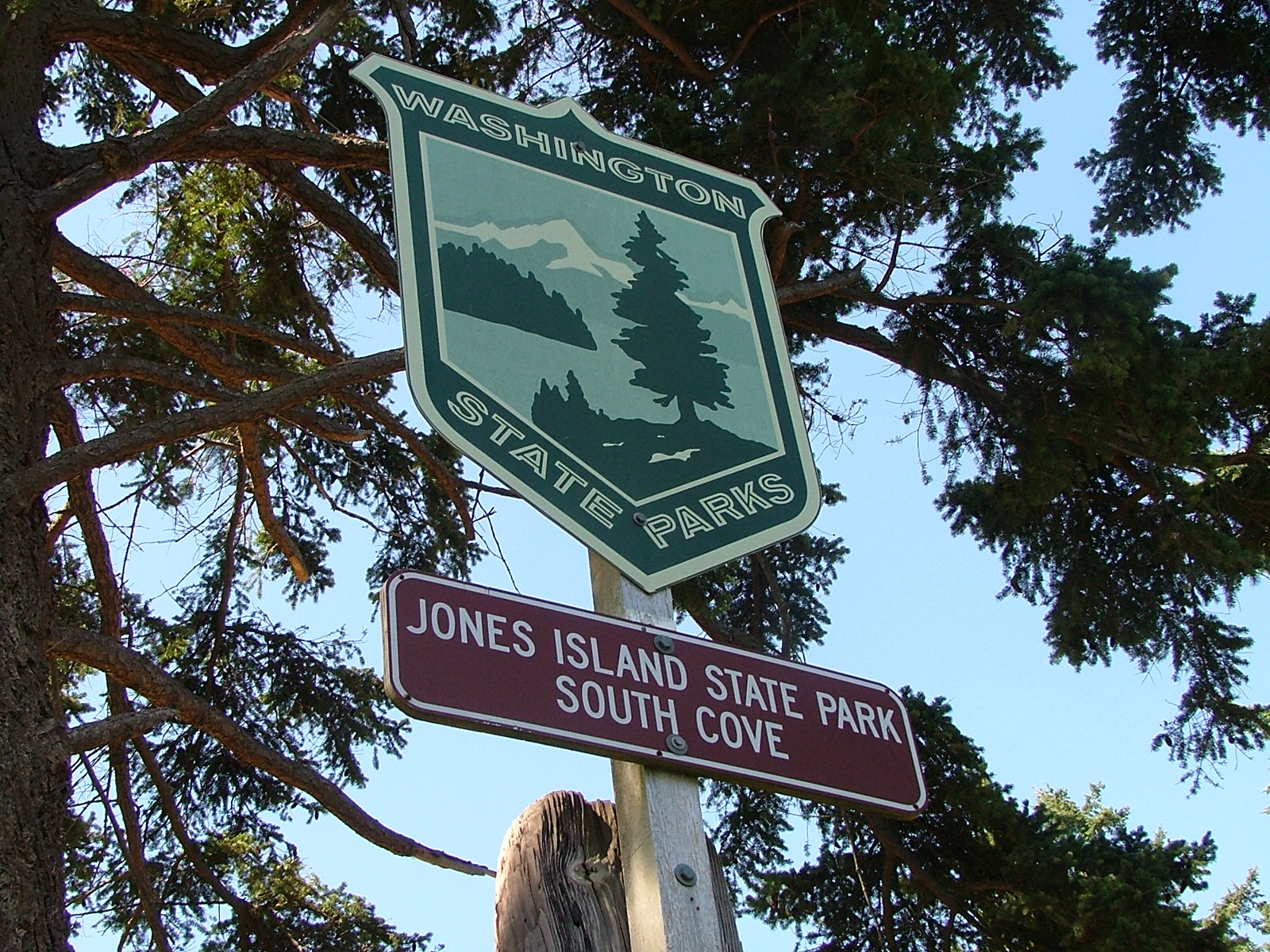
All of Jones is a state park, the north cove is preferred by power boaters and sailors alike, inside you will find a protected bay with docks and anchor buoys, plus room to anchor if the five buoys are in use.
The south cove is favored by kayaker's, there are several campgrounds and the island has running water, fire pits and picnic tables. On a sunny summer weekend it would not be unusual to find several large groups camping with many first time kayakers in guided tour groups. Offshore are a few anchor buoys. The south cove is not protected from San Juan Channel traffic or winter storms so the beaches are piled with sun silvered driftwood.
The North Cove is absolutely wonderful, There is a brand new dock, anchor buoys, a steep gravel beach (good for dinghy's), and room to anchor. The cove is protected from all but the worst north winds (very infrequent) On shore are lots of tent sites, each with picnic table and fire rings. There is a nice mowed lawn area for games and grazing deer. Bathrooms and running water are clean, cool, clear and convenient.
The island has several hiking trails, rated, easy and moderate. From the trails are magnificent views of the surrounding islands, and waters. Bring your camera to Jones, you will want to preserve the memories to show your friends that aren't as fortunate as you.
NORTH COVE DOCK AT JONES ISLAND
Click the Jones Island link below for satellite view
Where in the San Juan Islands area should we visit?
If you are a newbie, you should go to tried and true hot spots like Roche - Friday - Jones - Sucia - La Conner - Deception Pass.
Some places I suggest and visit myself are technically not part of the San Juan archipelago, but if we limit ourselves to one county or zip code, who really benefits?
That's why the website title includes "Surrounding Area"
I don't remember where this is - sorry
Note: these are not ideas I am suggesting for you, (okay maybe a little) they are places I am thinking about for me to see again.
If you are a newbie, you should go to tried and true hot spots like Roche - Friday - Jones - Sucia - La Conner - Deception Pass. Use the search box - it's all there and then some.
If you have been around the San Juan's awhile you may be looking for new ideas, that's what my list is about. Dates don't really matter, these places are timeless.
My short list for 2018
I would like to spend a few days anchored at False Creek in Vancouver (we really enjoyed Granville Island and Stanley Park) (60 miles, one way) - ouch
Explore West Sound, we haven't entered West Sound for fifteen years. I guess it has been a drive by sound for us. I want to check out the marina and possibly see about making a bike/hike ride to one of the Turtleback Mt trailheads.
Hike Vendovi Preserve. This little jaunt will happen for sure.
Visit Lummi Island (we biked it in 2017, it's really flat and easy, I want to do it again)
Visit Victoria - Last time we had three little kids with us, a cramped sailboat and lots of pea soup fog, just the two of us should be easier if we can avoid any fog.
Hike Eagle Bluff (closed until after July 15) this hike never fails us
Take a shot again at bike hiking up Mt Constitution, probably start at Olga this time
I am thinking of skipping 4th of July, but Lopez is on my radar if we go anywhere
maybe go see Nanaimo or some Gulf Island Parks (means a lot of motoring) I doubt this will happen. (we went to Newcastle Park many years ago and had fun, but like Vancouver, it's a lot of motoring) maybe we can ride the current both ways.
Might want to anchor at Smallpox Bay for a night and do some orca watching.
Okay, that's about it. It's not much to choose from. Because of the miles involved, I don't see us visiting Victoria, Vancouver and Nanaimo on the same trip. I'll let this simmer for awhile and see what floats to the top. Lately we have fallen into the trap of repeating what we are comfortable with. I don't know if that is good or bad, but now I'm thinking of adding Jones Island to the list. So should I not go to Jones because I really enjoy it and feel comfortable there? Seems counterproductive to avoid visiting somewhere you really like.
What should you know before boating in the San Juan Islands?
#1 Hugely fluctuating water levels (tides)
The San Juans have high and low tides every day, some very high, some very low. This means you will need to be prepared to deal with going ashore at locations lacking floats. The easiest solution is to bring a dinghy; if you don't have a dinghy I suggest you buy a cheap inflatable boat or 2 person kayak for around $75. Once in the San Juans most people simply tow the dinghy everywhere they go, or deflate and stow it away. Those of you going in a ski boat or skiff may be thinking you can beach your boat, which will work, but only for a few minutes. On a falling tide in ten minutes your boat may be high and dry, unless you can carry it, your stuck until the tide comes back up. On a rising tide your boat will float away while you're on shore. Since your going to anchor in six feet of water at low tide you will need one hundred feet or more of anchor rode to accommodate a ten foot plus increase at high tide. Smart boaters bring two anchors and rode and a dinghy they can carry up above high tide.
#2 Strong Swirling Currents (in places)
San Juan currents are notorious, and the root of many stories. For fast planing boats you can pretty much ignore adverse current; however slower boats live and die by planning passages to get an assist from the current. A typical sailboat may putt along at 4.5 mph, against a 2.5 mph current their real speed over ground is 2 mph. Going with the same current their sog is 7 mph. So a ten mile passage takes 5 hours the dumb way or 1 hour 25 minutes the smart way. There are many prediction and forecast books and charts available and online. While you don't need a publication, I recommend that you buy something and keep it with you. I would also go online and print out a tide schedule for the time and area you expect to cruise. CLICK BELOW for Rosario Strait at Guemes Channel
In a nut shell, here's a simple rule of thumb to follow. On a incoming or rising tide, the water in most straits and passes flows "north" while during a falling tide the water reverses and flows "south." When the current hits an island straight on, the water will split and flow around the island usually at a slightly higher speed creating eddies at headlands and the tips of the island.
You can get lost in the dark, in the fog, or just plain lost on a sunny day. You need to bring with you a chart, and you would be smart to protect it from getting wet or torn up. I sandwich mine between two clear acrylic sheets held together with velcro.
Some will say the chart needs to be new and of the highest resolution, which may be true for ship captains and other navigators. What were talking about here is not getting lost, even a google print out may do the trick. If you are going to boat in the fog you must have a compass, and GPS, a portable handheld GPS will do fine and some new phones may do the trick too. (in thick fog you will go in circles and be totally disoriented without a compass) A gps will not replace a compass in rough water and fog, a gps is much too slow reacting when you are getting spun from broadsides or quartering waves (broaching) you need both. Many times in the San Juans visibility may be down to 3 or 4 miles and you think you can sneak across some open water to the next island, and you probably can, but if the fog thickens to pea soup you will be glad you have your compass and GPS. BTW, fast boats can't always go fast when waves and swells stack up. And only very dumb skippers go fast when they can't see.
See the ferry approaching the anchored sailboat?
#4 Wind or lack of wind (sorry sailors)
OK, here's some bad news for sailors. The San Juans are not known for great sailing winds in July and August. Out in the straits (Haro, Rosario, Georgia, Juan De Fuca)
you may get some decent sailing, but inside the islands, don't bet on it.
Sailing in April rain with reefed main
#5 Crowd control (no worries)
Most likely you won't have any problems with crowds except on the 4th of July and Labor Day. The good side is that you will always find a place to anchor, even on holidays, the dinghy ride may just be a little longer for some. Most marinas take reservations and you may as well take them up on it, but you don't need to. I suggest you slow down a little and enjoy the freedom of not planning ahead, take one day at a time and see where you go. Lastly, because this area is so close to Bellingham and Anacortes many boaters are day boaters. At the end of the day they head for home, leaving some resorts and parks half empty, especially on weekend Sunday nights. Monday or Tuesday are good days to begin your outing if you want to be alone.
Fourth of July celebration in the San Juan Islands at Roche Harbor Resort
Roche Harbor 4th of July balloon contest for kids in dinghys
yes, there was room for more, lots more
Expenses
DNR buoys are free (Cypress Island) State Park buoys are $10, many park floats are 50 cents a foot, Marinas charge between 75 cents and $2 a foot. Gasoline is a little more expensive than on land, but not much more. Food, groceries, ice are just a little more than the mainland but very fair priced overall.
How many days to plan
Plan a minimum of four days, but up to two weeks depending on what you like to do. (I like to sit on the dock at Jones Island and read my book between naps and walks, then I make a campfire in a empty tent site and cook Kielbasa followed by a glass of wine. Then retire to my boat for a good nights sleep. The next day, do it again)
Salt Water
Salt water drys sticky and does not suds up well with soap, you will get it all over you and your boat, count on it. After a week you will look forward to a shower. Your boat will be covered with salt crystals. Most marinas have little water and don't want you washing your boat.
Squalicum Harbor in Bellingham has boat and trailer fresh water wash down hoses in the parking lot. You should use them each time you dunk your trailer.
Provisions
For the most part you will want to provision before you leave on the boat. Anacortes and Bellingham have all the big stores and each has a West Marine store. All the resorts and towns have grocery stores, if you drive a fast boat, supply's may be only minutes away, putt putt's should work a store visit into your circuit. I say circuit because most cruisers will follow a circle of some sort trying to hit many stops. We find that ice needs renewing after four days, so a stop over at Friday Harbor, Deer Harbor, Roche Harbor, Blakelys, or Orcas landing fills the bill. All these places except Orcas, have gas and showers. Showers will cost a handful of quarters so be quick or be poor. Cold showers are free. Lopez Village has free showers but no dock so you will need a dinghy.how to dinghy to Lopez village
Garbage
All the parks are pack it in and pack it out, the marinas have dumpsters. If you are new to boat camping you will find garbage to be a pain because you are not used to storing everything in your boat. Little things like empty water bottles suddenly take space you don't have. You must give careful thought to what you are bringing, and the garbage it will generate. We don't use disposable bottles, minimize pop consumption, and try to have campfires to burn burnable trash. It is against the law to toss anything, (even a apple core) in the water.
Animals
Your dogs must be on a leash, period, everywhere. Raccoon's are on all islands and will climb right into your boat or kayak in the day time if you let them. Deer are all over too, but they shy away, except on Jones Island where you can hand feed them.
Otters live under most floats and docks, they will crawl all over your boat, get into things and make a mess. Otters also will mark their territory by pooing on your stuff, dock lines are a favorite.
Bathrooms
All the parks have nice composting toilets, (each island mentioned for overnight is a park) the rangers service all parks on a regular basis. You will be pleasantly surprised at how clean the facilities are.
Where to go:
Your destination is simply that, its the journey getting there and the experiences on the way that make a trip a wonderful vacation. Try the links below for some Island Park descriptions.
Bring your cell phone and charger, bring at least a portable handheld marine radio, bring basic first aid kit, call the Coast Guard, they can be there pretty fast, or arrange for vessel assist on your credit card, bring a friend with a similar boat, then you can help each other.
Where in the San Juan Islands can you boat camp for free?
Washington State DNR land (department of natural resources) is not state park land, it is DNR land and offers five amazing and free boat camping spots.
Before you pack up and get on your way, let's define what free means and where the San Juan Islands are located. For some, free may mean no charge for camping but may fail to add in the cost of a new boat or kayak and tons of gear. For others, anything less than the price of a five star hotel and plane ticket is a steal.
The San Juans are arguably defined as part of an archipelago including but not limited to the islands of San Juan County Washington. Therefore, including nearby islands with other zip codes seems appropriate when planning a camping trip to the San Juan's
All are first come and no reservations and only accessible by boat. All are pack it in and pack it out. Facilities are maintained by local volunteers and clubs.
Pelican Beach on Cypress Island
Cypress Head on Cypress Island
Lummi Campground on Lummi Island
Pt Doughty on Orcas Island
Griffin Bay on San Juan Island
Grifffin Bay:
Five campsites, each with tables, fire rings, one pit toilet. Bring your kayaks ashore or anchor off and come ashore by dinghy. One anchor buoy is provided. Enter this latitude and longitude into google search or your gps or your boats plotter to find the campsite 48.475944 N, 123.009857 W Another method would be to cruise along the west shore of Griffin Bay ( San Juan Island side) looking for a beach landing and buoy halfway between Fourth of July Beach and Low Point on your NOAA chart.
Griffin Bay free camping
Point Doughty:
Three campsites, fire rings and a toilet are on this lonely and exposed point on the north side of Orcas Island. Use this lat. and long. to locate on a map or chart, 48°42'42.2 N, 122°56'58.3 W
Lummi Island campground:
is easy to find but here are the coordinates. 48.659223 N, 122.614348 W.
Lummi Island Campground is reached from a small cove on the southeast side of Lummi Island
just south of Smugglers Cove, Inati Bay, and Reil Harbor.
Your best landmark clue will be the sign on the bluff.
click here>> Easy directions to Lummi Island Campground
Cypress Head Campground:
This kayaker and boaters and hikers dream destination is on Cypress Island a short 5 mile paddle from Anacortes or Washington Park. Cypress head is the eastern most tip of Cypress Island jutting out into Bellingham Channel just north of Deepwater Bay. The gps coordinates are 48.568919 N, 122.670692 W
Cypress Head point creates a nice protected bay with anchor balls and a very dinghy and kayak friendly gravel beach. Trails connecting to the the rest of the island are across the narrow isthmus.
Pelican Beach:
This free waterfront campground on Cypress Island is very popular with kayakers, power boaters, sail boaters, everyone likes Pelican Beach. It even has ADA compliant composting toilets. The shore is lined with about half a dozen campsites, each with tables and fire rings, directly offshore are anchor buoys. The easy trail up to the top of Eagle Bluff begins at the water edge. To find Pelican Beach simply follow the east side of Cypress Island north about one mile past the Eagle Harbor anchorage. If you run past the end of the island, turn around, you're a quarter mile too far. Here are the coordinates. 48.603400 N, 122.704134 W
By important, I mean important for camping, not that my list is important.
Camping and cruising equipment list
Over the years, camping aficionados tend to collect everything needed. They learn from painful experience what not to forget - again. Packing for them is just a matter of grabbing prepacked gear. They store it stuffed into one pack, one closet, or in my case, one group of Rubbermaid boxes. Everything is kept together so that when it is time to load up and go nothing important is forgot or left behind. We call ours "camping gear," and "camping boxes," and all of it is stored on the "camping shelves."
In our gear boxes you will find rolls of aluminum foil with only six inches left, dead spray cans, water logged matches, and barely functioning openers, corkscrews and rusty grimy pliers. Did I leave out dim flashlights?
Rather than list a truly massive list of mostly unneeded items, I thought I would attempt to list the important things that really impact me when forgot. Like my sleeping bag or coat, both I have forgot.
This is a boat camping list,
not surprisingly, it doubles as a car camping list:
folding saw
ropes and tarps
baby or folding shovel
flashlights - tested, with extra batteries
fire starting system or plan
stove or cooking system and fuel
fry pan
cooking pot
coffee system
bucket with bail (use for hauling water or bailing or storing icky stuff))
plastic bags big and little
sanitation needs
sponge or rags and towel
soap or detergent
water proof and animal proof food containers
kitchen stuff - spoons, openers,
folding chair
good knife or multi-tool
emergency tool kit
sleeping pad
sleeping bag
tent (for some)
water jugs
layered clothing for hot, cold, and rain
hat
mosquito repellant
suncreen
Added in 2023 >>steel wok for campfire cooking
Some of the items don't belong in a gear box (like clothing) but should be listed.
For those of you that need more, try my Mother of all packing lists - click here > Mother of all packing lists
Where is a map of San Juan Islands Parks, Docks, and Boat Ramps?
Map of the San Juan Island Area
With selected Parks, Docks, and Trailer Boat Ramps
The boat ramps (purple) are all on the mainland The ramps in the islands are not suitable for cruisers.
• Boat Ramps = Purple • Parks = Red• Docks = Green
Most docks (floats) are in parks, resorts, marinas and may be used for overnight camping. Boat launching ramps have long term parking. Parks without docks have anchor buoys or areas suitable for anchoring.
What are little known places in the San Juan Islands?
Everyone knows about Rosario - Friday Harbor - Roche Harbor and Sucia Island. Of course, they are famous and not to be missed.
But some of the best San Juan area destinations are much less traveled. And even less talked about.
Out of the way places have secrets where a little local knowledge may turn a ho-hum cruise into a truly memorable event. I am listing and describing some of our favorites, feel free to make them yours too.
Not in any order or preference!
#1Saddlebag Island
At the top of Guemes Channel northeast of Anacortes in Padilla Bay is diminutive Saddlebag Island State Park.
Saddlebag has only 24 acres, its distinctive dog-bone shape creates two teeny bays. The north one suitable for two anchored boats, or only one if the skipper hogs the middle on a long rode. We have always been able to anchor fifty feet from shore. The dinghy ride is short and sweet, the gravel beach is friendly and steep. The bay catches a little flotsam and wayward seaweed so an aroma may be mixed in with treasures you find.
The narrow center isthmus holds a small campground and outhouse (newer). Hiking the shoreline trail is easy and follows a handy figure eight shape affording views in all directions. Being less than two miles from Anacortes makes Saddlebag an easy kayak destination.
The waters on the east side of Saddlebag are shallow and rock strewn, circling the island is a white-knuckle event at lower tides. Your dinghy or kayak would be a better choice than the mother ship if you are determined to gunk-hole.
We stop at Saddlebag for lunch and a hike, overnight if it is late, or just a quick anchor and hike. We always see something new, and never go away unhappy.
Saddlebag may only be rated as five star, you will be glad you stopped by.
What is a good bike ride on Lopez Island in the San Juans?
We spent the night at the dock on James Island. Our plan was to ride the morning current south through Lopez Pass and over to the county dock at Hunter Bay.
Next, we would unload our bicycles and ride to Agate Beach, where we would then hike to Iceberg Point. If time permitted after returning to the boat, we would whale watch while cruising up Haro Strait on the outside of San Juan Island to spend the night at Garrison Bay or Roche Harbor. This seemed like an ambitious but doable first full day of our loosely planned vacation. Keep reading and find out what really happened.
We left James late (9am) and arrived at Hunter Bay early (9:45), so far so good for the first 4 1/2 miles.
Spotting the small county dock from a distance was difficult because a little rocky islet blocked our view until we were right on top of it. Half the boat hung out from the tiny cargo loading space, but we got the bicycles off without any problem, and then moved away and anchored in ten feet on a rising tide.
The county dock and ramp at Hunter Bay is for public use, and is primarily used by nearby local residents. Like all county docks, the signs say you may not spend the night but our experience around the islands is that the two hour rule is largely ignored. Under the gangway is a spot for dinghy's and next to our bicycles is a spot reserved for loading and unloading only. Placement of pilings makes much of the float unusable. Anchoring nearby is easy and the bay is well protected except from northerlies.
In the far distance you can see Orcas Island, so any north winds building waves will be coming all the way from Eastsound and can be a touch big, just like southerlies coming from Hunter Bay tend to be uncomfortable when they reach the top of East Sound -- touche'
Southend Store and restaurant is about a two mile walk with a pretty significant hill to go up and over. Off to the left where the cove is more protected are a number of cruisers bedded down. All in all, this is a pretty peaceful place to hang on the hook or come ashore.
We tied up in the already crowded dinghy spot under the gangplank. We were watered, sun screened and raring to ride to Iceberg Point
We pedaled a few hundred feet and ended up walking up a rather steep hill the first 3/4 mile. It was a nice forested walk, we mingled with baby deer and glimpsed homes nestled around towering trees. Still pushing our bikes, we crested the hill only to find another much smaller hill. Finally we started coasting at flank speed down the other side and I'm thinking, oh boy, we have to come back over this mountain later today in blazing afternoon sun.
Once out on the islands only south end main road, we merged with and then were left in the dust of several large bicycle excursion groups complete with chase vans and guides. We caught up with them resting at Southend Store only to have them fly by us again on the way to Agate Beach Park. At Agate Beach we may have accidentally photo bombed them while they posed for group photos. We pushed on for a quarter mile and padlocked the bikes at the trail head to Iceberg Point.
We are almost at the half way point of our days planned bike/hike, all we have to do is walk the mile or so out to the point and back, then head for the boat like a horse to its barn. I want to call Uber.
I will save the details about Iceberg Point for another day except to say it is the tip of Lopez Island facing the Strait of Juan De Fuca, and I think it was a great worthwhile place to visit. I also think it would be a very miserable place on shore in a storm and downright dangerous off shore in small craft. Our day so far, has been balmy and near perfect except for the sun and pushing bikes up hills. ("Lopez" the bicycler's island, tell that to my legs)
On the way back we were overtaken again by fit and trim excursion bicyclists,
each one wishing us a good day as they sped by. The ones riding tandems seemed extra peppy, even happy.
We stopped at the same store/restaurant (Southend) on the way back, no other bicyclists were in sight.
I had been talking about getting a hamburger, coke and fries since leaving Iceberg Point. We sat down in the restaurant portion of the store at a table with a checkered tablecloth loaded with chips and salsa. I picked up the Mexican only menu to find pages of burritos, enchiladas and nachos. The hamburger and fries will have to wait. The pulled pork burritos we ordered were huge and the warm salsa was out of this world good.
I was ready for Uber or even a stranger with a rusty pickup when we saddled up for the last time an hour later, but the hill coming back was not as steep and we pedaled all but a short section, making it back to the dinghy and Kraken in short order.
Iceberg Point Nav. aid. In the background is Cattle Pass and San Juan Island. It is a beautiful calm day with a little lingering low haze. Across the Strait of Juan De Fuca we were treated to the snow capped Olympic mountains
The same nav-aid viewed from the water hours later as we head north hoping to spot orcas, still a flat hazy day. You don't have to ride bikes from Hunter Bay like we did, you can anchor at Agate Beach and make the easy hike out to Iceberg Point.
There is no dock at Agate Beach but you can anchor right in front of the stairs
and hike the short distance to the Iceberg Point trail head.
The bike ride from Hunter Bay to Iceberg Point is enjoyable and takes you by Southend Store for a handy lunch stop or in my case - directions.
Our bike and hike was just about perfect, we will do it again someday. All together we pedaled about 7 1/2 miles, and walked 1 or 2. After loading up we headed leisurely around the south end of Lopez fighting a small current until we cleared Cattle Pass where we got a little boost all the way through Mosquito Pass. We took a slip at Roche Harbor in time to watch the "Lowering of the flags" ceremony. When they fired the canon, my day was complete. I slept well that night.
Is it worth it to take bicycles on our boat to the San Juan Islands?
Yes, and if you limit yourself to places with docks to offload bikes you are also missing out on some of the best places worth exploring.
Learning to haul bikes in the dinghy opens up a world of onshore expeditions.
Furthermore, if you are planning to use a dock to unload bikes, and the dock is for whatever reason, ie. crowded or out of service, there go all your well thought out plans. However, we have only used the dinghy to haul bikes a few times, it turns out that most places with rideable trails and roads also have a dependable dock. I still think it is best to be prepared.
Prior to heading out you should experiment with ways to load bikes into the dinghy.
You do not want to learn the hard way what not to do. Poking a hole in the favorite and likely the only inflatable would be the hard way. I think type four seat cushions will protect an inflatable, but I have never tried it since my dinghy is fiberglass.
Plan ahead, one time we sewed up huge bicycle bags from tarps to protect our bikes during an extended trip we knew may have salt water cascading over us.
Tips:
Bring your old bikes if possible, saltwater means rust. Flush and wash asap afterwards.
I accept that I will be wading in ankle deep water when reaching shore, so I wear sandals.
Bike chains, pedals and spokes will get snagged, be patient and super careful not to do damage while transporting and untangling a mess.
I bring a tire patch kit, basic tools and pump.
plus I use that anti leak slime stuff in all my tubes.
Many of our bike rides end up as hikes where we leave the bikes unattended so we bring a cable and lock. It's not that I don't trust people, I just don't want to risk walking miles and miles back to the boat.
Going ashore we took two at a time, which meant three round trips for four people. Upon coming back, Ryan suggested we try stacking all four bikes which meant only two trips. Count them, it worked fine. The dinghy is a nine foot Livingston.
How and why you should mark or tag your anchor rode?
Why mark the anchor rode? Easy -- sooner or later, you will wonder how much line is out.
In my opinion, marking the rode is neither hard nor costly. Suppliers sell tags, with footage numbers, some people use cable ties or bits of yarn. Some exuberant skippers, mark every twenty five feet and use day-glo colors.
Years of anchoring in the San Juans has honed my system, or should I say reduced it to what works for me.
It seems to me that we don't need this conversation. Anchoring and tying to a float are fundamental and crucial to successful cruising and boating in general. And yet when I look back at the problems I have endured, I see that anchoring and dealing with docks seem to be at the head of the list of self-inflicted issues. So this is advice and observations for me.
Below are some of my obvious observations and methods employed.
Anchoring, like coming into the dock or slip, must be done fairly quickly or the boat floats away. This means doing math calculations or untangling snarly rode or line should be completed beforehand.
Under water, red, black, and dark colors look the same, light colors just disappear.
Trying to spot, cutesy paint marks, little tags or bits of string flying out of the hawse pipe is problematic, especially for newbie crew.
Guesstimating how much rode has been let out is not accurate, but is nevertheless the system I used for years.
I tried using a code, such as two marks, three marks, four marks to designate small increments. It was confusing, hard to keep track of, and kinda pointless anyway since I forgot the code.
Anchoring in dark or windy conditions, or stiff current, quickly identifies inadequate systems, poor planning, and lack of preparation. Not surprisingly, the same holds true when coming into the dock.
What I do today:
My experience has been that all the paints I have tried last only one season. Spray paints are the worst. Now I use whatever leftover black or red latex paint I have. I brush it on a three to four-foot section so it is impossible to miss.
My first mark is at fifty feet, then one hundred, then one fifty, etc. Since I usually anchor in 15 - 20 feet, the third mark seldom sees water and stays in good shape.
If I suspect problems or crucial timing issues, I will pull all the needed rode out of the locker and cleanly flake it on deck beforehand.
When I up anchor, if conditions permit, I flake the rode on deck for cleaning and drying and then carefully drop it in the locker later. Sometimes I put my thirty feet of wet or muddy chain in a milk crate and leave it in the sun. Putting away wet gear tends to stink, so I avoid it when I can, especially if I plan to anchor again that same day.
I have a pair of dedicated gloves I use for anchor handling.
How well I anchor is proportional to how well I sleep!
If you are thinking Vendovi sounds familiar but can't quite place it, I will tell you - it is the little 200+ acre dot on your chart due south from the southern tip of Lummi Island.
For years all of us have been going around Vendovi Island on our way to Sucia or the inner islands. 200 acres is about the size of Jones Island if that comparison is of any help. The map clipping below should help you zero in on Vendovi's location.
The San Juan Preservation Trust has owned and protected Vendovi Island since 2010.
Visiting days are April 1st through Sept. 30. Open hours are 10 am to 6 pm, Thursday through Monday. They are closed Tues. and Wed.
Access is a small cove at the north end. There is a 70 foot, first come no reserve dock behind the breakwater, or you may beach kayaks and dinghy's in front of the caretaker home if the dock is full. No anchoring in the cove or overnight stays at the dock are allowed.
Bring your hiking shoes and plan to immerse yourself in unspoiled wilderness, but you should stay on the trails if you truly respect the wilderness and the SJPT mission to preserve. No camping, fires, bicycles, or hunting, pets are to be on leash. Enjoy!
Learn about the many San Juan Preservation Trust preserves here >> Map of SJPT preserves
It was a tranquil Sunday afternoon, the kind where the air feels warm and still, and the water gently laps against the hull
"Moments later, my attention was abruptly drawn away by the unmistakable roar of an engine revving at full throttle."
We were relaxing on deck, enjoying the peaceful atmosphere, when the gentleman moored behind us untied his lines. As he cast off, he mentioned he was making a quick stop at the pumpout station on the adjacent dock before heading out. I gave him a casual wave from the cockpit and returned to my magazine, assuming it was just another routine departure.
Moments later, my attention was abruptly drawn away by the unmistakable roar of an engine revving at full throttle. A feeling of unease crept over me.
“Something’s wrong,” I said to Linda, glancing up. “Look over there.”
Sure enough, the boater who had just left was now in the next fairway, visibly struggling against a powerful current. His boat, a thirty-footer, was being dragged toward the aluminum footbridge connecting the walkways. He was clearly in trouble. “He’s not going to make the turn,” I muttered, my concern growing by the second.
Then, to my astonishment, he made a desperate decision—he gunned the engine,
slamming it into full throttle in an attempt to execute a rapid 180-degree turn before colliding with the walkway. For a moment, it seemed like he might succeed. The boat narrowly missed the footbridge and almost completed the turn, but the momentum was too great. Instead of cleanly maneuvering away, the vessel barreled into the dock adjacent to the pumpout station. With the engines screaming, the impact was forceful enough to propel the boat nearly three-quarters of the way onto the dock, its bow perched at a steep, precarious angle.
Panic seemed to set in. Desperate to correct the situation, the boater threw the engine into reverse,
the sudden jolt pulled the vessel off the dock sending it sliding back into the water. Now facing the opposite direction, the boat roared backward—straight toward the footbridge. A heartbeat later, the sickening crunch of fiberglass meeting metal filled the air. The unmistakable sound of damage done. Then, finally, the engine fell silent.
The entire chaotic episode had unfolded in mere moments, as quickly as an engine could rev and a boat could collide. By the time I and a few other onlookers hurried over with boat hooks, the vessel was once again floating peacefully next to the pumpout, as if nothing had happened. But the damage was done.
What does one even say to someone who has just put their boat through such a disastrous sequence of missteps,
each error compounding upon the last? There is no easy way to soften the blow of such an expensive and humiliating lesson.
Speaking for myself—and likely for many other seasoned skippers—I can admit that I, too, have misjudged currents or the handling of my boat. I have, in moments of desperation, gunned the engine to avoid a collision, and I may have even suffered a few minor bumps as a result. Fortunately, I’ve never caused significant damage—or perhaps I’ve just blocked those memories from my mind.
Experience is a relentless teacher, and sometimes, the lessons it imparts come at a steep price.
In this case, the takeaway is clear: Never attempt to turn around upstream of an obstacle you absolutely do not want to hit. And if you do, for the love of fiberglass, do not hit it at full throttle.
With hindsight, two alternative courses of action present themselves. First, the boater could have turned around outside the fairway and backed down toward the pumpout, though this would still have carried the risk of losing control in the strong current. A second, and arguably much wiser, choice would have been to seek out a different location or simply wait for a tide change. Sometimes, the best course of action is no action, or to acknowledge the conditions and exercise patience. When it comes to boating, luck should never be the primary strategy.