Ideas and wish list for San Juan Islands Summer vacation
In an earlier post I made a wish list for my summer travels, this is a follow up. But first a link to my earlier post so readers may see what I wanted to do and compare that with what we really did.
Ideas for this summers cruises posted in January 2018
Because of a hectic summer with two weddings and a Boston trip we almost stayed home, but just before Labor Day I said lets go or forever wish we had. On the morning of our departure we were battening down and about to hit I-5 north when a neighbor came walking by. He is also a San Juan traveler so we ended up talking for two hours.
Finally heading out, we immediately stopped to fill the trucks 33 gallon tank, next stop besides the usual rest areas was Seattle where we picked up another 29 gallons. It is always a shock to find out we only have a few gallons left when I am hauling 10,000 lbs. Next stop was Winco in Tulalip where we purchased our entire food and beverage supply. No shopping list for us, we just walked the aisles and filled the cart with everything we liked, except we forgot to get a sack of ice for our drinks even though we talked about it in the check out line.
Day 1. We arrived in Bellingham about two hours before sundown,
took the port of Bellingham exit and went straight to Fred Meyers for the forgotten ice. I am thinking, I hope this 30-40 minute delay doesn't bite us, especially after losing 2 hours gabbing at home. (see, no stress for me!)
Splashing the boat and parking in the free lot was a breeze as it always is, but hosing down my salty trailer got me all wet because the water hose is full of holes. ( zero kudos to Squalicum Harbor staff in charge of wash down hoses.)
Staying at the transient dock and paying the tourist per foot fee just didn't interest me this trip, I wanted to get underway. I said to Linda, we have one solid hour of daylight and I can anchor in the dark at Inati Bay if I have to, so off we went. We arrived at Inati Bay on Lummi Island almost exactly at sunset. I set the anchor in fifteen feet, thirty feet from shore, opened the first box of wine and broke out the barbecue as darkness settled around us. I remember looking at the ink black water and the nearby shore cliffs blending together and thinking how anchoring in the dark would have meant dropping the hook a lot further out.
Day 2. Got the coffee dripping first thing.
Last night was great, stars were out. Actually slept in a little. We listened to the weather radio for conditions expected if we head for Victoria. Sounds like a go but I'm not sure. With deteriorating conditions expected that evening we might be headed into a gale if the front blows in early, but at this point I am set for going to Victoria.
We up anchor and head south around Lummi so I can get a better picture of the Lummi Island Campground sign (takes two minutes), when we clear the south end and head northwest, I'm staring right at Clark Island, Clark is another on my bucket list of places I need new pictures for my planned updated Cruising Guide. We grab a buoy at Clark and dinghy ashore. I haven't changed my negative opinion of Clark but I did get the pics I wanted. Linda thinks I'm unfairly maligning Clark but I am more convinced than ever that putting a state park in the middle of Rosario Strait is a dumb, bordering on dangerous idea.
Back on the boat I check the clock, do some simple math and decide we have lost our favorable current window for Victoria. I don't want to get to Victoria late (after 4pm) nor do I want to push Kraken, our 36 year old Nordic Tug hard for the five plus hours it will take, so Victoria is out for today.
We get to Fossil Bay on Sucia and grab a place at the dock. (there are at least eight open spots to choose from) Another place on my bucket list to get pictures, I brought a drone along for some aerial photos.
It's early afternoon at Sucia. Mosquitos along the lowlands and the beaches are horrendous, totally ruining some areas for beach combing and snooping. We literally ran screaming flapping our arms to get away. Okay, no one screamed but it reads well and I did flap some. We hike the ridge trail out to EV Henry Point.
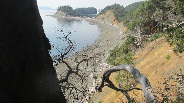 |
You can see three connected islands, the trail runs along the top of the cliff/bank. In some places a misstep would be fatal. This is not a trail for loose dogs, kids, or drunken sots. |
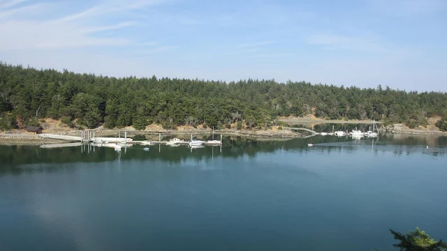 |
| Two half empty docks at Fossil Bay on Thursday before Labor Day |
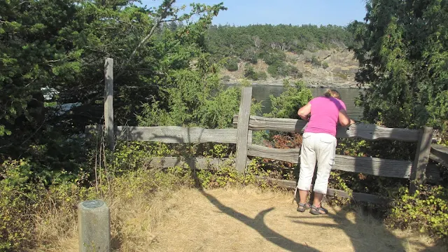 |
| The view from the point is okay, but the views on the way to the point are spectacular. |
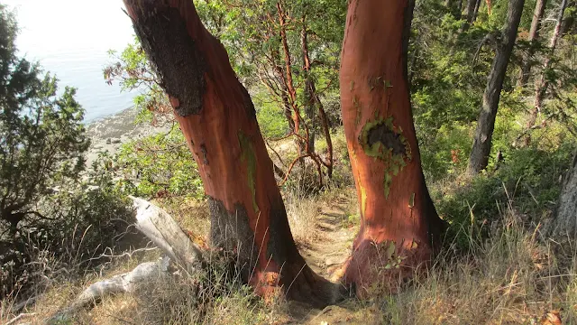 |
| These twin Madrones are the largest single trunks we have ever seen, maybe. |
 |
| I have no idea what his trail marker means. |
Day 3. In the morning I checked the weather radio - bad news. The forecast for the San Juans is great,
unless you are planning on sailing, no wind and sunshine, balmy temps. But the east end of the Strait of Juan De Fuca where Victoria is, is 25 mph, gusts to 35. If we go to Victoria it will be a replay of our Vancouver, over the roof, wave-busting outing and I want no part of it. We have a leisurely breakfast and then hike the point above Fox Cove. We cast off heading out late for a short run with a huge helping current to Prevost Harbor on Stuart Island. We don't go ashore but I get my bucket list photo of the county dock.
We circle Prevost Harbor and get some pics of the State Park dock and then head for Jones Island. Puzzled by our slow pace, Linda digs out our Canadian current guide and sure enough, we are battling a weird counter-current running the length of Stuart Island, Johns Island, and Spieden. Kraken could be smoking along at ten knots but we are barely making five.
It's 3:30 when we pull into the north cove at Jones Island. We take the loading zone spot and pay our fees. (after 3:30 or 4:00 it is not a loading zone) We move out of the loading zone in the morning when someone leaves making room.
Days 4 and 5 - Victoria is out again, and for good this trip.
The radio says a gale is blowing in the Strait of Juan De Fuca. We end up staying at Jones for three nights. We hike all our favorite hikes and pet lots of deer. There is a new spike that lets everyone rub his ears and scratch his neck, but don't touch the velvet, apparently that hurts because he pulls his head away when I do .
Day 6. Every day I have been thinking we can sneak across to Victoria but the winds in the Strait of Juan de Fuca ended that
. In a way I am glad we didn't head over on day one because we would have been trapped on the wrong side.
We cast off from Jones after sleeping late (sleeping late is anytime we don't get up at sunrise) and a light breakfast and head for our bucket list hike up Turtleback Mountain on Orcas Island. West Sound is our destination.
We unloaded our bikes and left the boat tied to the dock. The sign says the same at all the county docks, No overnight stays. That's okay, we plan to be back well before dark, let alone morning. Off we go down the narrow shoulder-less road with no bike lanes toward Deer Harbor. It's easy to tell when the ferry unloads because the cars come at us bumper to bumper ten at a time. Thankfully, we are only riding one mile to the Turtleback Mountain trailhead and parking lot.
We are exhausted when we get back to the county dock and load the bikes into Kraken's cockpit. All the hot weather hiking is taking a toll on us. None of the hikes have been particularly hard but we have been at it daily for a week.
It's Saturday afternoon on Labor Day Weekend, we head through Wasp Passage with Friday Harbor in our sights.
We don't really have a plan but I call for a slip assignment on channel 66 anyway. She (the Harbormaster) says no slips are available but we can raft at the customs float. I decline rafting when I spot a possibility. We squeeze our thirty feet into a thirty two foot space on the outside of the the breakwater by moving a dinghy a few feet under the overhang of a sixty footer. The wakes are pounding us mercilessly, I see boats getting damaged, the place is orderly pandemonium. Even though we can stay the night where we are, I have no intention of doing it. We walk up to Kings market and buy all the that the two of us are able to carry two blocks plus the dock walk back to the boat. We could have anchored in the calm cove a short dinghy ride away but neither of us cared about visiting anywhere in Friday Harbor so we shove off and leave the two foot wake waves to the other die-hards for their Labor Day outing.
We motored over to Fisherman Bay on Lopez Island. We knew we would have to anchor, but we also knew we would have flat water and a quiet evening. Fisherman Bay was crowded at the resorts but we had our pick of great anchor spots. I chose a little protected point of land near the S shaped entrance channel with deep water and high banks blocking the wind common to Fisherman Bay. We were snug as one can be and still be floating on a rope.
Let's recap today, we started out on this long day with a morning loop hike on Jones Island, moved over to climb Turtleback Mountain on Orcas Island.
Next, we swung by Friday Harbor on San Juan, and finally anchored at Fisherman Bay on Lopez. Four islands, two hikes, a bike ride, and walking about a mile to get groceries, we went to bed early and slept in.
Day 7, I put the 2hp motor on the dinghy for the first time this morning.
The short-run out through the entrance channel to the stairway may have too much current for rowing. We bring with us towels, soap/shampoo, and a change of clothes and head for the village. The Lopez Village Park has a free hot shower (donations) and it is only fifty yards or so from where we land the dinghy. What a joy not having to hurry before my quarters run out. Not only are hot showers free but the facility is very nice as well. The water is really hot too and there is room in the shower for both of us. We come out of our private shower room new people smelling good.
A half block away is the Lopez Saturday Market (it's Sunday), we wander over there, watch the herd of grazing bunnies and buy some really good fudge. We are in absolutely no hurry nor do we have a plan for our next nights location, so we wander the village until we circle back to the dinghy tied to the stairs.
We motor the dinghy across to "The Spit" Preserve, hike around, look for beach glass. Eventually, we up anchor and set course for Olga, another place on my bucket list to get updated photos. The Olga float is full but I manage to fit our stern most fifteen feet on the dock. I had read that the restaurant gallery up the hill had a fire and was under new management so I wanted to see for myself.
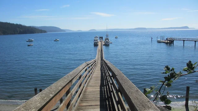 |
| Olga dock in East Sound |
FYI, I have made a point of not reviewing local small businesses we come across, (restaurants, shops, etc.) this is because I want to pass on accurate, timeless local knowledge to fellow visitors, and not outdated useless flowery prose. My readers may be assured the parks, preserves, Islands and little coves, will still be there when they visit.
We left Olga about 3 pm and slipped out Obstruction Pass.
It was tough not stopping at Blakelys for ice cream but yesterday we had purchased more than enough butterbrickle at Kings Market. Having a freezer is a nice luxury when boat camping but ours only barely keeps ice frozen so we were forced to eat all the ice cream for a late lunch.
Rosario Strait was asleep, we chugged straight across getting my best photo yet of Eagle Cliff and then continued around to the east side of Cypress Island. Pelican Beach and Eagle Harbor were a predictable Labor Day Weekend crowd. We cruised right on by to the anchor cove at Cypress Head, I couldn't believe it, there were two open buoys, (2 of 4) and no one is anchored. What is wrong with all those people just a mile up the island crowded along a relatively unprotected shoreline.
 |
| Eagle Cliff, Cypress Island |
It was windy at the buoy and gusting sideways, I slipped a line through the ring and back to our Samson post. I thought about chaffing and then went back and slipped a second line on just to be sure and then rigged a bridle trying to keep the bow into the waves, wakes and swell. We dinghied to shore and dragged the Livingston way up the beach plus tied the painter to a log and then started up the trail to the old airstrip. This hike is by far the steepest and most steps anywhere. We take breaks to rest every ten or twenty feet. We wished we had brought a map. It was starting to get late and we certainly did not want to get caught on this trail after dark. (I had slipped a flashlight into my pocket which made Linda worry and ask me why I did that) A map would have told us how close we were, as it was, we turned around, possibly with only a quarter mile left to go. We have been to the airstrip before from a different trail so it was not a big loss.
Day 8. The next morning after breakfast we hike around Cypress Head
and meet some kayak campers that had braved the night and wind out on the point. Our plan today is to visit Vendovi Island preserve and hike the trails and then go ashore on Lummi Island with our bikes to ride the seven mile mostly level loop road along the shore.
I drop the lines to our buoy around eleven and the wind blows us rapidly toward shore. By the time I get back in the cabin and put Kraken in gear there is no room for error or a dead engine.
Vendovi is under an hours run north, there is room at the dock when we arrive.
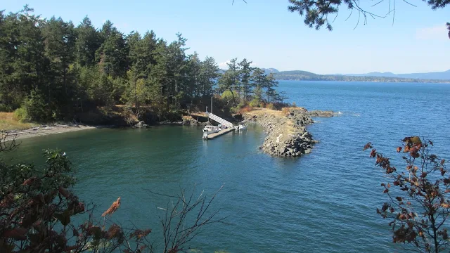 |
| Vendovi Island Preserve. |
Vendovi Island is a recently opened cog in the San Juan Preservation Trust as is Turtleback Mountain and many others. We hiked the three primary trails and tacked on another 3 miles to our total.
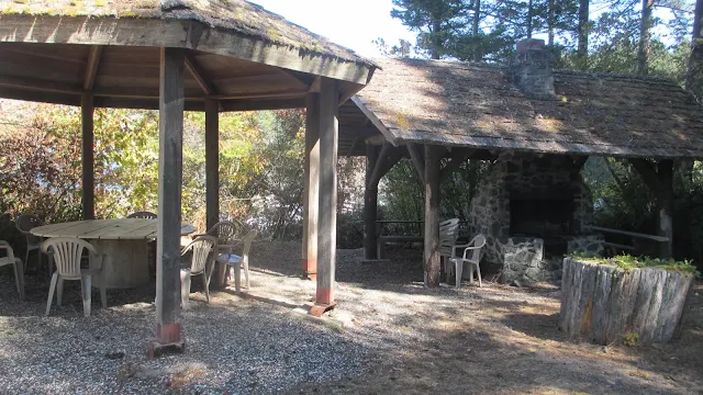 |
| Picnic shelter left over from when Vendovi was a private island |
We hurried off of Vendovi and headed north to nearby Lummi Island, but not where we had anchored a week earlier. This time we anchor temporarily in an exposed bay near the ferry terminal and haul our bikes to shore in the dinghy.
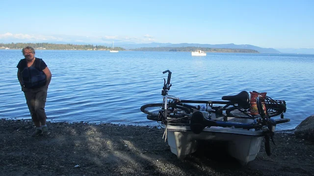 |
We are just about done with my bucket list, pedal for seven miles around Lummi and we will need to find a new place to anchor for the night. |
 |
This is the only legal public access to the roads on Lummi Island but the ferry wake four times an hour makes it a poor place to anchor. |
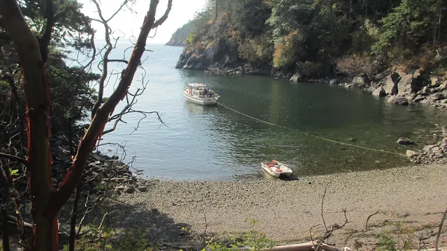
After our whirlwind tour, we haul the bikes back on board and pull the anchor. We have less than two hours to sundown. We talk about running back to Squalicum Harbor where we could arrive in the dark, but I still don't want to spend the night at the dock or pay the fees. It is our last night, I want to stretch it out, it is really hard to quit and go home. We run down the coast just past Inati Bay and duck into a teensey cove only big enough for one boat called Lummi Island Campground. It is part of the Department of Natural Resources, as is Pelican Beach, Eagle Harbor and Cypress Head.
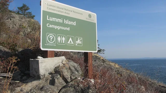 |
| You won't find this place on charts and from the water, this sign is awfully small |
With daylight fading fast, I anchored Kraken fore and aft and stretched her in the middle as the only way to keep her off the rocks. When the tide went out and the lines went slack she got close, probably too close for some but I never worried.
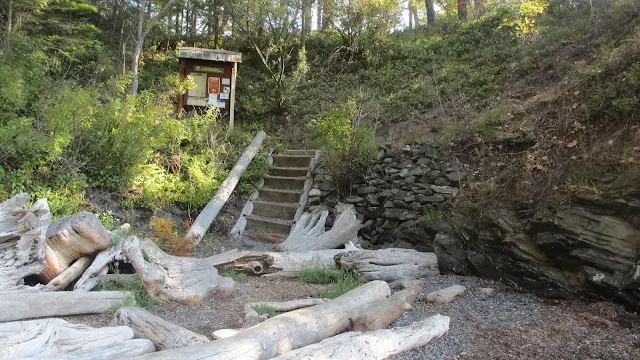
In the morning we walked around the four site camground and discovered a loop trail we didn't know about. I now have a new item for next summers bucket list.
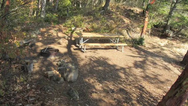
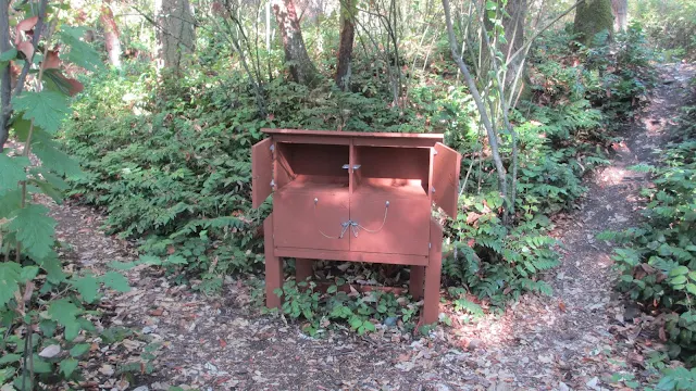 |
| Raccoon proof boxes for your goodies |

Day 9. We hung around as long as we possibly could, probably too long. It was 3 pm when we got to Seattle
and the added traffic added two more hours to our travel time. It was a little after sunset when we arrived back in Portland.
This trip was a huge success and to think I considered not making it because it had been such a hectic summer.
I wrote this brief synopsis of our trip partly to highlight how easy it is to just cut loose and go. We never had anything more than a loose bucket list. We could have stayed at resorts or reserved a slip every night at Friday Harbor. We enjoy hiking and bike riding, others go crabbing and fishing, and others yet, read books while floating in secluded anchorages.
One last thought, I hope you noticed how much of our trip was devoted to and made possible by Preserves, Land Bank Property and Department of Natural Resources and community and county resources. You don't have to depend on state parks or resorts to enjoy your own cruise.
FYI, I have already started my plans for 2019, number one is to watch the Lopez Island fireworks on the fourth of July. Number two is to try for Victoria again, we will see what happens.


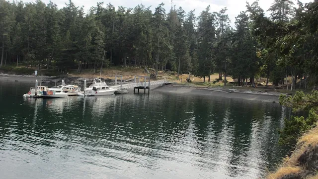


No comments:
Post a Comment
The comment box was recently restored after being misplaced for a few years. Feel free to offer comments. Use the e-mail box to ask questions.