• Discover boat-in spots from Sucia’s anchorages to the trails of Stuart and Jones Island
• Experience the Islands
• Visit bustling Friday and Roche Harbors
• Find serene, secret coves • Your adventure begins now!
New Feature
Below every post is a satellite view hot link - You may drag image to your area and/or use the plus button to zoom in all the way or click street view when enabled.
++++ ============================= All Posts Below
Current Posts Below Note: The first few posts below are for first timers and stay on top — New posts are scattered throughout the website — use the search box or look in archives on the left side to find your interests
Yes, but size affects each of us differently. Safety, food preparation, shore excursions, sleeping, comfort, and fuel expense. The list is long.
The difference in expense, crew requirements, and comfort are obvious, and if you drill down into the pros and cons of mega versus micro, each skipper will have a laundry list rationalizing and justifying their choices.
Sometimes I see micro yachts being paddled or sailed across straits and marvel at them just as much, if not more than the mega bruisers with the eight-foot freeboard.
In the end, the boats most of us use in the San Juans are the ones we already have, it's as simple as that. It's not a matter of what is appropriate or proper, it's a matter of making proper choices for the conditions, and your boat's ability to handle those conditions.
From a 14 foot open fishing boat, kayak or canoe, to the Queen Mary, all have a time and place in the San Juans.
The boats in the pictures below are likely to be found just about everywhere.
So if it floats -- get going.
Everything but the kitchen sink
And the kitchen sink
Too big to fit in picture (please remove shoes!)
Runabouts - ski boats - open boats
Common at Jones Island
Mega yacht won't be using any of the park facilities.
These guys anchor out and dinghy into the coves and floats
See the tender on top?
Another camper on a runabout
They may be using tents onshore at one of three campgrounds on James Island, or just a lunch stop.
Kayak campers use campground at top of steps
At Jones Island, its a full float of day-trippers.
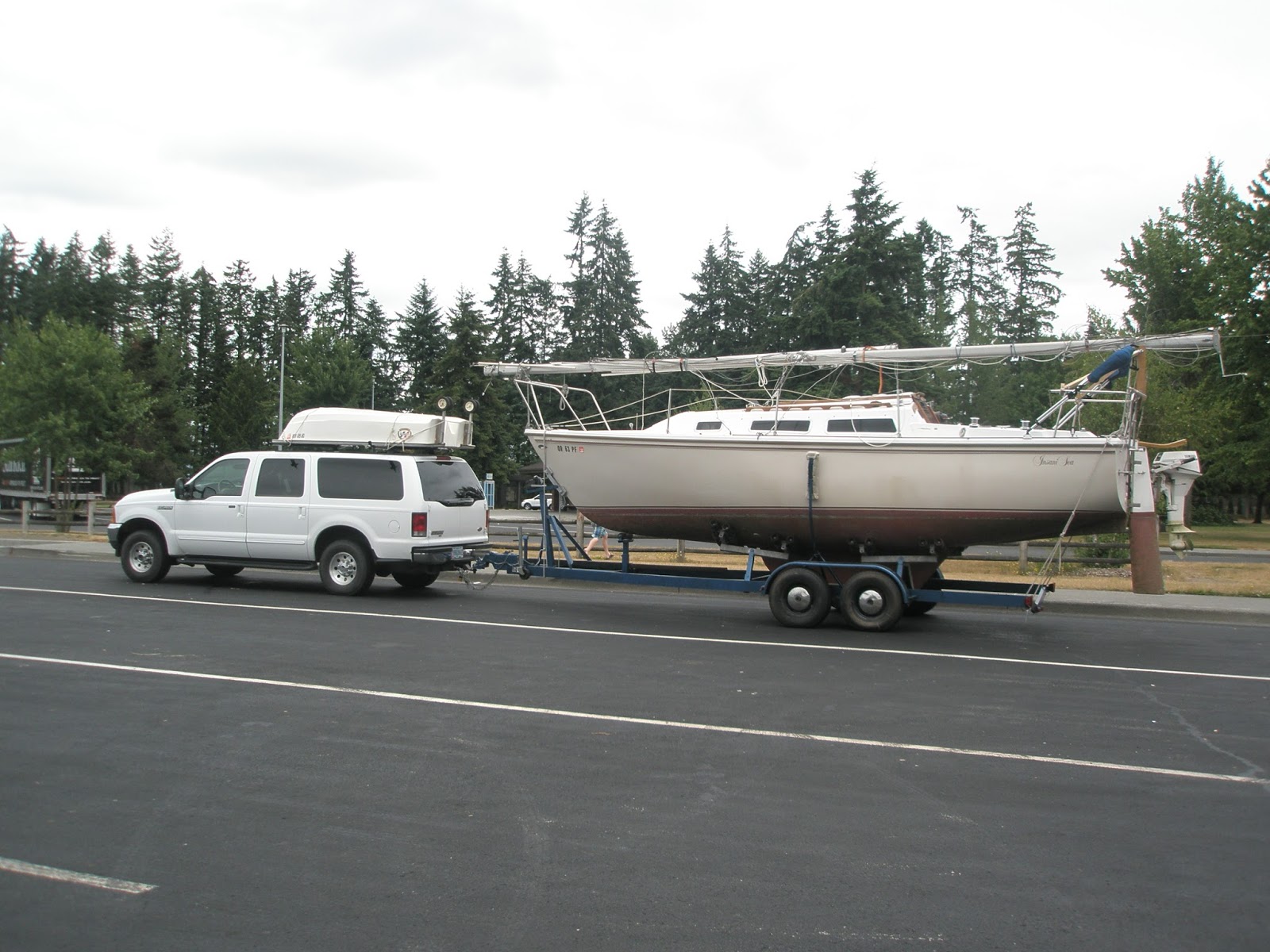
This trailer sailer just rolled down the ramp
becalmed in a car-topper in Lopez Sound
This boater paddles the final feet to Pelican Beach
Here's a shot that captures mega to mini.
The sailboat is a 70's Catalina 22 towing an inflatable. The mega is 164' Eileen , built in Italy with an 31' beam. If you look closely you can see the 35 foot center console dinghy attached crosswise at Eileens stern.
This was at Friday Harbor on the 4th of July 2016.
Click below to see satellite view of Obstruction Island
What rules do boaters follow in the San Juan Islands?
The url below is for the Washington boating rules on the State Parks web site. http://parks.state.wa.us/435/Boating
Many of the rules we follow are based upon sound reason. Sometimes a rule is put in place after tragedy strikes in an effort to make sure it never happens again.
It is impossible to personally experience and learn from every accident scenario so we must rely on others to come up with guidelines for us to follow. This is why we are required to carry a pfd for everyone on board. This is why we carry fire extinguishers.
Rest assured though, even when all the rules are followed, there are still plenty of dumb things you can do to potentially maim or kill your friends and family, or complete strangers.
The url below is for the Washington boating rules on the State Parks web site. http://parks.state.wa.us/435/Boating
I use a folding grappling hook type anchor for my secondary anchor. I usually heave (lower) it off the stern, or paddle it out with the dinghy, and set it by pulling the primary in, shortening the scope.
Anyway, last week I was helping out at a Boy Scout Eagle project, and we were pulling some small shrubbery stumps, and I got the great idea to use my anchor to hook onto the stumps, and snap. I broke the cast iron shank right at the base. (No, I wasn't pulling stumps with my boat, that would be weird, I was using my 4x4)
So now I'm short my favorite anchor, but more importantly, how much should an anchor hold, and should it break? I didn't think I was pulling that hard on the stump, it seemed to break with little effort.
I'm wondering, of all the times I have anchored using the same folding anchor, and how close I was to snapping the shank and coming unhooked.
I would prefer that things bend and not break when overloaded. Is that too much to expect?
I don't know the answer, but I'm going to take a good look at all my gear, especially things made with cast parts.
The shank broke under the locking bell. (btw, I fixed it but I don't trust it anymore)
I have always known the devastating effects of UV radiation. How can you miss hearing about it with today's instant internet news?
If you are like me, you have pretty much ignored it though - that is, until about ten years back when I had two of my travel trailer tires pop one at a time while on a trip.
On close inspection, all four had simply rotted with age. They had very few miles and virtually all the tread was perfect.
UV radiation is more than just sunshine - it's all daylight all the time.
My trailer boater days run from spring to Christmas, then I change the oil and put the boat away for about 4-5 months. Now I also cover my tires so I wont be buying new ones.
You can probably get some tire sacks from your local tire store, but I don't like the bright colors and I already had some extra 6 mil plastic.
All I did was cut the plastic into a long enough strip to circle my wheel and then use my desk stapler to close the top leaving an open gap in the back for the axle.
BTW, my covers frustrate cats and dogs too.
Save your tires - black construction plastic stapled into a bag shape
another cheap option -- use big black or green garbage bags
Where are the off-the-beaten-path and hidden gems of the San Juan Islands?
It's easy to go to the marine parks and jostle with the other boaters at the dock or scramble amongst a minefield of anchors and buoys. Sometimes seclusion and communing with nature is simply a matter of going around the point.
Low tide and still lots of water for anchoring, but open to swell from Rosario Strait.
As with all gunkholing and exploring, you must be vigilant, watch for rocks, know your tide range and proceed dead slow or pay the price. Speaking of paying >>> paying the price Suggested backdoors, (none preferred over another) and places to get away from other boaters.
Matia Island: Matia Cove is a fairly long indent (see pic) at the east end of the island and holds several boats. An unnamed cove is just around the corner from Rolfe Cove where Matias dock is located. Both these coves offer anchorage away from the usual hustle and bustle.
Sucia Island: Snoring Bay is between Echo Bay and Fossil Bay on Sucia and Ewing Cove is accessed via Echo bay on the northeast side. Both coves offer access to the Sucia trail system, and may have anchor buoys still intact.
Saddlebag Island: This state park is so little visited, you may consider the entire island a backdoor, but there is a second minor cove on the south side with a great view of Cap Sante should the northside be full up.
Inati Bay on Lummi Island is located on the southeast side of Lummi Island. This medium size cove holds a handful of boats and is a perfect storm refuge when you are caught on your way to or from Squalicum Harbor.
Cypress Head: The normally used cove with anchoring and buoys is on the north side of the isthmus and open to passing wakes, but the long cove on the south side of the isthmus is easily navigated and may be calm. Watch your depth here.
Doe Island State Park: The last we looked (2015) the float was still gone but you can anchor here in relative peace and protection.
East Sound: If you're at Eastsound (the city) and it gets dark, you can anchor in Judd Bay on the far north end (left side) of East Sound. You will be a long dinghy ride from the Eastsound dock, which does not allow overnighting. Anchoring near the county dock is liable to be rolly after dark.
Roche Harbor: If crowds drive you bonkers and you want to run away, just run two miles to Westcott or Garrison Bay. Anchor anywhere but watch your depth and don't block access. You wont be totally secluded or alone, but you will be away from the mob at Roche.
Smallpox Bay: This small bay is on the Haro Strait side of San Juan Island just a few miles south of Roche Harbor (scoot through Mosquito Pass) it's a dinghy ride to shore at this San Juan County Park where campers watch for orca's.
There are lots more hidden places, too many to list but you can use the search box for them. Search - coves, bays, anchoring, camping, parks, things to do, places to go, etc.
You can anchor off to one side virtually anywhere but you may suffer wakes. I left out well known places like Blind Bay, Fisherman Bay, Parks Bay. which will all be crowded. I wanted to suggest mostly secluded easily overlooked locations that will be appreciated by the discerning recluse.
Okay, sorry - that was a trick question. There are no perfect cruises, only typical cruises.
Aspiring San Juan cruisers might be a little nervous and holding back making that long talked about trip. If you are not quite sure you have it figured out and need a little push to take off for the San Juans, let me assure you that you can do it. Everything doesn't have to be figured out. To help you take the plunge and to entertain vicarious armchair captains, I have put together a simple rundown of one of our outings in the San Juans.
Our cruises start out with a general idea and a few hard dates, but no carved-in-stone plans. It just happens. There are no typical cruises.
In the months (year maybe) leading up to actually departing, we talk and think about what we want to do. Kinda daydreaming if you will. Part of our early dreaming included young children, and that morphed into teenagers, which morphed into adults on their own boats.
This time:
I wanted to Orca watch off San Juan Island in Haro Strait.
I wanted to visit Victoria without rushing.
I hoped to see English Camp and hike Young Hill again.
I wanted to hang out, and have a campfire on Jones, and go dinghy sailing in the bay, and maybe circle the island if conditions are favorable.
I had already promised Linda a romantic dinner in Friday Harbor
We had a firm date to pick up our kids in Eastsound - with bikes and gear.
We had a firm date to drop the kids at Odlin Park on Lopez (these kids are 30 something's)
I promised I would drop the kids somewhere they could catch the ferry back to Anacortes.
I semi-promised I would take them to some neat places they could only get to by boat.
I wanted to ride my bicycle some since I bring it everywhere.
We knew we would start at Squalicum Harbor in Bellingham for the great ramp and free parking.
So that pretty much sums up my plans, or you could call this a one plus week or so San Juan Island's itinerary.
Let's see what we really did:
1st night, I slept like a baby on board at Squalicum Harbor after pigging out at a Chinese buffet in Bellingham.
1st morning, had a great but costly breakfast downtown, (always hungry after Chinese), and then cast off about noon and head for Inati Bay for a look-see at the logging operation dropping logs in the bay. We have lots of time, so I detoured through Pea Pod Rocks over to Doe Island to verify the dock is still missing, it is, and then we stopped by Shaw Landing for a cold Coke and a quick look around to check out bicycling possibilities. Next, we moseyed past Deer Harbor and on to setting the hook at Jones Island before dark. Fire danger has canceled campfires anywhere in the state (again) so I cross off number four on my list of things I want to do. But it's ok, who wants smoky clothes anyway? We cooked hot dogs on the stove and cracked open the 1st boxed wine.
Drip coffee on the boat is how every day begins. We headed out mid-morning on the north side of Spieden Island into Haro Strait for whale watching and a lazy run to Victoria. A couple of hours later, all hell broke loose on us and over the decks. The little ship was tossed, we were tossed, provisions were tossed. It's not long before I lost interest in whale watching (couldn't see anything anyway) and Victoria and said to heck with this bs and turned toward Roche Harbor. Scratch one and two from my list. We pounded into Roche Harbor and peacefully putted right by the resort and on to English Camp, where we anchored and then got a spot at the dinghy dock and enjoyed walking around the park. Some volunteer hosts entertained us in the interpretive building. When leaving I continued out Mosquito Pass and took another stab at Haro Strait and big waves. We turned around quickly to putt putt right by the Roche Harbor marina, again without stopping. We anchored back at Jones in my favorite corner in time for a nice hike.
Spent the next two days hiking (two days we could've been at Victoria) and reading at Jones, (and washing dried salt crystal from windows) finally at 5pm on our 4th night we tried to start the motor to discover the starting battery had shorted (could've been at Victoria) and the house battery was too discharged to help. Two hours later (another story), we got her going with help from the generator, and headed for Eastsound and tied up at the county dock just before sunset.
8 am, there is a warning ticket tied to our lifeline by the local sheriff for overnighting at the dock. We have a really great breakfast in town and hitch a ride to NAPA, by noon our new battery is online, and our daughter and her husband show up on bicycles after riding the 7:30 ferry from Anacortes. They drop some gear and pedal off to tour the local brewery. Eventually, we take off for Jones, where we anchor back in the very same spot, waving to the folks we met earlier. Still can't have campfires, but there is plenty of time to beachcomb and hike around. The kids camp on shore, not the boat, that was a hard, fast deal we made before agreeing to meet up.
This morning, we head for the county dock on Stuart Island. We spent a busy day riding out to the lighthouse museum and the shut-down schoolhouse museum. I bought a T-shirt at the honor system T-shirt stand. We then motored all the way across the San Juans to the county dock at Odlin Park on Lopez, where we drop the kids and their bikes on the dock and then anchored in front of their reserved campsite and dinghyed their gear ashore. It's close to 5 pm, we say adios and run over to Friday Harbor where we take a slip for two nights. Alone again, we talked and hung around the promenade enjoying the local musicians. This was a busy day, but it worked out great. We are really tired.
We start out this next day by sleeping in, eating on the boat, and then walking around town, we end up riding the Transit Bus out to Lime Kiln (Whale Watch Park) for another shot at spotting Orcas in Haro Strait, but no luck. Back in town we eat at a water front crab place overlooking the harbor, its not romantic, and not very good. I think number five on the list needs a do-over, but we spent lots of money so someone is happy. Btw, the kids are bicycling Lopez, but forgot and left their helmets on board with us.
I think we slept in this morning too, after topping off with fuel, we eventually got going back to Lopez to pick up the kids. We did the reverse of when we dropped them off, all the gear came off the beach by dinghy, and the bikes off the county dock. We left Odlin Park and went straight to Blakey's for double ice creams, we hung around sitting on the lawn and watched deer try to out-lazy us. Boaters came and went getting fuel and zoomed off through Peavine Pass, it was peaceful to be sure. At about mid afternoon we left Blakely's for Cypress where we snagged a buoy off Pelican beach. We dinghied ashore and hiked to the top of Eagle Bluff. An hour later we let go of the buoy and ran down to Cypress Head where we wanted to anchor and the kids could camp but couldn't find a suitable place because of the wind. By now, it was getting late so I took my own advice and headed for dependable Saddlebag Island, anchoring in the cove just a stones throw from the beach. The kids set up in an empty campsite, (still no fires)
This morning there is no rush, there seldom is, we have breakfast burritos, and then we all hike the figure eight shore trail from different directions. From Saddlebag Island State Park, it's only five miles to Washington Park where they left their car when they biked over to ride the ferry four days earlier. They wanted to get back to the car around 1 pm so we pulled the anchor at noon. We dropped them at the Washington Park dock with their gear and bikes, and then, alone once again, we headed north for Squalicum Harbor where we tied to the transient float for our last dinner and night on the boat.
From my lame descriptions, you should be able to follow our course on the maps or charts. The distances are small enough that just about any boat could duplicate our wanderings, but that's not the idea. The idea is to just cut loose and go, charting your own great cruise.
That's it, that's what a typical cruise is for us today.
Many years ago a cruise might have included all day sailing in the straits and keeping little kids entertained around tidepools.
You might want to stay at Friday Harbor seven nights in a row, venturing out to distant points each day and then returning to a waiting slip and four star restaurants. You could even sleep on shore at a B&B or hotel. For me, I prefer to hang at Jones Island.
Here is the promised itinerary if you still want a day by day list of where to go -- click here >>
Is there a public bus or transportation in the San Juans?
Yes. Don't go to Friday Harbor and just stay there. If you do you are missing out. About once an hour the San Juan Transit van/bus picks up and drops off passengers. From the marina, simply walk over to the ferry lanes where cars are waiting to board and look for the small four foot wide island between the waiting lanes and the road.
There's a little sign saying Transit Stop - that's where you wait.
Look for a schedule on the post. It will tell you when the next bus leaves. For five bucks you can ride anywhere, and for five more you can ride back. For fifteen bucks you can ride all day back and forth everywhere. Kids are cheaper.
The talkative drivers will give you a mini tour guide talk while taking you over to Roche or to whale watch at Lime Kiln.
So, get on the bus, get off somewhere and hang around, get on the next bus, and repeat. When you've had enough, go back to the marina and talk to your neighbor boat people who went nowhere.
Lopez and Orcas transit bus/vans are the same, except with different stops (you think?)
Click here to go to the page with all the schedules and links and much more
When you cruise somewhere with no local knowledge, you must bring it with you or make do as best you can. That's how you avoid buying $5 wine for $20, and getting outdated perishables.
Just about all little landings have snack bars and minimally stocked shelves, and I admit I buy lots of stuff from these guys and so should you. If we don't support them with our purchases they will not stay in business. When they are gone, everyone loses.
But, what about the other products that the little guys simply don't have?
These places have major stores with everything we want.
The store is about a one block easy walk. You can walk from the Islander in Fisherman Bay, but its further than I want to carry groceries. You can bicycle from Odlin Park in twenty minutes.
Friday Harbor:
The marina will let you park in a slip or at the breakwater while you walk up to Kings Market. It's about two blocks right on the main street, you cant miss it. This is a big and busy place and so close you can run up from the boat when your cooking breakfast and need eggs.
Eastsound:
It's kind of a long run up East Sound to Eastsound but the store is big and only one block to walk from the county dock. Note: the dock is small, you may not get to park the mother ship and may have to anchor and dinghy over. One time we dragged the dinghy up on to the dock because there was no room in the water, you can also beach the dinghy and climb up a trail. Don't worry, you will get to the store one way or another. BTW - Eastsound has a good assortment of places to eat, yum.
La Conner:
There are three public docks scattered along the city waterfront, all right on main street. (these docks are not at the marina, which is a little longer walk) Once on shore, walk to the left on the main drag to the stop sign and then follow the only main street to the right. Follow this street about one block to the towns grocery store, it's pretty big, keeps long hours and is only two blocks from boat at worst.
The above map shows the five tie up floats at La Conner and the red dot is the grocery store, (no, not the dot marking the boat ramp under the bridge)
Cap Sante
(Anacortes): The store is a full size Safeway and is directly across the street from the marina. Call the harbor master to arrange for a short term shopping slip. If you are transiting Swinomish Channel, its just a small detour into Cap Sante to provision.
Roche Harbor:
Lastly, don't forget Roche Harbor for groceries. The store is right at the top of the marina gangway. You can get a free slip assignment for shopping or anchor out and dinghy over to one of several dinghy docks. You could even walk upstairs while getting fuel. The Roche Harbor store is the smallest of the bunch but is complete and stuffed to the gills.
More Stores:
Yes, but those are the biggies with complete inventories. The smaller stores include Blakely's, Rosario, Deer Harbor, West Beach, Shaw Landing, Orcas Landing, Cornet Bay at Deception Pass, and that's pretty much all of them.
First some background thinking - most of us simply use the boat we have the way the PO (previous owner) set it up, plus some of our own tinkering. Once in awhile though we get to make a major decision.
For example; about twenty years back we acquired a boat with a pump up alcohol cook top, and of course it was a useless rusty piece of stainless (s)crap so over the side it went. (dumpster) My cheap rush rush solution was to nail a piece of plywood over the gap where the alcohol stove used to take up, and set my propane camp stove on top. And then we took off for the San Juans or somewhere.
Later I replaced the nails with screws and painted plywood for formica on plywood and created a pretty nice looking counter top. Of course while underway the propane camp stove is stowed away. Boring - Ok, what I learned was how well the set up worked. Over the years several of our boats have had factory propane ovens, some with gimbals, and I admit they were nice, but they also took up precious space 100% of the time. Don't forget the propane bottle fills a locker too.
So let's fast forward to Kraken to see what we do today. Thanks to the PO, Kraken has a Dickinson diesel stove which gets zero use in the summer because its primary function is to blast us out of the boat in freezing weather, which it does very well. Our cast iron soot belching mini monster takes forever to heat up and cool off, but for now, I put up with it in spite of the baggage, weight, space, and occasional tantrums. (to be honest, this is not what we do today, we upgraded to propane and got rid of the diesel stove and never regretted it)
Our Dickinson Bristol with door open - yes, the oven on your boat is bigger.
I could have set kitchen dishes etc. on the cold cook top, but I opted for a cleaner counter and varnished up a scrap of plywood with little spacer legs.
See!
But wait there's more. I made sure my camp stove would sit comfortably on top.
I also whacked up a set of shims for leveling, which we use once in awhile when making pancakes.
Here's more in our galley bag of tricks.
This cool Coleman oven fits just fine, and is just a smidge bigger than the Dickinson, (see the same tray)
It also heats and cools as fast as the flame can be turned on or off. This set up makes fantastic biscuits, pizza and cookies, I highly recommend it
Wait, it gets better.
Our camp drip drip coffee maker fits too!
Hot cinnamon rolls and coffee anyone!
(guilt free boating at its best)
Everything gets easily stowed, and we get our counter space back.
The oven folds up into that little box and fits under the Dickinson next to the camp stove
And that's the way our galley stove works.
BTW - when the diesel stove is hot we place the camp stove on the counter to the left of the sink and carry on.
The rest of the story, follow this link and then scroll way down to our last straw with soot and the diesel stove replacement. new propane stove install
You have a few options, Fix it yourself, get help from another boater, call for a tow. We managed to fix it on our own.
This post could go several ways
I'll list a few.
#1 More proof that paying it forward is alive and well #2 Evidence that being prepared helps (well duh) #3 Dumb luck favors the ignorant (not true, but it reads well) #4 Redundancy - redundancy - redundancy #5 Do County Cops work late? #6 Do regular auto parts work on boats?
I'll just hit the important points.
We were on the hook at Jones for two days, the battery switch was clearly on #1, saving #2 for starting. Lights and the fridge killed #1 as expected. But what we did not know, was that #2 had shorted while in rough water out in Haro Strait and now only held 6-8 volts -it sounded like this -- #2 click click, #1 click click, oh crap! #both click click, shit!
I fired up the portable Honda 2000 and plugged in the shore-power cord, plus I plugged in my portable smart charger, only to discover that my onboard Guest 2 bank smart charger wasn't smart enough to coexist with my portable smart charger, meaning nothing worked - grrrrrr.
One and a half hours later, after separating wiring charging circuits and waiting and waiting, the diesel fires up. I am of course, not going to turn it off for anything.
Previously (before discovering all my batteries are dead) I had pulled the stern anchor, against my own advice to not pull anchors until the motor is idling. So I'm frantically re-anchoring my dead boat from grrrrr- the dinghy - nice show for everyone at Jones Island watching and wondering what I am doing.
When we arrive at the San Juan County Dock in Eastsound 2 hours later, I squeeze our thirty feet onto fifteen feet of vacant dock right under the sign saying four hours max. (or is it two?)and -no over-nighting- grrrr
At midnight the local constable wrote us a warning and taped it to the stern rail. It said -vacate immediately- or risk getting cited. Midnight! grrrrrr, I know it was midnight cause he wrote 11:55 pm in the box.
The next day, a really nice guy living offshore in a boat gave us a ride to NAPA,(he owned a rusty Land Cruiser)(it was his inflatable I squeezed) and he carried the new battery down to the boat for me (see, paying it forward works).
By noon we were in good shape and on our way back to Jones Island.
OK, lets wrap this up. Our misadventure turned out to be slightly inconvenient at most. We got to bike around Eastsound and had breakfast out. The battery I bought, I would have bought anyway. We met a nice guy. It was creepy knowing a cop had been hanging around our boat while we slept.
The lessons learned are:
don't pull anchors until the motor is running or your ready to hoist sail
don't leave home without the Honda. (we have a Honda kicker too)
get an old fashioned dumb charger for the tool bag
have two batteries that work if you're going cruising overnight
stuff happens, and things break at inconvenient places - be prepared
be flexible, take it easy (and bring a credit card)
Yes, they will be good forever, it is the page number that you need to know because like the tides they repeat year after year but you need to know which pages have the correct charts for your cruise. Just like tide forecasts need a date/time and location to be useful, so do the current charts.
Here is a url to find date tables for use with the Canadian Current Atlas. There are others online, or you can do the mathematics outlined in the front of the Canadian Atlas.
http://code.borsboom.io/current-atlas-tables/
If you don't know what this is referring to, you need to go to the Current Atlas guide posting several years ago >> go now by clicking this link
BTW if you find something you like, or helps you, you should say so. Lots of people work for nothing, not even a thank you!
No No Not me, I work for nothing cause I'm bored
JR
Big arrows are faster currents. An hour later or earlier will be different. What you need is a date and time for this forecast. That's why you need a page table for the current atlas, just like you need the date and time when you look up tide forecasts.
Turn Point Lighthouse on Stuart Island: A Must-Visit Stop for San Juan Islands Boaters.
The Lighthouse and museum are a tried-and-true cruiser's destination that never disappoints.
First I need to tell you that as of this posting, Boundary Pass Traders is still in business selling T-shirts along the road to Stuart Island Lighthouse.
For those of you that don't know, Boundary Pass Traders is a local family business, they have two unmanned sales kiosks complete with fresh water.(after hiking up the hill you will appreciate a drink) They sell screen printed t-shirts on the honor system. One booth, (more like an opening in the trees that resembles an upscale homeless camp) is next to the schoolhouse at the top of the long grueling hill coming up from Reid Harbor. The other and newer location is at the intersection of the road coming from the county dock. This means if you walk from the state park you will stroll by both, but if you walk from the county dock at Prevost Harbor, you will only see the one. Moving along - You make your choice from ten or more San Juan Island themed shirts, and then when you get home, mail them a check in the provided envelope. (or pay online) that's right, they trust you! We picked out an adult size replacement shirt for our youngest son, (think "Pirates of the San Juans") to replace his stretched out, frayed, and faded child size he picked out many years ago.
Volunteers at Stuart Island Lighthouse keep a pretty spiffy privy
(I actually don't run any ads because I don't think the teeny tiny return is worth annoying readers. But the concept is still valid.)
Here is the deal. Lots and lots of people that you know have websites (like this one) and advertise products. When a click is registered or a product is ordered, the website gets paid. (same as boat dollars)
For instance someone clicked an Amazon advertisement on this site and bought a $25.00 item, since they started here (this site) and ultimately bought something, this site got about a buck (boat buck)
So, if you are planning to buy something from Amazon anyway (You know they sell everything in the world), why not give someone the free money? Go to your favorite site first,(this site) then click an Amazon ad, then buy anything you want, it does not need to be what is advertised.
Now go tell everyone you know to come here first -- to order anything Amazon sells.
(free boat bucks stop here)
~John~ TRY THIS link TO YOUR FAVORITE EATERIES AND COFFEE SHOPS -Restaurant gift cards
Just so you know, I gave some thought to deleting this post, but I thought it might be entertaining.
What is a good boating itinerary in South Puget Sound?
A good South Puget Sound boating itinerary is a loop from Olympia’s Swantown Marina, visiting multiple Washington State Parks along the way, with options to extend into Lake Union and Lake Washington. This easy cruise offers protected waters and an easy multi-day route for exploring the region.
Puget Sound is different things to different folks. If you read a few articles or listen to more than one traveler you will likely come away with some overlapping opinions. Lots of people think the San Juans and Puget Sound are the same. They are not.
On your NOAA chart, there is a place labeled Puget Sound, it's offshore from Seattle all the way up to Whidbey Island. Virtually every body of water is named something. Names sometimes include a descriptive hint, such as bay, passage, inlet, cove, strait, and of course sound. Did I miss any besides Canal and Channel? Oh yeah, bank, shoal, flats...
Some of us consider, Puget Sound (as an area) to encompass everything salty, from the Strait of Juan De Fuca south. So this means both sides of Whidbey Island are included, but not the northwest side that faces the San Juans and Vancouver Island, or Anacortes, or Bellingham. I like to think of Bellingham as on Bellingham Bay and Anacortes as up Guemes channel a bit from Rosario Strait. So where does that put Olympia or Friday Harbor?
We started in Olympia, at Swantown Marina, and so should you.
There are numerous ramps scattered around the area, but nothing compares to the Port of Olympia facilities, they have the welcome mat out more than any (boating) city we have ever visited, bar none. I haven't forgotten the praise I lavish on Squalicum Harbor in Bellingham, but the entire waterfront at Olympia is boater friendly, which bumps them to the head of my list.
At Swantown, is a two-lane all-tide ramp, open 24/7 with a long-term parking lot for only $3/day. Transient moorage is abundant, both at the ramp and a short walk away, at the old town waterfront. Don't make a mistake and think of Olympia as simply a place to splash the boat and take off from. Plan your trip to include one or more nights or days at the dock, and bring your bikes, you will be glad you did.
Rather than gush over Olympia, let's get going north. On this trip, our turnaround point is Lake Washington. This means we will wander a circuitous course to Seattle, visiting as many Marine State Parks as we can. At Seattle, we will go through the Ballard Locks, through Lake Union (Lake Union is the downtown area you see from the freeway), and into Lake Washington to spend the night anchored at Seward City Park. All total we will visit eleven parks, bike and hike most of them, spend seven nights at docks, one at anchor, and motor about 175 miles. Wow-- when I write the specifics it sounds rushed, but we relaxed the entire time.
Day One: We are in the water and on our way at 5pm, this may seem late to get going, but we only have 8 miles, maybe 16, to our first nights stop.
We ran the 8 miles to Hope Island State Park, but all the buoys were taken so we continued to the dock at Jerrel Cove State Park, another easy 8 miles, and with plenty of daylight, why not?
Sail-boaters should know that we encountered a low 31-foot fixed bridge providing vehicle access to Harstine Island. You can avoid the bridge by taking the long way around Harstine. Jerrel Cove has two docks, and across the way is a private marina with a store and transient space. The park is well kept with onsite rangers, car campers, a mile or two of trails that are rideable, and of course, you can head out onto the island roads and ride to your heart's content. Perhaps I should remind you that, unlike most of the San Juan destinations, all of the places we spent the night are car accessible. This means you can plan a Puget Sound rendezvous with friends or family to re-supply or switch out crew members.
Jerrel Cove at low tide, the ramp is as steep as we have ever seen.